Running Springs, California
| Running Springs | |
|---|---|
| census-designated place | |
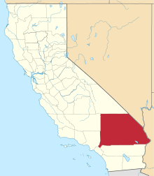
 Location in San Bernardino County and the state of California | |
 Running Springs Location in the United States | |
| Coordinates: 34°12′28″N 117°6′30″W / 34.20778°N 117.10833°WCoordinates: 34°12′28″N 117°6′30″W / 34.20778°N 117.10833°W | |
| Country |
|
| State |
|
| County | San Bernardino |
| Area[1] | |
| • Total | 4.213 sq mi (10.912 km2) |
| • Land | 4.204 sq mi (10.889 km2) |
| • Water | 0.009 sq mi (0.023 km2) 0.21% |
| Elevation | 6,109 ft (1,862 m) |
| Population (2010) | |
| • Total | 4,862 |
| • Density | 1,281.3/sq mi (497.6/km2) |
| Time zone | PST (UTC-8) |
| • Summer (DST) | PDT (UTC-7) |
| ZIP code | 92382 |
| Area code(s) | 909 |
| FIPS code | 06-63316 |
| GNIS feature ID | 1661346 |
Running Springs is a census-designated place (CDP) in San Bernardino County, California, United States. The population was 4,862 at the 2010 census, down from 5,125 at the 2000 census.
History
Running Springs was originally known as Hunsaker Flats, named for Abraham Hunsaker, an early member of a Mormon Battalion. The area was developed after improvements to the state highways in the 1920s.[2]
Geography
Running Springs is located at 34°12′28″N 117°6′30″W / 34.20778°N 117.10833°W (34.207739, -117.108285).[3]
According to the United States Census Bureau, the CDP has a total area of 4.2 square miles (10.9 km²), 99.79% of it is land and 0.21% is water.
Demographics
2010
The 2010 United States Census[4] reported that Running Springs had a population of 4,862. The population density was 1,154.0 people per square mile (445.6/km²). The racial makeup of Running Springs was 4,325 (89.0%) White (79.8% Non-Hispanic White),[5] 23 (0.5%) African American, 47 (1.0%) Native American, 50 (1.0%) Asian, 6 (0.1%) Pacific Islander, 146 (3.0%) from other races, and 265 (5.5%) from two or more races. Hispanic or Latino of any race were 695 persons (14.3%).
The Census reported that 4,862 people (100% of the population) lived in households, 0 (0%) lived in non-institutionalized group quarters, and 0 (0%) were institutionalized.
There were 1,944 households, out of which 611 (31.4%) had children under the age of 18 living in them, 1,026 (52.8%) were opposite-sex married couples living together, 171 (8.8%) had a female householder with no husband present, 106 (5.5%) had a male householder with no wife present. There were 114 (5.9%) unmarried opposite-sex partnerships, and 38 (2.0%) same-sex married couples or partnerships. 477 households (24.5%) were made up of individuals and 140 (7.2%) had someone living alone who was 65 years of age or older. The average household size was 2.50. There were 1,303 families (67.0% of all households); the average family size was 2.99.
The population was spread out with 1,119 people (23.0%) under the age of 18, 375 people (7.7%) aged 18 to 24, 1,157 people (23.8%) aged 25 to 44, 1,672 people (34.4%) aged 45 to 64, and 539 people (11.1%) who were 65 years of age or older. The median age was 41.7 years. For every 100 females there were 105.5 males. For every 100 females age 18 and over, there were 103.4 males.
There were 3,729 housing units at an average density of 885.1 per square mile (341.7/km²), of which 1,419 (73.0%) were owner-occupied, and 525 (27.0%) were occupied by renters. The homeowner vacancy rate was 5.3%; the rental vacancy rate was 12.6%. 3,450 people (71.0% of the population) lived in owner-occupied housing units and 1,412 people (29.0%) lived in rental housing units.
According to the 2010 United States Census, Running Springs had a median household income of $59,111, with 9.3% of the population living below the federal poverty line.[6]
2000
As of the census[7] of 2000, there were 5,125 people, 1,903 households, and 1,366 families residing in the CDP. The population density was 1,286.1 inhabitants per square mile (497.2/km²). There were 3,686 housing units at an average density of 925.0 per square mile (357.6/km²). The racial makeup of the CDP was 87.7% White, 0.5% African American, 1.7% Native American, 0.9% Asian, 0.1% Pacific Islander, 4.1% from other races, and 5.1% from two or more races. Hispanic or Latino of any race were 11.1% of the population.
There were 1,903 households out of which 35.4% had children under the age of 18 living with them, 56.2% were married couples living together, 10.5% had a female householder with no husband present, and 28.2% were non-families. 21.5% of all households were made up of individuals and 5.3% had someone living alone who was 65 years of age or older. The average household size was 2.61 and the average family size was 3.04.
In the CDP the population was spread out with 27.4% under the age of 18, 7.4% from 18 to 24, 28.8% from 25 to 44, 27.6% from 45 to 64, and 8.7% who were 65 years of age or older. The median age was 38 years. For every 100 females there were 102.9 males. For every 100 females age 18 and over, there were 102.3 males.
The median income for a household in the CDP was $50,524, and the median income for a family was $56,855. Males had a median income of $45,172 versus $34,492 for females. The per capita income for the CDP was $22,231. About 7.0% of families and 8.8% of the population were below the poverty line, including 7.7% of those under age 18 and 9.9% of those age 65 or over.
Government
In the California State Legislature, Running Springs is in the 23rd Senate District, represented by Republican Mike Morrell, and in the 33rd Assembly District, represented by Republican Jay Obernolte.[8]
In the United States House of Representatives, Running Springs is in California's 8th congressional district, represented by Republican Paul Cook.[9]
Surroundings and economy
Running Springs is a mountain community in the San Bernardino Mountains. It is an inholding in the San Bernardino National Forest. Situated at the junction of SR-18 and SR-330, it is a major gateway to the mountain communities of Lake Arrowhead, Arrowbear, Green Valley Lake, and Big Bear and is the closest community to Snow Valley Mountain Resort. It lies some 16 miles (24 kilometres) northeast of the city of Highland, California, up State Highway 330, at an elevation of 6,080 feet (1,850 m). While there is no primary industry in Running Springs, there are service industries geared to the tourist market, as the San Bernardino National Forest is a highly popular year-round tourist destination. Also, taking advantage of the forested setting, the area is home to multiple summer camps, such as Pali Adventures, which also houses an outdoor education program known as Pali Institute.
Additionally, Running Springs, together with surrounding communities, form a bedroom community for commuters who are employed in San Bernardino and points beyond who are willing to tolerate the notorious Southern California commute in order to live above the city's considerable smog and pollution.
Running Springs is a member community of the Rim of the World, an inhabited stretch of the San Bernardino Mountains and wholly contained in the San Bernardino National Forest. The Rim (as it is locally known) extends from Crestline to Big Bear, a distance of some 30 miles (50 kilometres). Running Springs is served by Rim of the World High School and Mary Putnam Henck Intermediate School situated in Lake Arrowhead.
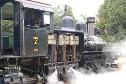
Logging in the San Bernardino Mountains was once done on a large scale, with the Brookings Lumber Company operation the largest. It operated on 8,000 acres (32 km2) between Fredalba and Hunsaker Flats (present-day Running Springs), and extending northward to Heap's Ranch and Lightningdale (near Green Valley Lake) between 1899 and 1912. It built a logging railroad to bring logs to the mill at Fredalba. The Shay locomotives had to be disassembled and hauled by wagon up the mountain, since the railroad operated in the high country but did not connect to other railroads in the lowlands. About 60% of the finished lumber was hauled by wagon down the steep grades to the Molino box factory in Highland, CA, which made packing crates for the citrus grown in the area. The remaining 40% went to the company's retail lumber yard in San Bernardino. In 1912, the company dismantled the Fredalba sawmill and moved much of the machinery to Brookings, Oregon.[10][11][12][13][14][15][16][17][18]
In popular culture
The film Running Springs was set and filmed in the Running Springs area.[19]
See also
References
- ↑ "2010 Census U.S. Gazetteer Files – Places – California". United States Census Bureau.
- ↑ "The history of Running Springs". The Rim of the World Historical Society. Retrieved 11 January 2014.
- ↑ "US Gazetteer files: 2010, 2000, and 1990". United States Census Bureau. 2011-02-12. Retrieved 2011-04-23.
- ↑ "2010 Census Interactive Population Search: CA - Running Springs CDP". U.S. Census Bureau. Retrieved July 12, 2014.
- ↑ http://factfinder2.census.gov/faces/tableservices/jsf/pages/productview.xhtml?pid=DEC_10_DP_DPDP1. Missing or empty
|title=(help) - ↑ http://factfinder2.census.gov/faces/nav/jsf/pages/community_facts.xhtml#none. Missing or empty
|title=(help) - ↑ "American FactFinder". United States Census Bureau. Retrieved 2008-01-31.
- ↑ "Statewide Database". UC Regents. Retrieved December 8, 2014.
- ↑ "California's 8th Congressional District - Representatives & District Map". Civic Impulse, LLC.
- ↑ Barnhill, John, "Logging No Easy Task," Trainboard Web site (http://www.nps.gov/gosp/photosmultimedia/photogallery.htm) Retrieved 6-19-11.
- ↑ "Forests of Inland Southern California," San Bernardino County Museum Web site (http://www.co.san-bernardino.ca.us/museum/exhibits/ff%20history.pdf) Retrieved 6-19-11
- ↑ "Lima Machine Works," photo of Brookings Lumber Co. locomotive (http://www.shaylocomotives.com/data/lima/sn-154.htm) Retrieved 6-19-11.
- ↑ "Logging the San Bernardino Mountains," Big Bear History Web site (http://www.bigbear.us/logging.html) Retrieved 6-19-11.
- ↑ Garrett, Lewis, Place Names of the San Bernardino Mountains, pp. 37, 47, 77-78, Big Bear Valley Historical Society, Big Bear City, CA, 1998.
- ↑ Robinson, John W., The San Bernardinos: The Mountain Country from Cajon Pass to Oak Glen: Two Centuries of Changing Use, pp. 25-47, Big Santa Anita Historical Society, Arcadia, CA, 1989.
- ↑ Core, Tom, Big Bear: The First 100 Years, pp. 306-8, The Core Trust, Big Bear City, CA, 2002.
- ↑ Belden, L. Burr, "Brookings Turns Lumbering Into Big Business," San Bernardino Sun-Telegram, San Bernardino, CA, Nov. 29, 1953.
- ↑ La Fuze, Pauliena B., Saga of the San Bernardinos, Hogar Pub. Co., 1984.
- ↑ Running Springs at IMDB
External links
- Big Bear Discovery Center
- Big Bear Grizzly, in depth news, sports and entertainment information
- Big Bear Valley Historical Museum Web site