Dong, Arunachal Pradesh
| Dong | |
|---|---|
| town | |
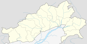 Dong  Dong Location in Arunachal Pradesh, India | |
| Coordinates: 28°10′12″N 97°2′30″E / 28.17000°N 97.04167°ECoordinates: 28°10′12″N 97°2′30″E / 28.17000°N 97.04167°E | |
| Country |
|
| State | Arunachal Pradesh |
| District | Lohit district |
| Elevation | 1,240 m (4,070 ft) |
| Languages | |
| • Official | English |
| Time zone | IST (UTC+05:30) |
| Vehicle registration | AR |
Dong is a small village in Dong valley of Lohit district, Arunachal Pradesh, India. It is mistakenly popular as the easternmost village in the country, near the point where India, China and Myanmar meet as it is the location of a peak where tourists climb up to at 3 am to see the sun rise, it is not the easternmost place but it is one of the eastern-most places accessible by car.[1] The last village on the India-China border in Arunachal Pradesh is Kaho, India, which lies just north of Kibithu on the banks of Lohit River.
Location
Dong lies at the junction of the Lohit River and the Sati (or Sai Ti) stream at an elevation of 1,240 metres (4,070 ft).[1]
Tourism
The Dong valley is unspoiled and has great natural beauty.[2]
Demographics
The village, with just three huts, can be reached on foot from Walong in a 90-minute climb. The children go to school in Walong. The local people grow rice, makai and maize and raise pigs and chickens.[1]
Transport
The 2,000-kilometre-long (1,200 mi) proposed Mago-Thingbu to Vijaynagar Arunachal Pradesh Frontier Highway along the McMahon Line,[3][4][5][6] (will intersect with the proposed East-West Industrial Corridor Highway) and will pass through this district, alignment map of which can be seen here and here.[7]
See also
References
Citations
- 1 2 3 Gokhale 2001.
- ↑ Dong in Arunachal...
- ↑ "Top officials to meet to expedite road building along China border". Dipak Kumar Dash. timesofindia.indiatimes.com. Retrieved 27 October 2014.
- ↑ "Narendra Modi government to provide funds for restoration of damaged highways". http://www.dnaindia.com. Retrieved 27 October 2014. External link in
|publisher=(help) - ↑ "Indian Government Plans Highway Along Disputed China Border". Ankit Panda. thediplomat.com. Retrieved 27 October 2014.
- ↑ "Govt planning road along McMohan line in Arunachal Pradesh: Kiren Rijiju". Live Mint. Retrieved 2014-10-26.
- ↑ "China warns India against paving road in Arunachal". Ajay Banerjee. tribuneindia.com. Retrieved 2014-10-26.
Sources
- "Dong in Arunachal will herald millennium dawn". Rediff. December 20, 1999. Retrieved 2012-12-16.
- Gokhale, Nitin A. (20 August 2001). "Dong". Outlook India. Retrieved 2012-12-16.
 |
|
| ||
| |
|
| ||
| ||||
| | ||||
| Assam | Nagaland | |