Katihar district
| Katihar district कटिहार जिलाضلع کٹیہار | |
|---|---|
| District of Bihar | |
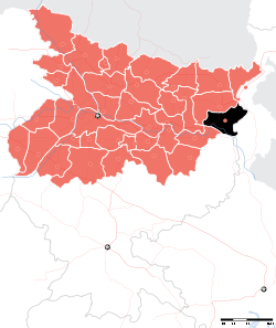 Location of Katihar district in Bihar | |
| Country | India |
| State | Bihar |
| Administrative division | Purnia |
| Headquarters | Katihar |
| Tehsils | 17 |
| Government | |
| • Lok Sabha constituencies | Katihar |
| • Assembly seats | korha (vidhan sabha constituency ) korha |
| Area | |
| • Total | 3,056 km2 (1,180 sq mi) |
| Population (2011) | |
| • Total | 30, 68,149 |
| Demographics | |
| • Sex ratio | 916 |
| Major highways | NH 31, NH 81 |
| Website | Official website |
Katihar district is one of the thirty-eight districts of Bihar state, India, and Katihar town is the administrative headquarters of this district. The district is a part of Purnia Division.
History
Katihar became a district when it was split from Purnia in 1973.[1] Earlier, Katihar district was dominated by the Choudhary family, who were the biggest landlords of Kosi zone. The founder of Choudhary family was Khan Bahadur Choudhary Mohammad Baksh and he had an authority over 126 small landlords of Kosi zone. He died in 1943. The family holds lands of about 15,000 acres in Katihar district, and 8,500 acres in Purnia. Now his successors Choudhary Taj Mohammad and Choudhary Mohammad Ashraf still live there in a haweli known as Taj Dehori. Katihar was also the part of Bengal before the Partition of Bengal. And after the partition of Bengal, Katihar district became part of Bihar. Although it's culturally a part of Bengal this district is in Bihar.Durgo Poojo is widely celebrated in this district. It is also starting point of North East Frontier Railway.
Geography
Katihar district occupies an area of 3,057 square kilometres (1,180 sq mi),[2] comparatively equivalent to Canada's Akimiski Island.[3]
Rivers: Mahananda, Ganges, Koshi, Righa
Katihar district is situated in the plains of North Eastern part of Bihar State, surrounded by Purnea district (Bihar) in the north and the west, Bhagalpur district (Bihar) and Sahebganj district (Jharkhand) in the south and Malda district and Uttar Dinajpur district (Paschim Bengal) in the east.
Economy
In 2006 the Ministry of Panchayati Raj named Katihar one of the country's 250 most backward districts (out of a total of 640).[4] It is one of the 36 districts in Bihar currently receiving funds from the Backward Regions Grant Fund Programme (BRGF).[4]
Political history
The Katihar Lok Sabha constituency has been represented by politicians like Sitaram Kesri former Teasurer and President of AICC, Tariq Anwar, Nikhil Choudhary, Mohammad Yunus Saleem. Mufti Mohammad Sayeed also unsuccessfully tried his luck.
The district has seen immense activity during freedom struggle. There has been renowned freedom fighters like Alhaj Azhar Ali after whose name there is a village called Ajhrail. Among notable freedom fighters were Dhrub Kundu his father Dr kundu Nakshtra Malakar known as Robinhood of Kosi belt.
Sub-divisions
Katihar District comprises 3 Sub-divisions:
- Katihar,
- Barsoi and
- Manihari,
Katihar sub-division is further divided into 10 blocks: Katihar, Korha, Falka, Sameli, Barari, Kursela, Pranpur, Hasanganj, Dandkhora and Mansahi. Barsoi sub-division consists 4 blocks: Barsoi, Kadwa, Azamnagar and Balrampur. Manihari sub-division has 2 blocks: Manihari and Amdabad. Hasanganj being the largest block which was under the zamindari rule with accres of land under the possession of then Late Shri Jogendranarayan Roy Choudhury. The entire landmass with school, temple and market has been donated to the people from the predecessors who remain in Katihar now with little of the possession under the Paul Choudhury fame. Mansahi was also very active zamindari estate which was at par with Kursela and Falka.
Demographics
According to the 2011 census Katihar district has a population of 3,068,149,[5] roughly equal to the nation of Oman[6] or the US state of Iowa.[7] This gives it a ranking of 117th in India (out of a total of 640).[5] The district has a population density of 1,004 inhabitants per square kilometre (2,600/sq mi).[5] Its population growth rate over the decade 2001–2011 was 28.23%.[5] Katihar has a sex ratio of 916 females for every 1000 males,[5] and a literacy rate of 53.56%.[5] The district has a significant concentration of Muslims.[5]
Surjapuri language, north Bengal's native language is spoken in Barsoi subdivision of Katihar district while Bengali language is also significantly spoken in Katihar.
References
- ↑ Law, Gwillim (2011-09-25). "Districts of India". Statoids. Retrieved 2011-10-11.
- ↑ Srivastava, Dayawanti et al. (ed.) (2010). "States and Union Territories: Bihar: Government". India 2010: A Reference Annual (54th ed.). New Delhi, India: Additional Director General, Publications Division, Ministry of Information and Broadcasting (India), Government of India. pp. 1118–1119. ISBN 978-81-230-1617-7.
- ↑ "Island Directory Tables: Islands by Land Area". United Nations Environment Program. 1998-02-18. Retrieved 2011-10-11.
Akimiski Island 3,001km2
- 1 2 Ministry of Panchayati Raj (September 8, 2009). "A Note on the Backward Regions Grant Fund Programme" (PDF). National Institute of Rural Development. Retrieved September 27, 2011.
- 1 2 3 4 5 6 7 "District Census 2011". Census2011.co.in. 2011. Retrieved 2011-09-30.
- ↑ US Directorate of Intelligence. "Country Comparison:Population". Retrieved 2011-10-01.
Oman 3,027,959
- ↑ "2010 Resident Population Data". U. S. Census Bureau. Retrieved 2011-09-30.
Iowa 3,046,355
External links
 |
Purnia district | North Dinajpur district, West Bengal | | |
| |
||||
| ||||
| | ||||
| Bhagalpur district | Sahebganj district, Jharkhand | Malda district, West Bengal |
Coordinates: 25°33′00″N 87°34′12″E / 25.55000°N 87.57000°E