Sambhal district
| Sambhal district | |
|---|---|
| District of Uttar Pradesh | |
 Location of Sambhal district in Uttar Pradesh | |
| Country | India |
| State | Uttar Pradesh |
| Administrative division | Moradabad |
| Headquarters | Sambhal |
| Tehsils | Sambhal, Chandausi, Gunnaur |
| Government | |
| • Lok Sabha constituencies | Sambhal |
| • Assembly seats | Sambhal, Asmoli, Chandausi, Gunnaur |
| Demographics | |
| • Literacy | 77% |
| • Sex ratio | 78% |
| Average annual precipitation | 115cm mm |
| Website | Official website |
Sambhal district is a district of Uttar Pradesh state in India.
Creation
The district was created by the state government on 23 July 2012 as one of three new districts in the state. At the time of its creation, the state government decided to name the new district "Bhimnagar" in honour of Bhimrao Ambedkar. However, massive protests broke out in Sambhal town and the adjoining rural areas against the move to give a new name to the ancient town.[1] Sambhal had been known by the same name for over five hundred years, had been an important town in medieval India, and had never had any connection with Bhimrao Ambedkar, the dalit icon. The protests against renaming the town were successful and the government had to revert to the old name of Sambhal.[2]
Location
The district of Sambhal is part of the Moradabad division Uttar Pradesh state.[3] The town of Sambhal is its headquarters.[4] The districts which adjoin Sambhal district are (clockwise from north) Amroha, Moradabad, Rampur, Badaun, Aligarh and Bulandshahr.
The nearest major metropolis is New Delhi. Sambhal lies 158.6 kilometres (98.5 mi) due east from New Delhi, past Ghaziabad, Noida and Hapur. The driving time from New Delhi is about 2 hours 40 minutes.[5] Sambhal lies 355 km north-west from the state capital Lucknow.
History

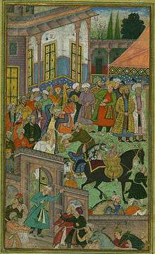
Sambhal has been an urban center for hundreds of years. it was a prominent town during the medieval period. The painting shown here is a folio from the Baburnama, and depicts an awards ceremony in Sultan Ibrāhīm Lodi's court before an expedition to Sambhal in the early 16th century.
Demographics
Sambhal is a Muslim dominated area.
References
- ↑ UP: Protest in Sambhal Over Change of District's Name
- ↑ http://www.outlookindia.com/news/article/up-protest-in-sambhal-over-change-of-districts-name/769919
- ↑ "UP gets three new districts: Prabuddhanagar, Panchsheel Nagar, Bhimnagar". The Indian Express. 29 September 2011. Retrieved 2 October 2011.
- ↑ "Bandh in Sambhal over location of new district headquarters". Retrieved 2012-10-27.
- ↑ http://www.distancesfrom.com/distance-from-New-Delhi-to-Sambhal/DistanceHistory/5148.aspx
External links
| Wikimedia Commons has media related to Sambhal district. |
- "Official Website District Sambhal". Sambhal District.
Coordinates: 28°34′48″N 78°33′00″E / 28.5800°N 78.5500°E