Emmeloord
| Emmeloord | |
|---|---|
| Town | |
|
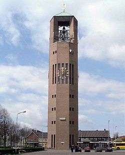
The Poldertoren in Emmeloord | |
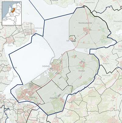 Emmeloord Location of Emmeloord in the province of Flevoland | |
| Coordinates: 52°42′35″N 5°45′3″E / 52.70972°N 5.75083°E | |
| Country | Netherlands |
| Province | Flevoland |
| Municipality | Noordoostpolder |
| Population (1 January 2016) | |
| • Total | 25,642[1] |
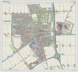
Emmeloord is the administrative center of the municipality of Noordoostpolder, Flevoland, Netherlands.
Overview
At the heart of the Noordoostpolder, where the three main drainage canals intersect, is the city of Emmeloord (1943). Emmeloord is in a polder: land reclaimed from the IJsselmeer, which earlier was part of the sea. Planned from the outset to be the first and the only major town of the polder, it is the local governmental and services centre. Ten smaller villages, conceived more as agricultural communities, were planned in a wide circle around Emmeloord, with the distances between them determined to be easily reachable by bicycle. The first settlements were Ens, Marknesse and Kraggenburg (1949), then Bant (1951), then Creil and Rutten (1953), and finally Espel, Tollebeek and Nagele (1956). There is another village called Luttelgeest (located northeast in the Noordoostpolder). From Emmeloord three canals take their water to three pumping stations, the Buma near Lemmer, the Smeenge at Vollenhove and the Vissering on Urk.
Emmeloord was named after an abandoned village on the island of Schokland.
In the center of Emmeloord there is a watertower called the Poldertoren. The tower is the central point of the Noordoostpolder and could be seen from almost every location in the early years of the Noordoostpolder, when there were no tall trees. In Japan there is a replica of this watertower.
For history see Zuiderzee Works.
Gallery
 Emmeloord, shopping street: Lange Nering
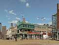 Emmeloord, view to a street: Beursstraat-De Dreef
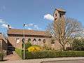 Emmeloord, reformed church: De Hoeksteen
 Emmeloord, church: Heilige Michaelkerk
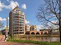 Emmeloord, view to an apartment building
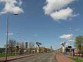 Emmeloord, view to a street and bridge
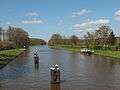 Emmeloord, canal: de Lemstervaart
Transportation
There is no railway station in Emmeloord, but the following are a few suggestions also showing possible major destination. Bus Times can be found at this link .
| Station | Destinations | How To Get There |
|---|---|---|
| Lelystad Centrum, Lelystad | Almere, Amsterdam, Amsterdam Airport Schiphol | Bus 315 (Only From Bus Station) |
| Kampen, Kampen | Zwolle | Bus 141 |
| Zwolle, Zwolle | Groningen, Leeuwarden, Emmen, Almelo, Enschede, Deventer, Arnhem, 's-Hertogenbosch, Breda, Roosendaal, Amersfoort, Utrecht, Rotterdam, The Hague | Bus 71, 141, 171 |
Emmeloord lies at the intersection of the A6 motorway and the N50 highway, providing a rapid connection to Amsterdam, Zwolle and Friesland.
See also
References
- ↑ (Dutch) Feiten en cijfers, Municipality of Noordoostpolder
External links
| Wikimedia Commons has media related to Emmeloord. |
- http://www.emmeloord.info/ (Dutch)
- http://www.noordoostpolder.nl/ (Dutch)
Coordinates: 52°42′35″N 5°45′3″E / 52.70972°N 5.75083°E