Fort Wright, Kentucky
| Fort Wright, Kentucky | |
|---|---|
| City | |
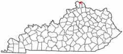 Location of Fort Wright, Kentucky | |
| Coordinates: 39°3′4″N 84°32′6″W / 39.05111°N 84.53500°WCoordinates: 39°3′4″N 84°32′6″W / 39.05111°N 84.53500°W | |
| Country | United States |
| State | Kentucky |
| County | Kenton |
| Area | |
| • Total | 3.5 sq mi (9.0 km2) |
| • Land | 3.5 sq mi (9.0 km2) |
| • Water | 0.0 sq mi (0.0 km2) |
| Elevation | 846 ft (258 m) |
| Population (2000) | |
| • Total | 5,681 |
| • Density | 1,642.1/sq mi (634.0/km2) |
| Time zone | Eastern (EST) (UTC-5) |
| • Summer (DST) | EDT (UTC-4) |
| ZIP codes | 41011, 41017 |
| Area code(s) | 859 |
| FIPS code | 21-28612 |
| GNIS feature ID | 0492358 |
Fort Wright is a home rule-class city[1] in Kenton County, Kentucky, in the United States. The population was 5,723 at the 2010 census.
Geography
Fort Wright is located at 39°3′4″N 84°32′6″W / 39.05111°N 84.53500°W (39.051011, -84.535042).[2]
According to the United States Census Bureau, the city has a total area of 3.5 square miles (9.1 km2) of which 3.5 square miles (9.1 km2) is land and 0.29% is water.
History
The area that is now Fort Wright was the site of one of the American Civil War fortifications built for the Defense of Cincinnati. The city, incorporated in 1941, was named for Major General Horatio Gouverneur Wright, a Union Army engineer.[3]
It annexed the neighboring communities of Lookout Heights in 1937, South Hills in 1949 and Lakeview in 1960.[4] [5]
Demographics
| Historical population | |||
|---|---|---|---|
| Census | Pop. | %± | |
| 1950 | 594 | — | |
| 1960 | 2,184 | 267.7% | |
| 1970 | 4,819 | 120.7% | |
| 1980 | 4,481 | −7.0% | |
| 1990 | 6,570 | 46.6% | |
| 2000 | 5,681 | −13.5% | |
| 2010 | 5,723 | 0.7% | |
| Est. 2015 | 5,781 | [6] | 1.0% |
At the 2000 census,[8] there were 5,681 people, 2,430 households and 1,569 families residing in the city. The population density was 1,642.1 per square mile (633.9/km²). There were 2,573 housing units at an average density of 743.7 per square mile (287.1/km²). The racial makeup of the city was 97.32% White, 0.99% African American, 0.05% Native American, 0.79% Asian, 0.02% Pacific Islander, 0.21% from other races, and 0.62% from two or more races. Hispanic or Latino of any race were 0.69% of the population.
There were 2,430 households of which 25.9% had children under the age of 18 living with them, 52.8% were married couples living together, 8.7% had a female householder with no husband present, and 35.4% were non-families. 30.9% of all households were made up of individuals and 10.5% had someone living alone who was 65 years of age or older. The average household size was 2.34 and the average family size was 2.97.
21.5% were under the age of 18, 7.5% from 18 to 24, 30.9% from 25 to 44, 24.6% from 45 to 64, and 15.5% who were 65 years of age or older. The median age was 39 years. For every 100 females there were 94.4 males. For every 100 females age 18 and over, there were 89.8 males.
The median household income was $52,394, and the median family income was $62,464. Males had a median income of $46,736 versus $35,220 for females. The per capita income for the city was $27,448. About 3.9% of families and 3.9% of the population were below the poverty line, including 6.1% of those under age 18 and 2.6% of those age 65 or over.
References
- ↑ "Summary and Reference Guide to House Bill 331 City Classification Reform" (PDF). Kentucky League of Cities. Retrieved December 30, 2014.
- ↑ "US Gazetteer files: 2010, 2000, and 1990". United States Census Bureau. 2011-02-12. Retrieved 2011-04-23.
- ↑ Rennick, Robert M. (1987). Kentucky Place Names. University Press of Kentucky. p. 107. Retrieved 2013-04-28.
- ↑ Commonwealth of Kentucky. Office of the Secretary of State. Land Office. "Fort Wright, Kentucky". 25 Jul 2013.
- ↑ City of Fort Wright. www.fortwright.com. 05 February 2015
- ↑ "Annual Estimates of the Resident Population for Incorporated Places: April 1, 2010 to July 1, 2015". Retrieved July 2, 2016.
- ↑ "Census of Population and Housing". Census.gov. Retrieved June 4, 2015.
- ↑ "American FactFinder". United States Census Bureau. Retrieved 2008-01-31.
External links
Municipalities and communities of Kenton County, Kentucky, United States | ||
|---|---|---|
| Cities | 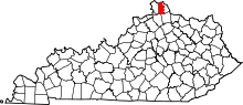 | |
| Unincorporated communities | ||
| Footnotes | ‡This populated place also has portions in an adjacent county or counties. | |