Kenton Vale, Kentucky
| Kenton Vale, Kentucky | |
|---|---|
| City | |
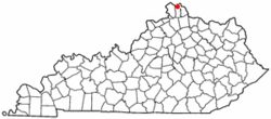 Location of Kenton Vale, Kentucky | |
| Coordinates: 39°3′5″N 84°31′12″W / 39.05139°N 84.52000°WCoordinates: 39°3′5″N 84°31′12″W / 39.05139°N 84.52000°W | |
| Country | United States |
| State | Kentucky |
| County | Kenton |
| Incorporated | 1949 |
| Named for | its county |
| Area | |
| • Total | 0.1 sq mi (0.1 km2) |
| • Land | 0.1 sq mi (0.1 km2) |
| • Water | 0.0 sq mi (0.0 km2) |
| Elevation | 528 ft (161 m) |
| Population (2000) | |
| • Total | 156 |
| • Density | 2,694.5/sq mi (1,040.3/km2) |
| Time zone | Eastern (EST) (UTC-5) |
| • Summer (DST) | EDT (UTC-4) |
| ZIP code | 41015 |
| Area code(s) | 859 |
| FIPS code | 21-42094 |
| GNIS feature ID | 0495662 |
Kenton Vale is a 6th-class city in Kenton County, Kentucky, in the United States. The population was 110 at the 2010 U.S. census.
Kenton Vale consists of only one subdivision and a cemetery branching off Madison Pike (Kentucky Route 17). The subdivision was named for the county, which in turn was named for explorer and pioneer Simon Kenton. There is only one way in and out of the city: through the intersection of Kuhrs Lane and Madison Pike. Incorporated by the state legislature in 1949,[1] the city was primarily created to keep Covington from annexing homes in the area.
Geography
Kenton Vale is located at 39°3′5″N 84°31′12″W / 39.05139°N 84.52000°W (39.051491, -84.520079).[2] According to the United States Census Bureau, the city has a total area of 0.1 square miles (0.26 km2), all land.
Demographics
| Historical population | |||
|---|---|---|---|
| Census | Pop. | %± | |
| 1950 | 165 | — | |
| 1960 | 168 | 1.8% | |
| 1970 | 178 | 6.0% | |
| 1980 | 145 | −18.5% | |
| 1990 | 358 | 146.9% | |
| 2000 | 156 | −56.4% | |
| 2010 | 110 | −29.5% | |
| Est. 2015 | 112 | [3] | 1.8% |
As of the census[5] of 2000, there were 156 people, 57 households, and 44 families residing in the city. The population density was 2,694.5 people per square mile (1,003.9/km²). There were 59 housing units at an average density of 1,019.1 per square mile (379.7/km²). The racial makeup of the city was 100.00% White.
There were 57 households out of which 28.1% had children under the age of 18 living with them, 70.2% were married couples living together, 7.0% had a female householder with no husband present, and 21.1% were non-families. 17.5% of all households were made up of individuals and 5.3% had someone living alone who was 65 years of age or older. The average household size was 2.74 and the average family size was 3.13.
In the city the population was spread out with 23.1% under the age of 18, 9.0% from 18 to 24, 29.5% from 25 to 44, 23.7% from 45 to 64, and 14.7% who were 65 years of age or older. The median age was 38 years. For every 100 females there were 100.0 males. For every 100 females age 18 and over, there were 93.5 males.
The median income for a household in the city was $43,750, and the median income for a family was $50,625. Males had a median income of $30,625 versus $23,125 for females. The per capita income for the city was $19,540. About 1.9% of families and 3.1% of the population were below the poverty line, including 12.5% of those under the age of eighteen and none of those sixty five or over.
References
- ↑ Commonwealth of Kentucky. Office of the Secretary of State. Land Office. "Kenton Vale, Kentucky". Accessed 1 Aug 2013.
- ↑ "US Gazetteer files: 2010, 2000, and 1990". United States Census Bureau. 2011-02-12. Retrieved 2011-04-23.
- ↑ "Annual Estimates of the Resident Population for Incorporated Places: April 1, 2010 to July 1, 2015". Retrieved July 2, 2016.
- ↑ "Census of Population and Housing". Census.gov. Retrieved June 4, 2015.
- ↑ "American FactFinder". United States Census Bureau. Retrieved 2008-01-31.
Municipalities and communities of Kenton County, Kentucky, United States | ||
|---|---|---|
| Cities | 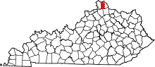 | |
| Unincorporated communities | ||
| Footnotes | ‡This populated place also has portions in an adjacent county or counties. | |