Lakeside Park, Kentucky
| Lakeside Park, Kentucky | |
|---|---|
| City | |
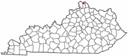 Location of Lakeside Park, Kentucky | |
| Coordinates: 39°1′59″N 84°34′5″W / 39.03306°N 84.56806°WCoordinates: 39°1′59″N 84°34′5″W / 39.03306°N 84.56806°W | |
| Country | United States |
| State | Kentucky |
| County | Kenton |
| Incorporated | 1930 |
| Area | |
| • Total | 0.8 sq mi (2.0 km2) |
| • Land | 0.8 sq mi (2.0 km2) |
| • Water | 0.0 sq mi (0.0 km2) |
| Elevation | 850 ft (259 m) |
| Population (2000) | |
| • Total | 2,869 |
| • Density | 3,746.8/sq mi (1,446.7/km2) |
| Time zone | Eastern (EST) (UTC-5) |
| • Summer (DST) | EDT (UTC-4) |
| ZIP code | 41017 |
| Area code(s) | 859 |
| FIPS code | 21-43606 |
| GNIS feature ID | 0495923 |
| Website | www.cityoflakesidepark.com |
Lakeside Park is a home rule-class city[1] in Kenton County, Kentucky, in the United States. As of the 2010 U.S. census, the city had a total population of 2,668.
History
Lakeside Park was incorporated in 1930.[2]
Geography
Lakeside Park is located at 39°1′59″N 84°34′5″W / 39.03306°N 84.56806°W (39.033113, -84.568160).[3] According to the United States Census Bureau, the city has a total area of 0.8 square miles (2.1 km2), of which 0.8 square miles (2.1 km2) is land and 1.28% is water.
Demographics
| Historical population | |||
|---|---|---|---|
| Census | Pop. | %± | |
| 1940 | 761 | — | |
| 1950 | 988 | 29.8% | |
| 1960 | 2,214 | 124.1% | |
| 1970 | 2,511 | 13.4% | |
| 1980 | 3,062 | 21.9% | |
| 1990 | 3,131 | 2.3% | |
| 2000 | 2,869 | −8.4% | |
| 2010 | 2,668 | −7.0% | |
| Est. 2015 | 2,779 | [4] | 4.2% |
As of the census[6] of 2000, there were 2,869 people, 1,237 households, and 755 families residing in the city. The population density was 3,746.8 people per square mile (1,438.6/km²). There were 1,288 housing units at an average density of 1,682.1 per square mile (645.8/km²). The racial makeup of the city was 96.72% White, 1.60% African American, 0.10% Native American, 0.28% Asian, 0.59% from other races, and 0.70% from two or more races. 1.15% of the population were Hispanic or Latino of any race.
There were 1,237 households out of which 27.4% had children under the age of 18 living with them, 49.9% were married couples living together, 8.0% had a female householder with no husband present, and 38.9% were non-families. 31.9% of all households were made up of individuals and 12.2% had someone living alone who was 65 years of age or older. The average household size was 2.30 and the average family size was 2.95.
In the city the population was spread out with 23.0% under the age of 18, 10.8% from 18 to 24, 27.6% from 25 to 44, 23.4% from 45 to 64, and 15.2% who were 65 years of age or older. The median age was 37 years. For every 100 females there were 91.0 males. For every 100 females age 18 and over, there were 85.6 males.
The median income for a household in the city was $50,781, and the median income for a family was $70,000. Males had a median income of $50,171 versus $30,329 for females. The per capita income for the city was $29,711. About 0.5% of families and 1.2% of the population were below the poverty line, including 0.1% of those under the age of 18 and 4.2% of those 65 and older.
References
- ↑ "Summary and Reference Guide to House Bill 331 City Classification Reform" (PDF). Kentucky League of Cities. Retrieved December 30, 2014.
- ↑ Kleber, John E. The Kentucky Encyclopedia. University Press of Kentucky. p. 533. ISBN 0-8131-2883-8.
- ↑ "US Gazetteer files: 2010, 2000, and 1990". United States Census Bureau. 2011-02-12. Retrieved 2011-04-23.
- ↑ "Annual Estimates of the Resident Population for Incorporated Places: April 1, 2010 to July 1, 2015". Retrieved July 2, 2016.
- ↑ "Census of Population and Housing". Census.gov. Retrieved June 4, 2015.
- ↑ "American FactFinder". United States Census Bureau. Retrieved 2008-01-31.
External links
Municipalities and communities of Kenton County, Kentucky, United States | ||
|---|---|---|
| Cities | 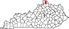 | |
| Unincorporated communities | ||
| Footnotes | ‡This populated place also has portions in an adjacent county or counties. | |