Gautam Budh Nagar district
| Gautam Buddh Nagar district गौतमबुद्धनगर گوتم بدھ نگر | |
|---|---|
| District of Uttar Pradesh | |
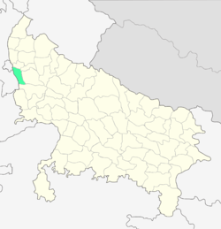 Location of Gautam Buddh Nagar district in Uttar Pradesh | |
| Country | India |
| State | Uttar Pradesh |
| Administrative division | Meerut |
| Headquarters | Greater Noida |
| Tehsils | Dadri,Jewar and Noida |
| Government | |
| • Lok Sabha constituencies | Gautam Buddha Nagar |
| • Assembly seats | Noida, Dadri & Jewar |
| Area | |
| • Total | 1,442 km2 (557 sq mi) |
| Population (2011) | |
| • Total | 1,674,714 |
| • Density | 1,200/km2 (3,000/sq mi) |
| Demographics | |
| • Literacy | 82.2 per cent[1] |
| • Sex ratio | 852:1000 |
| Major highways | Noida–Greater Noida Expressway and Yamuna Expressway |
| Website | Official website |
Gautam Budh Nagar is a largely suburban district of Uttar Pradesh state in northern India.[2] It is part of the National Capital Region (India). Greater Noida is the district administrative headquarters.
The district is one of the fastest growing parts of India, registering 51.52% growth in the preceding decade, according to the census of 2011.[3]
Gautam Budh Nagar is included in the proposed Delhi-Mumbai Industrial Corridor.[4]
Demographics
According to the 2011 census, Gautam Budh Nagar has a population of 1,674,714.[5] It is ranked 294th out of a total of 640 Indian districts in terms of population.[5] Gautam Budh Nagar has a population density of 1,161 inhabitants per square kilometre (3,010/sq mi).[5] Its population growth rate over the decade 2001-2011 was 39.32%.[5] Gautam Budh Nagar has a sex ratio of 852 females for every 1,000 males,[5] and a literacy rate of 82.2%.
Due to its close proximity to Delhi, the population is highly literate with 82.2% of population in the district are literate compared to 74.04% national average.[5] The female lieracy stands at 72.78% much higher than national average of 65.46%.[3]
Education
State University
References
- ↑ "District-specific Literates and Literacy Rates, 2001". Registrar General, India, Ministry of Home Affairs. Retrieved 1 June 2014.
- ↑ http://gbnagar.nic.in/profile/profiletest.htm
- 1 2 "Ghaziabad, GB Nagar hub of high literacy, falling sex ratio". The Times Of India. TNN. 6 April 2011. Retrieved 6 April 2011.
- ↑ Official Website of Delhi Mumbai Industrial Corridor Development Corporation Retrieved 15 March 2014
- 1 2 3 4 5 6 "District Census 2011". Census2011.co.in. 2011. Retrieved 30 September 2011.
External links
 |
East Delhi district, NCT South Delhi district, NCT |
Ghaziabad district | | |
| Faridabad district, Haryana | |
Bulandshahr district | ||
| ||||
| | ||||
| Palwal district, Haryana | Tappal |
Coordinates: 28°32′00″N 77°23′21″E / 28.5333°N 77.3891°E