Gentry, Missouri
| Gentry, Missouri | |
|---|---|
| Village | |
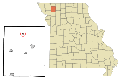 Location of Gentry, Missouri | |
| Coordinates: 40°19′56″N 94°25′26″W / 40.33222°N 94.42389°WCoordinates: 40°19′56″N 94°25′26″W / 40.33222°N 94.42389°W | |
| Country | United States |
| State | Missouri |
| County | Gentry |
| Area[1] | |
| • Total | 0.23 sq mi (0.60 km2) |
| • Land | 0.23 sq mi (0.60 km2) |
| • Water | 0 sq mi (0 km2) |
| Elevation | 892 ft (272 m) |
| Population (2010)[2] | |
| • Total | 72 |
| • Estimate (2012[3]) | 73 |
| • Density | 313.0/sq mi (120.8/km2) |
| Time zone | Central (CST) (UTC-6) |
| • Summer (DST) | CDT (UTC-5) |
| ZIP code | 64453 |
| Area code(s) | 660 |
| FIPS code | 29-26776[4] |
| GNIS feature ID | 0718382[5] |
Gentry is a village in Gentry County, Missouri. The population was 72 at the 2010 census.
History
Gentry was platted in 1899 by the railroad.[6] Gentry was named from Gentry County,[7] which was named for Richard Gentry, a hero of the Seminole Wars.[8]
Geography
Gentry is located at 40°19′56″N 94°25′26″W / 40.33222°N 94.42389°W (40.332140, -94.423759).[9]
According to the United States Census Bureau, the village has a total area of 0.23 square miles (0.60 km2), all of it land.[1]
Demographics
| Historical population | |||
|---|---|---|---|
| Census | Pop. | %± | |
| 1850 | 126 | — | |
| 1860 | 160 | 27.0% | |
| 1870 | 255 | 59.4% | |
| 1880 | 298 | 16.9% | |
| 1890 | 223 | −25.2% | |
| 1900 | 147 | −34.1% | |
| 1910 | 226 | 53.7% | |
| 1920 | 217 | −4.0% | |
| 1930 | 202 | −6.9% | |
| 1940 | 196 | −3.0% | |
| 1950 | 159 | −18.9% | |
| 1960 | 98 | −38.4% | |
| 1970 | 143 | 45.9% | |
| 1980 | 126 | −11.9% | |
| 1990 | 95 | −24.6% | |
| 2000 | 101 | 6.3% | |
| 2010 | 72 | −28.7% | |
| Est. 2015 | 72 | [10] | 0.0% |
2010 census
As of the census[2] of 2010, there were 72 people, 29 households, and 18 families residing in the village. The population density was 313.0 inhabitants per square mile (120.8/km2). There were 35 housing units at an average density of 152.2 per square mile (58.8/km2). The racial makeup of the village was 98.6% White and 1.4% from two or more races.
There were 29 households of which 34.5% had children under the age of 18 living with them, 51.7% were married couples living together, 10.3% had a female householder with no husband present, and 37.9% were non-families. 34.5% of all households were made up of individuals. The average household size was 2.48 and the average family size was 3.17.
The median age in the village was 36.3 years. 27.8% of residents were under the age of 18; 9.7% were between the ages of 18 and 24; 26.4% were from 25 to 44; 26.4% were from 45 to 64; and 9.7% were 65 years of age or older. The gender makeup of the village was 50.0% male and 50.0% female.
2000 census
As of the census[4] of 2000, there were 101 people, 34 households, and 22 families residing in the village. The population density was 445.7 people per square mile (169.5/km²). There were 44 housing units at an average density of 194.2 per square mile (73.9/km²). The racial makeup of the village was 100.00% White.
There were 34 households out of which 38.2% had children under the age of 18 living with them, 41.2% were married couples living together, 17.6% had a female householder with no husband present, and 32.4% were non-families. 32.4% of all households were made up of individuals and 5.9% had someone living alone who was 65 years of age or older. The average household size was 2.97 and the average family size was 3.78.
In the village the population was spread out with 44.6% under the age of 18, 5.0% from 18 to 24, 27.7% from 25 to 44, 14.9% from 45 to 64, and 7.9% who were 65 years of age or older. The median age was 26 years. For every 100 females there were 106.1 males. For every 100 females age 18 and over, there were 107.4 males.
The median income for a household in the village was $20,000, and the median income for a family was $28,750. Males had a median income of $28,750 versus $15,625 for females. The per capita income for the village was $8,501. There were 25.0% of families and 17.1% of the population living below the poverty line, including 10.4% of under eighteens and none of those over 64.
Notable people
References
- 1 2 "US Gazetteer files 2010". United States Census Bureau. Archived from the original on January 24, 2012. Retrieved 2012-07-08.
- 1 2 "American FactFinder". United States Census Bureau. Retrieved 2012-07-08.
- ↑ "Population Estimates". United States Census Bureau. Archived from the original on June 17, 2013. Retrieved 2013-05-30.
- 1 2 "American FactFinder". United States Census Bureau. Archived from the original on September 11, 2013. Retrieved 2008-01-31.
- ↑ "US Board on Geographic Names". United States Geological Survey. 2007-10-25. Retrieved 2008-01-31.
- ↑ Earngey, Bill (1995). Missouri Roadsides: The Traveler's Companion. University of Missouri Press. p. 4.
- ↑ Eaton, David Wolfe (1916). How Missouri Counties, Towns and Streams Were Named. The State Historical Society of Missouri. p. 170.
- ↑ Gannett, Henry (1905). The Origin of Certain Place Names in the United States. Govt. Print. Off. p. 136.
- ↑ "US Gazetteer files: 2010, 2000, and 1990". United States Census Bureau. 2011-02-12. Retrieved 2011-04-23.
- ↑ "Annual Estimates of the Resident Population for Incorporated Places: April 1, 2010 to July 1, 2015". Retrieved July 2, 2016.
- ↑ "Census of Population and Housing". Census.gov. Archived from the original on May 11, 2015. Retrieved June 4, 2015.
External links
- Historic maps of Gentry in the Sanborn Maps of Missouri Collection at the University of Missouri
Municipalities and communities of Gentry County, Missouri, United States | ||
|---|---|---|
| Cities | 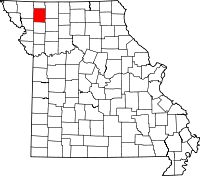 | |
| Village | ||
| Townships | ||
| Unincorporated communities | ||
| Ghost town | ||