Gloverville, South Carolina
| Gloverville, South Carolina | |
|---|---|
| Census-designated place | |
|
Gloverville Post Office | |
 Location of Gloverville, South Carolina | |
| Coordinates: 33°31′36″N 81°49′24″W / 33.52667°N 81.82333°WCoordinates: 33°31′36″N 81°49′24″W / 33.52667°N 81.82333°W | |
| Country | United States |
| State | South Carolina |
| County | Aiken |
| Area | |
| • Total | 3.6 sq mi (9.4 km2) |
| • Land | 3.6 sq mi (9.4 km2) |
| • Water | 0.0 sq mi (0.0 km2) |
| Elevation | 203 ft (62 m) |
| Population (2010) | |
| • Total | 2,831 |
| • Density | 780/sq mi (301.2/km2) |
| Time zone | Eastern (EST) (UTC-5) |
| • Summer (DST) | EDT (UTC-4) |
| ZIP code | 29828 |
| Area code(s) | 803 |
| FIPS code | 45-29410[1] |
| GNIS feature ID | 1231324[2] |
.jpg)
Gloverville is a census-designated place (CDP) in Aiken County, South Carolina, United States. The population was 2,831 at the 2010 census.[3] It is part of the Augusta, Georgia metropolitan area. Gloverville is located in historic Horse Creek Valley.
Geography
Gloverville is located in western Aiken County at 33°31′36″N 81°49′24″W / 33.52667°N 81.82333°W (33.526665, -81.823352).[4] Neighboring communities are Langley to the southwest, part of Burnettown to the northwest, Graniteville to the north, and Warrenville to the east. Gloverville is located 9 miles (14 km) east of downtown Augusta, Georgia, and 8 miles (13 km) southwest of downtown Aiken.
According to the United States Census Bureau, the Gloverville CDP has a total area of 3.6 square miles (9.4 km2), of which 0.0077 square miles (0.02 km2), or 0.25%, is water.[3]
Demographics
As of the census[1] of 2000, there were 2,805 people, 1,142 households, and 771 families residing in the CDP. The population density was 801.6 people per square mile (309.4/km²). There were 1,324 housing units at an average density of 378.4/sq mi (146.1/km²). The racial makeup of the CDP was 86.27% White, 10.91% African American, 0.32% Native American, 0.11% Asian, 0.36% from other races, and 2.03% from two or more races. Hispanic or Latino of any race were 1.21% of the population.
There were 1,142 households out of which 31.9% had children under the age of 18 living with them, 46.8% were married couples living together, 16.4% had a female householder with no husband present, and 32.4% were non-families. 28.2% of all households were made up of individuals and 10.6% had someone living alone who was 65 years of age or older. The average household size was 2.45 and the average family size was 2.99.
In the CDP the population was spread out with 26.9% under the age of 18, 10.2% from 18 to 24, 28.4% from 25 to 44, 23.4% from 45 to 64, and 11.1% who were 65 years of age or older. The median age was 34 years. For every 100 females there were 94.4 males. For every 100 females age 18 and over, there were 90.4 males.
The median income for a household in the CDP was $24,679, and the median income for a family was $31,719. Males had a median income of $29,088 versus $18,143 for females. The per capita income for the CDP was $13,314. About 18.0% of families and 22.5% of the population were below the poverty line, including 29.6% of those under age 18 and 19.5% of those age 65 or over.
2010 Census
As of 2010, the census reported a population of 2,831. Of this, 2,290 were White, (80.89%) 382 (13.49%) were Black or African American, 86 (3.04%) were two or more races, 46 (1.62%) were some other race, 21 (0.74%) were American Indian or Alaska Native 6 (0.21%) were Asian.[5]
References
- 1 2 "American FactFinder". United States Census Bureau. Retrieved 2008-01-31.
- ↑ "US Board on Geographic Names". United States Geological Survey. 2007-10-25. Retrieved 2008-01-31.
- 1 2 "Geographic Identifiers: 2010 Demographic Profile Data (G001): Gloverville CDP, South Carolina". U.S. Census Bureau, American Factfinder. Retrieved August 6, 2013.
- ↑ "US Gazetteer files: 2010, 2000, and 1990". United States Census Bureau. 2011-02-12. Retrieved 2011-04-23.
- ↑ http://censusviewer.com/city/SC/Gloverville/2010
Municipalities and communities of Aiken County, South Carolina, United States | ||
|---|---|---|
| Cities | 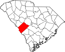 | |
| Towns | ||
| CDPs | ||
| Unincorporated communities | ||
| Footnotes | ‡This populated place also has portions in an adjacent county or counties | |