Perkins, Georgia
| Perkins | |
|---|---|
| Unincorporated community & census-designated place | |
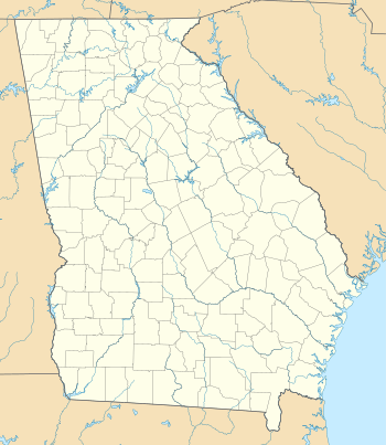 Perkins  Perkins Location within the state of Georgia | |
| Coordinates: 32°54′35″N 81°57′10″W / 32.90972°N 81.95278°WCoordinates: 32°54′35″N 81°57′10″W / 32.90972°N 81.95278°W | |
| Country | United States |
| State | Georgia |
| County | Jenkins |
| Elevation | 239 ft (73 m) |
| Time zone | Eastern (EST) (UTC-5) |
| • Summer (DST) | EDT (UTC-4) |
| ZIP codes | 30822 |
| GNIS feature ID | 332641 |
Perkins (also Perkins Station) is a census-designated place and unincorporated community in Jenkins County, Georgia, United States. It lies a short distance east of U.S. Route 25 to the north of the city of Millen, the county seat of Jenkins County.[1] Its elevation is 239 feet (73 m).[2][3]
See also
References
- ↑ Rand McNally. The Road Atlas '05. Skokie: Rand McNally, 2005, p. 28.
- ↑ U.S. Geological Survey Geographic Names Information System: Perkins, Georgia, Geographic Names Information System, 1979-09-25. Accessed 2007-12-23.
- ↑ Zip Code Lookup
External links
- Old Buckhead Church historical marker
Municipalities and communities of Jenkins County, Georgia, United States | ||
|---|---|---|
| City | 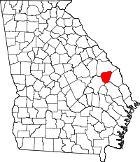 | |
| CDP | ||
| Unincorporated community | ||
This article is issued from Wikipedia - version of the 12/2/2016. The text is available under the Creative Commons Attribution/Share Alike but additional terms may apply for the media files.