Snelling, South Carolina
| Snelling, South Carolina | |
|---|---|
| Town | |
 Location of Snelling, South Carolina | |
| Coordinates: 33°14′29″N 81°27′11″W / 33.24139°N 81.45306°WCoordinates: 33°14′29″N 81°27′11″W / 33.24139°N 81.45306°W | |
| Country | United States |
| State | South Carolina |
| County | Barnwell |
| Area | |
| • Total | 4.1 sq mi (10.6 km2) |
| • Land | 4.1 sq mi (10.5 km2) |
| • Water | 0.04 sq mi (0.1 km2) |
| Elevation | 230 ft (70 m) |
| Population (2010) | |
| • Total | 274 |
| • Density | 68/sq mi (26.2/km2) |
| Time zone | Eastern (EST) (UTC-5) |
| • Summer (DST) | EDT (UTC-4) |
| ZIP code | 29812 |
| Area code(s) | 803 |
| FIPS code | 45-67255[1] |
| GNIS feature ID | 1226722[2] |
Snelling is a town in Barnwell County, South Carolina, United States. The population was 274 at the 2010 census.[3]
Geography
Snelling is located near the center of Barnwell County at 33°14′29″N 81°27′11″W / 33.24139°N 81.45306°W (33.241284, -81.453184).[4] South Carolina Highway 64 passes through the center of town, leading east 5 miles (8 km) to Barnwell, the county seat, and west 1 mile (2 km) to the east entrance of the Savannah River Site, a nuclear reservation.
According to the United States Census Bureau, the town has a total area of 4.1 square miles (10.6 km2), of which 4.1 square miles (10.5 km2) is land and 0.04 square miles (0.1 km2), or 1.20%, is water.[3]
Demographics
| Historical population | |||
|---|---|---|---|
| Census | Pop. | %± | |
| 1910 | 338 | — | |
| 1920 | 137 | −59.5% | |
| 1930 | 126 | −8.0% | |
| 1940 | 128 | 1.6% | |
| 1950 | 34 | −73.4% | |
| 1960 | 100 | 194.1% | |
| 1970 | 150 | 50.0% | |
| 1980 | 111 | −26.0% | |
| 1990 | 125 | 12.6% | |
| 2000 | 246 | 96.8% | |
| 2010 | 274 | 11.4% | |
| Est. 2015 | 259 | [5] | −5.5% |
As of the census[1] of 2000, there were 246 people, 87 households, and 70 families residing in the town. The population density was 79.8 people per square mile (30.8/km²). There were 105 housing units at an average density of 34.1 per square mile (13.2/km²). The racial makeup of the town was 78.05% White, 19.92% African American, 0.81% from other races, and 1.22% from two or more races. Hispanic or Latino of any race were 2.85% of the population.
As of the census there were 87 households out of which 46.0% had children under the age of 18 living with them, 65.5% were married couples living together, 9.2% had a female householder with no husband present, and 18.4% were non-families. 16.1% of all households were made up of individuals and 3.4% had someone living alone who was 65 years of age or older. The average household size was 2.83 and the average family size was 3.13.
In the town the population was spread out with 30.9% under the age of 18, 6.1% from 18 to 24, 33.7% from 25 to 44, 22.0% from 45 to 64, and 7.3% who were 65 years of age or older. The median age was 36 years. For every 100 females there were 108.5 males. For every 100 females age 18 and over, there were 109.9 males.
The median income for a household in the town was $35,313, and the median income for a family was $40,139. Males had a median income of $34,286 versus $25,625 for females. The per capita income for the town was $13,420. About 6.0% of families and 9.7% of the population were below the poverty line, including 7.1% of those under the age of eighteen and 14.3% of those sixty five or over.
References
- 1 2 "American FactFinder". United States Census Bureau. Retrieved 2008-01-31.
- ↑ "US Board on Geographic Names". United States Geological Survey. 2007-10-25. Retrieved 2008-01-31.
- 1 2 "Geographic Identifiers: 2010 Demographic Profile Data (G001): Snelling town, South Carolina". U.S. Census Bureau, American Factfinder. Retrieved April 3, 2014.
- ↑ "US Gazetteer files: 2010, 2000, and 1990". United States Census Bureau. 2011-02-12. Retrieved 2011-04-23.
- ↑ "Annual Estimates of the Resident Population for Incorporated Places: April 1, 2010 to July 1, 2015". Retrieved July 2, 2016.
- ↑ "Census of Population and Housing". Census.gov. Retrieved June 4, 2015.
Municipalities and communities of Barnwell County, South Carolina, United States | ||
|---|---|---|
| City | 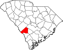 | |
| Towns | ||
| Ghost town | ||