Mitchell, Georgia
| Mitchell, Georgia | |
|---|---|
| Town | |
 Location in Glascock County and the state of Georgia | |
| Coordinates: 33°13′21″N 82°42′1″W / 33.22250°N 82.70028°WCoordinates: 33°13′21″N 82°42′1″W / 33.22250°N 82.70028°W | |
| Country | United States |
| State | Georgia |
| County | Glascock |
| Area | |
| • Total | 1.48 sq mi (3.84 km2) |
| • Land | 1.48 sq mi (3.83 km2) |
| • Water | 0.008 sq mi (0.02 km2) |
| Elevation | 535 ft (163 m) |
| Population (2010) | |
| • Total | 199 |
| • Density | 135/sq mi (52.0/km2) |
| Time zone | Eastern (EST) (UTC-5) |
| • Summer (DST) | EDT (UTC-4) |
| ZIP code | 30820 |
| Area code(s) | 706 |
| FIPS code | 13-51968[1] |
| GNIS feature ID | 0318336[2] |
Mitchell is a town in Glascock County, Georgia, United States. The population was 199 at the 2010 census.[3] Mitchell is home to the Mitchell Depot Historical Museum.
Geography

Mitchell is located in western Glascock County at the intersection of State Routes 102 and 123. SR 102 leads east 6 miles (10 km) to Gibson, the Glascock County seat, and southwest 19 miles (31 km) to Sandersville, while SR 123 leads northwest 18 miles (29 km) to Sparta.
According to the United States Census Bureau, the town of Mitchell has a total area of 1.5 square miles (3.8 km2), of which 0.01 square miles (0.02 km2), or 0.42%, is water.[3] It is located 2 miles (3 km) east of the Ogeechee River.
Demographics
| Historical population | |||
|---|---|---|---|
| Census | Pop. | %± | |
| 1900 | 246 | — | |
| 1910 | 212 | −13.8% | |
| 1920 | 257 | 21.2% | |
| 1930 | 237 | −7.8% | |
| 1940 | 228 | −3.8% | |
| 1950 | 240 | 5.3% | |
| 1960 | 184 | −23.3% | |
| 1970 | 187 | 1.6% | |
| 1980 | 214 | 14.4% | |
| 1990 | 181 | −15.4% | |
| 2000 | 173 | −4.4% | |
| 2010 | 199 | 15.0% | |
| Est. 2015 | 201 | [4] | 1.0% |
As of the census[1] of 2000, there were 173 people, 72 households, and 51 families residing in the town. The population density was 119.2 people per square mile (46.1/km²). There were 77 housing units at an average density of 53.0 per square mile (20.5/km²). The racial makeup of the town was 83.82% White and 16.18% African American.
There were 72 households out of which 26.4% had children under the age of 18 living with them, 62.5% were married couples living together, 5.6% had a female householder with no husband present, and 27.8% were non-families. 26.4% of all households were made up of individuals and 12.5% had someone living alone who was 65 years of age or older. The average household size was 2.40 and the average family size was 2.90.
In the town the population was spread out with 19.1% under the age of 18, 6.9% from 18 to 24, 25.4% from 25 to 44, 27.7% from 45 to 64, and 20.8% who were 65 years of age or older. The median age was 43 years. For every 100 females there were 98.9 males. For every 100 females age 18 and over, there were 94.4 males.
The median income for a household in the town was $34,375, and the median income for a family was $44,063. Males had a median income of $35,000 versus $21,875 for females. The per capita income for the town was $18,103. About 2.9% of families and 7.8% of the population were below the poverty line, including 12.5% of those under the age of eighteen and 6.7% of those sixty five or over.
See also
References
- 1 2 "American FactFinder". United States Census Bureau. Retrieved 2008-01-31.
- ↑ "US Board on Geographic Names". United States Geological Survey. 2007-10-25. Retrieved 2008-01-31.
- 1 2 "Geographic Identifiers: 2010 Demographic Profile Data (G001): Mitchell town, Georgia". American Factfinder. U.S. Census Bureau. Retrieved November 22, 2016.
- ↑ "Annual Estimates of the Resident Population for Incorporated Places: April 1, 2010 to July 1, 2015". Retrieved July 2, 2016.
- ↑ "Census of Population and Housing". Census.gov. Retrieved June 4, 2015.
External links
- The News and Farmer and Wadley Herald/ Jefferson Reporter, the county's weekly newspaper and the oldest weekly newspaper in Georgia.
Municipalities and communities of Glascock County, Georgia, United States | ||
|---|---|---|
| Cities | 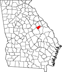 | |
| Town | ||