Willington, South Carolina
| Willington, South Carolina | |
|---|---|
| CDP | |
 Location in McCormick County and the state of South Carolina. | |
| Coordinates: 33°58′6″N 82°27′12″W / 33.96833°N 82.45333°WCoordinates: 33°58′6″N 82°27′12″W / 33.96833°N 82.45333°W | |
| Country | United States |
| State | South Carolina |
| County | McCormick |
| Area | |
| • Total | 6.0 sq mi (15.6 km2) |
| • Land | 6.0 sq mi (15.5 km2) |
| • Water | 0.0 sq mi (0.1 km2) |
| Elevation | 486 ft (148 m) |
| Population (2000) | |
| • Total | 177 |
| • Density | 29.6/sq mi (11.4/km2) |
| Time zone | Eastern (EST) (UTC-5) |
| • Summer (DST) | EDT (UTC-4) |
| ZIP code | 29835 |
| Area code(s) | 864 |
| FIPS code | 45-77920[1] |
| GNIS feature ID | 1230504[2] |
Willington is a census-designated place (CDP) in McCormick County, South Carolina, United States. The population was 177 at the 2000 census.
History
The Calhoun-Gibert House and Guillebeau House are listed on the National Register of Historic Places.[3]
Geography
Willington is located at 33°58′6″N 82°27′12″W / 33.96833°N 82.45333°W (33.968197, -82.453232).[4]
According to the United States Census Bureau, the CDP has a total area of 6.0 square miles (16 km2), of which, 6.0 square miles (16 km2) of it is land and 0.04 square miles (0.10 km2) of it (0.67%) is water.
Demographics
As of the census[1] of 2000, there were 177 people, 68 households, and 43 families residing in the CDP. The population density was 29.6 people per square mile (11.4/km²). There were 80 housing units at an average density of 13.4/sq mi (5.2/km²). The racial makeup of the CDP was 15.25% White, 82.49% African American and 2.26% Asian.
There were 68 households out of which 25.0% had children under the age of 18 living with them, 41.2% were married couples living together, 22.1% had a female householder with no husband present, and 35.3% were non-families. 33.8% of all households were made up of individuals and 14.7% had someone living alone who was 65 years of age or older. The average household size was 2.60 and the average family size was 3.41.
In the CDP the population was spread out with 25.4% under the age of 18, 10.7% from 18 to 24, 25.4% from 25 to 44, 24.3% from 45 to 64, and 14.1% who were 65 years of age or older. The median age was 38 years. For every 100 females there were 96.7 males. For every 100 females age 18 and over, there were 100.0 males.
The median income for a household in the CDP was $31,429, and the median income for a family was $33,750. Males had a median income of $35,227 versus $21,250 for females. The per capita income for the CDP was $14,057. None of the families and 7.0% of the population were living below the poverty line.
References
- 1 2 "American FactFinder". United States Census Bureau. Retrieved 2008-01-31.
- ↑ "US Board on Geographic Names". United States Geological Survey. 2007-10-25. Retrieved 2008-01-31.
- ↑ National Park Service (2010-07-09). "National Register Information System". National Register of Historic Places. National Park Service.
- ↑ "US Gazetteer files: 2010, 2000, and 1990". United States Census Bureau. 2011-02-12. Retrieved 2011-04-23.
Municipalities and communities of McCormick County, South Carolina, United States | ||
|---|---|---|
| Towns | 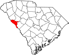 | |
| CDPs | ||