Blythe, Georgia
| Blythe, Georgia | |
|---|---|
| City | |
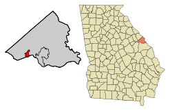 Location in Richmond County and the state of Georgia | |
| Coordinates: 33°17′41″N 82°12′2″W / 33.29472°N 82.20056°WCoordinates: 33°17′41″N 82°12′2″W / 33.29472°N 82.20056°W | |
| Country | United States |
| State | Georgia |
| Counties | Richmond, Burke |
| Area | |
| • Total | 2.8 sq mi (7.3 km2) |
| • Land | 2.8 sq mi (7.3 km2) |
| • Water | 0 sq mi (0 km2) |
| Elevation | 453 ft (138 m) |
| Population (2010) | |
| • Total | 721 |
| • Density | 256.4/sq mi (98.4/km2) |
| Time zone | Eastern (EST) (UTC-5) |
| • Summer (DST) | EDT (UTC-4) |
| ZIP code | 30805 |
| Area code(s) | 706 |
| FIPS code | 13-09040[1] |
| GNIS feature ID | 0354797[2] |
Blythe US /ˈblaɪθ/ is a city in Burke and Richmond Counties in the U.S. state of Georgia. As of the 2010 census, the city had a population of 721.[3] It is part of the Augusta, Georgia metropolitan area.
Geography
Blythe is located at 33°17′41″N 82°12′2″W / 33.29472°N 82.20056°W (33.294858, -82.200623).[4]
According to the United States Census Bureau, the city has a total area of 2.8 square miles (7.3 km2), of which, 2.8 square miles (7.3 km2) of it is land and 0.35% of it is water.
Demographics
| Historical population | |||
|---|---|---|---|
| Census | Pop. | %± | |
| 1930 | 209 | — | |
| 1940 | 181 | −13.4% | |
| 1950 | 268 | 48.1% | |
| 1960 | 172 | −35.8% | |
| 1970 | 333 | 93.6% | |
| 1980 | 367 | 10.2% | |
| 1990 | 300 | −18.3% | |
| 2000 | 718 | 139.3% | |
| 2010 | 721 | 0.4% | |
| Est. 2015 | 701 | [5] | −2.8% |
As of the 2010 United States Census, there were 721 people residing in the city. The racial makeup of the city was 78.6% White, 14.0% Black, 0.4% Native American, 0.6% Asian, 0.1% from some other race and 1.9% from two or more races. 4.3% were Hispanic or Latino of any race.
As of the census[1] of 2000, there were 718 people, 240 households, and 185 families residing in the city. The population density was 253.6 people per square mile (98.0/km²). There were 262 housing units at an average density of 92.5 per square mile (35.7/km²). The racial makeup of the city was 81.62% White, 14.21% African American, 0.28% Native American, 0.70% Pacific Islander, 0.42% from other races, and 2.79% from two or more races. Hispanic or Latino of any race were 3.20% of the population.
There were 240 households out of which 46.7% had children under the age of 18 living with them, 54.2% were married couples living together, 17.9% had a female householder with no husband present, and 22.9% were non-families. 18.8% of all households were made up of individuals and 3.3% had someone living alone who was 65 years of age or older. The average household size was 2.91 and the average family size was 3.30.
In the city the population was spread out with 34.0% under the age of 18, 6.4% from 18 to 24, 30.2% from 25 to 44, 21.4% from 45 to 64, and 7.9% who were 65 years of age or older. The median age was 31 years. For every 100 females there were 102.8 males. For every 100 females age 18 and over, there were 103.4 males.
The median income for a household in the city was $36,705, and the median income for a family was $40,000. Males had a median income of $28,393 versus $22,039 for females. The per capita income for the city was $15,190. About 10.2% of families and 16.4% of the population were below the poverty line, including 19.1% of those under age 18 and 9.5% of those age 65 or over.
See also
References
- 1 2 "American FactFinder". United States Census Bureau. Archived from the original on 2013-09-11. Retrieved 2008-01-31.
- ↑ "US Board on Geographic Names". United States Geological Survey. 2007-10-25. Retrieved 2008-01-31.
- ↑ http://factfinder2.census.gov/faces/tableservices/jsf/pages/productview.xhtml?pid=DEC_10_SF1_GCTP2.ST13&prodType=table
- ↑ "US Gazetteer files: 2010, 2000, and 1990". United States Census Bureau. 2011-02-12. Retrieved 2011-04-23.
- ↑ "Annual Estimates of the Resident Population for Incorporated Places: April 1, 2010 to July 1, 2015". Retrieved July 2, 2016.
- ↑ "Census of Population and Housing". Census.gov. Archived from the original on May 11, 2015. Retrieved June 4, 2015.
External links
Municipalities and communities of Burke County, Georgia, United States | ||
|---|---|---|
| Cities | 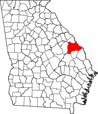 | |
| Town | ||
| Unincorporated community | ||
| Footnotes | ‡This populated place also has portions in an adjacent county or counties | |
Municipalities and communities of Richmond County, Georgia, United States | ||
|---|---|---|
| Cities |  | |
| Communities of Augusta | ||
| Ghost towns | ||
| Footnotes | ‡This populated place also has portions in an adjacent county or counties | |