Google Earth
|
| |
|
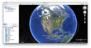
Google Earth Pro version 7.1.5.1557 running on OS X El Capitan. | |
| Original author(s) | Google Inc. |
|---|---|
| Developer(s) | Google Inc. |
| Initial release | June 11, 2001 |
| Stable release | |
| Preview release |
Windows, OS X, Linux 7.1.2.2041 (October 31, 2013[5]) [±] |
| Written in | C++ |
| Operating system | Windows, OS X, Linux, Android, iOS |
| Size |
|
| Available in | 45 languages |
| Type | Virtual globe |
| License | Freeware |
| Website |
earth |
Google Earth is a virtual globe, map and geographical information program that was originally called EarthViewer 3D created by Keyhole, Inc, a Central Intelligence Agency (CIA) funded company acquired by Google in 2004 (see In-Q-Tel). It maps the Earth by the superimposition of images obtained from satellite imagery, aerial photography and geographic information system (GIS) onto a 3D globe. It was originally available with three different licenses, but has since been reduced to just two: Google Earth (a free version with limited function) and Google Earth Pro, which is now free (it previously cost $399 a year) and is intended for commercial use.[6] The third original option, Google Earth Plus, has been discontinued.[7][8]
The product, re-released as Google Earth in 2005, is available for use on personal computers running Windows 2000 and above, Mac OS X 10.3.9 and above, Linux kernel: 2.6 or later (released on June 12, 2006), and FreeBSD. Google Earth is also available as a browser plugin which was released on May 28, 2008.[9] It was also made available for mobile viewers on the iPhone OS on October 28, 2008, as a free download from the App Store, and is available to Android users as a free app in the Google Play store. In addition to releasing an updated Keyhole based client, Google also added the imagery from the Earth database to their web-based mapping software, Google Maps. The release of Google Earth in June 2005 to the public caused a more than tenfold increase in media coverage on virtual globes between 2004 and 2005,[10] driving public interest in geospatial technologies and applications. As of October 2011, Google Earth has been downloaded more than a billion times.[11][12]
Google Earth displays satellite images of varying resolution of the Earth's surface, allowing users to see things like cities and houses looking perpendicularly down or at an oblique angle (see also bird's eye view). The degree of resolution available is based somewhat on the points of interest and popularity, but most land (except for some islands) is covered in at least 15 meters of resolution. Maps showing a visual representation of Google Earth coverage Melbourne, Victoria, Australia; Las Vegas, Nevada, United States; and Cambridge, Cambridgeshire, United Kingdom include examples of the highest resolution, at 15 cm (6 inches). Google Earth allows users to search for addresses for some countries, enter coordinates, or simply use the mouse to browse to a location.
For large parts of the surface of the Earth only 2D images are available, from almost vertical photography. Viewing this from an oblique angle, there is perspective in the sense that objects which are horizontally far away are seen smaller, like viewing a large photograph, not quite like a 3D view.
For other parts of the surface of the Earth, 3D images of terrain and buildings are available. Google Earth uses digital elevation model (DEM) data collected by NASA's Shuttle Radar Topography Mission (SRTM).[13] This means one can view almost the entire earth in three dimensions. Since November 2006, the 3D views of many mountains, including Mount Everest, have been improved by the use of supplementary DEM data to fill the gaps in SRTM coverage.[14]
Some people use the applications to add their own data, making them available through various sources, such as the Bulletin Board Systems (BBS) or blogs mentioned in the link section below. Google Earth is able to show various kinds of images overlaid on the surface of the earth and is also a Web Map Service client. Google Earth supports managing three-dimensional Geospatial data through Keyhole Markup Language (KML).[15]
Detail
Google Earth is simply based on 3D maps, with the capability to show 3D buildings and structures (such as bridges), which consist of users' submissions using SketchUp, a 3D modeling program software. In prior versions of Google Earth (before Version 4), 3D buildings were limited to a few cities, and had poorer rendering with no textures. Many buildings and structures from around the world now have detailed 3D structures; including (but not limited to) those in the United States, Canada, Mexico, India, Japan, United Kingdom, Spain, Germany, Pakistan and the cities, Amsterdam and Alexandria. In August 2007, Hamburg became the first city entirely shown in 3D, including textures such as façades. The 'Westport3D' model was created by 3D imaging firm AM3TD using long-distance laser scanning technology and digital photography and is the first such model of an Irish town to be created. As it was developed initially to aid Local Government in carrying out their town planning functions it includes the highest-resolution photo-realistic textures to be found anywhere in Google Earth. Three-dimensional renderings are available for certain buildings and structures around the world via Google's 3D Warehouse[16] and other websites. In June 2012, Google announced that it will start to replace user submitted 3D buildings with auto-generated 3D mesh buildings starting with major cities. Although there are many cities on Google Earth that are fully or partially 3D, more are available in the Earth Gallery. The Earth Gallery is a library of modifications of Google Earth people have made. In the library there are not only modifications for 3D buildings, but also models of earthquakes using the Google Earth model, 3D forests, and much more.[17]
Recently, Google added a feature that allows users to monitor traffic speeds at loops located every 200 yards in real-time. In 2007, Google began offering traffic data in real-time, based on information crowdsourced from the GPS-identified locations of cellular phone users.[18] In version 4.3 released on April 15, 2008, Google Street View was fully integrated into the program allowing the program to provide an on the street level view in many locations.[19]
On January 31, 2010, the entirety of Google Earth's ocean floor imagery was updated to new images by SIO, NOAA, US Navy, NGA, and GEBCO. The new images have caused smaller islands, such as some atolls in the Maldives, to be rendered invisible despite their shores being completely outlined.[20]
Uses
Google Earth may be used to perform some day-to-day tasks and for other purposes.
- Google Earth can be used to view areas subjected to widespread disasters if Google supplies up-to-date images. For example, after the January 12, 2010 Haiti earthquake images of Haiti were made available on January 17.
- With Google's push for the inclusion of Google Earth in the Classroom,[21] teachers are adopting Google Earth in the classroom for lesson planning, such as teaching students geographical themes (location, culture, characteristics, human interaction, and movement)[22] to creating mashups with other web applications such as Wikipedia.[21][22]
- One can explore and place location bookmarks on the Moon and Mars.
- One can get directions using Google Earth, using variables such as street names, cities, and establishments. But the addresses must by typed in search field, one cannot simply click on two spots on the map.
- Google Earth can function as a hub of knowledge, pertaining the users location. By enabling certain options, one can see the location of gas stations, restaurants, museums, and other public establishments in their area. Google Earth can also dot the map with links to images, YouTube videos, and Wikipedia articles relevant to the area being viewed.
- One can create custom image overlays for planning trips, hikes on handheld GPS units.
- Google Earth can be used to map homes and select a random sample for research in developing countries.[23]
All of these features are also released by Google Earth Blog.[24]
Features
Wikipedia and Panoramio integration
In December 2006, Google Earth added a new layer called "Geographic Web" that includes integration with Wikipedia and Panoramio. In Wikipedia, entries are scraped for coordinates via the Coord templates. There is also a community-layer from the project Wikipedia-World. More coordinates are used, different types are in the display and different languages are supported than the built-in Wikipedia layer.[25][26] Google announced on May 30, 2007 that it is acquiring Panoramio.[27] In March 2010, Google removed the "Geographic Web" layer. The "Panoramio" layer became part of the main layers and the "Wikipedia" layer was placed in the "More" layer.
Flight simulator
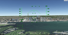
In Google Earth v4.2 a flight simulator was included as a hidden feature. Starting with v4.3 it is no longer hidden. The flight simulator could be accessed by holding down the keys Ctrl, Alt, and A. Initially the F-16 Fighting Falcon and the Cirrus SR-22 were the only aircraft available, and they could be used with only a few airports. However, one can start flight in "current location" and need not to be at an airport. One will face the direction they face when they start the flight simulator. They cannot start flight in ground level view and must be near the ground (approximately 50m-100m above the ground) to start in take-off position. Otherwise they will be in the air with 40% flaps and gears extended (landing position). In addition to keyboard control, the simulator can be controlled with a mouse or joystick.[28] Google Earth v5.1 and higher crashes when starting flight simulator with Saitek and other joysticks. The user can also fly underwater.
Featured planes
- F-16 Fighting Falcon – A much higher speed and maximum altitude than the Cirrus SR-22, it has the ability to fly at a maximum speed of Mach 2, although a maximum speed of 1678 knots (3108 km/h) can be achieved. The take-off speed is 225 knots, the landing speed is 200 knots (370 km/h).
- Cirrus SR-22 – Although slower and with a lower maximum altitude, the SR-22 is much easier to handle and is preferred for up-close viewing of Google Earth's imagery. The take-off speed is 75 knots (139 km/h), the landing speed is 70 knots (130 km/h)[29]
The flight simulator can be commanded with the keyboard, mouse or plugged-in joystick. Broadband connection and a high speed computer provides a very realistic experience.[30] The simulator also runs with animation, allowing objects (for example: planes)[31] to animate while on the simulator. Programming language can also be used to make it look like the cockpit of a plane, or for instrument landing.
Sky mode
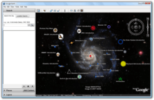
Google Sky is a feature that was introduced in Google Earth 4.2 on August 22, 2007, and allows users to view stars and other celestial bodies.[32] It was produced by Google through a partnership with the Space Telescope Science Institute (STScI) in Baltimore, the science operations center for the Hubble Space Telescope. Dr. Alberto Conti and his co-developer Dr. Carol Christian of STScI plan to add the public images from 2007,[33] as well as color images of all of the archived data from Hubble's Advanced Camera for Surveys. Newly released Hubble pictures will be added to the Google Sky program as soon as they are issued. New features such as multi-wavelength data, positions of major satellites and their orbits as well as educational resources will be provided to the Google Earth community and also through Christian and Conti's website for Sky.[34] Also visible on Sky mode are constellations, stars, galaxies and animations depicting the planets in their orbits. A real-time Google Sky mashup of recent astronomical transients, using the VOEvent protocol, is being provided by the VOEventNet[35] collaboration. Google's Earth maps are being updated each 5 minutes.
Google Sky faces competition[36] from Microsoft WorldWide Telescope (which runs only under the Microsoft Windows operating systems) and from Stellarium, a free open source planetarium that runs under Microsoft Windows, OS X, and Linux.
On March 13, 2008, Google made a web-based version[37] of Google Sky available via the internet.
Street View
On April 15, 2008 with version 4.3, Google fully integrated its Street View into Google Earth. In version 6.0, the photo zooming function has been removed because it is incompatible with the new 'seamless' navigation.
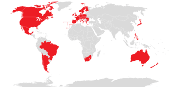
Google Street View provides 360° panoramic street-level views and allows users to view parts of selected cities and their surrounding metropolitan areas at ground level. When it was launched on May 25, 2007 for Google Maps, only five cities were included. It has since expanded to more than 40 U.S. cities, and includes the suburbs of many, and in some cases, other nearby cities. Recent updates have now implemented Street View in most of the major cities of Canada, Mexico, Denmark, South Africa, Japan, Spain, Norway, Finland, Sweden, France, the UK, Republic of Ireland, the Netherlands, Italy, Switzerland, Portugal, Taiwan, and Singapore.
Google Street View, when operated, displays photos that were previously taken by a camera mounted on an automobile, and can be navigated by using the mouse to click on photograph icons displayed on the screen in the user's direction of travel. Using these devices, the photos can be viewed in different sizes, from any direction, and from a variety of angles.
Water and ocean
Introduced in version 5.0 (February 2009), the Google Ocean feature allows users to zoom below the surface of the ocean and view the 3D bathymetry beneath the waves. Supporting over 20 content layers, it contains information from leading scientists and oceanographers.[38] On April 14, 2009, Google added underwater terrain data for the Great Lakes.[39] In 2010, Google added underwater terrain data for Lake Baikal.
In June 2011, higher resolution of some deep ocean floor areas increased in focus from 1-kilometer grids to 100 meters thanks to a new synthesis of seafloor topography released through Google Earth.[40] The high-resolution features were developed by oceanographers at Columbia University's Lamont-Doherty Earth Observatory from scientific data collected on research cruises. The sharper focus is available for about 5 percent of the oceans (an area larger than North America). Underwater scenery can be seen of the Hudson Canyon off New York City, the Wini Seamount near Hawaii, and the sharp-edged 10,000-foot-high Mendocino Ridge off the U.S Pacific Coast. There is a Google 2011 Seafloor Tour for those interested in viewing ocean deep terrain.[41]
Historical Imagery
Introduced in version 5.0, Historical Imagery allows users to traverse back in time and study earlier stages of any place. This feature allows research that require analysis of past records of various places.[42]
Mars

Google Earth 5 includes a separate globe of the planet Mars, that can be viewed and analysed for research purposes. The maps are of a much higher resolution than those on the browser version of Google Mars and it also includes 3D renderings of the Martian terrain. There are also some extremely-high-resolution images from the Mars Reconnaissance Orbiter's HiRISE camera that are of a similar resolution to those of the cities on Earth. Finally, there are many high-resolution panoramic images from various Mars landers, such as the Mars Exploration Rovers, Spirit and Opportunity, that can be viewed in a similar way to Google Street View. Interestingly enough, layers on Google Earth (such as World Population Density) can also be applied to Mars. Layers of Mars can also be applied onto Earth. Mars also has a small application found near the face on Mars. It is called Meliza, and features a chat between the user and an automatic robot speaker.[43] It is useful for research on Mars, but is not recommended for normal conversations.
Moon
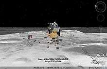
On July 20, 2009, the 40th anniversary of the Apollo 11 mission, Google introduced the Google Earth version of Google Moon,[44] which allows users to view satellite images of the Moon. It was announced and demonstrated to a group of invited guests by Google along with Buzz Aldrin at the Newseum in Washington, D.C.[45][46]
Google Earth Engine
Google Earth Engine is a separate product, not a part of Google Earth.
Liquid Galaxy
Liquid Galaxy is a cluster of computers running Google Earth creating an immersive experience. On September 30, 2010, Google made the configuration and schematics for their rigs public,[47] placing code and setup guides on the Liquid Galaxy wiki.[48]
Liquid Galaxy has also been used as a panoramic photo viewer using KRpano, as well as a Google Street View viewer using Peruse-a-Rue[49] Peruse-a-Rue is a method for synchronizing multiple Maps API clients.[50]
Influences
Google Earth can be traced directly back to a small company named Autometric, now a part of Boeing. A team at Autometric, led by Robert Cowling, created a visualization product named Edge Whole Earth. Bob demonstrated Edge to Michael T. Jones, Chris Tanner and others at SGC in 1996. Several other visualization products using imagery existed at the time, including Performer-based ones, but Michael T. Jones stated emphatically that he had "never thought of the complexities of rendering an entire globe ..." The catch phrase "from outer space to in your face" was coined by Autometric President Dan Gordon, and used to explain his concept for personal/local/global range. Edge blazed a trail as well in broadcasting, being used in 1997 on CBS News with Dan Rather, in print for rendering large images draped over terrain for National Geographic, and used for special effects in the feature film Shadow Conspiracy in 1997.
Gordon was a huge fan of the 'Earth' program described in Neal Stephenson's sci-fi classic Snow Crash. Indeed, a Google Earth co-founder claimed that Google Earth was modeled after Snow Crash,[51] while another co-founder said it was inspired by the short science education film Powers of Ten.[52] In fact Google Earth was at least partly inspired by a Silicon Graphics demo called "From Outer Space to in Your Face" which zoomed from space into the Swiss Alps then into the Matterhorn.[53] This launch demo was hosted by an Onyx 3000 with InfiniteReality4[54] graphics, which supported Clip Mapping and was inspired by the hardware texture paging capability (although it did not use the Clip Mapping) and "Powers of Ten". The first Google Earth implementation called Earth Viewer emerged from Intrinsic Graphics as a demonstration of Chris Tanner's software based implementation of a Clip Mapping texture paging system and was spun off as Keyhole Inc.
Versions and variations
Mac version
Since version 4.1.7076.4558 (released on May 9, 2007) onward OS X users can, among other new features, upgrade to the "Plus" version via an option in the Google Earth menu.[55] Some users reported difficulties with Google Earth crashing in the then current version when zooming in. Version 5 of Google Earth for Mac was released in 2009,[56] and version 7 was released concomitantly with the Mac and PC versions on 31 October 2012.[57]
Linux version
Starting with the version 4 beta Google Earth functions under Linux, as a native port using the Qt toolkit. The Free Software Foundation consider the development of a free compatible client for Google Earth to be a High Priority Free Software Project.[58]
Android version
An Android version was released on Monday, February 22, 2010.[59]
iOS version
A version for the iOS, which runs on the iPhone, iPod Touch and the iPad, was released for free on the App Store on October 27, 2008.[60][61] It makes use of the multi-touch interface to move on the globe, zoom or rotate the view, and allow to select the current location using the iPhone integrated Assisted GPS. Although it previously did not support any layers apart from Wikipedia and Panoramio, version 6.2 brought KML support to add additional layers. Version 7 introduced 3D modeling of several cities.[62]
Google Earth Plus (Discontinued in 2008)
Discontinued in December 2008, Google Earth Plus was an individual-oriented paid subscription upgrade to Google Earth that provided customers with the following features, most of which are now available in the free Google Earth.[63]
- GPS integration: read tracks and waypoints from a GPS device. A variety of third-party applications have been created which provide this functionality using the basic version of Google Earth by generating KML or KMZ files based on user-specified or user-recorded waypoints. However, Google Earth Plus provides direct support for the Magellan and Garmin product lines, which together hold a large share of the GPS market.
The Linux version of the Google Earth Plus application does not include any GPS functionality. - Higher-resolution printing.
- Customer support via email.
- Data importer: read address points from CSV files; limited to 100 points/addresses. A feature allowing path and polygon annotations, which can be exported to KML, was formerly only available to Plus users, but was made free in version 4.0.2416.
- Higher data download speeds
Google Earth Pro
Google Earth Pro is a business-oriented upgrade to Google Earth that has more features than the Plus version. It is the most feature-rich version of Google Earth available to the public, with various additional features such as a movie maker and data importer. In addition to business-friendly features, it has also been found useful for travelers with map-making tools. Up until late January 2015, it was available for $399/year, however Google decided to make it free to the public. It is now for free and Google does not mention anything about new policy changes.[64][65] The Pro version includes add-on software such as:
- Movie making.
- GIS data importer.
- Advanced printing modules.
- Radius and area measurements.
Google Earth Pro is available for Windows (NT-based versions), Mac OS X 10.4 or later.[66][67]
Google Earth Enterprise
Google Earth Enterprise is a version of Google Earth designed for use by organizations whose businesses could take advantage of the program's capabilities, for example by having a globe that holds company data available for anyone in that company.[68] As of March 20, 2015 Google has retired the Google Earth Enterprise product, with support ending March 22, 2017.[69]
Automotive version
An automotive version of Google Earth is available in the 2010 Audi A8.[70]
Google Earth Plug-in
The Google Earth API is a free beta service, available for any web site that is free to consumers. The Plug-in and its JavaScript API let users place a version of Google Earth into web pages. The API enables sophisticated 3D map applications to be built.[71] At its unveiling at Google's 2008 I/O developer conference, the company showcased potential applications such as a game where the player controlled a milktruck atop a Google Earth surface.[72]
The Google Earth API has been deprecated as of 15 December 2014 and will remain supported until the 15th of December 2015.[73] Google Chrome aims to end support for the Netscape Plugin API (which the Google Earth API relies on) by the end of 2016.[74]
Controversy and criticism
The software has been criticized by a number of special interest groups, including national officials, as being an invasion of privacy and even posing a threat to national security. The typical argument is that the software provides information about military or other critical installations that could be used by terrorists.
- Former President of India APJ Abdul Kalam expressed concern over the availability of high-resolution pictures of sensitive locations in India.[75] Google subsequently agreed to censor such sites.[76]
- The Indian Space Research Organisation said Google Earth poses a security threat to India, and seeks dialogue with Google officials.[77]
- The South Korean government expressed concern that the software offers images of the presidential palace and various military installations that could possibly be used by hostile neighbor North Korea.[78]
- In 2006, one user spotted a large topographical replica in a remote region of China. The model is a small-scale (1/500) version of the Karakoram Mountain Range, which is under the control of China but claimed by India. When later confirmed as a replica of this region, spectators began entertaining military implications.[79][80]
- In 2006, Google Earth began offering detailed images of classified areas in Israel. The images showed Israel Defense Forces bases, including secret Israeli Air Force facilities, Israel's Arrow missile defense system, military headquarters and Defense Ministry compound in Tel Aviv, a top-secret power station near Ashkelon, and the Negev Nuclear Research Center. Also shown was the alleged headquarters of the Mossad, Israel's foreign intelligence service, whose location is highly classified.[81][82]
- Operators of the Lucas Heights nuclear reactor in Sydney, New South Wales, Australia asked Google to censor high-resolution pictures of the facility.[83] However, they later withdrew the request.[84]
- In July 2007, it was reported that a new Chinese Navy Jin-class nuclear ballistic missile submarine was photographed at the Xiaopingdao Submarine Base south of Dalian.[85]
- Hamas and the al-Aqsa Martyrs' Brigades have reportedly used Google Earth to plan Qassam rocket attacks on Israel from Gaza (See: List of Qassam rocket attacks.)[86][87]
- The lone surviving gunman involved in the 2008 Mumbai attacks admitted to using Google Earth to familiarise himself with the locations of buildings used in the attacks.[88]
- Michael Finton, aka Talib Islam, used Google Earth in planning his attempted September 24, 2009, bombing of the Paul Findley Federal Building and the adjacent offices of Congressman Aaron Schock in Springfield, Illinois.[89]
- In 2009, Google superimposed old woodblock prints of maps from 18th and 19th century Japan over Japan today. These maps marked areas inhabited by the burakumin caste, who were considered "non-humans" for their "dirty" occupations, including leather tanning and butchery. Descendants of members of the burakumin caste still face discrimination today and many Japanese people feared that some would use these areas, labeled etamura (穢多村, translation: "village of an abundance of defilement""), to target current inhabitants of them. These maps are still visible on Google Earth, but with the label removed where necessary.[90]
| Country | By Whom | Reason | Since When | Source |
|---|---|---|---|---|
| Iran | US government export restrictions | 2007 | [91] | |
| Morocco | Maroc Telecom, the most popular service provider | Unknown | 2006 | [92] |
| Sudan | US government export restrictions | 2007 | [93] |
Google Earth has been blocked by Google in Iran[91] and Sudan[93] since 2007 due to US government export restrictions. The program has also been blocked in Morocco since 2006 by Maroc Telecom, a major service provider in the country.[92]

Some citizens may express concerns over aerial information depicting their properties and residences being disseminated freely. As relatively few jurisdictions actually guarantee the individual's right to privacy, as opposed to the state's right to secrecy, this is an evolving point. Perhaps aware of these critiques,[94] for a time, Google had Area 51 (which is highly visible and easy to find) in Nevada as a default placemark when Google Earth is first installed.
As a result of pressure from the United States government, the residence of the Vice President at Number One Observatory Circle was obscured through pixelization in Google Earth and Google Maps in 2006, but this restriction has since been lifted. The usefulness of this downgrade is questionable, as high-resolution photos and aerial surveys of the property are readily available on the Internet elsewhere.[95] Capitol Hill also used to be pixelized in this way. The Royal Stables in The Hague, Netherlands also used to be pixelized, and are still pixelized at high zoom levels.
Critics have expressed concern over the willingness of Google to cripple their dataset to cater to special interests, believing that intentionally obscuring any land goes against its stated goal of letting the user "point and zoom to any place on the planet that you want to explore".[96]
In the United Kingdom, critics have also argued that Google Earth has led to the vandalism of private property, highlighting the graffiti of a penis being drawn on the roof of a house near Hungerford,[97] on the roof of Yarm School at Stockton on Tees[98] and on the playing fields of a school in Southampton[99] as examples of this.
In Hazleton, Pennsylvania, media attention and critics focused on Google Earth once more because of the defacing of the Hazleton Area High School football field. Grass was removed to create the image of a penis approximately 35 yards long and 20 yards wide.[100]
Late 2000s versions of Google Earth require a software component running in the background that will automatically download and install updates. Several users expressed concerns that there is not an easy way to disable this updater, as it runs without the permission of the user.[101]
In the academic realm increasing attention has been devoted to both Google Earth and its place in the development of digital globes more generally. In particular, the International Journal of Digital Earth[102] now features many articles evaluating and comparing the development Google Earth and its differences when compared to other professional, scientific and governmental platforms.
Elsewhere, in the Humanities and Social Sciences, Google Earth's role in the expansion of "earth observing media" has been examined. Leon Gurevitch in particular has examined the role of Google Earth in shaping a shared cultural consciousness regarding climate change and humanity's capacity to treat the earth as an engineerable object.[103] Gurevitch has described this interface between earth representation in Google Earth and a shared cultural imaginary of geo-engineering as "Google Warming".
Copyright
Every image created from Google Earth using satellite data provided by Google Earth is a copyrighted map. Any derivative from Google Earth is made from copyrighted data which, under United States Copyright Law, may not be used except under the licenses Google provides. Google allows non-commercial personal use of the images (e.g. on a personal website or blog) as long as copyrights and attributions are preserved.[104] By contrast, images created with NASA's globe software World Wind use The Blue Marble, Landsat or USGS layer, each of which is a terrain layer in the public domain. Works created by an agency of the United States government are public domain at the moment of creation. This means that those images can be freely modified, redistributed and used for commercial purposes.
Layers
Google Earth also features many layers as a source for information on businesses and points of interest, as well as showcasing the contents of many communities, such as Wikipedia, Panoramio and YouTube.
Borders and labels
Contains borders for countries/provinces and shows placemarks for cities and towns.
- Borders: Marks international borders with a thick yellow line (borders with territorial disputes with thick red lines), 1st level administrative borders (generally provinces and states) with a lavender line, and 2nd level administrative borders (counties) with a cyan line. Coastlines appear as a thin yellow line. Displays names of countries, 1st level administrative areas, and islands.
- Labels: Displays labels for large bodies of water, such as oceans, seas, and bays, and populated places.
3D Imagery
Google Earth 3D shows many 3D computer graphics building models in many cities, in these styles:
- 3D trees: Shows many trees in Athens, Greece; Surui Forest, Brazil; Kahigaini, Kenya; Mangrove Forests, Mexico; Jedediah Smith Redwoods State Park, California
- Photorealistic: Shows many buildings in a realistic style, with more complex polygons and surface images.
- Autogen: Renders entire metropolitan areas in 3D via processing of 45 degree aerial imagery.
- Gray: Low-detail models of city buildings designed for computers that may not have the capability of showing the photorealistic models.
In 2009, in a unique collaboration between Google and the Museo del Prado in Madrid, the museum selected 14 of its most important paintings to be photographed and displayed at the ultrahigh resolution of 14,000 megapixels inside the 3D version of the Prado in Google Earth and Google Maps.[105][106]
In June 2012, Google announced that it will be replacing user made 3D buildings with an auto-generated 3D mesh. This will be phased in, starting with select larger cities, with the notable exception of cities such as London and Toronto which require more time to process detailed imagery of their vast number of buildings. The reason given is to have greater uniformity in 3D buildings, and to compete with other platforms already using the technology such as Nokia Here and Apple Maps.
The first 3D buildings in Google Earth were created using 3D modeling applications such as SketchUp and, beginning in 2009, Building Maker,[107] and were uploaded to Google Earth via the 3D Warehouse.
In 2012, Google began incorporating automatically-generated 3D imagery, which displays entire areas in 3D rather than individual buildings, into the mobile and desktop versions of Google Earth,[108] releasing coverage of 21 cities in four countries that year.[109] By March 2015, 3D imagery covering more than 300,000 km² was available[110] and by early 2016 had been expanded to hundreds of cities in over 40 countries, including every U.S. state and encompassing every continent except Antarctica.
During 2015, Hong Kong and places in the Philippines were added to the coverage.
As of February 2016, 3D imagery covering more than 495,000 km2 was available[111] in cities in over 40 countries, covering all continents except Antarctica.
Google Street View
Shows placemarks with 360 degree panoramic views of streets of many cities in Australia, France, the United Kingdom, Republic of Ireland, Italy, Japan, New Zealand, Spain, the United States, and recently Portugal, Brazil, the Netherlands, Taiwan, Switzerland, Canada, Mexico, Sweden, Norway, South Africa and Finland.
Weather
- Clouds – Displays cloud cover based on data from both geostationary and low Earth-orbiting satellites. The clouds appear at their calculated elevation, determined by measuring the cloud top temperature relative to surface temperature.[112]
- Radar – Displays weather radar data provided by weather.com and Weather Services International, updating every 5–6 minutes.[112]
- Conditions and Forecast – Displays local temperatures and weather conditions. Clicking on an indicator displays a 2 Day Forecast (Example: Monday Morning, Monday Night, Tuesday Morning, Tuesday Night) forecast provided by weather.com.[112]
- Information – Clicking Information allows users to further read up on where Google Earth gets weather information.[112]
Sky layers
Layers for Google Sky.
- EarthSky Podcasts[113]
See also
- Bhuvan
- Bing Maps Platform (previously Microsoft Virtual Earth)
- Geoweb
- Keyhole Markup Language
- Marble
- NASA World Wind
- Oracle Spatial and Graph
- Orthophotomap
- Planet Google, a book by Randall Stross about Google and its products, including Earth.
- Virtual globe
- Web mapping
References
- ↑ map 2016.6.16
- ↑ "Google Earth". Google. Retrieved 7 Dec 2013.
- ↑ "Google Earth". Google Play. Google. June 6, 2013. Retrieved June 6, 2013.
- ↑ Google Inc. (June 26, 2013). "Google Earth". App Store. Apple. Retrieved June 29, 2013.
- ↑ "Google Earth Release Notes". Google. Retrieved 1 Nov 2013.
- ↑ "Google Earth Product Family". Retrieved 2007-08-05.
- ↑ "Google Earth Plus Discontinued".
- ↑ "Google Discontinues "Google Earth Plus"".
- ↑ "Google Earth, meet the browser".
- ↑ "Media Coverage of Geospatial Platforms". Retrieved 2007-08-05.
- ↑ "Official Google Blog: Google Earth downloaded more than one billion times". Googleblog.blogspot.com. Retrieved 2012-07-30.
- ↑ Axetue Team (2011-10-12). "Google Earth Gets a Billion Downloads". Axetue.com. Retrieved 2012-07-30.
- ↑ Farr et al., 2007, The Shuttle Radar Topography Mission, v. 45, Reviews of Geophysics, doi: 1029/2005RG000183. SRTM web site
- ↑ "Google Earth Community: Nov. 23rd — Thanksgiving Day imagery update".
- ↑ "Keyhole Markup Language — Google Developers". Developers.google.com. 2012-03-01. Retrieved 2013-06-15.
- ↑ "3D Warehouse". Sketchup.google.com. Retrieved 2010-08-25.
- ↑ "Google and Apple to use new hi-tech mapping planes". The Times Of India. 11 June 2012.
- ↑ Wang, David (February 28, 2007). "Stuck in traffic?". Google.
- ↑ Thornton, James (2013-06-05). "Google SketchUp – Download". Google-sketchup.en.softonic.com. Retrieved 2013-06-15.
- ↑ "New View of Ocean Floor in Google Earth | Google Earth Blog". Gearthblog.com. Retrieved 2010-08-25.
- 1 2 Natasha Wyatt. "Reinventing classroom geography with Google Earth API". Google Earth and Maps team. Retrieved 2010-04-29.
- 1 2 Karen Ganzel (2010-04-27). "Geography Lesson Plans Using Google Earth". Lesson Planet. Retrieved 2010-04-29.
- ↑ Wampler, Peter; Rediske, RR; Molla AR (January 18, 2013). "Using ArcMap, Google Earth, and Global Positioning Systems to select and locate random households in rural Haiti". International Journal of Health Geographics. 12 (3). doi:10.1186/1476-072X-12-3.
- ↑ Google Earth Blog
- ↑ "Earth". Retrieved 2012-11-19.
- ↑ "Homepage von Stefan Kühn". webkuehn.de. Retrieved 2012-07-30.
- ↑ "Google is planning to acquire Panoramio". google.com.
- ↑ "Use Google Earth flight simulator – Google Earth Help". Support.google.com. Retrieved 2013-06-15.
- ↑ http://googleearthflight.weebly.com/learn-how-to-fly-better.html. Retrieved June 27, 2010. Missing or empty
|title=(help) - ↑ Webwise: Google's flight simulator The Sunday Times, January 27, 2008
- ↑ "Planes For Google Earth Flight Simulator | Google Earth Blog". Gearthblog.com. Retrieved 2012-07-30.
- ↑ "Explore the sky with Google Earth". Google. 2007-08-22. Retrieved 2007-08-22.
- ↑ "Celestial add-on points Google Earth at the stars – tech – August 22, 2007 – New Scientist Tech". Technology.newscientist.com. Retrieved 2010-08-25.
- ↑ "Explore Astronomy – gSky Browser". HubbleSite. Retrieved 2012-07-30.
- ↑ "はっぴーめーる". Voeventnet.org. Retrieved 2012-07-30.
- ↑ Olsen, Stefanie. "WorldWide Telescope peers into Big Dipper | Crave – CNET". Crave.cnet.com. Retrieved 2010-08-25.
- ↑ "Google Sky". Google.com. Retrieved 2012-07-30.
- ↑ "Google Earth dives under the sea". BBC News. February 2, 2009. Retrieved May 3, 2010.
- ↑ "Google Earth now includes US "Third Coast"".
- ↑ "New Google Ocean Maps Dive Deep". The Earth Institute – Columbia University. 2011-06-08. Retrieved 2012-07-30.
- ↑ "Google Lat Long: See the seafloor like never before on World Oceans Day". Google-latlong.blogspot.com. 2011-06-08. Retrieved 2013-06-15.
- ↑ "Dive into New Google Earth". Retrieved 2009-02-03.
- ↑ "Chat With a Martian in Google Earth 5". Googlesystem.blogspot.com. 2009-02-03. Retrieved 2012-07-30.
- ↑ "Look at the Moon in Google Earth – Available Now! | Google Earth Blog". Gearthblog.com. Retrieved 2010-08-25.
- ↑ "Google Earth Event on July 20th in DC – Expect the Moon | Google Earth Blog". Gearthblog.com. 2009-07-09. Retrieved 2010-08-25.
- ↑ "Google LatLong: Fly yourself to the moon". Google-latlong.blogspot.com. 2009-07-20. Retrieved 2010-08-25.
- ↑ "A galaxy of your own". Google-latlong.blogspot.com. 2010-09-30. Retrieved 2012-03-10.
- ↑ "Liquid Galaxy wiki on code.google.com". 2010-09-30. Retrieved 2012-03-10.
- ↑ "Peruse-a-Rue: Street View for Liquid Galaxy". 2013-09-03. Retrieved 2013-11-20.
- ↑ "Liquid Galaxy and its Very Own Street View App". 2013-11-09. Retrieved 2013-11-20.
- ↑ "Google Earth interview". Web User. 2008-04-11. Retrieved 2010-08-25.
- ↑ "Avi Bar-Ze'ev (from Keyhole, the precursor to Google Earth) on origin of Google Earth". Brownianemotion.org. Archived from the original on 2008-10-12. Retrieved 2010-08-25.
- ↑ "Google Earth: From Space to Your Face ... and Beyond". Bnhsu.wordpress.com. 2007-04-30. Retrieved 2010-08-25.
- ↑ "Infinite Reality Technical Report". Futuretech.blinkenlights.nl. Retrieved 2010-08-25.
- ↑ "Google Earth 4.2.180.1134 – MacUpdate".
- ↑ Jason D. O'Grady (2 February 2009). "Google Earth 5 released for the Mac". ZDNet. Retrieved January 7, 2015.
- ↑ Panzarino, Matthew (31 October 2012). "Google Earth 7 Gets 11 3D Cities and 11,000 Virtual Tours". The Next Web. Retrieved 2015-01-07.
- ↑ FSF.org: High Priority Free Software Projects
- ↑ "Google Earth now available for Android". google-latlong.blogspot.com.
- ↑ Sorrel, Charlie (2008-10-27). "Google Earth Comes to the iPhone". Wired. Retrieved 2008-10-27.
- ↑ "Google Earth now available for the iPhone". Google Mobile team. 2008-10-27. Retrieved 2008-10-27.
- ↑ Golson, Jordan. "Google Earth for iOS Update Adds Support for KML Files". Mac Rumors. Retrieved 18 May 2012.
- ↑ http://earth.google.com/enterprise/earth_plus.html:. Retrieved May 24, 2013. Missing or empty
|title=(help) - ↑ Kate Knibbs (February 2, 2015). "Google Earth Pro Is Now Available for Free".
- ↑ Rose, Robert (2015-02-11). "Good News Everyone! Google Earth Pro Now Free!". Mapshole. Retrieved 22 February 2015.
- ↑ "Google Earth". Earthprostore.appspot.com. 2010-04-29. Retrieved 2012-07-30.
- ↑ "Google Earth for Desktop". Google Earth. Google. Retrieved 22 February 2015.
- ↑ "Google Earth Enterprise – Google Earth and Maps Enterprise". Google.com. Retrieved 2012-11-16.
- ↑ "(Deprecated) Google Earth Enterprise Help". Google.com. Retrieved 2016-07-12.
- ↑ Redmer, Jens (2009-12-16). "Google LatLong: Google & Audi take Google services in a car to the next level in the new Audi A8". Google-latlong.blogspot.com. Retrieved 2010-08-25.
- ↑ "Google Earth API — Google Developers". Developers.google.com. 2012-02-24. Retrieved 2013-06-15.
- ↑ Teglet, Traian (29 May 2008). "Driving the Monster Milktruck in Google Earth". Softpedia. Retrieved 30 March 2012.
- ↑ "Google Earth API Developer's Guide". Google Developers. 8 May 2015.
- ↑ "Chromium Blog: Saying Goodbye to Our Old Friend NPAPI". Chromium Blog.
- ↑ "Kalam Concerned Over Google Earth". Archived from the original on 2012-03-20. Retrieved 2007-01-25.
- ↑ Deshpande, Rajeev (2007-02-04). "Google Earth agrees to blur pix of key Indian sites". The Times Of India.
- ↑ "Google Earth Poses Security Threat to India, ISRO Chief seeks Dialogue". Retrieved 2007-01-25.
- ↑ "Google Earth images compromise secret installations in S. Korea". Archived from the original on 2007-07-01. Retrieved 2007-01-25.
- ↑ "Chinese X-file excites spotters". The Sydney Morning Herald. July 20, 2006. Retrieved 2007-01-25.
- ↑ "From sky, see how China builds model of Indian border 2400 km away". Retrieved 2007-01-25.
- ↑ "Google 'spying' on IDF". Ynetnews.com. 1995-06-20. Retrieved 2011-08-06.
- ↑ Daily Mail: Google Exposes Israeli Top Secret Sites
- ↑ "Google Earth prompts security fears". Archived from the original on January 24, 2007. Retrieved 2007-01-25.
- ↑ "Aussie Nuclear Reactor on Google Earth". Retrieved 2007-01-25.
- ↑ "New Chinese Ballistic Missile Submarine Spotted". Retrieved 2007-07-10.
- ↑ Clancy Chassay in Gaza City and Bobbie Johnson (2007-10-25). "Google Earth used to target Israel". London: Guardian. Retrieved 2010-08-25.
- ↑ Hutcheon, Stephen (2009-01-30). "We're not stalking you or helping terrorists, says Google Earth boss". Sydney Morning Herald. Retrieved 2009-11-07.
- ↑ Bedi, Rahul (2008-12-09). "Mumbai attacks: Indian suit against Google Earth over image use by terrorists". Telegraph.co.uk. Retrieved 2011-08-06.
- ↑ Gruen, Madeleine,"Attempt to Attack the Paul Findley Federal Building in Springfield, Illinois" Archived March 1, 2012, at the Wayback Machine.," The NEFA Foundation, December 2009, accessed December 18, 2009
- ↑ "Google Earth maps out discrimination against burakumin caste in Japan". Timesonline.co.uk. 2012-03-13. Retrieved 2012-07-30.
- 1 2 "Why is Google Earth being blocked in Iran?" Google Earth Help forums June 17, 2009
- 1 2 "Morocco censorship?". Ogleearth.com. 2006-08-24. Retrieved 2011-08-06.
- 1 2 "Google Earth ban in Sudan is due to US export restrictions" Sudan Tribune, April 22, 2007
- ↑ Privacy Lawsuit Against Google Earth, Spatial Law blog, 2008-04-09
- ↑ "Eyeballing the US Vice Presidential Residence".
- ↑ "The Creative Reconstruction of the Internet: Google and the Privatization of Cyberspace and DigiPlace" (PDF).
- ↑ "Teenager's 60ft painting of penis on parents' roof spotted in space", The Guardian, accessed 29 May 2010
- ↑ "The Piddler On The Roof", The Sun, accessed 29 May 2010
- ↑ "Schoolyard penis seen from space", The Guardian, accessed 29 May 2010
- ↑ "Hazleton Penis Made Famous by Google Maps". nepamedia blogspot.com. Retrieved 2010-07-07.
- ↑ Gilbertson, Scott (2009-02-13). "Why Google's Software Update Tool Is Evil". Wired.
- ↑ "An Error Occurred Setting Your User Cookie". Retrieved 4 October 2014.
- ↑ "Google Warming". Retrieved 4 October 2014.
- ↑ "Can I post images to the web?". Google Earth Help Center:.
- ↑ Giles Tremlett (14 January 2009). "Online gallery zooms in on Prado's masterpieces (even the smutty bits)". The Guardian. London.
- ↑ "The Prado in Google Earth". Google. Retrieved 2010-04-03.
- ↑ "Introducing Google Building Maker". Retrieved 24 July 2016.
- ↑ "Explore the world with tour guide and 3D imagery in Google Earth 7". Retrieved 24 July 2016.
- ↑ "Google Earth adds new 3D imagery in 21 cities to its 11,000 guided tours of our planet". Retrieved 24 July 2016.
- ↑ "More fun with KML areas - Google Earth Blog". 6 March 2015. Retrieved 24 July 2016.
- ↑ "Google Earth 3D imagery progress". Gearthblog.com. 22 February 2016. Retrieved 26 February 2016.
- 1 2 3 4 Google Earth: Weather layer, information link -- accessed: 03 March 2009 v5.0.11337.1968 (beta)
- ↑ "EarthSky.org". Retrieved 4 October 2014.
External links
| Wikimedia Commons has media related to Google Earth. |
Official and related sites
- Official website
- Facebook page
- Google LatLong – News and notes by the Google Earth and Maps team
Unofficial guides and tips
- Google Earth Blog: Google Earth news, tips, and updates
- Google Sightseeing – Guide to interesting and unusual sights
- Ogle Earth – Google Earth news site charting innovative uses and political implications of Google Earth
- Google Earth in Education – A guided tour by a teacher for teachers, students and all.
- Google Earth Germany: Germany's Google Earth Portal
- Using Google Earth as a mini GIS: Changing icons to show data. Examples and guide.
- How to Use and Get the Most from Google Earth
Placemarks and overlays
- North Korea Uncovered – An extensive mapping of North Korea's economic, cultural, political, and military infrastructures, featured in the Wall Street Journal.
- King's College London's Collection of KML databases
- STScI's community contributions to Sky website
- Google Earth Anomalies- Satellite imagery of documented, scientific anomaly sites including mound sites and unexplained circular features via Google Earth
- Virtual Prospector – BLM ownership maps, USGS topos, geologic maps via Google Earth Plugin
Tools
- GeoServer – Server to generate KML from Shapefiles, ArcSDE, Oracle, PostGIS, MySQL, GeoTiff, ArcGrid, with support for Network links, superoverlays, time and custom pop-ups.
- GPSVisualizer – Will convert GPS data for use in Google Earth.
- GoogleEarthToolbox – Matlab & Octave functions that output KML.
- PlaceSurf – Dynamic KML file generator
| Mapping sites |  | |
|---|---|---|
| Street View | ||
| Street View locations | ||
| Other | ||
| Development |
|  |
|---|---|---|
| Releases | ||
| Derivatives | ||
| Nexus devices | ||
| Google Play edition | ||
| Customized variants | ||
| Applications | ||
| APIs | ||
| Alternative user interfaces | ||
| Lists | ||
| Other | ||
| Related topics | ||
| History | |
|---|---|
| |
| Ecology | |
| Imaging | |
| |
| Other topics | |
| |