Grain Valley, Missouri
| Grain Valley, Missouri | |
|---|---|
| City | |
 Location of Grain Valley, Missouri | |
| Coordinates: 39°0′31″N 94°12′27″W / 39.00861°N 94.20750°WCoordinates: 39°0′31″N 94°12′27″W / 39.00861°N 94.20750°W | |
| Country | United States |
| State | Missouri |
| County | Jackson |
| Incorporated | 1945[1] |
| Area[2] | |
| • Total | 6.07 sq mi (15.72 km2) |
| • Land | 6.06 sq mi (15.70 km2) |
| • Water | 0.01 sq mi (0.03 km2) |
| Elevation | 794 ft (242 m) |
| Population (2010)[3] | |
| • Total | 12,854 |
| • Estimate (2012[4]) | 13,030 |
| • Density | 2,121.1/sq mi (819.0/km2) |
| Time zone | Central (CST) (UTC-6) |
| • Summer (DST) | CDT (UTC-5) |
| ZIP code | 64029 |
| Area code(s) | 816 |
| FIPS code | 29-28090[5] |
| GNIS feature ID | 0718661[6] |
Grain Valley is a city in Jackson County, Missouri, in the United States. Grain Valley is located in the Kansas City Metropolitan Area and is a suburb of Kansas City, Missouri. It is approx. 23 miles east of Kansas City. The population was 12,854 as of the 2010 census.
History
Grain Valley was founded in the 1870s.[7] The city was named for the general character of the grain-producing region.[8] A post office called Grain Valley has been in operation since 1879.[9]
The Grain Valley High School marching band appeared in the 2016 Macy's Thanksgiving Day Parade.
Geography
Grain Valley is located at 39°0′31″N 94°12′27″W / 39.00861°N 94.20750°W (39.008733, -94.207465).[10]
According to the United States Census Bureau, the city has a total area of 6.07 square miles (15.72 km2), of which, 6.06 square miles (15.70 km2) is land and 0.01 square miles (0.03 km2) is water.[2] Nickname- The Valley
Demographics
| Historical population | |||
|---|---|---|---|
| Census | Pop. | %± | |
| 1880 | 80 | — | |
| 1890 | 193 | 141.3% | |
| 1910 | 133 | — | |
| 1920 | 354 | 166.2% | |
| 1930 | 358 | 1.1% | |
| 1940 | 362 | 1.1% | |
| 1950 | 348 | −3.9% | |
| 1960 | 552 | 58.6% | |
| 1970 | 709 | 28.4% | |
| 1980 | 1,327 | 87.2% | |
| 1990 | 1,898 | 43.0% | |
| 2000 | 5,160 | 171.9% | |
| 2010 | 12,854 | 149.1% | |
| Est. 2015 | 13,379 | [11] | 4.1% |
2010 census
As of the census[3] of 2010, there were 12,854 people, 4,566 households, and 3,395 families residing in the city. The population density was 2,121.1 inhabitants per square mile (819.0/km2). There were 4,867 housing units at an average density of 803.1 per square mile (310.1/km2). The racial makeup of the city was 92.6% White, 2.5% African American, 0.6% Native American, 0.6% Asian, 0.1% Pacific Islander, 1.2% from other races, and 2.3% from two or more races. Hispanic or Latino of any race were 4.9% of the population.
There were 4,566 households of which 47.4% had children under the age of 18 living with them, 56.0% were married couples living together, 13.1% had a female householder with no husband present, 5.3% had a male householder with no wife present, and 25.6% were non-families. 19.1% of all households were made up of individuals and 5.6% had someone living alone who was 65 years of age or older. The average household size was 2.81 and the average family size was 3.22.
The median age in the city was 30.5 years. 32.1% of residents were under the age of 18; 7.5% were between the ages of 18 and 24; 35.2% were from 25 to 44; 18.3% were from 45 to 64; and 6.8% were 65 years of age or older. The gender makeup of the city was 48.9% male and 51.1% female.
2000 census
As of the census[5] of 2000, there were 5,160 people. The city, however, estimates that currently there are approximately 12,975 people living in the city's 4,647 households. The population density was 1,075.0 people per square mile (415.1/km²). There were 2,022 housing units at an average density of 421.2 per square mile (162.6/km²). The racial makeup of the city was 96.43% White, 0.56% African American, 0.48% Asian, 0.39% Native American, 0.16% Pacific Islander, 0.43% from other races, and 1.55% from two or more races. Hispanic or Latino of any race were 2.48% of the population.
There were 1,921 households out of which 44.9% had children under the age of 18 living with them, 61.2% were married couples living together, 9.8% had a female householder with no husband present, and 24.9% were non-families. 20.4% of all households were made up of individuals and 6.6% had someone living alone who was 65 years of age or older. The average household size was 2.69 and the average family size was 3.11.
In the city the population was spread out with 31.0% under the age of 18, 9.3% from 18 to 24, 39.0% from 25 to 44, 14.7% from 45 to 64, and 6.0% who were 65 years of age or older. The median age was 29 years. For every 100 females there were 99.6 males. For every 100 females age 18 and over, there were 92.4 males.
The median income for a household in the city was $50,118 (current estimate $64,859), and the median income for a family was $57,240. Males had a median income of $37,436 versus $27,961 for females. The per capita income for the city was $20,265. About 3.9% of families and 4.4% of the population were below the poverty line, including 6.2% of those under age 18 and 8.8% of those age 65 or over.
Economy
The Owner–Operator Independent Drivers Association is based in Grain Valley.
Education
The Grain Valley R-V School District serves Grain Valley, as well as parts of Blue Springs, Oak Grove, and unincorporated eastern Jackson County, in the State of Missouri. The district has an enrollment of over 4000 students in 2015, up from 1659 students in 2000.[13]
References
- ↑ http://cityofgrainvalley.org/about-the-city/history/
- 1 2 "US Gazetteer files 2010". United States Census Bureau. Retrieved 2012-07-08.
- 1 2 "American FactFinder". United States Census Bureau. Retrieved 2012-07-08.
- ↑ "Population Estimates". United States Census Bureau. Retrieved 2013-05-30.
- 1 2 "American FactFinder". United States Census Bureau. Retrieved 2008-01-31.
- ↑ "US Board on Geographic Names". United States Geological Survey. 2007-10-25. Retrieved 2008-01-31.
- ↑ Eaton, David Wolfe (1916). How Missouri Counties, Towns and Streams Were Named. The State Historical Society of Missouri. p. 177.
- ↑ "Jackson County Place Names, 1928–1945 (archived)". The State Historical Society of Missouri. Retrieved 16 October 2016.
- ↑ "Post Offices". Jim Forte Postal History. Retrieved 16 October 2016.
- ↑ "US Gazetteer files: 2010, 2000, and 1990". United States Census Bureau. 2011-02-12. Retrieved 2011-04-23.
- ↑ "Annual Estimates of the Resident Population for Incorporated Places: April 1, 2010 to July 1, 2015". Retrieved July 2, 2016.
- ↑ "Census of Population and Housing". Census.gov. Retrieved June 4, 2015.
- ↑ "Missouri Comprehensive Data System - District and School Information". mcds.dese.mo.gov. Retrieved 2016-01-09.
External links
Municipalities and communities of Jackson County, Missouri, United States | ||
|---|---|---|
| Cities | 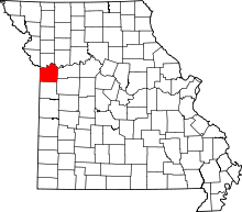 | |
| Villages | ||
| Townships | ||
| Unincorporated communities | ||
| Footnotes | ‡This populated place also has portions in an adjacent county or counties | |
Kansas City metropolitan area's cities and counties | ||
|---|---|---|
| Central city | 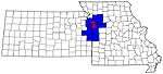 | |
| Largest cities (over 100,000 in 2000) | ||
| Medium-sized cities (10,000 to 100,000 in 2000) | ||
| Smaller Cities (between 5,000 and 9,900 in 2010) | ||
| Counties | ||