Grants, New Mexico
| Grants, New Mexico | |
|---|---|
| City | |
| Nickname(s): Uranium Capital of the World | |
| Motto: "City of Spirit" | |
 Location of Grants, New Mexico | |
 Grants, New Mexico Location in the United States | |
| Coordinates: 35°9′19″N 107°50′32″W / 35.15528°N 107.84222°WCoordinates: 35°9′19″N 107°50′32″W / 35.15528°N 107.84222°W | |
| Country | United States |
| State | New Mexico |
| County | Cibola |
| Government | |
| • Mayor | Martin "Modey" Hicks[1] |
| Area | |
| • Total | 14.9 sq mi (38.5 km2) |
| • Land | 14.9 sq mi (38.5 km2) |
| • Water | 0.0 sq mi (0.0 km2) |
| Elevation | 6,460 ft (1,969 m) |
| Population (2010) | |
| • Total | 9,182 |
| • Density | 618/sq mi (238.6/km2) |
| Time zone | Mountain (MST) (UTC-7) |
| • Summer (DST) | MDT (UTC-6) |
| ZIP code | 87020 |
| Area code(s) | 505 |
| FIPS code | 35-30490 |
| GNIS feature ID | 0933386 |
| Website |
www |

Grants is a town in Cibola County, New Mexico, United States. It is located about 78 miles (126 km) west of Albuquerque. The population was 9,182 at the 2010 Census.[2] It is the county seat of Cibola County.[3]
It is on the Trails of the Ancients Byway, one of the designated New Mexico Scenic Byways.[4]
History
Grants began as a railroad camp in the 1880s, when three Canadian brothers – Angus A. Grant, John R. Grant, and Lewis A. Grant – were awarded a contract to build a section of the Atlantic and Pacific Railroad through the region. The Grant brothers' camp was first called Grants Camp, then Grants Station, and finally Grants. The new city enveloped the existing colonial New Mexican settlement of Los Alamitos and grew along the tracks of the Atlantic and Pacific Railroad.
The town prospered as a result of railroad logging in the nearby Zuni Mountains, and it served as a section point for the Atlantic and Pacific, which became part of the Atchison, Topeka and Santa Fe Railway. The Zuni Mountain Railroad short line had a roundhouse in town (near present-day Exit 81 off Interstate 40) and housed workers in a small community named Breecetown. Timber from the Zuni Mountains was shipped to Albuquerque, where a large sawmill converted the timber to wood products that were sold around the west.
After the decline of logging in the 1930s, Grants gained fame as the "carrot capital" of the United States. Agriculture was aided by the creation of Bluewater Reservoir, and the region's volcanic soils provided ideal conditions for farming. Grants also benefited from its location, both being an airway beacon and later by U.S. Route 66, which brought travelers and tourists and the businesses that catered to them. Today the beacon and FSS building on the airport (KGNT) is being restored as museum.[5]
Perhaps the most memorable boom in the town's history occurred when Paddy Martinez, a Navajo shepherd, discovered uranium ore near Haystack Mesa, sparking a mining boom that lasted until the 1980s (see Uranium mining in New Mexico). The collapse of mining pulled the town into a depression, but the town has enjoyed a resurgence based on interest in tourism and the scenic beauty of the region. Recent interest in nuclear power has revived the possibility of more uranium mining in the area, and energy companies still own viable mining properties and claims in the area.
Geography
Grants is located in north-central Cibola County at 35°9′19″N 107°50′32″W / 35.15528°N 107.84222°W (35.155269, -107.842099).[6] Santa Fe Avenue (former US 66) is the main road through the city, while Interstate 40 passes through the southwest side of the city, with access from exits 81 and 85. I-40 leads east to Albuquerque and west 61 miles (98 km) to Gallup. The town of Milan borders the northwest end of Grants.
According to the United States Census Bureau, the city has a total area of 14.9 square miles (38.5 km2), all of it land. Grants is on the north end of the large and recent (youngest flows around 3,000 years old) lava field known as El Malpais ("the badlands"), part of which is preserved as El Malpais National Monument. To the northeast of town are the San Mateo Mountains and Mount Taylor, at 11,301 feet (3,445 m) the highest peak in the region. West of the city is the Continental Divide and the Zuni Mountains, an eroded anticline with 2-billion-year-old Precambrian granites and metamorphic rocks at its core. The region is primarily high desert country, dominated by sandstones and lava flows.
Climate
| Climate data for Grants, New Mexico (1981–2010 normals) | |||||||||||||
|---|---|---|---|---|---|---|---|---|---|---|---|---|---|
| Month | Jan | Feb | Mar | Apr | May | Jun | Jul | Aug | Sep | Oct | Nov | Dec | Year |
| Average high °F (°C) | 49 (9) |
54 (12) |
61 (16) |
69 (21) |
79 (26) |
89 (32) |
91 (33) |
88 (31) |
83 (28) |
72 (22) |
59 (15) |
50 (10) |
70.3 (21.3) |
| Average low °F (°C) | 15 (−9) |
20 (−7) |
26 (−3) |
32 (0) |
41 (5) |
49 (9) |
57 (14) |
55 (13) |
46 (8) |
34 (1) |
23 (−5) |
15 (−9) |
34.4 (1.4) |
| Average precipitation inches (mm) | 0.60 (15.2) |
0.50 (12.7) |
0.65 (16.5) |
0.55 (14) |
0.58 (14.7) |
0.55 (14) |
1.62 (41.1) |
1.81 (46) |
1.23 (31.2) |
0.97 (24.6) |
0.73 (18.5) |
0.71 (18) |
10.5 (266.5) |
| Source: NOAA [7] | |||||||||||||
Demographics
| Historical population | |||
|---|---|---|---|
| Census | Pop. | %± | |
| 1950 | 2,251 | — | |
| 1960 | 10,274 | 356.4% | |
| 1970 | 8,768 | −14.7% | |
| 1980 | 11,439 | 30.5% | |
| 1990 | 8,626 | −24.6% | |
| 2000 | 8,806 | 2.1% | |
| 2010 | 9,182 | 4.3% | |
| Est. 2015 | 9,239 | [8] | 0.6% |
As of the census[10] of 2000, there were 8,806 people, 3,202 households, and 2,321 families residing in the city. The population density was 644.4 people per square mile (248.7/km²). There were 3,626 housing units at an average density of 265.3 per square mile (102.4/km²). The racial makeup of the city among Non-Hispanic groups was 56.18% White, 1.62% African American, 11.97% Native American, 0.92% Asian, 0.12% Pacific Islander, 24.80% from other races, and 4.38% from two or more races. Hispanic or Latino of any race were 52.36% of the population.
There were 3,202 households out of which 37.5% had children under the age of 18 living with them, 49.5% were married couples living together, 17.1% had a female householder with no husband present, and 27.5% were non-families. 24.1% of all households were made up of individuals and 8.5% had someone living alone who was 65 years of age or older. The average household size was 2.61 and the average family size was 3.06.
In the city the population was spread out with 28.8% under the age of 18, 9.3% from 18 to 24, 27.9% from 25 to 44, 21.7% from 45 to 64, and 12.3% who were 65 years of age or older. The median age was 34 years. For every 100 females there were 85.3 males. For every 100 females age 18 and over, there were 79.4 males.
The median income for a household in the city was $30,652, and the median income for a family was $33,464. Males had a median income of $31,870 versus $20,808 for females. The per capita income for the city was $14,053. About 19.4% of families and 21.9% of the population were below the poverty line, including 31.8% of those under age 18 and 11.1% of those age 65 or over.

Education
All public schools in the county are operated by Grants/Cibola County Schools.
Seven elementary schools, one middle school and two high schools serve Grants/Cibola County.
Los Alamitos Middle School and Grants High School serve Grants.
St. Teresa of Avila Catholic School is the only private accredited school in Grants and serves grades Pre-Kindergarten through Eighth Grades.
There is a branch of New Mexico State University. The branch offers a two-year postsecondary program as well as advanced degrees through distance education.
Culture
The National Park Service and the Bureau of Land Management operate the El Malpais Visitor Center at Exit 85 in Grants. The visitor center highlights the many features of El Malpais National Monument and El Malpais National Conservation Area.
There is a mining museum in town, as well as the Western New Mexico Aviation Heritage Museum at the Grants-Milan Municipal Airport.
On Route 66/Santa Fe Avenue, the Cibola Arts Council runs an art gallery and museum that features the works of local artists and many Route 66 artifacts including a Ford Model T roadster. The museum hosts special events, shows, and openings on a regular basis.
There is a Tibetan Buddhist stupa in the Zuni Mountains west of town, the Zuni Mountain Stupa.
Communications
Radio
Television
- Cibola Beacon
Grants in popular culture
- Author Robison Wells has stated in his novel On Second Thought that the town of Alamitos is based on Grants, which is the historical name before it was renamed after the mining camp.[11] Wells lived in Grants during the late 1990s.
- Scenes from the movie 21 Grams starring Sean Penn and Naomi Watts were filmed in Grants.
- In the Louis L'Amour book Flint, Los Alamitos (Grants) and the nearby El Malpais provided some of the settings for the main character in the book.
References
- ↑ "Swearing In Grants Officials". Cibola Beacon. Retrieved 2014-04-25.
- ↑ "Geographic Identifiers: 2010 Demographic Profile Data (G001): Grants city, New Mexico". U.S. Census Bureau, American Factfinder. Retrieved October 17, 2014.
- ↑ "Find a County". National Association of Counties. Retrieved 2011-06-07.
- ↑ Trail of the Ancients. New Mexico Tourism Department. Retrieved August 14, 2014.
- ↑
- ↑ "US Gazetteer files: 2010, 2000, and 1990". United States Census Bureau. 2011-02-12. Retrieved 2011-04-23.
- ↑ "NowData - NOAA Online Weather Data". National Oceanic and Atmospheric Administration. Retrieved 2012-02-02.
- ↑ "Annual Estimates of the Resident Population for Incorporated Places: April 1, 2010 to July 1, 2015". Retrieved July 2, 2016.
- ↑ "Census of Population and Housing". Census.gov. Retrieved June 4, 2015.
- ↑ "American FactFinder". United States Census Bureau. Retrieved 2008-01-31.
- ↑ Questions about On Second Thought
External links
| Wikimedia Commons has media related to Grants, New Mexico. |
- City of Grants official website
- New Mexico State University - Grants
- Cibola Beacon
- Grants, NM - Uranium City USA
-
 Grants travel guide from Wikivoyage
Municipalities and communities of Cibola County, New Mexico, United States | ||
|---|---|---|
| City | 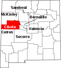 | |
| Village | ||
| CDPs | ||
| Unincorporated communities | ||
| Indian reservations | ||
| Footnotes | ‡This populated place also has portions in an adjacent county or counties | |