U.S. Route 66
| |
|---|---|
| Will Rogers Memorial Highway | |
 | |
| Route information | |
| Length: | 2,451 mi (3,945 km) |
| Existed: | November 26, 1926[1] – June 26, 1985[2] |
| Tourist routes: |
|
| Major intersections (In 1947)[3] | |
| West end: |
|
| |
| East end: |
|
| Location | |
| States: | California, Arizona, New Mexico, Texas, Oklahoma, Kansas, Missouri, Illinois |
| Highway system | |
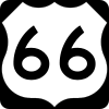
U.S. Route 66 (US 66 or Route 66), also known as the Will Rogers Highway, the Main Street of America or the Mother Road, was one of the original highways within the U.S. Highway System. US 66 was established on November 11, 1926, with road signs erected the following year.[4] The highway, which became one of the most famous roads in America, originally ran from Chicago, Illinois, through Missouri, Kansas, Oklahoma, Texas, New Mexico, and Arizona before ending at Santa Monica, California, covering a total of 2,448 miles (3,940 km).[5] It was recognized in popular culture by both the hit song "(Get Your Kicks on) Route 66" and the Route 66 television show in the 1960s.
US 66 served as a major path for those who migrated west, especially during the Dust Bowl of the 1930s, and the road supported the economies of the communities through which it passed. People doing business along the route became prosperous due to the growing popularity of the highway, and those same people later fought to keep the highway alive in the face of the growing threat of being bypassed by the new Interstate Highway System.
US 66 underwent many improvements and realignments over its lifetime, and it was officially removed from the United States Highway System in 1985,[2] after it had been replaced in its entirety by segments of the Interstate Highway System. Portions of the road that passed through Illinois, Missouri, New Mexico, and Arizona have been designated a National Scenic Byway of the name "Historic Route 66", which is returning to some maps.[6][7] Several states have adopted significant bypassed sections of the former US 66 into the state road network as State Route 66.
History
| mi[8] | km | |
|---|---|---|
| California | 314 | 505 |
| Arizona | 401 | 645 |
| New Mexico | 487 | 784 |
| Texas | 186 | 299 |
| Oklahoma | 432 | 695 |
| Kansas | 13 | 21 |
| Missouri | 317 | 510 |
| Illinois | 301 | 484 |
| Total | 2,448 | 3,940 |
Before the U.S. Highway System
In 1857, Lt. Edward Fitzgerald Beale, a Naval officer in the service of the U.S. Army Corps of Topographical Engineers, was ordered by the War Department to build a government-funded wagon road along the 35th Parallel. His secondary orders were to test the feasibility of the use of camels as pack animals in the southwestern desert. This road became part of US 66.[9]
Parts of the original Route 66 from 1913, prior to its official naming and commissioning, can still be seen north of the Cajon Pass. The paved road becomes a dirt road, south of Cajon, which was also the original Route 66.[10]
Before a nationwide network of numbered highways was adopted by the states, named auto trails were marked by private organizations. The route that would become US 66 was covered by three highways. The Lone Star Route passed through St. Louis on its way from Chicago to Cameron, Louisiana, though US 66 would take a shorter route through Bloomington rather than Peoria. The transcontinental National Old Trails Road led via St. Louis to Los Angeles, but was not followed until New Mexico; instead US 66 used one of the main routes of the Ozark Trails system,[11] which ended at the National Old Trails Road just south of Las Vegas, New Mexico. Again, a shorter route was taken, here following the Postal Highway between Oklahoma City and Amarillo. Finally, the National Old Trails Road became the rest of the route to Los Angeles.[12]
While legislation for public highways first appeared in 1916, with revisions in 1921, it was not until Congress enacted an even more comprehensive version of the act in 1925 that the government executed its plan for national highway construction. The original inspiration for a roadway between Chicago and Los Angeles was planned by entrepreneurs Cyrus Avery of Tulsa, Oklahoma and John Woodruff of Springfield, Missouri. The pair lobbied the American Association of State Highway Officials (AASHO) for the creation of a route following the 1925 plans.[13]
From the outset, public road planners intended US 66 to connect the main streets of rural and urban communities along its course for the most practical of reasons: most small towns had no prior access to a major national thoroughfare.
Birthplace and rise of US 66
The numerical designation 66 was assigned to the Chicago-to-Los Angeles route on April 30, 1926[13] in Springfield, Missouri. A placard in Park Central Square was dedicated to the city by the Route 66 Association of Missouri,[14] and traces of the "Mother Road" are still visible in downtown Springfield along Kearney Street, Glenstone Avenue, College, and St. Louis streets and on Route 266 to Halltown, Missouri.[15]
Championed by Avery when the first talks about a national highway system began, US 66 was first signed into law in 1927 as one of the original U.S. Highways, although it was not completely paved until 1938. Avery was adamant that the highway have a round number and had proposed number 60 to identify it. A controversy erupted over the number 60, largely from delegates from Kentucky who wanted a Virginia Beach–Los Angeles highway to be US 60 and US 62 between Chicago and Springfield, Missouri.[16] Arguments and counterarguments continued throughout February, including a proposal to split the proposed route through Kentucky into Route 60 North (to Chicago) and Route 60 South (to Newport News).[17] The final conclusion was to have US 60 run between Virginia Beach, Virginia, and Springfield, Missouri, and the Chicago–L.A. route be US 62.[18] Avery and highway engineer John Page settled on "66," which was unassigned, because he thought the double-digit number would be easy to remember as well as pleasant to say and hear. Both Avery and Page also appreciated the number 66's use in numerology as a master number bringing material pleasure and success.[19]
The state of Missouri released its 1926 state highway map with the highway labeled as US 60.[20]
After the new federal highway system was officially created, Cyrus Avery called for the establishment of the U.S. Highway 66 Association to promote the complete paving of the highway from end to end and to promote travel down the highway. In 1927, in Tulsa, the association was officially established with John T. Woodruff of Springfield, Missouri, elected the first president. In 1928, the association made its first attempt at publicity, the "Bunion Derby," a footrace from Los Angeles to New York City, of which the path from Los Angeles to Chicago would be on US 66.[21] The publicity worked: several dignitaries, including Will Rogers, greeted the runners at certain points on the route. The race ended in Madison Square Garden, where the $25,000 first prize (equal to $345,107 in 2015) was awarded to Andy Hartley Payne, a Cherokee runner from Oklahoma. The U.S. Highway 66 Association also placed its first advertisement in the July 16, 1932, issue of the Saturday Evening Post. The ad invited Americans to take US 66 to the 1932 Summer Olympics in Los Angeles. A U.S. Highway 66 Association office in Oklahoma received hundreds of requests for information after the ad was published.[22] The association went on to serve as a voice for businesses along the highway until it disbanded in 1976.
Traffic grew on the highway because of the geography through which it passed. Much of the highway was essentially flat and this made the highway a popular truck route. The Dust Bowl of the 1930s saw many farming families, mainly from Oklahoma, Arkansas, Kansas, and Texas, heading west for agricultural jobs in California. US 66 became the main road of travel for these people, often derogatorily called "Okies" or "Arkies." And during the Depression, it gave some relief to communities located on the highway. The route passed through numerous small towns and, with the growing traffic on the highway, helped create the rise of mom-and-pop businesses, such as service stations, restaurants, and motor courts, all readily accessible to passing motorists.[23]

Much of the early highway, like all the other early highways, was gravel or graded dirt. Due to the efforts of the U.S. Highway 66 Association, US 66 became the first highway to be completely paved in 1938. Several places were dangerous: more than one part of the highway was nicknamed "Bloody 66" and gradually work was done to realign these segments to remove dangerous curves. However, one section through the Black Mountains outside Oatman, Arizona, was fraught with hairpin turns and was the steepest along the entire route, so much so that some early travelers, too frightened at the prospect of driving such a potentially dangerous road, hired locals to navigate the winding grade. The section remained as US 66 until 1953 and is still open to traffic today as the Oatman Highway. Despite such hazards in some areas, US 66 continued to be a popular route.[23]
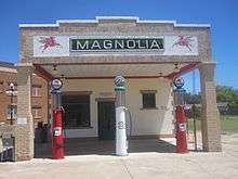
Notable buildings include the art deco–styled U-Drop Inn, constructed in 1936 in Shamrock, in Wheeler County east of Amarillo, Texas, listed on the National Register of Historic Places.[24][25] A restored Magnolia fuel station is also located in Shamrock as well as Vega, in Oldham County, west of Amarillo.[26]
During World War II, more migration west occurred because of war-related industries in California. US 66, already popular and fully paved, became one of the main routes and also served for moving military equipment. Fort Leonard Wood in Missouri was located near the highway, which was locally upgraded quickly to a divided highway to help with military traffic. When Richard Feynman was working on the Manhattan Project at Los Alamos, he used to travel nearly 100 miles (160 km) to visit his wife, who was dying of tuberculosis, in a sanatorium located on US 66 in Albuquerque.[27]
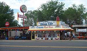
In the 1950s, US 66 became the main highway for vacationers heading to Los Angeles. The road passed through the Painted Desert and near the Grand Canyon. Meteor Crater in Arizona was another popular stop. This sharp increase in tourism in turn gave rise to a burgeoning trade in all manner of roadside attractions, including teepee-shaped motels, frozen custard stands, Indian curio shops, and reptile farms. Meramec Caverns near St. Louis, began advertising on barns, billing itself as the "Jesse James hideout." The Big Texan advertised a free 72 ounces (2.0 kg) steak dinner to anyone who could consume the entire meal in one hour. It also marked the birth of the fast-food industry: Red's Giant Hamburg in Springfield, Missouri, site of the first drive-through restaurant, and the first McDonald's in San Bernardino, California. Changes like these to the landscape further cemented 66's reputation as a near-perfect microcosm of the culture of America, now linked by the automobile.[23]
Changes in routing

Many sections of US 66 underwent major realignments.
In 1930, between the Illinois cities of Springfield and East St. Louis, US 66 was shifted farther east to what is now roughly Interstate 55 (I-55). The original alignment followed the current Illinois Route 4 (IL 4).[28]
From downtown St. Louis to Gray Summit, Missouri, US 66 originally went down Market Street and Manchester Road, which is largely Route 100. In 1932, this route was changed and the original alignment never viewed as anything more than temporary. The planned route was down Watson Road, which is now Route 366 but Watson Road had not been completed yet.
In Oklahoma, from west of El Reno to Bridgeport, US 66 turned north to Calumet and then west to Geary, then southwest across the South Canadian River over a suspension toll bridge into Bridgeport. In 1933, a straighter cut-off route was completed from west of El Reno to one mile (1.6 km) south of Bridgeport, crossing over a 38-span steel pony truss bridge over the South Canadian River, bypassing Calumet and Geary by several miles.
From west of Santa Rosa, New Mexico to north of Los Lunas, New Mexico, the road originally turned north from current I-40 along much of what is now US 84 to near Las Vegas, New Mexico, followed (roughly) I-25—then the decertified US 85 through Santa Fe and Albuquerque to Los Lunas and then turned northwest along the present New Mexico State Road 6 (NM 6) alignment to a point near Laguna. In 1937, a straight-line route was completed from west of Santa Rosa through Moriarty and east–west through Albuquerque and west to Laguna. This newer routing saved travelers as much as four hours of travel through New Mexico. According to legend, the rerouting was done at the behest of Democratic Governor Arthur T. Hannett to punish the Republican Santa Fe Ring, which had long dominated New Mexico out of Santa Fe.[29]
In 1940, the first freeway in Los Angeles was incorporated into US 66; this was the Arroyo Seco Parkway, later known as the Pasadena Freeway; now again known as Arroyo Seco Parkway.[28]

In 1953, the Oatman Highway through the Black Mountains was completely bypassed by a new route between Kingman, Arizona and Needles, California;[28] by the 1960s, Oatman, Arizona, was virtually abandoned as a ghost town.
Since the 1950s, as Interstates were being constructed, sections of US 66 not only saw the traffic drain to them, but often the name itself was moved to the faster means of travel. In some cases, such as to the east of St. Louis, this was done as soon as the Interstate was finished to the next exit. The displacement of US 66 signage to the new freeways, combined with restrictions in the 1965 Highway Beautification Act which often denied merchants on the old road access to signage on the freeway, became factors in the closure of many established US 66 businesses as travellers could no longer easily find or reach them.[30]
In 1936, US 66 was extended from downtown Los Angeles to Santa Monica to end at US 101 Alt., today the intersection of Olympic and Lincoln Boulevards. Even though there is a plaque dedicating US 66 as the Will Rogers Highway placed at the intersection of Ocean Boulevard and Santa Monica Boulevard, the highway never terminated there.
US 66 was rerouted around several larger cities via bypass or beltline routes to permit travelers to avoid city traffic congestion. Some of those cities included Springfield, Illinois; St. Louis, Missouri; Rolla, Missouri; Springfield, Missouri; Joplin, Missouri; and Oklahoma City, Oklahoma. The route was also a foundation for many chain stores back in the 1920s. For example, because of the growing popularity of the Mother Road, chain stores started sprouting up next to it to increase business and sales.
Decline
The beginning of the decline for US 66 came in 1956 with the signing of the Interstate Highway Act by President Dwight D. Eisenhower who was influenced by his experiences in 1919 as a young Army officer crossing the country in a truck convoy (following the route of the Lincoln Highway), and his appreciation of the autobahn network as a necessary component of a national defense system.[31]
During its nearly 60-year existence, US 66 was under constant change. As highway engineering became more sophisticated, engineers constantly sought more direct routes between cities and towns. Increased traffic led to a number of major and minor realignments of US 66 through the years, particularly in the years immediately following World War II when Illinois began widening US 66 to four lanes through virtually the entire state from Chicago to the Mississippi River just east of St. Louis, Missouri, and included bypasses around virtually all of the towns. By the early to mid-1950s, Missouri also upgraded its sections of US 66 to four lanes complete with bypasses. Most of the newer four-lane 66 paving in both states was upgraded to freeway status in later years.
One of the remnants of US 66 is the highway now known as Veterans Parkway, east and south of Normal, Illinois, and Bloomington, Illinois. The two sweeping curves on the southeast and southwest of the cities originally were intended to easily handle traffic at speeds up to 100 miles per hour (160 km/h), as part of an effort to make Illinois 66 an Autobahn equivalent for military transport.
In 1953, the first major bypassing of US 66 occurred in Oklahoma with the opening of the Turner Turnpike between Tulsa and Oklahoma City. The new 88-mile (142 km) toll road paralleled US 66 for its entire length and bypassed each of the towns along 66. The Turner Turnpike was joined in 1957 by the new Will Rogers Turnpike, which connected Tulsa with the Oklahoma-Missouri border west of Joplin, Missouri, again paralleling US 66 and bypassing the towns in northeastern Oklahoma in addition to its entire stretch through Kansas. Both Oklahoma turnpikes were soon designated as I-44, along with the US 66 bypass at Tulsa that connected the city with both turnpikes.
In some cases, such as many areas in Illinois, the new interstate highway not only paralleled the old US 66, it actually incorporated much of it. A typical approach was to build one new set of lanes, then move one direction of traffic to it, while retaining the original road for traffic flowing in the opposite direction. Then a second set of lanes for traffic flowing in the other direction would be constructed, finally followed by abandoning the other old set of lanes or converting them into a frontage road.
The same scenario was used in western Oklahoma when US 66 was initially upgraded to a four-lane highway such as from Sayre through Erick to the Texas border at Texola in 1957 and 1958 where the old paving was retained for westbound traffic and a new parallel lane built for eastbound traffic (much of this section was entirely bypassed by I-40 in 1975), and on two other sections; from Canute to Elk City in 1959 and Hydro to Weatherford in 1960, both of which were upgraded with the construction of a new westbound lane in 1966 to bring the highway up to full interstate standards and demoting the old US 66 paving to frontage road status. In the initial process of constructing I-40 across western Oklahoma, the state also included projects to upgrade the through routes in El Reno, Weatherford, Clinton, Canute, Elk City, Sayre, Erick, and Texola to four-lane highways not only to provide seamless transitions from the rural sections of I-40 from both ends of town but also to provide easy access to those cities in later years after the I-40 bypasses were completed.

In New Mexico, as in most other states, rural sections of I-40 were to be constructed first with bypasses around cities to come later. However, some business and civic leaders in cities along US 66 were completely opposed to bypassing fearing loss of business and tax revenues. In 1963, the New Mexico Legislature enacted legislation that banned the construction of interstate bypasses around cities by local request. This legislation was short-lived, however, due to pressures from Washington and threat of loss of federal highway funds so it was rescinded by 1965. In 1964, Tucumcari and San Jon became the first cities in New Mexico to work out an agreement with state and federal officials in determining the locations of their I-40 bypasses as close to their business areas as possible in order to permit easy access for highway travelers to their localities. Other cities soon fell in line including Santa Rosa, Moriarty, Grants and Gallup although it wasn't until well into the 1970s that most of those cities would be bypassed by I-40.
%2C_Hist._Route_66_--_2012_--_1.jpg)
By the late 1960s, most of the rural sections of US 66 had been replaced by I-40 across New Mexico with the most notable exception being the 40-mile (64 km) strip from the Texas border at Glenrio west through San Jon to Tucumcari, which was becoming increasingly treacherous due to heavier and heavier traffic on the narrow two-lane highway. During 1968 and 1969, this section of US 66 was often referred to by locals and travelers as "Slaughter Lane" due to numerous injury and fatal accidents on this stretch. Local and area business and civic leaders and news media called upon state and federal highway officials to get I-40 built through the area; however, disputes over proposed highway routing in the vicinity of San Jon held up construction plans for several years as federal officials proposed that I-40 run some five to six miles (8 to 10 km) north of that city while local and state officials insisted on following a proposed route that touched the northern city limits of San Jon. In November 1969, a truce was reached when federal highway officials agreed to build the I-40 route just outside the city, therefore providing local businesses dependent on highway traffic easy access to and from the expressway via the north–south highway that crossed old US 66 in San Jon. I-40 was completed from Glenrio to the east side of San Jon in 1976 and extended west to Tucumcari in 1981, including the bypasses around both cities.

Originally, highway officials planned for the last section of US 66 to be bypassed by interstates in Texas, but as was the case in many places, lawsuits held up construction of the new interstates. The US Highway 66 Association had become a voice for the people who feared the loss of their businesses. Since the interstates only provided access via ramps at interchanges, travellers could not pull directly off a highway into a business. At first, plans were laid out to allow mainly national chains to be placed in interstate medians. Such lawsuits effectively prevented this on all but toll roads. Some towns in Missouri threatened to sue the state if the US 66 designation was removed from the road, though lawsuits never materialized. Several businesses were well known to be on US 66, and fear of losing the number resulted in the state of Missouri officially requesting the designation "Interstate 66" for the St. Louis to Oklahoma City section of the route, but it was denied. In 1984, Arizona also saw its final stretch of highway decommissioned with the completion of I-40 just north of Williams, Arizona. Finally, with decertification of the highway by the American Association of State Highway and Transportation Officials the following year, US 66 officially ceased to exist.
With the decommissioning of US 66, no single interstate route was designated to replace it. I-55 covered the section from Chicago to St. Louis; I-44 carried the traffic on to Oklahoma City; I-40 took the largest chunk, replacing 66 to Barstow, California; I-15 took over for the route to San Bernardino; and I-210 and State Route 2 (SR 2) or I-10 carried the traffic of US 66 across the Los Angeles metropolitan area to Santa Monica, and the seashore.
After decertification

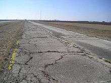
When the highway was decommissioned, sections of the road were disposed of in various ways. Within many cities, the route became a "business loop" for the interstate. Some sections became state roads, local roads, private drives, or were abandoned completely. Although it is no longer possible to drive US 66 uninterrupted all the way from Chicago to Los Angeles, much of the original route and alternate alignments are still drivable with careful planning. Some stretches are quite well preserved, including one between Springfield, Missouri, and Tulsa, Oklahoma. Some sections of US 66 still retain their historic 9-foot-wide (2.7 m) "sidewalk highway" form, never having been resurfaced to make them into full-width highways. These old sections have a single, paved lane, concrete curbs to mark the edge of the lane, and gravel shoulders for passing.
Some states have kept the 66 designation for parts of the highway, albeit as state roads. In Missouri, Routes 366, 266, and 66 are all original sections of the highway. State Highway 66 (SH-66) in Oklahoma remains as the alternate "free" route near its turnpikes. "Historic Route 66" runs for a significant distance in and near Flagstaff, Arizona. Farther west, a long segment of US 66 in Arizona runs significantly north of I-40, and much of it is designated as State Route 66 (SR 66). This runs from Seligman to Kingman, Arizona, via Peach Springs. A surface street stretch between San Bernardino and La Verne (known as Foothill Boulevard) to the east of Los Angeles retains its number as SR 66. Several county roads and city streets at various places along the old route have also retained the "66" number.
Revival

The first Route 66 associations were founded in Arizona in 1987 and Missouri in 1989 (incorporated in 1990).[32][33] Other groups in the other US 66 states soon followed. In 1990, the state of Missouri declared US 66 in that state a "State Historic Route". The first "Historic Route 66" marker in Missouri was erected on Kearney Street at Glenstone Avenue in Springfield, Missouri (now replaced—the original sign has been placed at Route 66 State Park near Eureka).[34] Other historic markers now line—at times sporadically—the entire 2,400-mile (3,900 km) length of road.[23] In many communities, local groups have painted or stencilled the "66" and U.S. Route shield or outline directly onto the road surface, along with the state's name.[23] This is common in areas where conventional signage for "Historic Route 66" is a target of repeated theft by souvenir hunters.[35]
Various sections of the road itself have been placed on the National Register of Historic Places. The Arroyo Seco Parkway in the Los Angeles Area and US 66 in New Mexico have been made into National Scenic Byways. Williams Historic Business District and Urban Route 66, Williams were added to the National Register of Historic Places in 1984 and 1989, respectively. In 2005, the State of Missouri made the road a state scenic byway from Illinois to Kansas. In the cities of Rancho Cucamonga, Rialto, and San Bernardino in California, there are US 66 signs erected along Foothill Boulevard, and also on Huntington Drive in the city of Arcadia. "Historic Route 66" signs may be found along the old route on Colorado Boulevard in Pasadena, San Dimas, LaVerne, and along Foothill Boulevard in Claremont, California. The city of Glendora, California, renamed Alosta Avenue, its section of US 66, by calling it "Route 66." Flagstaff, Arizona, renamed all but a few blocks of Sante Fe Avenue as "Route 66." The Chicago Blues Festival held each year in June in Grant Park, includes a "Route 66 Roadhouse" stage which is located on the actual pavement of old US 66, on Jackson Boulevard (which is closed to traffic for the festival) near the route's former eastern terminus at US 41 Lake Shore Drive. Since 2001, Springfield, Illinois has annually held its "International Route 66 Mother Road Festival" in its downtown district surrounding the Old State Capitol.[36]
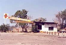
Many preservation groups have tried to save and even landmark the old motels and neon signs along the road in different states.[37]
In 1999, President Bill Clinton signed a National Route 66 Preservation Bill which provided for $10 million in matching fund grants for preserving and restoring the historic features along the route.[38]
In 2008, the World Monuments Fund added US 66 to the World Monuments Watch as sites along the route such as gas stations, motels, cafés, trading posts and drive-in movie theaters are threatened by development in urban areas and by abandonment and decay in rural areas.[39] The National Park Service developed a Route 66 Discover Our Shared Heritage Travel Itinerary describing over one hundred individual historic sites.[40] As the popularity and mythical stature of US 66 has continued to grow, demands have begun to mount to improve signage, return US 66 to road atlases and revive its status as a continuous routing.
The U.S. Route 66 Recommissioning Initiative is a group that seeks to recertify US 66 as a US Highway along a combination of historic and modern alignments.[41] The group's redesignation proposal does not enjoy universal support, as requirements the route meet modern US Highway system specifications could force upgrades which compromise its historic integrity or require US 66 signage be moved to Interstate highways for some portions of the route.

US 66 has been a fixture in popular culture. Pixar's 2006 animated film Cars describes the decline of a once-booming Radiator Springs, nearly a ghost town once its mother road, US 66, was bypassed by Interstate 40.[42] Pixar's creative director John Lasseter, inspired by what he saw during a cross-country road trip with his family in 2000, contacted road historian Michael Wallis who led the creative team down the still-drivable parts of the route as research for the film. The fictional Radiator Springs is based on multiple real places visited on the five-state research trip through Peach Springs, Arizona, Baxter Springs, Kansas and countless small towns along the way.[43] The movie's success generated a resurgence of public interest in US 66.[44]
National Museum of American History
The National Museum of American History in Washington, D.C. has a section on US 66 in its "America on the Move" exhibition. In the exhibit is a portion of pavement of the route taken from Bridgeport, Oklahoma and a restored car and truck of the type that would have been driven on the road in the 1930s. Also on display is a "Hamons Court" neon sign that hung at a gas station and tourist cabins near Hydro, Oklahoma, a "CABINS" neon sign that pointed to Ring's Rest tourist cabins in Muirkirk, Maryland, as well as several post cards a traveler sent back to his future wife while touring the route.[45]
Autry National Center
The Autry National Center in Los Angeles opened an exhibition about the fact and fiction of US 66 on June 8, 2014, which ran through January 4, 2015. The exhibit includes the original manuscript of Jack Kerouac's "On The Road," the original scribbled song lyrics for "Route 66" by Bobby Troup (and multiple versions of the song itself), a neon motel sign, maps, the "Green Book for Negro Travelers," Woody Guthrie's Martin guitar (and recordings of his dust-bowl-era songs), and many other interesting artifacts.[46]
Route description
Over the years, US 66 received many nicknames. Right after US 66 was commissioned, it was known as "The Great Diagonal Way" because the Chicago-to-Oklahoma City stretch ran northeast to southwest. Later, US 66 was advertised by the U.S. Highway 66 Association as "The Main Street of America". The title had also been claimed by supporters of US 40, but the US 66 group was more successful. In the John Steinbeck novel The Grapes of Wrath, the highway is called "The Mother Road", its prevailing title today.[47] Lastly, US 66 was unofficially named "The Will Rogers Highway" by the U.S. Highway 66 Association in 1952, although a sign along the road with that name appeared in the John Ford film, The Grapes of Wrath, which was released in 1940, twelve years before the association gave the road that name. A plaque dedicating the highway to Will Rogers is still located in Santa Monica, California. There are more plaques like this; one can be found in Galena, Kansas. It was originally located on the Kansas-Missouri state line, but moved to the Howard Litch Memorial Park in 2001.[48]
California

US 66 had its western terminus in California, and covered 315 miles (507 km) in the state.[49] The terminus was located at the Pacific Coast Highway, then US 101 Alternate and now SR 1, in Santa Monica, California. The highway ran through major cities such as Santa Monica, Los Angeles, and San Bernardino. San Bernardino also contains one of the two surviving Wigwam Motels along US 66. The highway had major intersections with US 101 in Hollywood, I-5 in Los Angeles, I-15, and I-40 in Barstow, and US 95 in Needles. It also ran concurrent to I-40 at California's very eastern end.[50]
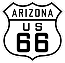
Arizona

In Arizona, the highway originally covered 401 miles (645 km) in the state. Along much of the way, US 66 paralleled I-40. It entered across the Topock Gorge, passing through the ghost town of Oatman along the way to Kingman.[51] Between Kingman and Seligman, the route is still signed as SR 66. Notably, just between Seligman and Flagstaff, Williams was the last point on US 66 to be bypassed by an Interstate. Holbrook also contains one of the two surviving Wigwam Motels on the route.[52]
New Mexico
US 66 covered 380 miles (610 km) in the state and passed through many Indian reservations in the western half of New Mexico.[53] East of those reservations, the highway passed through Albuquerque, Santa Fe, and Las Vegas. As in Arizona, in New Mexico, U.S. 66 paralleled I-40.[54]
Texas
US 66 covered 178 miles (286 km) in the Texas Panhandle, travelling in an east–west line between Glenrio, New Mexico and Texas and Texola, Oklahoma.[55] Adrian, in the western Panhandle, was notable as the midpoint of the route. East of there, the highway passed through Amarillo, famous for the Cadillac Ranch, Conway, Groom, and Shamrock.
Oklahoma and Kansas
The highway covered 267 miles (430 km) in Oklahoma. Today, it is marked by I-40 west of Oklahoma City, and SH-66 east of there. After entering at Texola, US 66 passed through Sayre, and Elk City before entering Oklahoma City.[56] Beyond Oklahoma City, the highway passed through Edmond on its way to Tulsa. Past there, US 66 passed through northeastern Oklahoma before entering Kansas where it covered only 13.2 miles (21.2 km).[57] Only three towns are located on the route in Kansas: Galena, Riverton and Baxter Springs.
Missouri
US 66 covered 292 miles (470 km) in Missouri. Upon entering from Galena, Kansas, the highway passed through Joplin. From there, it passed through Carthage, Springfield, where Red's Giant Hamburg, the world's first drive-thru stands, Waynesville, Devils Elbow, and Rolla before passing through St. Louis.[58]
Illinois

US 66 covered 301 miles (484 km) in Illinois. It entered Illinois in East St. Louis after crossing the Mississippi River. Near there, it passed by Cahokia Mounds, a UNESCO World Heritage Site. The highway then passed through Hamel, Springfield, passing by the Illinois State Capitol, Pontiac, and Gardner.[59] It then entered the Chicago area. After passing through the suburbs, U.S. 66 entered Chicago itself, where it terminated at Lake Shore Drive.[60]
Bannered routes
Several alternate alignments of US 66 occurred because of traffic issues. Business routes (BUS), bypass routes (BYP), alternate routes (ALT), and "optional routes" (OPT) (an early designation for alternate routes) came into being.
- U.S. Route 66 Alternate: Bolingbrook–Gardner, Illinois
- U.S. Route 66 Business: Towanda–Bloomington, Illinois
- U.S. Route 66 Business: Lincoln, Illinois
- U.S. Route 66 Business: Springfield, Illinois
- U.S. Route 66 Business: Mitchell–East St. Louis, Illinois
- U.S. Route 66 Business: St. Louis–Sunset Hills, Missouri
- U.S. Route 66 Optional: Venice, Illinois–St. Louis, Missouri
- U.S. Route 66 Bypass: Mitchell, Illinois–Sunset Hills, Missouri
- U.S. Route 66 Business: Springfield, Missouri
- U.S. Route 66 Bypass: Springfield, Missouri
- U.S. Route 66 Alternate Business: Springfield, Missouri
- U.S. Route 66 Alternate: Carthage, Missouri
- U.S. Route 66 Business: Carterville–Webb City, Missouri
- U.S. Route 66 Alternate: Webb City–Joplin, Missouri
- U.S. Route 66 Business: Joplin, Missouri
- U.S. Route 66 Bypass: Joplin, Missouri
- U.S. Route 66 Business: Tulsa, Oklahoma
- U.S. Route 66 Business: Oklahoma City, Oklahoma
- U.S. Route 66 Business: Clinton, Oklahoma
- U.S. Route 66 Business: Amarillo, Texas
- U.S. Route 66 Business: San Bernardino, California
- U.S. Route 66 Alternate: Pasadena–Los Angeles, California
In popular culture
American pop-culture artists publicized US 66 and the experience through song and television. Bobby Troup wrote "(Get Your Kicks on) Route 66", and the highway lent its name to a TV series in the 1960s.[61]
Other appearances in popular culture include:
- Billy Connolly's Route 66, a documentary covering a road trip along the highway by British personality Billy Connolly.[62]
- Cars, the Disney Pixar film, is set in large part in Radiator Springs, a composite of multiple real towns located on US 66. Part of the film's storyline revolves around how the once vibrant town fell into decline after the town was bypassed when US 66 was superseded by the new Interstate.[63]
- The Grapes of Wrath (novel) and The Grapes of Wrath (film), in which the Joad family is evicted from their small farm in Oklahoma and travel to California on US 66.[64]
- Songs of the Heart, by rock band Daniel Amos, tracked an elderly couple traveling along US 66 throughout the concept album.[65]
See also
- Phillips 66, a petroleum company named for the route
- National Old Trails Highway, precursor to western portion of US 66
- Southern Transcon railroad equivalent, runs parallel to US 66 for significant portions of its length
- Inland Empire 66ers of San Bernardino,named after US 66
- Tulsa 66ers, named after US 66
References
Notes
- ↑ Bureau of Public Roads & American Association of State Highway Officials (November 11, 1926). United States System of Highways Adopted for Uniform Marking by the American Association of State Highway Officials (Map). 1:7,000,000. Washington, DC: United States Geological Survey. OCLC 32889555. Retrieved November 7, 2013 – via University of North Texas Libraries.
- 1 2 Special Committee on U.S. Route Numbering (June 26, 1985). "Route Numbering Committee Agenda" (PDF) (Report). Duluth, MN: American Association of State Highway and Transportation Officials. Retrieved April 16, 2014 – via Wikimedia Commons.
- ↑ Rand McNally & Company (1947). Road and Reference Atlas (Map). Chicago: Rand McNally & Company. pp. 20–21, 25, 38–39, 54–55, 72–73, 80, 104, 107, 110.
- ↑ "Route 66 Timeline". Legends of America. Retrieved April 15, 2012.
- ↑ "A table of mileposts for the original US 66 alignment of 1926". Route 66 Web & Atlas. Retrieved April 15, 2012.
- ↑ Illinois Department of Transportation (2007). Illinois Highway Map (Map) (2007–08 ed.). 1:762,500. Springfield: Illinois Department of Transportation. OCLC 244286974. Retrieved May 26, 2012.
- ↑ Google (May 26, 2012). "Bloomington IL" (Map). Google Maps. Google. Retrieved May 26, 2012.
- ↑ "Historic Route 66: Description". Historic66.com. Swa Frantzen. Retrieved November 22, 2014.
- ↑ Weiser, Kathy (2014). "Beale's Wagon Road From New Mexico to California". Legends of America. Retrieved November 18, 2014.
- ↑ "Cajon Pass". BackRoadsWest.com. Retrieved March 29, 2016.
- ↑ Old Spanish Trail Association. Map of the Ozark Trails (Map). Old Spanish Trail Association. Retrieved April 15, 2012.
- ↑ Rand McNally (1926). Auto Road Atlas (Map). Chicago: Rand McNally. Retrieved April 15, 2012 – via Broer Maps Online.
- 1 2 Tremeear (2013), p. 10.
- ↑ "Route 66 Birthplace Festival set for Springfield, Missouri". Hemmings Motor News. American City Business Journals. Retrieved November 19, 2014.
- ↑ "Then, Now and In Between". sprinfieldmo.org. Sprinfield MIssouri Convention & Visitors Bureau. Retrieved November 19, 2014.
- ↑ "Exactly Where is Route 66". Route66 Chamber of Commerce. Retrieved November 19, 2014.
- ↑ Kelly (2014), p. 159.
- ↑ Weingroff, Richard F. (April 7, 2011). "From Names to Numbers: The Origins of the U.S. Numbered Highway System". Highway History. Federal Highway Administration. Retrieved April 15, 2012.
- ↑ Kelly (2014), p. 170.
- ↑ Missouri State Highway Commission (1926). Road Map of Missouri (PDF) (Map). Jefferson City: Missouri State Highway Commission. Retrieved April 15, 2012.
- ↑ "The Great American Foot Race". Retrieved April 15, 2012.
- ↑ Dedek (2007), p. 35.
- 1 2 3 4 5 "Route 66 History". Route 66 World. Retrieved November 18, 2014.
- ↑ "Tower Station". Texas Historic Sites Atlas. Texas Historical Commission. Retrieved March 25, 2010.
- ↑ Staff. "Texas: Wheeler County". National Register of Historic Places. National Park Service. Retrieved March 25, 2010.
- ↑ "Vega, Texas". TheRoadWanderer.net. Retrieved November 19, 2014.
- ↑ Gribbin, John; Feynman, Richard (1997). A Life in Science. p. 96.
- 1 2 3 "Route 66". nps.gov. nps. Retrieved November 19, 2014.
- ↑ "Santa Fe, Pre 1938 Rt. 66 Alignment". Shadows of Old Route 66. Retrieved April 15, 2012.
- ↑ "U.S. Route 66 in Arizona Multiple Property Submission" (PDF). National Register of Historic Places. National Park Service. April 5, 1989. pp. 25–26.
- ↑ Petroski, Henry (2006). "On the Road". American Scientist. 94 (5): 396–399. doi:10.1511/2006.61.396. ISSN 0003-0996.
- ↑ Cobb, Nathan (May 3, 1992). "Searching for Route 66". Boston Globe. p. 18 – via ProQuest Archiver.
- ↑ "Historic Route 66 Association of Missouri website". Missouri66.org. April 14, 2012. Retrieved May 5, 2012.
- ↑ Sonderman, Joe. "A Bit of Missouri 66 History". 66Postcards.com. Retrieved November 18, 2014.
- ↑ "Finding your way on Route 66". Route-66.tv. Retrieved November 18, 2014.
- ↑ "13th Annual International Route 66 Mother Road Festival & Car Show". Route66fest.com. The Promotion Company. Retrieved November 22, 2014.
- ↑ Juozapavicius, Justin (May 20, 2007). "Route 66 motels an endangered species". Yahoo! News. Associated Press. Retrieved April 15, 2012.
- ↑ Welch, Kevin (July 1, 1999). "House OKs Route 66 Bill". Amarillo Globe-News. Retrieved April 15, 2012.
- ↑ "Historic Route 66". World Monuments Fund. Retrieved April 15, 2012.
- ↑ The NPS route 66 itinerary is at http://www.nps.gov/nr/travel/route66/listofsites66.html
- ↑ Cain, Fred M. "The Plan". Route 66 Recommissioning Initiative. Retrieved June 4, 2012.
- ↑ drmcreif; paladin-64; preshusbane (2014). "Synopsis for Cars (2006)". IMDb. Amazon. Retrieved November 18, 2014.
- ↑ Warnick, Ron (June 13, 2006). "Pixar's Route 66 inspirations". Route66News.com. Retrieved November 18, 2014.
- ↑ "Kansas Historic Route 66 Association". KSHistoricRoute66.com. Retrieved November 18, 2014.
- ↑ "The Peoples Highway". America on the Move. National Museum of American History. Retrieved March 6, 2009.
- ↑ "Autry's 'Route 66' exhibition looks for its funding kicks online". Los Angeles Times. Retrieved March 29, 2014.
- ↑ McClure, Rosemary (November 29, 2010). "Get your kicks on Route 66—and 499 other great highways". Los Angeles Times. Retrieved December 7, 2010.
- ↑ Stokes, Keith. "Historic Route 66: Galena, Kansas". KansasTravel.org. Retrieved June 12, 2012.
- ↑ "Route 66 California". Road Trip USA. Avalon Travel. Retrieved November 12, 2014.
- ↑ Weiser, Kathy (2010). "About California Route 66 - Info & History". Legends of America. Retrieved November 18, 2014.
- ↑ "Old Route 66: Oatman". Road Trip USA. Avalon Travel. Retrieved November 18, 2014.
- ↑ "Holbrook: Wigwam Village". Road Trip USA. Avalon Travel. Retrieved November 18, 2014.
- ↑ "Route 66". AmericanSouthwest.net. John Crossley. Retrieved November 18, 2014.
- ↑ "Route 66 History". Albuquerque Convention & Visitors Bureau. Retrieved November 18, 2014.
- ↑ Weiser, Kathy (2011). "About Texas Route 66 - Info & History". Legends of America. Retrieved November 18, 2014.
- ↑ Weiser, Kathy (2013). "Route 66 Through Oklahoma". Legends of America. p. 2. Retrieved November 18, 2014.
- ↑ "Kansas Route 66 Main Page". Legends of America. 2012. Retrieved November 18, 2014.
- ↑ Weiser, Kathy (2012). "About Missouri Route 66 - Info & History". Legends of America. Retrieved November 18, 2014.
- ↑ "Historic Route 66 - Illinois". Historic66.com. Retrieved November 18, 2014.
- ↑ Illinois Division of Highways (April 1, 1955). Illinois Official Highway Map (Map). 1:805,000. Springfield: Illinois Division of Highways. Chicago and Vicinity inset. OCLC 713840599. Retrieved November 18, 2014 – via Illinois Digital Collections.
- ↑ Snyder, Tom (2000). Welcome to the Old Road. New York: St Martin's Press. p. xii.
- ↑ James, Clive (September 20, 2011). "Clive James on... Billy Connolly's Route 66, Sandhurst and Downton Abbey". The Telegraph. London. Retrieved October 2, 2016.
- ↑ MacDonald, Brady (January 5, 2013). "The Real Route 66 Inspirations Behind Disney's Cars Land". Los Angeles Times. Retrieved October 2, 2016.
- ↑ McGreal, Chris (August 27, 2009). "The Grapes of Wrath Revisited: Same Road, Same Grim Story, Same Sense of Optimism". The Guardian. London. Retrieved October 2, 2016.
- ↑ "Daniel Amos: Then & Now". CCMclassic.com. Retrieved October 2, 2016.
Works cited
- Arizona Highways. Phoenix: Arizona Department of Transportation. July 1981. ISSN 0004-1521. Missing or empty
|title=(help) Entire issue about Route 66. - Dedek, Peter B. (2007). Hip to the Trip: A Cultural History of Route 66. Albuquerque, NM: University of New Mexico Press. ISBN 9780826341945.
- Freeth, Nick (2001). Route 66. St. Paul, MN: MBI Publishing. ISBN 0-7603-0864-0.
- Kelly, Susan Croce (2014). Father of Route 66: The Story of Cy Avery. University of Oklahome Press. ISBN 978-0-806-14778-9.
- Krim, Arthur; Wood, Denis (2005). Route 66: Iconography of the American Highway (1st ed.). Sante Fe, NM: Center for American Places. ISBN 9781930066359.
- Mahar, Lisa (2002). American Signs: Form and Meaning on Route 66. New York: The Monacelli Press. ISBN 9781580931199.
- Rittenhouse, Jack D. (1989) [1946]. A Guide Book to Highway 66. Albuquerque, NM: University of New Mexico Press. ISBN 0-8263-1148-2.
- Schneider, Jill (1991). Route 66 Across New Mexico: A Wanderer's Guide. Albuquerque, NM: University of New Mexico Press. ISBN 0-8263-1280-2.
- Scott, Quinta; Kelly, Susan Croce (1988). Route 66: A Highway and Its People. Norman, OK: University of Oklahoma Press. ISBN 0-8061-2291-9.
- Tremeear, Janice (2013). Illinois' Haunted Route 66. The History Press. ISBN 978-1-626-19252-2.
- Wallis, Michael (2001). Route 66: The Mother Road. New York: St. Martin's Press. ISBN 0-312-28167-6.
Further reading
- Bischoff, Matt D. (2005). Life in the Past Lane the Route 66 Experience: Historic Management Contexts for the Route 66 Corridor in California. Statistical Research, Inc. ISBN 978-1879442887. OCLC 68569034.
External links
| Wikimedia Commons has media related to U.S. Route 66. |
| Wikivoyage has a travel guide for U.S. Route 66. |
- Route 66 at DMOZ
- Route 66: In the beginning why was it named 66, 1928 maps, details of the daughters of Route 66
- Route 66 Guide
- Route 66 World, a website dedicated to the preservation of Route 66 as well as educating travelers of the continuous growth and popularity of Route 66.
- Route 66 Motor Cycle: Guide, History, Directions, Maps, Message Board
- New Zealand travel experts explain Route 66
- Route 66 News, a blog about recent events of Route 66 and inspirations thereof, including the television show Route 66
- Route 66: The Allure of the Road on YouTube, Dan Rice, Past President, California Historic Route 66 Association
- route66map, map of US 66 routings
Routes in italics are no longer a part of the system. Highlighted routes are considered main routes of the system. |
{{US 66}}