Greentown, Ohio
| Greentown, Ohio | |
|---|---|
| CDP | |
|
The Miller House | |
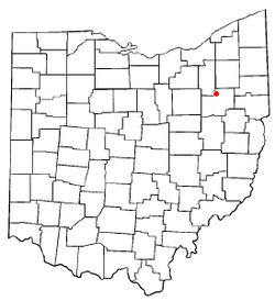 Location of Greentown, Ohio | |
| Coordinates: 40°55′45″N 81°24′7″W / 40.92917°N 81.40194°WCoordinates: 40°55′45″N 81°24′7″W / 40.92917°N 81.40194°W | |
| Country | United States |
| State | Ohio |
| County | Stark |
| Township | Lake |
| Area | |
| • Total | 2.7 sq mi (7.1 km2) |
| • Land | 2.7 sq mi (7.1 km2) |
| • Water | 0.0 sq mi (0.0 km2) |
| Elevation[1] | 1,201 ft (366 m) |
| Population (2000) | |
| • Total | 3,154 |
| • Density | 1,149.3/sq mi (443.7/km2) |
| Time zone | Eastern (EST) (UTC-5) |
| • Summer (DST) | EDT (UTC-4) |
| ZIP code | 44630 |
| Area code(s) | 330 |
| FIPS code | 39-32298[2] |
| GNIS feature ID | 1064760[1] |
.JPG)
Greentown is a census-designated place (CDP) in Stark County, Ohio, United States. The population was 3,154 at the 2000 census. It is part of the Canton-Massillon, OH Metropolitan Statistical Area.
History
Greentown was platted in 1816.[3] The community was formerly located in Green Township, hence the name.[4]
Geography
Greentown is located at 40°55′45″N 81°24′07″W / 40.929221°N 81.402015°W.[5]
According to the United States Census Bureau, the CDP has a total area of 2.7 square miles (7.0 km2), all land.
Demographics
As of the census[2] of 2000, there were 3,154 people, 1,039 households, and 870 families residing in the CDP. The population density was 1,149.3 people per square mile (444.4/km2). There were 1,077 housing units at an average density of 392.4/sq mi (151.8/km2). The racial makeup of the CDP was 97.18% White, 0.92% African American, 0.13% Native American, 0.76% Asian, 0.03% Pacific Islander, 0.32% from other races, and 0.67% from two or more races. Hispanic or Latino of any race were 0.98% of the population.
There were 1,039 households out of which 47.8% had children under the age of 18 living with them, 76.2% were married couples living together, 5.0% had a female householder with no husband present, and 16.2% were non-families. 13.3% of all households were made up of individuals and 4.4% had someone living alone who was 65 years of age or older. The average household size was 3.04 and the average family size was 3.34.
In the CDP the population was spread out with 32.7% under the age of 18, 6.1% from 18 to 24, 30.8% from 25 to 44, 23.7% from 45 to 64, and 6.7% who were 65 years of age or older. The median age was 35 years. For every 100 females there were 100.5 males. For every 100 females age 18 and over, there were 98.8 males.
The median income for a household in the CDP was $69,145, and the median income for a family was $74,712. Males had a median income of $48,472 versus $26,204 for females. The per capita income for the CDP was $24,854. About 1.4% of families and 0.9% of the population were below the poverty line, including none of those under age 18 and 11.9% of those age 65 or over.
School district
Greentown lies in the North Canton school district. The district includes Greentown Elementary School, which children who live in Greentown attend. Greentown Elementary used to be a high school, but was merged with the North Canton City Schools, when it became an elementary school.
References
- 1 2 "US Board on Geographic Names". United States Geological Survey. 2007-10-25. Retrieved 2008-01-31.
- 1 2 "American FactFinder". United States Census Bureau. Retrieved 2008-01-31.
- ↑ Perrin, William Henry (1881). History of Stark County: With an Outline Sketch of Ohio. Baskin & Battey. p. 564.
- ↑ Lehman, John H. (1916). A Standard History of Stark County, Ohio: An Authentic Narrative of the Past, with Particular Attention to the Modern Era in the Commercial, Industrial, Civic and Social Development. Lewis Publishing Company. p. 80.
- ↑ "US Gazetteer files: 2010, 2000, and 1990". United States Census Bureau. 2011-02-12. Retrieved 2011-04-23.
External links
Municipalities and communities of Stark County, Ohio, United States | ||
|---|---|---|
| Cities | 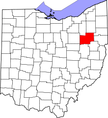 | |
| Villages | ||
| Townships | ||
| CDPs | ||
| Unincorporated communities | ||
| Footnotes | ‡This populated place also has portions in an adjacent county or counties | |