Gypsum, Kansas
| Gypsum, Kansas | |
|---|---|
| City | |
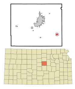 Location within Saline County and Kansas | |
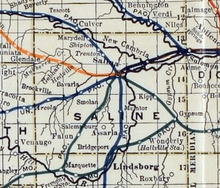
 KDOT map of Saline County (legend) | |
| Coordinates: 38°42′20″N 97°25′41″W / 38.70556°N 97.42806°WCoordinates: 38°42′20″N 97°25′41″W / 38.70556°N 97.42806°W[1] | |
| Country | United States |
| State | Kansas |
| County | Saline |
| Government | |
| • Type | Mayor–Council |
| • Mayor | Gary Bickel [2] |
| • City Clerk | Judy Scanlan [2] |
| Area[3] | |
| • Total | 0.36 sq mi (0.93 km2) |
| • Land | 0.36 sq mi (0.93 km2) |
| • Water | 0 sq mi (0 km2) |
| Elevation[1] | 1,227 ft (374 m) |
| Population (2010)[4] | |
| • Total | 405 |
| • Estimate (2014)[5] | 395 |
| • Density | 1,100/sq mi (440/km2) |
| Time zone | CST (UTC-6) |
| • Summer (DST) | CDT (UTC-5) |
| ZIP code | 67448 |
| Area code | 785 |
| FIPS code | 20-29250 [1][6] |
| GNIS ID | 476963 [1][7] |
Gypsum is a city in Saline County, Kansas, United States.[1] As of the 2010 census, the city population was 405.[8]
History
Early history
For many millennia, the Great Plains of North America was inhabited by nomadic Native Americans. From the 16th century to 18th century, the Kingdom of France claimed ownership of large parts of North America. In 1762, after the French and Indian War, France secretly ceded New France to Spain, per the Treaty of Fontainebleau.
19th century
In 1802, Spain returned most of the land to France. In 1803, most of the land for modern day Kansas was acquired by the United States from France as part of the 828,000 square mile Louisiana Purchase for 2.83 cents per acre.
In 1854, the Kansas Territory was organized, then in 1861 Kansas became the 34th U.S. state. In 1860, Saline County was established within the Kansas Territory, which included the land for modern day Gypsum.
The community was founded as a Templer community called Tempelfeld.[9] Gypsum was named after Gypsum Creek.[10] The Gypsum post office has operated under that name since 1886.[11]
Geography
Gypsum is located at 38°42′18″N 97°25′37″W / 38.70500°N 97.42694°W (38.705118, -97.426876).[12] According to the United States Census Bureau, the city has a total area of 0.36 square miles (0.93 km2), all of it land.[3]
Demographics
| Historical population | |||
|---|---|---|---|
| Census | Pop. | %± | |
| 1890 | 530 | — | |
| 1900 | 552 | 4.2% | |
| 1910 | 623 | 12.9% | |
| 1920 | 732 | 17.5% | |
| 1930 | 638 | −12.8% | |
| 1940 | 615 | −3.6% | |
| 1950 | 523 | −15.0% | |
| 1960 | 593 | 13.4% | |
| 1970 | 391 | −34.1% | |
| 1980 | 423 | 8.2% | |
| 1990 | 365 | −13.7% | |
| 2000 | 414 | 13.4% | |
| 2010 | 405 | −2.2% | |
| Est. 2015 | 395 | [13] | −2.5% |
| U.S. Decennial Census | |||
It is part of the Salina Micropolitan Statistical Area.[14]
2010 census
As of the census[4] of 2010, there were 405 people, 162 households, and 111 families residing in the city. The population density was 1,125.0 inhabitants per square mile (434.4/km2). There were 187 housing units at an average density of 519.4 per square mile (200.5/km2). The racial makeup of the city was 94.6% White, 0.5% African American, 1.2% Native American, 1.0% Asian, 1.0% from other races, and 1.7% from two or more races. Hispanic or Latino of any race were 2.5% of the population.
There were 162 households of which 29.0% had children under the age of 18 living with them, 50.6% were married couples living together, 11.7% had a female householder with no husband present, 6.2% had a male householder with no wife present, and 31.5% were non-families. 27.2% of all households were made up of individuals and 8.1% had someone living alone who was 65 years of age or older. The average household size was 2.50 and the average family size was 2.97.
The median age in the city was 39.9 years. 26.7% of residents were under the age of 18; 6.6% were between the ages of 18 and 24; 24.5% were from 25 to 44; 27.7% were from 45 to 64; and 14.6% were 65 years of age or older. The gender makeup of the city was 47.2% male and 52.8% female.
2000 census
As of the census[6] of 2000, there were 414 people, 158 households, and 111 families residing in the city. The population density was 956.5 people per square mile (371.7/km²). There were 179 housing units at an average density of 413.6 per square mile (160.7/km²). The racial makeup of the city was 95.17% White, 1.21% African American, 0.24% from other races, and 3.38% from two or more races. Hispanic or Latino of any race were 0.97% of the population.
There were 158 households out of which 36.7% had children under the age of 18 living with them, 57.6% were married couples living together, 7.6% had a female householder with no husband present, and 29.7% were non-families. 25.3% of all households were made up of individuals and 12.0% had someone living alone who was 65 years of age or older. The average household size was 2.62 and the average family size was 3.09.
In the city the population was spread out with 28.5% under the age of 18, 7.2% from 18 to 24, 29.7% from 25 to 44, 23.4% from 45 to 64, and 11.1% who were 65 years of age or older. The median age was 36 years. For every 100 females there were 102.9 males. For every 100 females age 18 and over, there were 107.0 males.
The median income for a household in the city was $30,833, and the median income for a family was $34,375. Males had a median income of $27,000 versus $17,386 for females. The per capita income for the city was $16,440. About 4.1% of families and 6.0% of the population were below the poverty line, including 3.5% of those under age 18 and 9.4% of those age 65 or over.
Government
The Gypsum government consists of a mayor and five council members. The council meets the 2nd Monday of each month at 7 pm.[2]
Education
Gypsum is part of Unified School District 306.[15][16][17] Its high school is Southeast of Saline Secondary School.
Notable people
- Steve Fritz, 1996 Olympic Decathlon.
- Frank Wilkeson, New York Times journalist and Washington explorer who owned a large ranch in Gypsum for nearly forty years and is buried in the town.
See also
Further reading
References
- 1 2 3 4 5 Geographic Names Information System (GNIS) details for Gypsum, Kansas; United States Geological Survey (USGS); October 13, 1978.
- 1 2 3 Gypsum - Directory of Public Officials
- 1 2 "US Gazetteer files 2010". United States Census Bureau. Archived from the original on January 24, 2012. Retrieved June 6, 2012.
- 1 2 "American FactFinder". United States Census Bureau. Retrieved July 6, 2012.
- ↑ "Annual Estimates of the Resident Population for Incorporated Places: April 1, 2010 to July 1, 2014". Retrieved June 4, 2015.
- 1 2 "American FactFinder". United States Census Bureau. Archived from the original on September 11, 2013. Retrieved 2008-01-31.
- ↑ "US Board on Geographic Names". United States Geological Survey. 2007-10-25. Retrieved 2008-01-31.
- ↑ "2010 City Population and Housing Occupancy Status". U.S. Census Bureau. Archived from the original on July 21, 2011. Retrieved March 6, 2011.
- ↑ History of the Temple Society.
- ↑ Heim, Michael (2007). Exploring Kansas Highways. p. 57.
- ↑ "Kansas Post Offices, 1828-1961". Kansas Historical Society. Archived from the original on October 9, 2013. Retrieved 23 June 2014.
- ↑ "US Gazetteer files: 2010, 2000, and 1990". United States Census Bureau. 2011-02-12. Retrieved 2011-04-23.
- ↑ "Annual Estimates of the Resident Population for Incorporated Places: April 1, 2010 to July 1, 2015". Retrieved July 2, 2016.
- ↑ Nussle, Jim (November 20, 2008). "Micropolitan Statistical Areas" (PDF format). List 1-9. Office of Management and Budget, Executive Office of the President. p. 97. Retrieved April 2, 2010.
- ↑ USD 306
- ↑ Kansas School District Boundary Map (PDF format).
- ↑ Saline County School District Map Archived July 27, 2011, at the Wayback Machine..
External links
| Wikimedia Commons has media related to Gypsum, Kansas. |
- City
- Schools
- USD 306, local school district
- Maps
- Gypsum City Map, KDOT
Municipalities and communities of Saline County, Kansas, United States | ||
|---|---|---|
| Cities |  | |
| CDPs | ||
| Unincorporated communities | ||
| Townships |
| |
| Footnotes | ‡This populated place also has portions in an adjacent county or counties | |