Salina, Kansas
| Salina, Kansas | |
|---|---|
| City | |
|
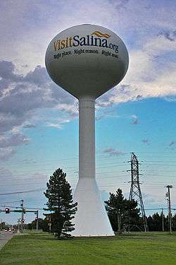
Water tower in Salina (2013) | |
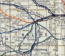
 Location within Saline County and Kansas | |
 KDOT map of Saline County (legend) | |
| Coordinates: 38°50′25″N 97°36′41″W / 38.84028°N 97.61139°WCoordinates: 38°50′25″N 97°36′41″W / 38.84028°N 97.61139°W[1] | |
| Country | United States |
| State | Kansas |
| County | Saline |
| Founded | 1858 |
| Incorporated | 1870 |
| Government | |
| • Type | Council-Manager |
| • Mayor | Jon Blanchard |
| • City Manager | Jason Gage |
| Area[2] | |
| • Total | 25.15 sq mi (65.14 km2) |
| • Land | 25.11 sq mi (65.03 km2) |
| • Water | 0.04 sq mi (0.10 km2) |
| Elevation[1] | 1,227 ft (374 m) |
| Population (2010)[3] | |
| • Total | 47,707 |
| • Estimate (2014)[4] | 47,867 |
| • Density | 1,900/sq mi (730/km2) |
| Time zone | CST (UTC-6) |
| • Summer (DST) | CDT (UTC-5) |
| ZIP code | 67401-67402 [5] |
| Area code | 785 |
| FIPS code | 20-62700 [1] |
| GNIS ID | 476808 [1] |
| Website |
ci |
Salina /səˈlaɪnə/ is a city in and the county seat of Saline County, Kansas, United States.[1] As of the 2010 census, the city population was 47,707.[6] Located in one of the world's largest wheat-producing areas, Salina, also known as the City of Swans,[7] is a regional trade center for north-central Kansas. It is home to multiple colleges.
History
Prior to European colonization of the area, the site of Salina was located within the territory of the Kansa people.[8] Claimed first by France as part of Louisiana and later acquired by the United States with the Louisiana Purchase in 1803, it was within the area organized by the U.S. as Kansas Territory in 1854.[9][10] In 1856, a colony led by Preston B. Plumb established the first American settlement near the site at a location on the Saline River.[11]
Settlers led by journalist and lawyer William A. Phillips founded Salina in 1858. During the following two years, the territorial legislature chartered the town company, organized the surrounding area as Saline County, and named Salina the county seat. The westernmost town on the Smoky Hill Trail, Salina established itself as a trading post for westbound immigrants, prospectors bound for Pikes Peak, and area American Indian tribes. The town's growth halted with the outbreak of the American Civil War when much of the male population left to join the U.S. Army.[12]
In 1862, local residents fended off American Indian raiders only to fall victim to a second assault by bushwhackers later that year.[12] In May and June 1864, the Salina Stockade was built to protect the town against further Indian raids. Troops were garrisoned in Salina until March 1865, and some may have returned in June 1865. The stockade was probably used until at least spring or summer 1865.
Growth returned with the soldiers after the war, and the town expanded rapidly with the arrival of the Kansas Pacific Railway in 1867. Salina incorporated as a city in 1870.[12][13] The cattle trade arrived in 1872, transforming Salina into a cowtown. The trade brought the city further prosperity, but also a rowdy culture that agitated local residents. The cattle trade relocated westward just two years later.[14] During the 1870s, wheat became the dominant crop in the area, steam-powered flour mills were built, and agriculture became the engine of the local economy. In 1874, Salina resident E. R. Switzer introduced alfalfa to area farmers, and its cultivation spread throughout the state. By 1880, the city was an area industrial center with several mills, a carriage and wagon factory, and a farm implement works.[15] Salina was the location of the first garment factory of jeans maker Lee, which opened in 1889.[16] Over the following decade, three railroads were built through the city.[15] The success of the wholesale and milling industries drove Salina's growth into the early 1900s such that, at one point, it was the third-largest producer in the state and the sixth-largest in the United States.[11]
In 1943, the U.S. Army established Smoky Hill Army Airfield southwest of the city. The installation served as a base for strategic bomber units throughout World War II. Renamed Smoky Hill Air Force Base in 1948, the base closed the following year only to be reopened in 1951 as Schilling Air Force Base, part of Strategic Air Command.[17] The re-opening of the base triggered an economic boom in Salina, causing the city's population to increase by nearly two-thirds during the 1950s.[11] The U.S. Department of Defense closed the base permanently in 1965, but the city of Salina acquired it and converted it into Salina Municipal Airport and an industrial park.[17] This led to substantial industrial development, attracting firms such as Beechcraft, and made manufacturing a primary driver of the local economy.[18]
Today, Salina remains a center of trade, transportation, and industry in north-central Kansas.[11]
Geography
Salina is located at 38°50′25″N 97°36′41″W / 38.84028°N 97.61139°W (38.8402805, -97.6114237) at an elevation of 1,224 feet (373 m).[1] Located in north-central Kansas at the intersection of Interstate 70 and Interstate 135, it is 81 miles (130 km) north of Wichita, Kansas, 164 miles (264 km) west of Kansas City, Missouri, and 401 miles (645 km) east of Denver, Colorado.[19]
Salina lies in the Smoky Hills region of the Great Plains approximately 6 miles (9.7 km) west-southwest of the confluence of the Saline and Smoky Hill Rivers.[20] The Smoky Hill River runs north then northeast through the eastern part of the city; the Saline River flows southeast immediately north of the city.[21] In the northeast part of the city, the old channel of the Smoky Hill branches from the river's current course and winds west, north, and back east before draining back into the river. Mulberry Creek, a tributary of the Saline, flows northeast through the far northern part of the city. Dry Creek, a tributary of Mulberry Creek, flows north through the western part of the city.[22]
According to the United States Census Bureau, the city has a total area of 25.15 square miles (65.14 km2), of which 25.11 square miles (65.03 km2) is land and 0.04 square miles (0.10 km2) is water.[2]
Climate
Salina lies in the transition area between North America's humid subtropical (Köppen Cfa) and humid continental climate (Köppen Dfa) zones. Consequently, summers in Salina are typically hot and humid, and winters are typically cold and dry.[23] On average, January is the coldest month, July is the hottest month, and May is the month with the greatest precipitation.[24]
As is common in the region, Salina is prone to severe thunderstorms which may produce damaging winds, hail, and tornadoes. On September 25, 1973, an F3 tornado passed through the southeast part of town, injuring six people and destroying two houses and a trailer park.[25] On June 11, 2008, another EF3 tornado passed on the south side of the town, severely damaging several buildings.[26]
The annual average temperature in Salina is 56.1 °F (13 °C). The monthly daily average temperature ranges from 31.0 °F (−0.6 °C) in January to 81.1 °F (27.3 °C) in July. The high temperature reaches or exceeds 90 °F (32 °C) an average of 62.6 days per year and reaches or exceeds 100 °F (38 °C) an average of 14.6 days per year. The low temperature falls below the freezing point, 32 °F (0 °C), an average of 111.8 days per year and below 0 °F (−18 °C) an average of 3.8 days per year.[27] The hottest temperature recorded in Salina was 117 °F (47 °C) on August 12, 1936; the coldest temperature recorded was −31 °F (−35 °C) on February 13, 1905.[28]
On average, Salina receives 32.2 in (818 mm) of precipitation per year with the largest share being received in May through August.[28] The average relative humidity is 64%.[29] Snowfall averages 18.4 inches (47 cm) per year.[28]
| Climate data for Salina Regional Airport (KSLN) | |||||||||||||
|---|---|---|---|---|---|---|---|---|---|---|---|---|---|
| Month | Jan | Feb | Mar | Apr | May | Jun | Jul | Aug | Sep | Oct | Nov | Dec | Year |
| Record high °F (°C) | 78 (26) |
84 (29) |
96 (36) |
105 (41) |
106 (41) |
114 (46) |
116 (47) |
117 (47) |
110 (43) |
100 (38) |
89 (32) |
81 (27) |
117 (47) |
| Average high °F (°C) | 41.6 (5.3) |
46.5 (8.1) |
57.0 (13.9) |
67.1 (19.5) |
76.5 (24.7) |
87.2 (30.7) |
93.0 (33.9) |
91.1 (32.8) |
81.9 (27.7) |
69.0 (20.6) |
54.9 (12.7) |
42.4 (5.8) |
67.4 (19.7) |
| Daily mean °F (°C) | 31.0 (−0.6) |
35.5 (1.9) |
45.4 (7.4) |
55.2 (12.9) |
65.3 (18.5) |
75.6 (24.2) |
81.1 (27.3) |
79.6 (26.4) |
70.2 (21.2) |
57.5 (14.2) |
43.9 (6.6) |
32.3 (0.2) |
56.05 (13.35) |
| Average low °F (°C) | 20.5 (−6.4) |
24.6 (−4.1) |
33.9 (1.1) |
43.2 (6.2) |
54.0 (12.2) |
64.0 (17.8) |
69.3 (20.7) |
68.1 (20.1) |
58.4 (14.7) |
46.0 (7.8) |
32.9 (0.5) |
22.3 (−5.4) |
44.8 (7.1) |
| Record low °F (°C) | −28 (−33) |
−31 (−35) |
−11 (−24) |
5 (−15) |
19 (−7) |
38 (3) |
46 (8) |
42 (6) |
28 (−2) |
14 (−10) |
−5 (−21) |
−24 (−31) |
−31 (−35) |
| Average precipitation inches (mm) | 0.72 (18.3) |
1.03 (26.2) |
2.41 (61.2) |
3.00 (76.2) |
4.76 (120.9) |
4.27 (108.5) |
4.08 (103.6) |
3.38 (85.9) |
2.52 (64) |
2.32 (58.9) |
1.25 (31.8) |
0.92 (23.4) |
30.66 (778.9) |
| Average snowfall inches (cm) | 5.9 (15) |
4.6 (11.7) |
2.2 (5.6) |
0.5 (1.3) |
0 (0) |
0 (0) |
0 (0) |
0 (0) |
0 (0) |
0.3 (0.8) |
1.0 (2.5) |
3.6 (9.1) |
18.1 (46) |
| Average precipitation days (≥ 0.01 in) | 5.2 | 5.2 | 7.6 | 8.5 | 10.6 | 9.6 | 7.9 | 7.7 | 6.9 | 6.4 | 5.3 | 5.3 | 86.1 |
| Average snowy days (≥ 0.1 in) | 3.1 | 1.8 | 1.0 | 0.3 | 0.0 | 0.0 | 0.0 | 0.0 | 0.0 | 0.2 | 0.7 | 2.0 | 9.1 |
| Average relative humidity (%) | 69 | 63 | 67 | 65 | 71 | 62 | 59 | 61 | 50 | 56 | 66 | 73 | 64 |
| Source: National Weather Service: Temperature averages (1981-2010),[27] Records (1888-present),[28] precipitation averages and days (1981-2010),[30] snowfall averages and days (1966-1995);[30] Weatherbase: Humidity[29] | |||||||||||||
Demographics
| Historical population | |||
|---|---|---|---|
| Census | Pop. | %± | |
| 1870 | 918 | — | |
| 1880 | 3,111 | 238.9% | |
| 1890 | 6,149 | 97.7% | |
| 1900 | 6,074 | −1.2% | |
| 1910 | 9,688 | 59.5% | |
| 1920 | 15,085 | 55.7% | |
| 1930 | 20,155 | 33.6% | |
| 1940 | 21,073 | 4.6% | |
| 1950 | 26,176 | 24.2% | |
| 1960 | 43,202 | 65.0% | |
| 1970 | 37,714 | −12.7% | |
| 1980 | 41,843 | 10.9% | |
| 1990 | 42,303 | 1.1% | |
| 2000 | 45,679 | 8.0% | |
| 2010 | 47,707 | 4.4% | |
| Est. 2015 | 47,813 | [31] | 0.2% |
| U.S. Decennial Census[32] | |||
Salina is the anchor city of the Salina Micropolitan Statistical Area which includes all of Saline and Ottawa counties.[33]
2010 census
As of the 2010 census, there were 47,707 people, 19,391 households, and 12,024 families residing in the city. The population density was 2,092.4 people per square mile (807.9/km²). There were 20,803 housing units at an average density of 916.4 per square mile (353.2/km²). The racial makeup of the city was 86.2% White, 3.7% African American, 2.3% Asian, 0.5% American Indian, 0.1% Pacific Islander, 3.8% from some other race, and 3.3% from two or more races. Hispanics and Latinos of any race were 10.7% of the population.[6]
There were 19,391 households of which 31.6% had children under the age of 18 living with them, 45.3% were married couples living together, 4.9% had a male householder with no wife present, 11.8% had a female householder with no husband present, and 38.0% were non-families. 31.6% of all households were made up of individuals, and 11.6% had someone living alone who was 65 years of age or older. The average household size was 2.39, and the average family size was 2.99.[6]
In the city the population was spread out with 25.1% of residents under the age of 18; 9.9% between the ages of 18 and 24; 25.4% from 25 to 44; 25.3% from 45 to 64; and 14.3% 65 years of age or older. The median age in the city was 36.4 years. The gender makeup of the city was 49.4% male and 50.6% female.[6]
The median income for a household in the city was $42,027, and the median income for a family was $54,491. Males had a median income of $39,143 versus $28,145 for females. The per capita income for the city was $23,253. About 9.3% of families and 13.6% of the population were below the poverty line, including 21.1% of those under age 18 and 7.3% of those age 65 or over.[6]
2000 census
As of the census[34] of 2000, there were 45,679 people, 18,523 households, and 11,873 families residing in the city. The population density was 2,009.6 people per square mile (775.9/km²). There were 19,599 housing units at an average density of 862.2 per square mile (332.9/km²). The racial makeup of the city was 87.76% White, 3.57% Black or African American, 0.56% Native American, 1.96% Asian, 0.05% Pacific Islander, 3.78% from other races, and 2.32% from two or more races. Hispanic or Latino of any race were 6.71% of the population.[34]
There were 18,523 households, of which 31.5% had children under the age of 18 living with them, 49.8% were married couples living together, 10.5% had a female householder with no husband present, and 35.9% were non-families. 30.1% of all households were made up of individuals and 11.3% had someone living alone who was 65 years of age or older. The average household size was 2.39 and the average family size was 2.98.
In the city the population was spread out with 25.9% under the age of 18, 10.0% from 18 to 24, 28.7% from 25 to 44, 21.1% from 45 to 64, and 14.3% who were 65 years of age or older. The median age was 35 years. For every 100 females there were 95.8 males. For every 100 females age 18 and over, there were 92.8 males.
The median income for a household in the city was $36,066, and the median income for a family was $45,433. Males had a median income of $31,250 versus $21,944 for females. The per capita income for the city was $18,593. About 6.7% of families and 9.6% of the population were below the poverty line, including 10.6% of those under age 18 and 9.2% of those age 65 or over.[6]
Economy

Manufacturing is the predominant industry in Salina.[35]:11 Agricultural transportation is also a major industry.[35]:17 Major employers in the city include these: Tony's Pizza, a Schwan Food Company brand, has operations in Salina to produce frozen pizzas and food for school cafeterias and other institutions;[36] Philips Lighting;[37] Exide Battery;[38] Great Plains Manufacturing makes farm equipment;[39] ElDorado National paints commercial buses;[40] and Asurion.
As of 2010, 71.0% of the population over the age of 16 was in the labor force. 0.4% was in the armed forces, and 70.6% was in the civilian labor force with 66.9% being employed and 3.7% unemployed. The composition, by occupation, of the employed civilian labor force was: 27.2% in management, business, science, and arts; 25.4% in sales and office occupations; 19.4% in service occupations; 9.9% in natural resources, construction, and maintenance; 18.2% in production, transportation, and material moving. The three industries employing the largest percentages of the working civilian labor force were: educational services, health care, and social assistance (21.2%); manufacturing (17.8%); and retail trade (13.1%).[6]
The cost of living in Salina is relatively low; compared to a U.S. average of 100, the cost of living index for the city is 80.9.[41] As of 2010, the median home value in the city was $109,700, the median selected monthly owner cost was $1,070 for housing units with a mortgage and $396 for those without, and the median gross rent was $599.[6]
Top employers
According to Salina's 2011 Comprehensive Annual Financial Report,[42] these are the city's top employers:
| # | Employer | # of Employees |
|---|---|---|
| 1 | Tony's Pizza | 1,850 |
| 2 | Salina Regional Health Center | 1,082 |
| 3 | USD 305 | 935 |
| 4 | Exide | 800 |
| 5 | Great Plains Manufacturing | 650 |
| 6 | Philips Lighting | 600 |
| 7 | City of Salina | 493 |
| 8 | Saline County | 277 |
| 9 | ElDorado National | 255 |
Government
Salina is a city of the first class with a commission-manager form of government which it adopted in 1921.[43][44] The city commission consists of five members elected at large, one of whom the commission annually selects to serve as mayor. Commission candidates who receive the most and second–most votes are elected for a four-year term; the candidate who receives the third most votes is elected for a two-year term.[44] The commission sets policy and appoints the city manager, who serves as the chief executive, responsible for administering the city government and appointing all city employees.[45]
The Salina Fire department operates four stations inside the city.
As the county seat, Salina is the administrative center of Saline County. The county courthouse is located downtown, and all departments of the county government base their operations in the city.[46]
Salina lies within Kansas's 1st U.S. Congressional District. For the purposes of representation in the Kansas Legislature, the city is located in the 24th district of the Kansas Senate and the 69th, 71st, and 108th districts of the Kansas House of Representatives.[43]
Education
Primary and secondary education
Salina Public Schools (USD 305) operates twelve schools in Salina:[41][47][48][49][50]
- Coronado Elementary School (Grades K-5)
- Cottonwood Elementary School (K-5)
- Grace E. Stewart Elementary School (K-5)
- Heusner Elementary School (K-5)
- Meadowlark Ridge Elementary School (K-5)
- Oakdale Elementary School (K-5)
- Schilling Elementary School (K-5)
- Sunset Elementary School (K-5)
- Lakewood Middle School (6-8)
- Salina South Middle School (6-8)
- Salina High School Central (9-12)
- Salina High School South (9-12)
There are four private schools in Salina:[41]
- St. John's Military School (6-12), male only[51]
- St. Mary's Grade School (Pre-K-6), Catholic school
- Salina Christian Academy (Pre-K-10)[52]
- Sacred Heart Junior-Senior High School (7-12), Catholic school
Colleges and universities
- Brown Mackie College
- Kansas State University Polytechnic Campus
- Kansas Wesleyan University
- Marymount College (closed in 1989)
- Salina Area Technical College
- Salina Normal University (closed in 1904)[53]
- University of Kansas School of Medicine- Salina
Infrastructure
Transportation
Interstate 70 and U.S. Route 40 run concurrently east-west north of Salina. Interstate 135 and U.S. Route 81 run concurrently north-south along the west side of the city. The I-70/I-135 interchange northwest of the city is the northern terminus of I-135.[54] K-140, which approaches Salina from the southwest, formally ends at its interchange with I-135 before entering the city as State Street. North of Salina, the city's main north-south thoroughfare, Ninth Street, becomes K-143 at its interchange with I-70.[22]
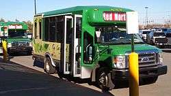
CityGo is the local public transport bus service, operating five routes in the city (yellow, blue, red, purple and green). CityGo also provides intercity paratransit bus service to surrounding communities.[55] Greyhound Lines provides bus service westward towards Denver, Colorado and eastward toward Kansas City, Missouri.[56] Bus service is provided daily southward towards Wichita, Kansas by BeeLine Express (subcontractor of Greyhound Lines).[56][57]
Salina Municipal Airport is located southwest of the city.[58] Used primarily for general aviation, it hosts one commercial airline (SeaPort Airlines) under the Essential Air Service program.[58][59]
Union Pacific Railroad operates one freight rail line through Salina. Its Kansas Pacific (KP) Line runs northeast-southwest through the northern part of the city.[22][60] Salina is also the southeastern terminus of the Salina Subdivision of the Kansas and Oklahoma Railroad.[61]
Utilities
The city government's Department of Public Works is responsible for water treatment and distribution, waste water removal, sewer maintenance, and trash collection. Westar Energy provides electric power.[62] Residents primarily use natural gas for heating fuel; natural gas service is provided by Kansas Gas Service.[41][62]
Health care
There are two hospitals in Salina: Salina Regional Health Center, a 204-bed not-for-profit general medical and surgical facility; and Salina Surgical Hospital, a specialized, 16-bed surgical facility.[63][64]
Media
The Salina Journal is the local newspaper, published daily.[65]
Salina is a center of broadcast media for north-central Kansas. Three AM and 13 FM radio stations are licensed to and/or broadcast from the city.[66] Salina is in the Wichita-Hutchinson television market, and five television stations broadcast from the city.[67][68] These include two independent stations as well as ABC, Fox, and NBC affiliates which are satellites of their respective affiliates in Wichita.[69][70] Salina is also home to the only Public, educational, and government access (PEG) cable TV channels in the state. Cox Communications is the main cable system serving the city, and customers can see local programming and create their own programming to be shown on channels 20 and 21.
Culture
Events

The city holds several community events throughout the year.[71] Each June, the Salina Arts & Humanities department holds the Smoky Hill River Festival. Held in Oakdale Park and lasting three and a half days, the Festival includes arts and crafts shows, music concerts, games, and other activities.[72] Originally held as a downtown street parade in 1976 to celebrate the United States Bicentennial, the festival proved popular enough for the city to hold it every year.[73] To celebrate Independence Day, the city puts on its All American Fourth and Play Day in the Park which includes children’s games, music, and dance performances in Oakdale Park.[74] The Smoky Hill Museum Street Fair takes place in September and includes a parade, a chili cook-off, and historic demonstrations.[75] In November, downtown Salina hosts the city’s Christmas Festival which includes a 5k run, a mile walk, live music, dance performances, children’s entertainment and the Parade of Lights, a parade of floats decorated with Christmas lights.[76]
The city's private organizations host several annual expos, fairs, trade shows, and various other events. Several of these pertain to area agriculture including the Chamber of Commerce’s Mid-America Farm Expo in March, the Discover Salina Naturally Festival in May, the 4-H Tri-Rivers Fair and Rodeo in August, and The Land Institute’s Prairie Festival in September. Other annual events held in the city include the Home Builders Associations of Salina’s Home and Leisure Show in February, the ISIS Shrine Circus and Saline County Mounted Patrol Rodeo in April, the Smoky Hill Sportsman Expo in August, Blue Heaven Studios’ Blues Masters at the Crossroads festival in October, and the Prairie Longrifles Wild West Trade Show in December as well as several car shows and high school sports events.[71][77]
Points of interest
Operated by the city government’s Arts & Humanities department, the Smoky Hill Museum contains artifacts and exhibits on local history, agriculture, and education with collections dating back to 1879. The museum also offers public educational programs.[78]
The Bicentennial Center is the primary venue in the city for large indoor events. It includes a 7,500-seat multipurpose arena and the 18,000 sq ft (1,700 m2) Heritage Hall convention center. The Center hosts concerts, sporting events, and trade shows.[79]
The Rolling Hills Wildlife Adventure is a public zoo and wildlife park located 6 miles (9.7 km) west of the city near Hedville.[80] In addition to its animal exhibits, the zoo includes a wildlife museum and theater.[81]
Indian Rock is the tallest point in the Salina area and is home to a park and several hiking trails.
Religion
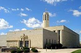
There are more than 70 Christian churches in and around Salina[82][83] including the cathedral of the Roman Catholic Diocese of Salina (Sacred Heart Cathedral) and the cathedral of the Episcopal Diocese of Western Kansas (Christ Cathedral).[84][85] The Roman Catholic Diocese has its regional administrative offices in Salina[86] as do the Presbytery of Northern Kansas[87] and the Salina District of the United Methodist Church which is based at Kansas Wesleyan University.[88]
A Buddhist temple is located northwest of the city.[89]
Sports
- Salina hosted the Kansas Cagerz[90] and Salina Rattlers[91] basketball teams.
- Salina hosts the National Junior College Athletic Association Division I women's basketball national tournament each season in the Bicentennial Center.[92]
- Salina hosted the Women's Big Eight basketball tournament at the Bicentennial Center. When the Big Eight became the Big 12, the tournament was moved to Kansas City, Missouri.
- Salina hosts the Kansas State High School Activities Association (KSHSAA) Class 4A State Wrestling Tournament as well as the Class 3A & 4A Volleyball Tournaments, the Class 4A State Basketball Tournament, and the Class 4A State Softball Tournament. Salina also occasionally hosts the Class 4A State Baseball Tournament and one of the state championship football games.
- Salina was home to the Salina Bombers, an indoor football team playing in the Champions Professional Indoor Football League from 2013-2014, then Champions Indoor Football.
- Salina hosts the Salina Liberty, the second indoor football team from the city, who now play in the CIF.
- Salina is the home of the Kansas Wesleyan University Coyotes, a 20-sport National Association of Intercollegiate Athletics athletics program. The Coyotes have been a member of the Kansas Collegiate Athletic Conference since 1928.
In popular culture
- The 1980 teen comedy film Up the Academy starring Ralph Maccio was filmed entirely in Salina, mostly on the campus of St. John's Military School.[93]
- Scenes in the 1955 movie Picnic, starring William Holden and Kim Novak, were filmed in Salina (arrival of the train at the beginning of the movie; The Bensons' mansion)
- Millie Dillmount, the fictional main character in the musical Thoroughly Modern Millie, is from Salina. She leaves home for New York City, determined never to return, as depicted in the opening number, "Not for the Life of Me."
- In Alfred Hitchcock's masterpiece Vertigo, the character Judy Barton (played by Kim Novak) comes from Salina (425 Maple Avenue).
The Avett Brothers wrote a song titled "Salina" which was included on their 2007 album Emotionalism.
Notable people
Notable individuals who were born in and/or have lived in Salina include former White House press secretary Marlin Fitzwater, astronaut Steven Hawley,[94] former Governors of Kansas John W. Carlin[95] and Bill Graves,[94] radio broadcaster Paul Harvey,[96] and pro football player Terence Newman.[97]
Gallery
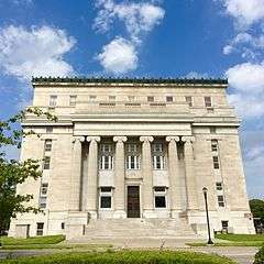 The Masonic Temple in Salina (2016)
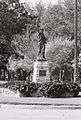 Lady Liberty of Salina (2002)
 Aerial photo of Salina at night (2010)
See also
Further reading
- Salina: 1858–2008 (Images of America); Salina History Book Committee; Arcadia Publishing; 2008; ISBN 0-7385-6181-9
- Salina: Mart of the Middle West; Salina Commercial Club, Padgett's Printing House; 1908. (Various formats eBook)
- Illustrated Salina: The Forest City; Frederick A. Loomis, S. E. Rankin Publisher, 1892. (Various formats eBook)
References
- 1 2 3 4 5 6 "GNIS Detail - Salina". Retrieved 22 August 2016.
- 1 2 "US Gazetteer files 2010". United States Census Bureau. Retrieved 2012-07-06.
- ↑ "American FactFinder". United States Census Bureau. Retrieved 2012-07-06.
- ↑ "Annual Estimates of the Resident Population for Incorporated Places: April 1, 2010 to July 1, 2014". Retrieved June 4, 2015.
- ↑ United States Postal Service (2012). "USPS - Look Up a ZIP Code". Retrieved 2012-02-15.
- 1 2 3 4 5 6 7 8 "American FactFinder 2". United States Census Bureau. Retrieved 2011-10-20.
- ↑ "Welcome to the City of Salina, Kansas - Home". www.cityofswans.com. Retrieved 2016-11-12.
- ↑ Sturtevant, William C. (1967). "Early Indian Tribes, Culture Areas, and Linguistic Stocks [Map]". Smithsonian Institution. Retrieved 2014-03-05.
- ↑ "Louisiana Purchase". Kansapedia. Kansas Historical Society. August 2012. Retrieved 2014-03-05.
- ↑ "Kansas Territory". Kansapedia. March 2013. Retrieved 2013-03-05.
- 1 2 3 4 "Salina History". City of Salina, Kansas. Retrieved 2014-03-05.
- 1 2 3 Blackmar, Frank W., ed. (1912). "Salina". Kansas: a cyclopedia of state history, embracing events, institutions, industries, counties, cities, towns, prominent persons, etc. 2. Chicago: Standard. pp. 634–635.
- ↑ Blackmar, Frank W., ed. (1912). "Saline County". Kansas: a cyclopedia of state history, embracing events, institutions, industries, counties, cities, towns, prominent persons, etc. 2. Chicago: Standard. pp. 635–639.
- ↑ Cutler, William G. (1883), "Salina, Part 1", History of the State of Kansas, Chicago: A.T. Andreas
- 1 2 WPA (1949). Kansas: A Guide to the Sunflower State. New York City: Hastings House. p. 273.
- ↑ "Lee Jeans History". lee.com. Retrieved 2010-10-19.
- 1 2 "SAC Bases: Smokey Hill / Schilling AFB". Strategic-Air-Command.com. Retrieved 2010-07-17.
- ↑ "Narrative". Salina Area Chamber of Commerce. 2008. Retrieved 2010-07-17.
- ↑ "City Distance Tool". Geobytes. Retrieved 2013-09-05.
- ↑ "Latitude/Longitude Distance Calculator". National Hurricane Center. Retrieved 2010-10-07. Used Latitude/Longitude of river confluence from United States Geological Survey and the latitude/longitude given on this page for Salina to calculate distance.
- ↑ "General Highway Map - Saline County, Kansas" (PDF). Kansas Department of Transportation. October 2008. Retrieved 2013-09-05.
- 1 2 3 "City of Salina [Map]" (PDF). Kansas Department of Transportation. 2011-08-01. Retrieved 2014-02-13.
- ↑ Peel, M. C., Finlayson, B. L., and McMahon, T. A.: Updated world map of the Köppen-Geiger climate classification, Hydrol. Earth Syst. Sci., 11, 1633-1644, doi:10.5194/hess-11-1633-2007, 2007.
- ↑ "Average Weather for Salina, KS". The Weather Channel. Retrieved 2013-09-05.
- ↑ Barbara Phillips (September 27, 1973). "Tornadoes take heavy Kansas toll". Salina Journal. p. 2.
- ↑ Lawson, Rob (2008-06-12). "June 11th, EF-3 Tornado and Extremely Large Hail Slam Central Kansas". Wichita National Weather Service News Archives. National Weather Service Wichita KS. Retrieved 2010-03-13.
- 1 2 "NOWData - NOAA Online Weather Data". National Weather Service Forecast Office - Wichita, KS. Retrieved 2013-09-05.
- 1 2 3 4 National Weather Service (March 2015). "Records/Extremes". National Oceanic & Atmospheric Administration. Retrieved 2015-04-18.
- 1 2 "Salina, Kansas Travel Weather Averages". Weatherbase. Retrieved 2013-09-05.
- 1 2 National Weather Service. "Monthly Summarized Data 1981-2010". NOWData. National Oceanic & Atmospheric Administration. Retrieved 2015-04-18.
- ↑ "Annual Estimates of the Resident Population for Incorporated Places: April 1, 2010 to July 1, 2015". Retrieved July 2, 2016.
- ↑ United States Census Bureau. "Census of Population and Housing". Retrieved November 30, 2014.
- ↑ "Updates to Statistical Areas; Office of Management and Budget" (PDF). Executive Office of the President, Office of Management and Budget. November 20, 2008. Retrieved October 28, 2009.
- 1 2 "American FactFinder". United States Census Bureau. Retrieved 2008-01-31.
- 1 2 Saline County Emergency Management (February 2009). "It Can Happen Here". A Study of the Hazards affecting Saline County, Kansas and their effects on the Community. Saline county Emergency Management. Archived from the original on March 2, 2012. Retrieved February 11, 2014.
- ↑ The Schwan Food Company (2007). "Communities of Operation". theschwanfoodcompany.com. The Schwan Food Company. Archived from the original on 2008-04-09. Retrieved 2010-03-13.
- ↑ Phillips Lighting (June 2009). "An energy saving solution for government facilities..." (PDF). Phillips Lighting. Retrieved 2010-03-13.
- ↑ Exide Technologies. "Exide's Worldwide Facilities". exide.com. Exide Technologies. Retrieved 2010-03-17.
- ↑ Great Plains Manufacturing. "Great Plains Contact Information". greatplainsmfg.com. Great Plains Manufacturing. Retrieved 2010-03-17.
- ↑ Web Creations and Consulting (2006). "About the Company". enconline.com. ElDorado National. Retrieved 2010-03-17.
- 1 2 3 4 "Salina, Kansas". City-Data.com. Retrieved 2011-12-20.
- ↑ City of Salina CAFR
- 1 2 "Salina". Directory of Kansas Public Officials. The League of Kansas Municipalities. Retrieved 2011-12-20.
- 1 2 "City Commission". City of Salina, Kansas. Retrieved 2010-02-27.
- ↑ "City Government". City of Salina, Kansas. Retrieved 2010-02-27.
- ↑ "Saline County–Official County Government Website". Retrieved 2014-02-13.
- ↑ "Salina USD 305 School Websites and Handbooks". Salina USD 305. Retrieved 2010-02-28.
- ↑ "Salina Public Schools / Overview". Retrieved 22 August 2016.
- ↑ Kansas School District Boundary Map
- ↑ Saline County School District Map
- ↑ "About St. John's Military School". St. John's Military School. Retrieved 2010-02-28.
- ↑ "Welcome". Salina Christian Academy. Retrieved 2010-02-28.
- ↑ Mathews, Erin (April 16, 2009). "Saving Lives & Property: A Fire Department Grows Up". Salina Journal. Retrieved December 12, 2009.
- ↑ "2011-2012 state transportation map" (PDF). Kansas Department of Transportation. Retrieved 2011-01-18.
- ↑ "OCCK Transportation Services". OCCK Inc. Retrieved 2013-02-13.
- 1 2 "Greyhound". Retrieved 22 August 2016.
- ↑ [email protected], beeline-express,. "Beeline Express". Retrieved 22 August 2016.
- 1 2 FAA Airport Master Record for SLN (Form 5010 PDF), effective 2010-09-23
- ↑ Melissa McCoy (2010-03-13). "SeaPort Airlines to Become Air Service at Salina Airport". KSAL. Retrieved 2010-10-07.
- ↑ "UPRR Common Line Names" (PDF). Union Pacific Railroad. Retrieved 2010-05-08.
- ↑ "Kansas & Oklahoma Railroad - Detailed Map". Watco, Inc. Retrieved 2010-05-08.
- 1 2 "Guide to City Services – M–Z". City of Salina, Kansas. Retrieved 2014-02-06.
- ↑ "Salina Regional Health Center – Stats & Services". U.S. News Best Hospitals. U.S. News & World Report. Retrieved 2014-02-06.
- ↑ "Salina Surgical Hospital - Stats & Services". U.S. News Best Hospitals. U.S. News & World Report. Retrieved 2014-02-06.
- ↑ "Record Details – Salina Journal". Kansas Press Association. Retrieved 2013-07-15.
- ↑ "Radio Stations in Salina, Kansas". Radio-Locator. Retrieved 2013-07-15.
- ↑ "TV Market Maps – Kansas". EchoStar Knowledge Base. Retrieved 2011-10-20.
- ↑ "TVQ TV Database Query". Federal Communications Commission. Retrieved 2009-09-13.
- ↑ "Stations for Hays, Kansas". RabbitEars. Retrieved 2013-07-15.
- ↑ "Contact Us". KSAS-TV. Retrieved 2011-10-20.
- 1 2 "Primary Annual Events". Salina Visitors Guide. Salina Area Chamber of Commerce. Retrieved 2014-08-23.
- ↑ "Smoky Hill River Festival". Salina Arts & Humanities. Retrieved 2014-08-23.
- ↑ "Smoky Hill River Festival – History". Riverfestival.com. Retrieved 2014-03-02.
- ↑ "All American Fourth/Play Day in the Park". Salina Area Chamber of Commerce. Retrieved 2014-08-23.
- ↑ "Street Fair". Smoky Hill Museum. Retrieved 2014-08-23.
- ↑ "Christmas Festival & Parade of Lights". Salina Area Chamber of Commerce. Retrieved 2014-08-23.
- ↑ "Community Calendar". Salina Area Chamber of Commerce. Retrieved 2014-08-23.
- ↑ "About Us". Smoky Hill Museum. Retrieved 2014-09-28.
- ↑ "General Information for the Arena". Salina Bicentennial Center. Retrieved 2014-09-28.
- ↑ "Rolling Hills Zoo". Google Maps. Retrieved 2014-09-28.
- ↑ "About Us". Rolling Hills Zoo. Retrieved 2014-09-28.
- ↑ "Find a Church in Salina, KS". Patheos. Retrieved 2014-08-24.
- ↑ "Churches in Salina by Denomination". Churchangel.com. Retrieved 2014-08-24.
- ↑ "Parish". Sacred Heart Cathedral. Retrieved 2014-08-23.
- ↑ "About". Christ Cathedral. Retrieved 2014-08-23.
- ↑ "History". Roman Catholic Diocese of Salina. Retrieved 2014-08-23.
- ↑ "Contact". Presbytery of Northern Kansas. Retrieved 2014-08-23.
- ↑ "Salina District". Great Plains United Methodists. Retrieved 2014-08-23.
- ↑ Fiedler, Gordon, Jr. (2011-11-20). "Buddhist monks find calling in Kansas temple". Topeka Capital Journal. Retrieved 2014-08-23.
- ↑ Davidson, Bob (2007-01-09). "USBL decides to take a breather for '08 - USBL quits". The Salina Journal. Retrieved 2011-02-17.
- ↑ "IBA Closes Its Doors". The Salina Journal. 2001-08-17. Retrieved 2011-02-17.
- ↑ "Juco women's tournament to stay in Salina through at least 2015". The Salina Journal. 2011-03-31. Retrieved 2011-04-22.
- ↑ "Up the Academy". 6 June 1980. Retrieved 22 August 2016 – via IMDb.
- 1 2 "Hall of Fame". Salina Central High School. 2010-11-05. Retrieved 2010-11-09.
- ↑ "John W. Carlin". Kansas Memory. Kansas Historical Society. Retrieved 2014-02-06.
- ↑ Salina Journal staff (2012-01-09). "A look back". The Salina Journal. Neighbors section, page 5.
Most of the talks were nostalgic remembrances of Salina of the 1930s when Paul Harvey worked for a local radio station.
- ↑ Sullivan, Amy (2003-01-16). "Terence Newman Day". The Salina Journal. Retrieved 2010-11-09.
!["Early Indian Tribes, Culture Areas, and Linguistic Stocks [Map]"](http://www.lib.utexas.edu/maps/united_states/early_indian_east.jpg)
External links
| Wikimedia Commons has media related to Salina, Kansas. |
- USD 305, Salina Public Schools
- Smoky Hill Museum
- Salina Arts & Humanities Commission
- Special Collections: A gift of William A. Phillips, the founder of Salina
- Antler Furniture on YouTube, from Hatteberg's People on KAKE TV news
- Salina City Map, KDOT
Municipalities and communities of Saline County, Kansas, United States | ||
|---|---|---|
| Cities |  | |
| CDPs | ||
| Unincorporated communities | ||
| Townships |
| |
| Footnotes | ‡This populated place also has portions in an adjacent county or counties | |