HSR Layout
| HSR Layout ಎಚ್ಎಸ್ಆರ್ ಲೇಔಟ್ | |
|---|---|
| urban/Neighbourhood | |
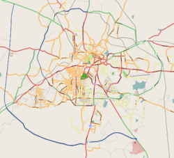 HSR Layout Location in metropolitan Bangalore | |
| Coordinates: 12°55′N 77°38′E / 12.91°N 77.64°ECoordinates: 12°55′N 77°38′E / 12.91°N 77.64°E | |
| Country | India |
| State | Karnataka |
| Metro | Bengaluru |
| Named for | Hosur and Sarjapur Road |
| Languages | |
| • Official | Kannada |
| Time zone | IST (UTC+5:30) |
| Vehicle registration | KA-01,KA-51 |
| Website | http://www.hsrlayout.in/ |
Hosur-Sarjapur Road Layout, popularly known as HSR Layout is a relatively new suburb located to the south-east of Bengaluru, India. It has become a gateway to Electronic City, a major IT hub of the city. HSR Layout has emerged as a posh locality of Bengaluru with wide streets, parks and all modern civic amenities.
- It lies in the Bommanahalli constituency of State assembly.
- The layout, which is built on land reclaimed from the Agara lake, is located between Hosur Road and Sarjapur Road.
- This layout is known for its quiet environment with lots of gardens and parks.
- This locality was developed by Bangalore Development Authority in 1985 .
- Now it has emerged into a leading residential area due to its proximity to the IT Parks of Bangalore.
Ever since the growth of the real estate market in Bengaluru, this area has witnessed a dramatic rise in residential housing, partly owing to its proximity to the commercial areas of the city. This has led the land prices to skyrocket in recent years. In its early stages, this area was neglected by the civic authorities. Now it has facilities such as a police station, post office (Pin Code: 560102 Earlier: 560034), Water Board office, electricity office, and numerous banks.
Like many residential areas in Bangalore, HSR Layout is divided into Sectors (Sectors 1 through 7), which are criss-crossed by main roads and cross roads. Main roads run north-south and Cross roads run east-west. Some part of the neighbouring villages such as Agara, Parangipalya, Venkatapura, Mangammanapalya and Hosapalya are also part of HSR Layout. Designed based on modern town planning principles, the layout has a centralized BDA Complex, which houses the city administrative offices. It also has a number of small parks in various parts of the layout. Several renowned educational institutions are also springing up in the area, like JSS Public School (established in 2004) [1] and the Oxford College (founded in 1974) and the very famous NIFT(National Institute of Fashion Technology).[2]
HSR Layout is about 7 km from Bangalore's other large residential area of Jayanagar, and 2 km from Koramangala.
Due to the low-lying nature of the layout, some parts of the layout were flooded during the seasonal rains in the past few years.[3][4]]. The city administration have now built flood drains to address this problem. Recently the corporators of HSR Layout have built strom water drains and asphalted the roads. The main roads are quite well maintained. Due to its close proximity with electronic city and other companies, there has been massive development in this area.
Banks
- UCO Bank 1669/A, 14th Main, 17th Cross, Near-B D A Complex, HSR Layout, Sector 7, HSR Layout, Bengaluru, Karnataka 560112
- State Bank of India 30, 14th Cross Road, 9th Main Road, 6th Sector, HSR Layout, Sector 6, HSR Layout, Bangalore, Karnataka 560102
- State Bank India Opposite NIFT, 27th Main Road, HSR Layout, Parangi Palaya, Sector 2, HSR Layout, Bengaluru, Karnataka 560102
- HDFC Bank 27th Main Road - 13th Cross Road Intersection, Sector 1, HSR Layout, Bengaluru, Karnataka 560102
- Vijaya Bank 7, 17th Cross, 7th Sector, HSR Layout, Bengaluru, 560034, Sector 6, HSR Layout, Bengaluru, Karnataka 560102
- State Bank of Patiala 54, 12th Main, 6 Sector, Near-BDA Complex, Hsr Layout, Sector 6, HSR Layout, Bengaluru, Karnataka 560102
- Bank of India 50, 20th Cross Rd, Sector 3, HSR Layout, Bengaluru, Karnataka 560102
- Punjab National Bank Shop No 23,BDA Complex,HSR Layout, Sector 6, HSR Layout, Bengaluru, Karnataka 560102
- Union Bank of India No. 1003, Sri Raja Rajeshwari, Nilaya, 9th Main, 7th Sector, Hsr Layout, Sector 7, HSR Layout, Bengaluru, Karnataka 560034
- State Bank of Travancore 2330, 24th Main, Sector 2, Near-Parangipalya Bus Stop, Hsr Layout, Sector 1, HSR Layout, Bengaluru, Karnataka 560102
- Allahabad Bank 1237, sri sai crystal, 17th cross, 5th Main Rd, Sector 6, HSR Layout 5th Sector, Bengaluru, Karnataka 560102
- State Bank of Mysore 1237, sri sai crystal, 17th cross, 5th Main Rd, Sector 6, HSR Layout 5th Sector, Bengaluru, Karnataka 560102
- Sreenidhi Souharda Sahakari Bank Niyamatha No 279, 5th Main Rd, Sector 6, HSR Layout, Bengaluru, Karnataka 560102
- Central Bank of India 10th Main Rd, Sector 7, HSR Layout, Bengaluru, Karnataka 560102
- IDBI Bank Ltd 7 Hills, 1st Sector, 27th Main, No.424, 10th Cross, HSR Layout Bangalore, Karnataka 560102
- ICICI Bank 420, 27th Main Rd, 1st Sector, HSR Layout, Bengaluru, Karnataka 560102. Phone:080 3366 7777
- Axis Bank C.A.Site No.21, Opp. CPWD Quarters, Sector 1, 27th Main Road, HSR Layout, Bengaluru, Karnataka 560102. Phone # 080-2572 7250/51
Notes
External links
A monthly neighbourhood guide to HSR Layout, Bangalore.
- Apartments & Properties in HSR layout
- HSRLayout.Biz
- HSRLayout.in
- Apartments near HSR layout, Bangalore
- Residential Apartments in HSR layout, Bangalore
 |
Madiwala | Koramangala | Bellandur | |
| BTM Layout | |
Military Land | ||
| ||||
| | ||||
| Bommanahalli | Kudlu | Military Land |