Hannibal, Missouri
| Hannibal, Missouri | |
|---|---|
| City | |
|
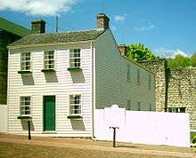
Mark Twain's boyhood home in Hannibal | |
| Nickname(s): America's Hometown | |
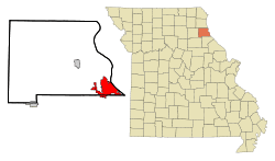 Location within Marion County (left) and Missouri (right) | |
| Coordinates: 39°42′15″N 91°22′39″W / 39.70417°N 91.37750°WCoordinates: 39°42′15″N 91°22′39″W / 39.70417°N 91.37750°W | |
| Country | United States |
| State | Missouri |
| Counties | Marion, Ralls |
| Platted | 1819 |
| Incorporated | 1845 |
| Government | |
| • Type | City Manager and Council |
| • Mayor | James Hark |
| • City Manager | Jeff LaGarce |
| Area[1] | |
| • Total | 16.21 sq mi (41.98 km2) |
| • Land | 15.74 sq mi (40.77 km2) |
| • Water | 0.47 sq mi (1.22 km2) |
| Elevation | 502 ft (153 m) |
| Population (2010)[2] | |
| • Total | 17,916 |
| • Estimate (2012[3]) | 17,814 |
| • Density | 1,100/sq mi (430/km2) |
| Time zone | CST (UTC-6) |
| • Summer (DST) | CDT (UTC-5) |
| ZIP code | 63401 |
| Area code | 573 |
| FIPS code | 29-30214[4] |
| GNIS feature ID | 0735640[5] |
| Website | City Website |

Hannibal is a city in Marion and Ralls counties in the U.S. state of Missouri. It is located at the intersection of Interstate 72 and U.S. Routes 24, 36, and 61, approximately 100 miles (160 km) northwest of St. Louis. According to the 2010 U.S. Census, the population was 17,606, making it the largest city in Marion County, although it is not the county seat. It is also the principal city of the Hannibal, Missouri micropolitan area, which consists of both counties.
History and landmarks

The community is best known as the boyhood home of author Samuel Langhorne Clemens (aka Mark Twain) and as the setting of his The Adventures of Tom Sawyer and Adventures of Huckleberry Finn, with numerous historical sites related to Mark Twain and sites depicted in his fiction. Hannibal draws both American and international tourists. The Mark Twain Boyhood Home & Museum marked its 100th anniversary in 2012 and has hosted visitors from all fifty states and some sixty countries.[6] Most Hannibal residents enjoy the visitors, and the town at large benefits from tourism revenue.[7]
The site of Hannibal was previously occupied by early settlers and Native American tribes. It was laid out as a town in 1819 by Moses Bates,[8] and named from Hannibal Creek (now known as Bear Creek).[9] The name is ultimately derived from the hero of ancient Carthage, Hannibal.[10] Although the city initially grew slowly to a population of only 30 by 1830, access to the Mississippi river and railroad transportation fueled growth to 2,020 by 1850. The town of South Hannibal was annexed to it in 1843.[11] Hannibal had gained "city" status by 1845.[8] The city served as a bustling regional marketing center for livestock and grain as well as other products produced locally, such as cement and shoes, throughout the remainder of the 19th century and on to the present time.[12]
Cement for the Empire State Building and Panama Canal was created at the Atlas Portland Cement Company in the nearby unincorporated company town of Ilasco.[13]
Hannibal was Missouri's third largest city when the Hannibal and St. Joseph Railroad was organized in 1846 in the offices of John M. Clemens (Mark Twain's father).[14] It connected to the state's then second largest city (St. Joseph, Missouri) and was the furthest west railroad before the Transcontinental Railroad and was used to deliver mail to the Pony Express.
The town has other distinctions as well. In the Broadway musical Damn Yankees, Hannibal was the hometown of the protagonist’s assumed persona (Shoeless Joe from Hannibal, MO). In television, Hannibal was the hometown of Col. Sherman T. Potter (portrayed by actor Harry Morgan) on the long-running comedy series, M*A*S*H.[15] Hannibal was also the birthplace of singer and actor Cliff Edwards ("Ukulele Ike") and 'The Unsinkable Molly' Brown. Other natives include inventor Bill Lear and NBA basketball coach Cotton Fitzsimmons. The Mark Twain Memorial Lighthouse was constructed in 1933 and has been lit at three separate times by President Franklin Delano Roosevelt, President John F. Kennedy, and President Bill Clinton. Rockcliffe Mansion sits upon a knoll in Hannibal, is listed on the National Register of Historic places.
In 2011, the Mark Twain Boyhood Home and Museum released a star-studded CD that tells Mark Twain's life in spoken word and song: Mark Twain: Words & Music. Several songs were written especially for the project and feature Hannibal, including "Huck Finn Blues" sung by Brad Paisley and "Run Mississippi" sung by Rhonda Vincent. Other artists include Jimmy Buffett as Huckleberry Finn, Clint Eastwood as Twain, and Garrison Keillor as the narrator for the project.[16][17]
Geography
Hannibal is located next to the Mississippi River. According to the United States Census Bureau, the city has a total area of 16.21 square miles (41.98 km2), of which, 15.74 square miles (40.77 km2) is land and 0.47 square miles (1.22 km2) is water.[1]
Climate
Hannibal's climate is characterized as being humid continental, with cold, snowy winters, and hot, humid summers.
| Climate data for Hannibal, MO | |||||||||||||
|---|---|---|---|---|---|---|---|---|---|---|---|---|---|
| Month | Jan | Feb | Mar | Apr | May | Jun | Jul | Aug | Sep | Oct | Nov | Dec | Year |
| Record high °F (°C) | 75 (24) |
81 (27) |
88 (31) |
93 (34) |
93 (34) |
103 (39) |
114 (46) |
105 (41) |
101 (38) |
94 (34) |
82 (28) |
74 (23) |
114 (46) |
| Average high °F (°C) | 33 (1) |
39 (4) |
51 (11) |
63 (17) |
73 (23) |
82 (28) |
86 (30) |
85 (29) |
77 (25) |
66 (19) |
51 (11) |
38 (3) |
62 (17) |
| Average low °F (°C) | 16 (−9) |
21 (−6) |
32 (0) |
43 (6) |
53 (12) |
62 (17) |
67 (19) |
65 (18) |
56 (13) |
44 (7) |
33 (1) |
21 (−6) |
43 (6) |
| Record low °F (°C) | −21 (−29) |
−19 (−28) |
−9 (−23) |
16 (−9) |
30 (−1) |
44 (7) |
48 (9) |
42 (6) |
31 (−1) |
21 (−6) |
−6 (−21) |
−21 (−29) |
−21 (−29) |
| Average precipitation inches (mm) | 1.75 (44.4) |
2.14 (54.4) |
3.24 (82.3) |
3.78 (96) |
4.83 (122.7) |
3.46 (87.9) |
4.32 (109.7) |
4.06 (103.1) |
3.27 (83.1) |
3.24 (82.3) |
3.49 (88.6) |
2.59 (65.8) |
40.17 (1,020.3) |
| Average snowfall inches (cm) | 6.90 (17.53) |
7.10 (18.03) |
3.90 (9.91) |
0.90 (2.29) |
0 (0) |
0 (0) |
0 (0) |
0 (0) |
0 (0) |
0 (0) |
1.60 (4.06) |
5.50 (13.97) |
25.90 (65.79) |
| Source: [18] | |||||||||||||
Demographics
| Historical population | |||
|---|---|---|---|
| Census | Pop. | %± | |
| 1850 | 2,020 | — | |
| 1860 | 6,505 | 222.0% | |
| 1870 | 10,125 | 55.6% | |
| 1880 | 11,074 | 9.4% | |
| 1890 | 12,857 | 16.1% | |
| 1900 | 12,780 | −0.6% | |
| 1910 | 18,341 | 43.5% | |
| 1920 | 19,306 | 5.3% | |
| 1930 | 22,761 | 17.9% | |
| 1940 | 20,865 | −8.3% | |
| 1950 | 20,444 | −2.0% | |
| 1960 | 20,028 | −2.0% | |
| 1970 | 18,609 | −7.1% | |
| 1980 | 18,811 | 1.1% | |
| 1990 | 18,004 | −4.3% | |
| 2000 | 17,757 | −1.4% | |
| 2010 | 17,916 | 0.9% | |
| Est. 2015 | 17,839 | [19] | −0.4% |
The Hannibal Micropolitan Statistical Area is composed of Marion and Ralls counties.
2010 census
As of the census[2] of 2010, there were 17,916 people, 7,117 households, and 4,400 families residing in the city. The population density was 1,138.2 inhabitants per square mile (439.5/km2). There were 8,021 housing units at an average density of 509.6 per square mile (196.8/km2). The racial makeup of the city was 88.8% White, 7.1% African American, 0.2% Native American, 0.6% Asian, 0.1% Pacific Islander, 0.5% from other races, and 2.7% from two or more races. Hispanic or Latino of any race were 1.8% of the population.
There were 7,117 households of which 31.3% had children under the age of 18 living with them, 43.2% were married couples living together, 14.5% had a female householder with no husband present, 4.2% had a male householder with no wife present, and 38.2% were non-families. 31.6% of all households were made up of individuals and 13% had someone living alone who was 65 years of age or older. The average household size was 2.36 and the average family size was 2.96.
The median age in the city was 37.3 years. 23.5% of residents were under the age of 18; 11.2% were between the ages of 18 and 24; 24.4% were from 25 to 44; 26% were from 45 to 64; and 14.9% were 65 years of age or older. The gender makeup of the city was 47.5% male and 52.5% female.
2000 census
As of the census[4] of 2000, there were 17,757 people, 7,017 households, and 4,554 families residing in the city. The population density was 1,215.3 people per square mile (469.3/km²). There were 7,886 housing units at an average density of 539.7/sq mi (208.4/km²). The racial makeup of the city was 90.61% White, 6.57% African American, 0.35% Native American, 0.35% Asian, 0.07% Pacific Islander, 0.25% from other races, and 1.79% from two or more races. Hispanic or Latino of any race were 1.13% of the population. 25.9% were of American, 23.8% German, 10.9% Irish and 10.0% English ancestry according to Census 2000.
There were 7,017 households out of which 32.5% had children under the age of 18 living with them, 48.0% were married couples living together, 13.6% had a female householder with no husband present, and 35.1% were non-families. 30.6% of all households were made up of individuals and 15.0% had someone living alone who was 65 years of age or older. The average household size was 2.40 and the average family size was 2.98.
In the city the population was spread out with 25.8% under the age of 18, 10.5% from 18 to 24, 26.3% from 25 to 44, 20.6% from 45 to 64, and 16.8% who were 65 years of age or older. The median age was 36 years. For every 100 females there were 86.7 males. For every 100 females age 18 and over, there were 81.8 males.
The median income for a household in the city was $29,892, and the median income for a family was $37,264. Males had a median income of $30,677 versus $20,828 for females. The per capita income for the city was $16,902. About 11.3% of families and 14.1% of the population were below the poverty line, including 18.2% of those under age 18 and 10.8% of those age 65 or over.
Economy
Hannibal is emerging as a viable business destination due to its low taxes, local resources, and its close proximity to major highways and cities. A thriving artist community has emerged in large part due to its central location between the East and West coasts and stable real estate prices.[21] The General Mills plant was originally built by the Underwood Company because of its founder's appreciation for Mark Twain and his desire to do some good for Twain's hometown. Since then, businesses have enjoyed the many benefits afforded by the community.[22] The Hannibal Regional Hospital and related healthcare facilities account for a large source of the city's revenue. Major manufacturers include BASF Chemical Corporation (Formally American Cyanamid), General Mills and Watlow Electric Manufacturing Company. The Swiss Colony maintains a data call center in Hannibal.[23]
Because Hannibal is a Certified Local Government, residents and business owners can take advantage of federal and state tax credits, grants, and other funding sources.[24]
Government
Hannibal has a Home Rule Charter form of government. Public services include police, fire, parks and recreation, public works, streets, inspections, tourism, library and airport. There is a municipal court, and the Marion County Courthouse is located in Hannibal with a second courthouse located in nearby Palmyra, Missouri.
Education

Hannibal High School was founded in 1896.[25]
Hannibal-LaGrange University is a four-year, Christian liberal arts University accredited by the Higher Learning Commission and a member of the North Central Association of Colleges and Schools. Founded in 1858 in LaGrange, Missouri, the campus moved downriver to Hannibal in 1928. Dr. Anthony Allen was elected the 17th president of Hannibal-LaGrange University in 2012.
Moberly Area Community College (MACC-Hannibal Area Higher Education Center) is a two-year community college established in 1999. The MACC-Hannibal Campus is located on Shinn Lane near the hospital.
Media
The city is served by the Hannibal Courier-Post newspaper, printed daily on Tuesday through Saturday. KHQA is a television station licensed to Hannibal and located in Quincy, Illinois. Radio stations licensed to Hannibal include KGRC 92.9 FM, KHBL 96.9 FM, KHMO 1070 AM and KJIR 91.7 FM.
Transportation
Interstate 72 was extended into Hannibal across the Mark Twain Memorial Bridge in 2000. Interstate 72 extends west to the intersection with U.S. Route 61. Future plans call for extending Interstate 72 west along U.S. Route 36 to Cameron, MO giving Hannibal an east-west link connecting Kansas City to Springfield, IL. U.S. Route 61 connects to Saint Louis to the south and is part of the Avenue of the Saints corridor that links to Saint Paul, MN.
Hannibal Regional Airport, (formerly Hannibal Municipal Airport) was named William P. Lear Field in 2003 in honor of Lear who grew up in Hannibal and invented the Lear Jet. The airport is located 4 miles (6.4 km) west of the southern area and has one runway 4,400' x 100'.
Freight railroad tracks link Hannibal in all directions: Burlington Northern Santa Fe (BNSF) tracks lead north to the Quad Cities and south to Saint Louis. Norfolk Southern (NS) tracks lead west to Kansas City and east to Springfield, IL.[26]
Notable people
- Jake Beckley, major league baseball player[27]
- James Carroll Beckwith, painter
- Margaret Brown, passenger on the RMS Titanic, the "unsinkable Molly Brown"
- Blanche Bruce, politician
- Robert Coontz, admiral
- Helen Cornelius, country music singer and songwriter
- Cliff Edwards, the voice of Disney’s Jiminy Cricket
- Lester Gaba, sculptor, writer and retail display designer
- Clarence Earl Gideon, convict responsible for landmark U.S. Supreme Court ruling
- Robert V. Hogg, statistician, educator, and co-author of classic math-stat textbook
- James Kauffman, author, educator
- Harry Richard Landis, one of the last surviving World War I veterans, born near Hannibal
- William P Lear, inventor of car radio and manufacturer of the Learjet
- Warren H. Orr, Chief Justice of the Illinois Supreme Court
- George Poage, athlete from 1904 Olympics
- Ron Powers, author
- Benjamin Prentiss, Civil War officer
- William Hepburn Russell Attorney and political figure who owned the Boston Rustlers of the National League in 1911.
- Scott Sanders, baseball player
- Larry Thompson, Deputy Attorney General of the United States under President George W. Bush
- Mark Twain (Samuel L. Clemens), author
- John Wingate, broadcaster, writer, and communications consultant
Fictional characters
- Allison (Liberty Maid) from Josh and S.A.M., a 1993 film about two runaway boys fleeing to Canada.
- Joe Hardy, from the 1950s stage and film musical Damn Yankees. One of the songs in the musical is titled "Shoeless Joe from Hannibal, Mo".
- Joyce Palmieri from the movie Kindergarten Cop.
- Sherman T. Potter, a character in the TV series M*A*S*H.
- Nick Dunne, the protagonist in Gillian Flynn's Gone Girl, and David Fincher's film adaptation of the same name.
- Many of the characters from Mark Twain's fiction (primarily The Adventures of Tom Sawyer and Adventures of Huckleberry Finn) were from the fictional town of St. Petersburg, which is supposed to parallel Hannibal.
Attractions

- The Huck Finn Freedom Center:
- Cameron Cave
- Hannibal Cavemen - Prospect League baseball team. Plays at historic renovated Clemens Field downtown. Summer only.
- Hannibal Rocks Offroad Park
- John Garth’s Woodside Mansion[28]
- Mark Twain Boyhood Home & Museum Properties
- Mark Twain Cave - The cave that inspired Twain's tale of a lost Tom & Becky.
- Mark Twain Memorial Lighthouse - The only lighthouse built inland features a panoramic view of Hannibal and the Mississippi River. 244 steps to the top.
- Mark Twain Riverboat[29]
- Molly Brown Birthplace & Museum - Home of RMS Titanic survivor.
- Riverview Park - 465 acres (1.88 km2) of wooded land and scenic views of the Riverfront.
- Rockcliffe Mansion - Around the start of the 20th century mansion.
- Sawyer’s Creek Fun Park - Amusement complex on the riverfront.
- Lover's Leap
- Tom & Becky Appearances - Local children are chosen to portray the famous literary couple in local appearances and in downtown Hannibal every Saturday and Sunday from March to October.
- Tom Sawyer Days - Fence painting contest, frog jumping contest, mud volleyball, local arts and crafts and 4th of July fireworks display from Lover's Leap.
Gallery
-

The home of the girl who inspired Becky Thatcher.
-

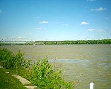
The Mississippi River viewed from Cardiff Hill in Hannibal.
-
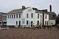
The office of John Clemens, Mark Twain's father, who was the Justice of the Peace.
References
- 1 2 "US Gazetteer files 2010". United States Census Bureau. Retrieved 2012-07-08.
- 1 2 "American FactFinder". United States Census Bureau. Retrieved 2012-07-08.
- ↑ "Population Estimates". United States Census Bureau. Retrieved 2013-05-30.
- 1 2 "American FactFinder". United States Census Bureau. Retrieved 2008-01-31.
- ↑ "US Board on Geographic Names". United States Geological Survey. 2007-10-25. Retrieved 2008-01-31.
- ↑ http://www.marktwainmuseum.org
- ↑ reported to be the third major source of city revenue. Agriculture and industry are reported as first and second respectively.
- 1 2 "Hannibal History". Hannibal Convention & Visitors Bureau. Retrieved 2015-01-06.
- ↑ Eaton, David Wolfe (1916). How Missouri Counties, Towns and Streams Were Named. The State Historical Society of Missouri. p. 193.
- ↑ Gannett, Henry (1905). The Origin of Certain Place Names in the United States. Govt. Print. Off. p. 149.
- ↑
 Chisholm, Hugh, ed. (1911). "Hannibal (Missouri)". Encyclopædia Britannica (11th ed.). Cambridge University Press.
 - ↑ Parts http://www.hanmo.com/history.html
- ↑ http://digital.hannibal.lib.mo.us/ilasco/ilasco.htm
- ↑ http://www.abandonedrails.com/Hannibal_and_Saint_Joseph_Railroad
- ↑ Sherman Potter, retrieved 3 December 2012
- ↑ http://www.marktwainmuseum.org/index.php/community-projects/mark-twain-cd
- ↑ http://latimesblogs.latimes.com/music_blog/2011/11/in-rotation-mark-twain-words-music.html
- ↑ http://www.intellicast.com/Local/History.aspx?unit=F&location=USMO0387
- ↑ "Annual Estimates of the Resident Population for Incorporated Places: April 1, 2010 to July 1, 2015". Retrieved July 2, 2016.
- ↑ "Census of Population and Housing". Census.gov. Retrieved June 4, 2015.
- ↑ http://www.npr.org/2012/08/30/156564691/hannibal-mo-art-abounds-in-twains-hometown
- ↑ http://www.develophannibal.org
- ↑ http://hannibalchamber.org/
- ↑ http://dnr.missouri.gov/shpo/TaxCrdts.htm
- ↑ http://www.hannibal.k12.mo.us/k12/hhs/index.html
- ↑ http://www.modot.org/othertransportation/rail/documents/rail_freight_101807.pdf | MoDOT Freight Railroad Map
- ↑ Reichler, Joseph L., ed. (1979) [1969]. The Baseball Encyclopedia (4th ed.). New York: Macmillan Publishing. ISBN 0-02-578970-8.
- ↑ Ralls County Historical
- ↑ http://www.marktwainriverboat.com/
External links
| Wikimedia Commons has media related to Hannibal, Missouri. |
- City Website
- Visitor information
- "Hannibal, Missouri photographs". University of Missouri–St. Louis.
- A visit to Mark Twain's Hannibal, Mo. - video & article by The LA Times
- Historic maps of Hannibal in the Sanborn Maps of Missouri Collection at the University of Missouri
Municipalities and communities of Marion County, Missouri, United States | ||
|---|---|---|
| Cities | 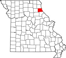 | |
| Townships | ||
| Unincorporated communities | ||
| Ghost towns | ||
| Footnotes | ‡This populated place also has portions in an adjacent county or counties | |
Municipalities and communities of Ralls County, Missouri, United States | ||
|---|---|---|
| Cities | 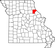 | |
| Village | ||
| Townships |
| |
| Unincorporated community | ||
| Footnotes | ‡This populated place also has portions in an adjacent county or counties | |