Palmyra, Missouri
| Palmyra, Missouri | |
|---|---|
| City | |
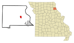 Location of Palmyra, Missouri | |
| Coordinates: 39°47′51″N 91°31′29″W / 39.79750°N 91.52472°WCoordinates: 39°47′51″N 91°31′29″W / 39.79750°N 91.52472°W | |
| Country | United States |
| State | Missouri |
| County | Marion |
| Government | |
| • Mayor | Loren Graham |
| Area[1] | |
| • Total | 2.76 sq mi (7.15 km2) |
| • Land | 2.76 sq mi (7.15 km2) |
| • Water | 0 sq mi (0 km2) |
| Elevation | 640 ft (195 m) |
| Population (2010)[2] | |
| • Total | 3,595 |
| • Estimate (2012[3]) | 3,610 |
| • Density | 1,302.5/sq mi (502.9/km2) |
| Time zone | Central (CST) (UTC-6) |
| • Summer (DST) | CDT (UTC-5) |
| ZIP code | 63461 |
| Area code(s) | 573 |
| FIPS code | 29-56036[4] |
| GNIS feature ID | 0736334[5] |
| Website | Palmyra, Missouri website |
Palmyra is a city in and the county seat of Marion County, Missouri, United States.[4] The population was 3,600 at the 2010 census. It is part of the Hannibal Micropolitan Statistical Area.
History
Palmyra wasw platted in 1819, and named after Palmyra, in Syria.[6] The settlement was designated county seat in 1827.[7] A post office called Palmyra has been in operation since 1830.[8]
In 1862, the city was the scene of the Palmyra Massacre, in which ten Confederate prisoners were killed in retaliation for the disappearance of a local Union man.[9]
Geography
Palmyra is located at 39°47′51″N 91°31′29″W / 39.79750°N 91.52472°W (39.797396, -91.524857).[10] According to the United States Census Bureau, the city has a total area of 2.76 square miles (7.15 km2), all of it land.[1]
Transportation
On US 61-24, a divided highway, Palmyra is six miles from I-72 (US 36). St. Louis is about two hours away by car; Springfield, Illinois is a little less. Daily Amtrak trains link nearby Quincy to downtown Chicago. Commuter air service connects Quincy to St. Louis.
Education
Palmyra’s school district serves a 200-square-mile area with 6,700 people; there are 1,150 students and 170 teachers and staff. There are strong early childhood programs, a private parochial school and several day-care facilities. Nearby Hannibal, Canton, Moberly, and Quincy are home to Hannibal-LaGrange College, Culver-Stockton College, Moberly Area Community College, Quincy University, and John Wood Community College.
Demographics
| Historical population | |||
|---|---|---|---|
| Census | Pop. | %± | |
| 1850 | 1,265 | — | |
| 1860 | 1,999 | 58.0% | |
| 1870 | 2,615 | 30.8% | |
| 1880 | 2,479 | −5.2% | |
| 1890 | 2,515 | 1.5% | |
| 1900 | 2,323 | −7.6% | |
| 1910 | 2,168 | −6.7% | |
| 1920 | 1,964 | −9.4% | |
| 1930 | 1,967 | 0.2% | |
| 1940 | 2,285 | 16.2% | |
| 1950 | 2,295 | 0.4% | |
| 1960 | 2,933 | 27.8% | |
| 1970 | 3,188 | 8.7% | |
| 1980 | 3,469 | 8.8% | |
| 1990 | 3,371 | −2.8% | |
| 2000 | 3,467 | 2.8% | |
| 2010 | 3,595 | 3.7% | |
| Est. 2015 | 3,616 | [11] | 0.6% |
2010 census
As of the census[2] of 2010, there were 3,595 people, 1,425 households, and 963 families residing in the city. The population density was 1,302.5 inhabitants per square mile (502.9/km2). There were 1,557 housing units at an average density of 564.1 per square mile (217.8/km2). The racial makeup of the city was 95.1% White, 2.6% African American, 0.1% Native American, 0.3% Asian, 0.1% Pacific Islander, 0.4% from other races, and 1.4% from two or more races. Hispanic or Latino of any race were 1.2% of the population.
There were 1,425 households of which 34.9% had children under the age of 18 living with them, 49.5% were married couples living together, 13.7% had a female householder with no husband present, 4.4% had a male householder with no wife present, and 32.4% were non-families. 29.3% of all households were made up of individuals and 14.8% had someone living alone who was 65 years of age or older. The average household size was 2.38 and the average family size was 2.91.
The median age in the city was 37.7 years. 25.4% of residents were under the age of 18; 6.9% were between the ages of 18 and 24; 26.7% were from 25 to 44; 22.8% were from 45 to 64; and 18.4% were 65 years of age or older. The gender makeup of the city was 47.5% male and 52.5% female.
2000 census
As of the census[4] of 2000, there were 3,467 people, 1,372 households, and 923 families residing in the city. The population density was 1,559.9 people per square mile (603.0/km²). There were 1,522 housing units at an average density of 684.8 per square mile (264.7/km²). The racial makeup of the city was 96.22% White, 2.62% African American, 0.23% Native American, 0.26% Asian, 0.03% from other races, and 0.63% from two or more races. Hispanic or Latino of any race were 0.61% of the population.
There were 1,372 households out of which 33.6% had children under the age of 18 living with them, 52.5% were married couples living together, 11.4% had a female householder with no husband present, and 32.7% were non-families. 30.0% of all households were made up of individuals and 16.1% had someone living alone who is 65 years of age or older. The average household size was 2.38 and the average family size was 2.94.
In the city, the population was spread out with 24.8% under the age of 18, 8.9% from 18 to 24, 25.6% from 25 to 44, 20.7% from 45 to 64, and 20.0% who were 65 years of age or older. The median age was 38 years. For every 100 females, there were 88.2 males. For every 100 females age 18 and over, there were 84.3 males.
The median income for a household in the city was $31,284, and the median income for a family was $42,946. Males had a median income of $30,829 versus $19,631 for females. The per capita income for the city was $15,625. About 5.5% of families and 8.1% of the population were below the poverty line, including 7.3% of those under the age of 18 and 10.5% of those 65 and older.
Notable people
- Harry Richard Landis, one of the last surviving World War I veterans, was born near Palmyra
- Actress Jane Darwell born October 15, 1879, won Academy Award for Best Supporting Actress in 1940 as Ma Joad in The Grapes of Wrath
References
- 1 2 "US Gazetteer files 2010". United States Census Bureau. Retrieved 2012-07-08.
- 1 2 "American FactFinder". United States Census Bureau. Retrieved 2012-07-08.
- ↑ "Population Estimates". United States Census Bureau. Retrieved 2013-05-30.
- 1 2 3 "American FactFinder". United States Census Bureau. Retrieved 2008-01-31.
- ↑ "US Board on Geographic Names". United States Geological Survey. 2007-10-25. Retrieved 2008-01-31.
- ↑ "Marion County Place Names, 1928–1945". The State Historical Society of Missouri. Archived from the original on June 24, 2016. Retrieved November 3, 2016.
- ↑ Eaton, David Wolfe (1916). How Missouri Counties, Towns and Streams Were Named. The State Historical Society of Missouri. p. 193.
- ↑ "Post Offices". Jim Forte Postal History. Retrieved 3 November 2016.
- ↑ The Flags of Civil War Missouri. Pelican Publishing. pp. 27–28. ISBN 978-1-4556-0433-3.
- ↑ "US Gazetteer files: 2010, 2000, and 1990". United States Census Bureau. 2011-02-12. Retrieved 2011-04-23.
- ↑ "Annual Estimates of the Resident Population for Incorporated Places: April 1, 2010 to July 1, 2015". Retrieved July 2, 2016.
- ↑ "Census of Population and Housing". Census.gov. Retrieved June 4, 2015.
External links
- Palmyra, Missouri website
- Historic maps of Palmyra in the Sanborn Maps of Missouri Collection at the University of Missouri
Municipalities and communities of Marion County, Missouri, United States | ||
|---|---|---|
| Cities | 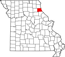 | |
| Townships | ||
| Unincorporated communities | ||
| Ghost towns | ||
| Footnotes | ‡This populated place also has portions in an adjacent county or counties | |