Harvard, Illinois
| Harvard, Illinois | |
| City | |
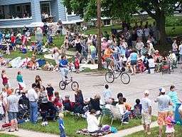 People gathered for the Harvard, Illinois Milk Days Parade. June 2, 2007 | |
| Motto: Success Comes Naturally Here | |
| Country | United States |
|---|---|
| State | Illinois |
| County | McHenry |
| Townships | Chemung, Dunham, Alden |
| Elevation | 922 ft (281 m) |
| Coordinates | 42°25′36″N 88°37′22″W / 42.42667°N 88.62278°WCoordinates: 42°25′36″N 88°37′22″W / 42.42667°N 88.62278°W |
| Area | 8.58 sq mi (22 km2) |
| - land | 8.58 sq mi (22 km2) |
| - water | 0.00 sq mi (0 km2) |
| Population | 9,447 (2010) |
| Density | 1,101.6/sq mi (425/km2) |
| Founded | February 28, 1867 |
| Mayor | Jay Nolan |
| Timezone | CST (UTC-6) |
| - summer (DST) | CDT (UTC-5) |
| Postal code | 60033 |
| Area codes | 815, 779 |
  Location of Harvard within Illinois
| |
| Wikimedia Commons: Harvard, Illinois | |
| Website: cityofharvard.org | |
| [1] | |
Harvard is a city located in McHenry County, Illinois, approximately 7 miles (11 km) south of the Illinois/Wisconsin border. The population was 9,447 at the 2010 census. The city is 63 miles (101 km) from the Chicago Loop, and it is the last stop on the Union Pacific/Northwest Line.
History

The original owners of the land which came to be Harvard, Illinois, were Abram Carmack and Jacob Davis, who obtained it from the government in 1845 and sold it to Gilbert Brainard shortly afterward. Upon Gilbert Brainard's death the land was purchased by Amos Page, Otis Eastman, and Eldridge G. Ayer. These three men planned the layout of the town and named it "Harvard" in honor of Harvard, Massachusetts. The plat was signed by Judge J. M. Strode in Woodstock, Illinois, on November 25, 1856. Shortly afterward Amos Page and Otis Eastman sold their shares of the property to Eldridge G. Ayers. Mr Ayers's involvement came out of his business interest in the extension of the Chicago and North Western Transportation Company railroad west from Cary, toward Janesville, Wisconsin. The newly platted town of Harvard was located directly on the route of the extension, and in April 1856 the railroad accepted Ayers's offer of land to build a station in the town.[2]
In 1856 Mr. Wesley Diggins built a hotel for Mr. H. C. Blackman, who sold it to Mr. Ayer in 1859. Mr. Ayer built additional floors to raise it to a height of three stories and added a wing and a veranda. During the Civil War, sick and wounded soldiers passing through Harvard were lodged at the hotel with no charge for their meals. In 1925 the Ayer Hotel was purchased by Mr. S. J. Noble and renamed the Noble Hotel. When he could not maintain mortgage payments it was purchased in 1937 by Mr. P. G. Allen and renamed the Hub Hotel. The building was destroyed in a fire on December 22, 1960.
As railroad employment expanded, Harvard's population grew. On April 18, 1869, voters incorporated the community and elected Ayer as the first village president.[3] The first ordinance adopted required every able-bodied citizen between the ages of 18 and 60 to perform one day of labor for the town.
Harvard was turned from a town into a city when citizens voted to do so (with a vote of 550 to 5) on April 6, 1891. With this change Harvard was no longer a town administered by a village president. It became a city administered by a mayor.
Motorola opened a 1,500,000 square feet (140,000 m2) mobile telephone manufacturing and distribution facility on Harvard's north side in 1997. The plant employed more than 5,000 at its peak. However, a combination of factors, including a significant decline in Motorola's business in the early 2000s, compelled the company to shutter the facility in 2003.[4] In 2012, the 1.5 million square foot facility was sold to Optima Ventures,[5][6] a Miami-based real estate investment firm led by Chaim Schochet and 2/3rd owned by the Privat Group, one of Ukraine's largest business and banking groups.[7]
In 2006, Harvard held a year-long Sesquicentennial Celebration.[8] The Greater Harvard Area Historical Society is located on Hart Street. The society identifies and marks historical sites in the area. It also works to obtain histories of Harvard families, businesses, and farms which have been in operation for more than 100 years.
Geography
According to the 2010 census, Harvard has a total area of 8.58 square miles (22.22 km2), all land.[9]
Major streets
- Airport Road
- Ayer Street
-
 Diggins Street/Brink Street
 -
 Division Street
 - Flat Iron Road
- Lawrence Road
-
 Marengo Street
 - Oak Grove Road
- Ramer Road
Demographics
| Historical population | |||
|---|---|---|---|
| Census | Pop. | %± | |
| 1870 | 1,120 | — | |
| 1880 | 1,607 | 43.5% | |
| 1890 | 1,967 | 22.4% | |
| 1900 | 2,602 | 32.3% | |
| 1910 | 3,008 | 15.6% | |
| 1920 | 3,294 | 9.5% | |
| 1930 | 2,988 | −9.3% | |
| 1940 | 3,121 | 4.5% | |
| 1950 | 3,464 | 11.0% | |
| 1960 | 4,248 | 22.6% | |
| 1970 | 5,177 | 21.9% | |
| 1980 | 5,126 | −1.0% | |
| 1990 | 5,975 | 16.6% | |
| 2000 | 7,996 | 33.8% | |
| 2010 | 9,447 | 18.1% | |
| Est. 2015 | 9,194 | [10] | −2.7% |
As of the census[12] of 2000, there were 7,996 people, 2,610 households, and 1,853 families residing in the city. The population density was 1,498.2 people per square mile (578.1/km²). There were 2,723 housing units at an average density of 510.2 per square mile (196.9/km²). The racial makeup of the city was 76.25% White, 0.85% African American, 0.38% Native American, 1.43% Asian, 0.01% Pacific Islander, 18.76% from other races, and 2.33% from two or more races. Hispanic or Latino of any race were 37.81% of the population.
There were 2,610 households out of which 39.7% had children under the age of 18 living with them; 53.8% were married couples living together, 11.1% had a female householder with no husband present, and 29.0% were non-families; 24.0% of all households were made up of individuals, and 10.1% had someone living alone who was 65 years of age or older. The average household size was 3.05 and the average family size was 3.56.
In the city the population was spread out with 30.1% under the age of 18, 12.7% from 18 to 24, 31.3% from 25 to 44, 16.8% from 45 to 64, and 9.1% who were 65 years of age or older. The median age was 29 years. For every 100 females there were 107.5 males. For every 100 females age 18 and over, there were 105.9 males.
The median income for a household in the city was $44,363, and the median income for a family was $48,087. Males had a median income of $30,578 versus $23,750 for females. The per capita income for the city was $17,253. About 6.9% of families and 9.1% of the population were below the poverty line, including 11.2% of those under age 18 and 1.2% of those age 65 or over.
Education

Harvard School District No. 50 operates four schools within the city:
- Harvard High School: grades 9-12
- Harvard Junior High School: grades 6-8
- Jefferson Elementary School: grades 4 and 5
- Richard B. Crosby Elementary School: grades K-3
- Washington School: Pre-K and ECE
In addition, the Roman Catholic Diocese of Rockford operates one school in Harvard, St. Joseph's School: pre-kindergarten, kindergarten, and grades 1-8. The school was closed at the end of the 2015-16 school year, due to financial issues.[13]
Library
Harvard Diggins Library was established when in 1908 Delos F. Diggins, a former resident, bequeathed to Harvard the sum of $40,000 to buy a site and build a library. Harvard became the first town in the county to have a library building. In his will, Mr. Diggins appointed the first library board, with instructions as to how members should be replaced when individuals died or moved from the town. The library was constructed by W. H. Ward and Son, dedicated in May 1909, and opened to the public for use in August of that year. When the library moved to its new facilities in 2001, the name was changed to Harvard Diggins Library. The library is a municipal library and receives its financial support from city taxes and endowment funds. It is governed by a nine-member City Library Board appointed by the mayor. The original Diggins Trustee Board assists with special funding. As an online member of the Prairie Area Library System's automation project, the library shares a database with other libraries in the system. Patrons may access these materials as well as local materials. Patrons are also able to use their card at the PALS libraries.[14]
Post office
The U.S. Post Office is located on Harvard's North Eastman Street. The current building was constructed during the Kennedy Administration in 1962, when J. Edward Day was the Postmaster General.
Law enforcement
The Harvard Police Department is located in the lower level of the old City Hall building. It consists of 15 full-time police officers, four full-time emergency dispatchers, three part-time emergency dispatchers and one full-time police assistant. The department has three bicycles for officers to patrol the city streets, parks, and downtown area.[15]
Fire protection
Harvard's Fire Protection District consists of 47 trained firefighters, of which 22 are Emergency medical technicians and 14 are paramedics. The district traces its history to 1865 when five men got together to purchase a fire engine for the village of Harvard. In 1871, the engine was sent to Chicago via the railroad to assist in the Great Chicago Fire. In 1892, it was again placed on a train to assist with a fire in the community of Kenosha, Wisconsin. In 1899, the first constitution and by-laws were drawn up for the Harvard Fire Department. The Harvard Rescue Squad was founded in 1956 with a $7000 donation from the Harvard Jaycees. In 1971, the City and Rural Fire Department merged to form the Harvard Fire Protection District.[16]
Currently the Harvard Fire Protection District is governed by a three-member board of trustees appointed by the McHenry County Board. While the Fire District works very closely with the city of Harvard, it is a separate government agency. The district provides fire and emergency medical service for 108 square miles (280 km2) and is funded by ambulance user fees and property taxes. It is part of the Rock River Region EMS System, which is affiliated with Rockford Memorial Hospital, a Level I trauma hospital. The district also has a SCUBA dive team, trained for water rescue. This team is part of the McHenry County MABAS 5 Dive Team.
Transportation
U.S. Route 14, locally known as the Northwest Highway and Division Street, runs north-south through Harvard. Illinois Route 23 begins in southern Harvard and connects the city with other locations to the south. Illinois Route 173 also runs east-west through Harvard, and it connects many other towns along the Wisconsin border to Harvard. The nearest Interstate Highway to Harvard is Interstate 90 in Belvidere; Interstate 39 in Machesney Park is also nearby, as is Interstate 43 in Wisconsin.
Harvard is also served by multiple forms of public transportation. Pace operates Route 808 in Harvard. This route links the city to the communities of Woodstock and Crystal Lake. Metra's Union Pacific/Northwest Line has a station in Harvard and operates daily service to Chicago's Ogilvie Transportation Center. The Harvard station is the most remote point in the Metra system at 62.8 miles (101.1 km) from downtown Chicago.[17]
Media
Harvard is served by WHIW-LP 101.3 FM, Harvard Community Radio. A low-power FM station, WHIW-LP began broadcasting on the FM frequency on May 18, 2015. Prior to May 2015, the station was heard at AM 1610. WHIW-LP also streams online.
WHIW-LP provides local programming including news, sports, school, music, arts and more. WHIW is an all-volunteer community radio station that depends on the support of it listeners and station underwriters. The station received its 501(c)(3) exempt status in 2013.
Notable people
- Edward E. Ayer (1841–1927) helped found the Field Museum of Natural History and the Newberry Library in Chicago
- Elbridge Ayer Burbank (1858–1949), portrait painter of Native Americans, especially known for Geronimo
- Bobby Cook (1923–2004), pro basketball player
- Clarence Darrow (1857–1938), of Scopes Trial fame, had a law office in downtown Harvard
- Dorothy Ayer Gardner Ford, mother of President Gerald Ford
- Paul Galvin (1895–1959), founder of Motorola Corporation
- Lon Haldeman, cyclist, Race Across America winner
- Red Lanning, pitcher and outfielder for the Philadelphia Athletics
- Jonathan J. Smith, Wisconsin state legislator[18]
See also
References
- ↑ U.S. Geological Survey Geographic Names Information System: City of Harvard
- ↑ Harvard - 150 Years, 1856-2006, Harvard Sesquicentennial Committee May 2006
- ↑ http://www.encyclopedia.chicagohistory.org/pages/567.html Retrieved September 23, 2006
- ↑ Happy end for Harvard? | Northwest Herald
- ↑ Chicago Tribune: " Motorola campus in Harvard has a buyer - Miami-based real estate investment firm looking at plans to lease shuttered facility" By Carolyn Starks and Jeff Long August 15, 2008
- ↑ Daily Herald: "Miami firm buys former Motorola plant in Harvard" By Lenore T. Adkins August 14, 2008
- ↑ Cleveland Plain Dealer: "The most important guy you've never heard of: Chaim Schochet, 25, builds downtown Cleveland empire" By Michelle Jarboe McFee February 04, 2012
- ↑ harvard150.com
- ↑ "G001 - Geographic Identifiers - 2010 Census Summary File 1". United States Census Bureau. Retrieved 2015-12-27.
- ↑ "Annual Estimates of the Resident Population for Incorporated Places: April 1, 2010 to July 1, 2015". Retrieved July 2, 2016.
- ↑ "Census of Population and Housing". Census.gov. Retrieved June 4, 2015.
- ↑ "American FactFinder". United States Census Bureau. Retrieved 2008-01-31.
- ↑ Prokop, Hannah (March 4, 2016). "St. Joseph School in Harvard to Close by End of Year, Rockford Diocese Says". Northwest Herald. Retrieved July 6, 2016.
- ↑ Harvard Diggins Library
- ↑ CITY OF HARVARD | Police Department
- ↑ Harvard Fire Protection District
- ↑ Metra Railfan Tips - Union Pacific/Northwest Line
- ↑ 'Jonathan J. Smith-obituary,' Barron County Shield, January 4, 1917
External links
| Wikisource has the text of the 1920 Encyclopedia Americana article Harvard. |
- City of Harvard
- Harvard Diggins Library
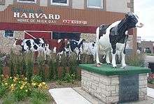
- Harvard Milk Days
- Harvard School District 50 website
- Postcards (historic) of Harvard
Municipalities and communities of McHenry County, Illinois, United States | ||
|---|---|---|
| Cities | ||
| Villages | ||
| Townships | ||
| CDPs | ||
| Other unincorporated communities | ||
| Footnotes | ‡This populated place also has portions in an adjacent county or counties | |
| Major city |  | |
|---|---|---|
| Cities (over 30,000 in 2010) | ||
| Towns and villages (over 30,000 in 2010) |
| |
| Counties | ||
| Regions | ||
| Sub-regions | ||