Kendall County, Illinois
| Kendall County, Illinois | |
|---|---|
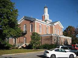 Kendall County Courthouse | |
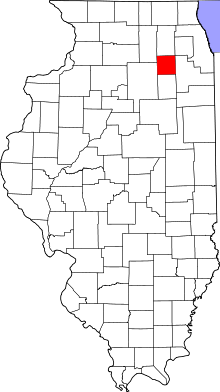 Location in the U.S. state of Illinois | |
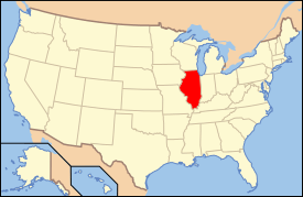 Illinois's location in the U.S. | |
| Founded | 1841 |
| Named for | Amos Kendall |
| Seat | Yorkville |
| Largest village | Oswego |
| Area | |
| • Total | 322 sq mi (834 km2) |
| • Land | 320 sq mi (829 km2) |
| • Water | 2.0 sq mi (5 km2), 0.61% |
| Population | |
| • (2010) | 114,736 |
| • Density | 358/sq mi (138/km²) |
| Congressional districts | 11th, 14th |
| Time zone | Central: UTC-6/-5 |
| Website |
www |

Kendall County is a county located in the U.S. state of Illinois. According to the 2010 census, it has a population of 114,736.[1] Its county seat is Yorkville,[2] and its most populous municipality is Oswego.
Kendall County is included in the Chicago-Naperville-Elgin, IL-IN-WI Metropolitan Statistical Area. It was the fastest-growing county in the United States between the years 2000 and 2010.[3]
History
Kendall County was formed in 1841 out of LaSalle and Kane counties.
The county is named after Amos Kendall.[4] Kendall was the editor of the Frankfort, Kentucky newspaper, and went on to be an important advisor to President Andrew Jackson. Kendall became the U.S. Postmaster General in 1835.
-

Kendall County at the time of its creation in 1841
Geography
According to the U.S. Census Bureau, the county has a total area of 322 square miles (830 km2), of which 320 square miles (830 km2) is land and 2.0 square miles (5.2 km2) (0.6%) is water.[5]
Kendall County is a small, but rapidly growing county that has the majority of its population in the northeast, and along the Fox River (the only river in the county) which runs through the northwestern section of the county. Many new subdivisions have been constructed in this county, which has produced considerable population growth. Southern Kendall still remains largely agricultural. Kendall County has two primary ranges of low-lying hills formed by what is known as an end moraine. Ransom, the more predominant of the two moraines, runs through the west and north-central part of the county. This moraine has created elevations of over 800 feet (240 m), in contrast to elevations in southern Kendall County that drop to the lower 500 feet (150 m) range. Minooka, the other major end moraine ridge in Kendall County, runs along its entire eastern border with Will County. The two moraines intersect at almost a right angle in the township of Oswego. The only designated state park in the county is Silver Springs State Fish and Wildlife Area.
Climate and weather
| Yorkville, Illinois | ||||||||||||||||||||||||||||||||||||||||||||||||||||||||||||
|---|---|---|---|---|---|---|---|---|---|---|---|---|---|---|---|---|---|---|---|---|---|---|---|---|---|---|---|---|---|---|---|---|---|---|---|---|---|---|---|---|---|---|---|---|---|---|---|---|---|---|---|---|---|---|---|---|---|---|---|---|
| Climate chart (explanation) | ||||||||||||||||||||||||||||||||||||||||||||||||||||||||||||
| ||||||||||||||||||||||||||||||||||||||||||||||||||||||||||||
| ||||||||||||||||||||||||||||||||||||||||||||||||||||||||||||
In recent years, average temperatures in the county seat of Yorkville have ranged from a low of 10 °F (−12 °C) in January to a high of 84 °F (29 °C) in July, although a record low of −26 °F (−32 °C) was recorded in January 1985 and a record high of 111 °F (44 °C) was recorded in July 1936. Average monthly precipitation ranged from 1.52 inches (39 mm) in February to 4.39 inches (112 mm) in July.[6]
Major highways
-
 Interstate 80
 -
 U.S. Highway 30
 -
 U.S. Highway 34
 -
 U.S. Highway 52
 -
 Illinois Route 25
 -
 Illinois Route 31
 -
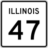 Illinois Route 47
 -
 Illinois Route 71
 -
 Illinois Route 126
Adjacent counties
- Kane County - north
- DuPage County - northeast
- Will County - east
- Grundy County - south
- LaSalle County - west
- DeKalb County - northwest
Government
(As of December 2014) County Board members run in two districts. All other officers run county-wide:
- County Board Members: John P. Purcell, John A. Shaw, Judy Gilmour, Matthew G. Prochaska, Robert "H.D." Davidson, Elizabeth Flowers, Lynn Cullick, Dan Koukol, Scott R. Gryder, Jeff Wehrli
- John A. Shaw - County Board Chairman
- Robyn Ingemunson - Clerk of the Circuit Court
- Ken Toftoy - Coroner
- Debbie Gillette - County Clerk and Recorder
- Dwight Baird - Sheriff
- Eric Weis - State's Attorney
- Jill Ferko - Treasurer
Demographics
| Historical population | |||
|---|---|---|---|
| Census | Pop. | %± | |
| 1850 | 7,730 | — | |
| 1860 | 13,074 | 69.1% | |
| 1870 | 12,399 | −5.2% | |
| 1880 | 13,083 | 5.5% | |
| 1890 | 12,106 | −7.5% | |
| 1900 | 11,467 | −5.3% | |
| 1910 | 10,777 | −6.0% | |
| 1920 | 10,074 | −6.5% | |
| 1930 | 10,555 | 4.8% | |
| 1940 | 11,105 | 5.2% | |
| 1950 | 12,115 | 9.1% | |
| 1960 | 17,540 | 44.8% | |
| 1970 | 26,374 | 50.4% | |
| 1980 | 37,202 | 41.1% | |
| 1990 | 39,413 | 5.9% | |
| 2000 | 54,544 | 38.4% | |
| 2010 | 114,736 | 110.4% | |
| Est. 2015 | 123,355 | [7] | 7.5% |
| U.S. Decennial Census[8] 1790-1960[9] 1900-1990[10] 1990-2000[11] 2010-2013[1] | |||

As of the 2010 United States Census, there were 114,736 people, 38,022 households, and 30,067 families residing in the county.[12] The population density was 358.2 inhabitants per square mile (138.3/km2). There were 40,321 housing units at an average density of 125.9 per square mile (48.6/km2).[5] The racial makeup of the county was 83.6% white, 5.7% black or African American, 3.0% Asian, 0.3% American Indian, 5.0% from other races, and 2.3% from two or more races. Those of Hispanic or Latino origin made up 15.6% of the population.[12] In terms of ancestry, 28.0% were German, 16.0% were Irish, 9.5% were Polish, 9.4% were Italian, 7.5% were English, and 3.2% were American.[13]
Of the 38,022 households, 47.9% had children under the age of 18 living with them, 65.8% were married couples living together, 9.2% had a female householder with no husband present, 20.9% were non-families, and 16.4% of all households were made up of individuals. The average household size was 3.01 and the average family size was 3.41. The median age was 32.9 years.[12]
The median income for a household in the county was $79,897 and the median income for a family was $87,309. Males had a median income of $64,048 versus $42,679 for females. The per capita income for the county was $30,565. About 2.9% of families and 3.9% of the population were below the poverty line, including 4.6% of those under age 18 and 3.4% of those age 65 or over.[14]
Kendall County was listed as the fastest-growing county in the US from 2000 to 2009, experiencing a population growth rate of 110.4% in this period.[15] The reason for this growth is heavy suburbanization stemming from the metropolitan Chicago area.
Education
- Lisbon Community Consolidated School District 90
- Newark Community Consolidated School District 66
- Newark Community High School District 18
- Oswego Community Unit School District 308
- Plano Community Unit School District 88
- Yorkville Community Unit School District 115
- School District #101
- School District #201
- School District #202
- School District #429
- School District #430 (Sandwich Community School District #430)
The northern half of the county is in Community College District 516 and is served by Waubonsee Community College in Sugar Grove, Aurora, and Plano. The southern half is in Community College District 525 and is served by Joliet Junior College in Joliet.[16]
Communities
Cities
Villages
- Lisbon
- Millbrook
- Millington (part)
- Minooka (part)
- Montgomery (part)
- Newark
- Oswego
- Plainfield (part)
- Plattville
Unincorporated communities
- Boulder Hill
- Bristol
- Helmar
- Little Rock
Townships
The county is an 18-mile (29 km) square which is divided up into 9 townships. Each township is divided into 36 1 mile square sections, except that the Fox River is used as a Township border, resulting in Bristol being the smallest township with the extra area being assigned to Oswego and Kendall Townships. There are also two exceptions to the section grid to reflect Indian land grants under the Treaty of Prairie du Chien in 1829: the Mo-Ah-Way Reservation in Oswego Township and the Waish-Kee-shaw Reservation in Na-Au-Say Township. These areas were eventually sold to European settlers.[17]
In popular culture
Various locations within and around the City of Plano was used as a stand-in for Clark Kent's hometown of Smallville, Kansas in the 2013 film Man of Steel as well as the 2016 film Batman v. Superman: Dawn of Justice. Plano has also been used in the film Witless Protection, with both films having been filmed in Plano's historic downtown area. Filming has also been done south of Plano at the Farnsworth House, a Modern architectural landmark for various documentaries and commercials.
See also
References
- Specific
- 1 2 "State & County QuickFacts". United States Census Bureau. Retrieved July 6, 2014.
- ↑ "Find a County". National Association of Counties. Retrieved 2011-06-07.
- ↑ "Population Distribution and Change: 2000 to 2010" (PDF). United States Census Bureau. March 2011. p. 9. Retrieved 2011-03-26.
- ↑ Gannett, Henry (1905). The Origin of Certain Place Names in the United States. Govt. Print. Off. p. 173.
- 1 2 "Population, Housing Units, Area, and Density: 2010 - County". United States Census Bureau. Retrieved 2015-07-12.
- 1 2 "Monthly Averages for Yorkville, Illinois". The Weather Channel. Retrieved 2011-01-27.
- ↑ "County Totals Dataset: Population, Population Change and Estimated Components of Population Change: April 1, 2010 to July 1, 2015". Retrieved July 2, 2016.
- ↑ "U.S. Decennial Census". United States Census Bureau. Retrieved July 6, 2014.
- ↑ "Historical Census Browser". University of Virginia Library. Retrieved July 6, 2014.
- ↑ "Population of Counties by Decennial Census: 1900 to 1990". United States Census Bureau. Retrieved July 6, 2014.
- ↑ "Census 2000 PHC-T-4. Ranking Tables for Counties: 1990 and 2000" (PDF). United States Census Bureau. Retrieved July 6, 2014.
- 1 2 3 "DP-1 Profile of General Population and Housing Characteristics: 2010 Demographic Profile Data". United States Census Bureau. Retrieved 2015-07-12.
- ↑ "DP02 SELECTED SOCIAL CHARACTERISTICS IN THE UNITED STATES – 2006-2010 American Community Survey 5-Year Estimates". United States Census Bureau. Retrieved 2015-07-12.
- ↑ "DP03 SELECTED ECONOMIC CHARACTERISTICS – 2006-2010 American Community Survey 5-Year Estimates". United States Census Bureau. Retrieved 2015-07-12.
- ↑ "2010 US Census Brief" (PDF). Retrieved 8 May 2012.
- ↑ retrieved 2007-02-13
- ↑ Place Names & Geological Features of Kendall County
- General
- Forstall, Richard L. (editor) (1996). Population of states and counties of the United States: 1790 to 1990 : from the twenty-one decennial censuses. United States Department of Commerce, Bureau of the Census, Population Division. ISBN 0-934213-48-8.
External links
 |
DeKalb County | Kane County | DuPage County | |
| LaSalle County | |
Will County | ||
| ||||
| | ||||
| Grundy County |
Municipalities and communities of Kendall County, Illinois, United States | ||
|---|---|---|
| Cities | ||
| Villages | ||
| Townships | ||
| CDP | ||
| Other unincorporated communities |
| |
| Footnotes | ‡This populated place also has portions in an adjacent county or counties | |
| Major city |  | |
|---|---|---|
| Cities (over 30,000 in 2010) | ||
| Towns and villages (over 30,000 in 2010) |
| |
| Counties | ||
| Regions | ||
| Sub-regions | ||

Coordinates: 41°35′N 88°26′W / 41.59°N 88.43°W