Bolingbrook, Illinois
| Bolingbrook | |
|---|---|
| Village | |
| Motto: A place to grow | |
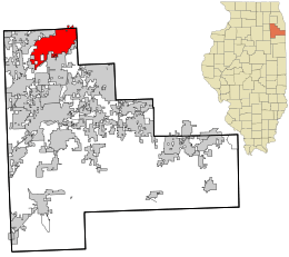 Location in Will County and the state of Illinois. | |
| Coordinates: 41°41′55″N 88°5′19″W / 41.69861°N 88.08861°WCoordinates: 41°41′55″N 88°5′19″W / 41.69861°N 88.08861°W | |
| Country |
|
| State | Illinois |
| Counties | Will, DuPage |
| Township | DuPage, Wheatland, Lisle, Plainfield |
| Incorporated | 6 Oct 1965[1] |
| Government | |
| • Type | Council-manager |
| • Mayor | Roger C. Claar(R) |
| Area | |
| • Total | 24.26 sq mi (62.8 km2) |
| • Land | 24.05 sq mi (62.3 km2) |
| • Water | 0.21 sq mi (0.5 km2) 0.87% |
| Population (2012) | |
| • Total | 74,039 |
| • Density | 3,100/sq mi (1,200/km2) |
| Standard of living | |
| • Per capita income | $23,468 (median: $67,852) |
| • Home value | $153,410 (2000) (median: $141,400) |
| Time zone | CST (UTC-6) |
| • Summer (DST) | CDT (UTC-5) |
| ZIP code(s) | 60439, 60440, and 60490 |
| Area code(s) | 630/331 and 815/779 |
| Geocode | 17-07133 |
| Website |
www |
| Demographics (2000)[2] | |||
|---|---|---|---|
| White | Black | Hispanic | Asian |
| 54.27% | 20.44% | 24.40% | 11.38% |
| Islander | Native | Other | |
| 0.03% | 0.3% | 10.5% | |
The village of Bolingbrook is a southwest suburb of Chicago that is partially in both Will and DuPage counties in the U.S. state of Illinois. As of the 2010 US Census, the population is 73,366. It is the 17th largest incorporated place in Illinois and the state's 2nd largest village.
Geography
Bolingbrook is at 41°41′55″N 88°5′19″W / 41.69861°N 88.08861°W (41.698613, -88.088668),[3] approximately 28 miles southwest of Downtown Chicago.
According to the 2010 census Bolingbrook has a total area of 24.257 square miles (62.83 km2), of which 24.05 square miles (62.29 km2) (or 99.15%) is land and 0.207 square miles (0.54 km2) (or 0.85%) is water.[4]
Bolingbrook borders the communities of Woodridge, Romeoville, Plainfield, and Naperville.
Interstate 55, also known as the Stevenson Expressway in Chicagoland, runs through the southern part of the village heading northeast toward Chicago and southwest toward Plainfield and Joliet. Interstate 355, also known as the Veterans Memorial Tollway (formerly the North-South Tollway) in Chicagoland, runs along the far east side of the village between New Lenox and Addison. Illinois Route 53, locally known as Bolingbrook Drive, runs north–south through the middle of the village.
Other main streets in Bolingbrook include Boughton Road, Lily Cache Lane, Weber Road, Veterans Parkway (formerly Naperville Road), Briarcliff Road, Hassert Boulevard (formerly 111th Street), Rodeo Drive (formerly 119th Street), Schmidt Road, Crossroads Parkway, and Remington Boulevard.
Demographics
| Historical population | |||
|---|---|---|---|
| Census | Pop. | %± | |
| 1970 | 7,651 | — | |
| 1980 | 37,261 | 387.0% | |
| 1990 | 40,843 | 9.6% | |
| 2000 | 56,321 | 37.9% | |
| 2010 | 73,366 | 30.3% | |
| Est. 2015 | 74,306 | [5] | 1.3% |
As of the census[7] of 2000, there were 56,321 people, 17,416 households, and 14,246 families residing in the village. The population density was 2,746.5 people per square mile (1,060.2/km²). There were 17,884 housing units at an average density of 872.1 per square mile (336.7/km²). The racial makeup of the village was 64.51% White, 20.41% African American, 0.23% Native American, 6.38% Asian, 0.06% Pacific Islander, 5.65% from other races, and 2.77% from two or more races. Hispanic or Latino of any race were 13.09% of the population.
There were 17,416 households out of which 48.0% had children under the age of 18 living with them, 66.5% were married couples living together, 10.9% had a female householder with no husband present, and 18.2% were non-families. 14.2% of all households were made up of individuals and 2.8% had someone living alone who was 65 years of age or older. The average household size was 3.22 and the average family size was 3.56.
In the village the population was spread out with 32.3% under the age of 18, 8.4% from 18 to 24, 35.2% from 25 to 44, 19.9% from 45 to 64, and 4.3% who were 65 years of age or older. The median age was 31 years. For every 100 females there were 99.6 males. For every 100 females age 18 and over, there were 97.0 males.
The median income for a household in the village was $67,852, and the median income for a family was $71,527 (these figures had risen to $76,392 and $82,462 respectively as of a 2007 estimate[8]). Males had a median income of $46,915 versus $33,665 for females. The per capita income for the village was $23,468. About 2.9% of families and 4.1% of the population were below the poverty line, including 5.1% of those under age 18 and 6.8% of those age 65 or over.
Growth
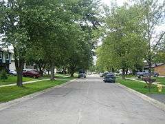
Bolingbrook is a relatively new suburb of Chicago, having been incorporated in 1965. The first settlement in what is now Bolingbrook was established in 1831, but the informal farming villages remained unincorporated for over 130 years. The tiny Boardman Cemetery, in what is now the Heritage Creek subdivision, contains the remains of some of these early residents.
Modern Bolingbrook has its roots in the housing boom of the 1950s. The first subdivision in Bolingbrook, known as Westbury, was immediately west of Route 53. A second subdivision, known as Colonial Village, followed on the far east side of Route 53.[9] The village continued to grow steadily for the remainder of the 1960s, reaching a population of 7,000 by 1970. The 1970s were the first period of rapid growth in Bolingbrook, during which its population quintupled to reach over 37,000 by 1980. Much of this growth was as much due to mass annexation as well as raw population growth; the population of Bolingbrook by the 1970 census but with its 1980 land boundary was approximately 25,000, further reflecting the vigorous annexation that took place during the 1970s. However, Bolingbrook made Illinois' list of 100 Top places to live.
During the 1980s, growth in Bolingbrook and Will County slowed considerably as the focus of Chicago-area growth in that decade largely shifted to the northern tier of suburbs in Lake and McHenry counties. By 1990, Bolingbrook's population had only increased by about 10% from the previous decade, to about 41,000. The main benefit of this slower growth is that it allowed the village's infrastructure (especially its school district) to catch up with its population.
The 1990s ushered in a second wave of strong growth to Bolingbrook, as Will and nearby Kendall counties once again became the Chicago metropolitan area's fastest growing subregion.
Law and government
John J. "Jack" Leonard was instrumental in the village's incorporation and served as the village's first mayor. Prior to hiring a full-time police chief, he served "double-duty" as both Village President and part-time Police Chief. At this time, the police "station" was headquartered in a spare bedroom in Leonard's home. The police car was kept in his garage when it was not patrolling. Later the station moved to an old farmhouse on Briarcliff Road next to Saint Dominic Church. Leonard's wife, Delphine M. Leonard (Hench) was the village's first police radio operator.
Eventually, the first police chief, Fred Greening was hired. He was recruited from the detective division of the Detroit Police Department.
In 1971, Bolingbrook purchased station 2 from the Lemont Fire Protection District, which had been serving much of the village, thus establishing its own fire department. Since then, that station has been expanded and four others have been built.[10]
The mayor of Bolingbrook is Republican Roger C. Claar, who has served in that role since 1986.[11] In 2007, Claar came under scrutiny for his lavish lifestyle funded by his campaign fund.[12][13]
Economy
Goya Foods' Illinois division as well as Ulta Beauty are headquartered in Bolingbrook.[14] WeatherTech has both its Corporate Headquarters and Factory Store in Bolingbrook. [15]
Major highways
Major highways in Bolingbrook include:
|
Interstate Highways |
US Highways |
Illinois Highways |
Schools
Most of Bolingbrook lies within the boundaries of Valley View School District 365U and Fountaindale Public Library District, both of which also include nearby Romeoville, Illinois. Other school districts that serve Bolingbrook include Plainfield School District 202, Indian Prairie School District 204, Naperville School District 203, Woodridge School District 68, and Downers Grove High School District 99.
Early history
School District 365U was originally known as District 94. It took its present name when it became the first school district in the United States to implement the 45-15 plan, in which schools were occupied year round with 3/4 of the students in session at any one time. Students went to school for 9 weeks and then had 3 weeks off. Additionally, teachers were optionally allowed to work year-round.
The first school built in Bolingbrook was North View School at 151 E. Briarcliff Rd., Bolingbrook, IL (now closed).[16]
High schools
Bolingbrook High School (365U), Plainfield North and Plainfield East (202), Neuqua Valley High School, Naperville (204), Naperville Central (203), and Downers Grove South (99). Romeoville High School also serves as an alternative for some students residing in Valley View 365U. In addition, selected Bolingbrook teens attend the Illinois Math and Science Academy in Aurora.
Middle schools
In Valley View 365U
- Brooks (in the former Bolingbrook High School building and home of the district's ESL program)
- Jane Addams (near the Bolingbrook Recreation and Aquatic Center)
- Hubert H. Humphrey
In Indian Prairie 204 (Naperville)
- Gregory
In Naperville CUSD 203
- Madison
In Plainfield Community Consolidated School District 202
- Kennedy (Plainfield)
In Woodridge Elementary School District 68
- Jefferson (Woodridge).
Elementary schools
In Valley View 365U
- Bernard J. Ward (formerly a middle school)
- Independence
- Jamie McGee
- John R. Tibbott
- Jonas E. Salk
- Pioneer
- Oak View
- Wood View
In Indian Prairie 204
- Builta
In Naperville 203
- River Woods
In Plainfield Community Consolidated School District 202
- Liberty
- Elizabeth Eichelberger
In Woodridge Elementary School District 68
- John L. Sipley
Alternative schools
In Valley View 365U
- STEP Program (also housed in the former Bolingbrook High School building)
Private schools
Catholic schools:
- St. Dominic School (serving grades PK - 8)
Parochial grade school students may go on to Catholic high schools in proximity to Bolingbrook such as Benet Academy in Lisle, Joliet Catholic Academy in Joliet, and Mount Assisi Academy (Girls) in Lemont.
Islamic schools:
- Furqaan Academy (PK-12)
Recreation
Bolingbrook Park District
The Bolingbrook Park District was created in 1970, after being approved by referendum. In 1974, the Park District built its first new building, the Deatherage-Drdak Center, constructed only with volunteer labor. In the following three decades the Bolingbrook Park District has grown to include numerous woodlands and parks, several community centers, the Pelican Harbor Indoor/Outdoor Aquatic Complex (recognized for its excellence by Chicago Magazine in April 2004), and the Bolingbrook Recreation and Aquatic Complex (BRAC). Most recently, the Bolingbrook Park District was one of the four finalists for the National Gold Medal Award for Excellence in Park Management, Facilities and Programs.
In 1982, the Park District opened the first indoor wave pool in the United States. It was closed shortly after the BRAC and Pelican Harbor opened in 1996, and has since been converted to an ice skating arena.[17]
In 2009, the Park District opened its Hidden Oaks Nature Center, which sits on 80 acres of woodland and river plain habitat. The Nature Center has a Platinum LEED Rating from the U.S. Green Building Council and was built from recycled materials. As of 2014, the Nature Center is used to run naturalist programs and summer camps. Animal residents include: coyotes, deer, great horned owls, and other species common to Northern Illinois.[18]
Golf
Bolingbrook is home to the Boughton Ridge Golf Course, a 9-hole course owned by the Bolingbrook Park District. In addition, the Bolingbrook Golf Club, a municipal facility which includes an 18-hole course, is in the village. Other Golf Courses within proximity of Bolingbrook include Naperbrook GC, Tamarack GC, Wedgewood GC, and Links at Carillon (all in Plainfield), White Eagle GC and Springbrook GC in Naperville, Village Greens of Woodridge and Seven Bridges GC in Woodridge, River Bend GC in Lisle, Carriage Greens GC and RCC in Darien, Cog Hill GC in Lemont, and Mistwood GC in Romeoville.
Aviation
Clow International Airport is a small airport off of Boughton-Weber with an estimated 3,362-foot (1,025 m) runway. Clow is a public (non-commercial) airport, owned by the Village and operated under a contract with a management company. In 1989, the airport was named the "best privately owned, public use airport in Illinois." Currently, there are 70,000 take-offs and landings at the airport annually.
A WGN-TV helicopter is stationed at Clow Airport. The airport previously served as a base station for Air Angels Aeromedical Transport before the company closed its doors in early 2009. It also provides flight training and airplane charters through A & M Aviation, aircraft maintenance through A & M Maintenance, and has an EAA chapter that provides free Young Eagles flights for children.
The Illinois Aviation Museum at Bolingbrook was formed in 2004. The museum is staffed by volunteers and is in a remodeled hangar at Clow International Airport, currently donated by the Village of Bolingbrook.
Notable people
- Kenneth Boatright, football free agent raised in Bolingbrook[19]
- J. J. Furmaniak, professional baseball infielder raised in Bolingbrook
- Drew Peterson, former Bolingbrook police sergeant, suspected in the disappearance of his fourth wife, convicted of drowning his third wife[20]
- Steve Williams, football free agent raised in Bolingbrook
- Ronnie Bull, retired Bears running back who currently lives in Bolingbrook
References in popular culture
In Money Magazine's September 2014 Edition of "Best Places to Live", Bolingbrook was placed at #38.[21] In its 2010 edition, it was placed at #43.[22]
Bolingbrook, specifically the Chicago Bow Hunters club, is mentioned by Nicolas Cage in the 2005 movie The Weather Man.
Bolingbrook is the setting of the 2012 TV movie Drew Peterson: Untouchable starring Rob Lowe.
Director Brian De Palma filmed scenes from his 1978 supernatural thriller film The Fury in Bolingbrook.
Sister cities
-
 San Pablo City, Laguna, Philippines
 -
 Sialkot, Punjab, Pakistan
 -
 Xuchang City, Henan, China
See also
References
- ↑ White, Jesse. "Illinois Counties & Incorporated Municipalities" (PDF). Cyber Drive Illinois. State of Illinois. Retrieved 18 June 2015.
- ↑ 2000 United States Census Data
- ↑ "US Gazetteer files: 2010, 2000, and 1990". United States Census Bureau. 2011-02-12. Retrieved 2011-04-23.
- ↑ "G001 - Geographic Identifiers - 2010 Census Summary File 1". United States Census Bureau. Retrieved 2015-08-02.
- ↑ "Annual Estimates of the Resident Population for Incorporated Places: April 1, 2010 to July 1, 2015". Retrieved July 2, 2016.
- ↑ "Census of Population and Housing". Census.gov. Archived from the original on May 11, 2015. Retrieved June 4, 2015.
- ↑ "American FactFinder". United States Census Bureau. Archived from the original on 2013-09-11. Retrieved 2008-01-31.
- ↑ http://factfinder.census.gov/servlet/ACSSAFFFacts?_event=Search&geo_id=16000US1706587&_geoContext=01000US%7C04000US17%7C16000US1706587&_street=&_county=bolingbrook&_cityTown=bolingbrook&_state=04000US17&_zip=&_lang=en&_sse=on&ActiveGeoDiv=geoSelect&_useEV=&pctxt=fph&pgsl=160&_submenuId=factsheet_1&ds_name=ACS_2007_3YR_SAFF&_ci_nbr=null&qr_name=null®=null%3Anull&_keyword=&_industry=
- ↑ http://www.bolingbrook.com/index.php?page_id=57
- ↑ "Fire department history". Bolingbrook Fire Department. Retrieved 4 October 2012.
- ↑ "Village of Bolingbrook Elected Officials". Retrieved 4 October 2012.
- ↑ http://www.chicagomag.com/Chicago-Magazine/October-2007/BolingbrookaCest-Moi/|Chicago Magazine article
- ↑ http://www.chicagotribune.com/news/local/chi-bolingbrook-money-mayoraug27,0,2126393.story?page=1|Chicago Tribune article
- ↑ "Contact Us." Goya Foods. Retrieved on March 26, 2016. "Goya Foods of Illinois 1401 Remington Blvd. Bolingbrook, IL 60490"
- ↑ "Corporate Headquarters Information". WeatherTech. WeatherTech. Retrieved 14 April 2016.
- ↑ http://articles.chicagotribune.com/1991-01-23/news/9101070476_1_district-enrollment-parents-group-parents-and-other-residents
- ↑ "Park District History". Bolingbrook Park District. Retrieved 4 October 2012.
- ↑ "Hidden Oaks Nature Center". Retrieved 2014-01-25.
- ↑ "Seattle Seahawks: Players". Retrieved 2 March 2014.
- ↑ Authorities call cop a suspect in wife's disappearance. Archived November 24, 2007, at the Wayback Machine. Associated Press. 9 November 2007.
- ↑ http://time.com/money/3312350/bolingbrook-il-best-places-to-live/
- ↑ //money.cnn.com/magazines/moneymag/bplive/2010/snapshots/PL1707133.html
External links
- Village website
- Clow Airport
- Illinois Aviation Museum
- website of the Bolingbrook Park District
- Fountaindale Public Library
- Bolingbrook Info
 |
Naperville | Woodridge | Darien |  |
| Oswego | |
Willow Springs | ||
| ||||
| | ||||
| Plainfield | Romeoville | Lemont |
