Hatherton, Cheshire
| Hatherton | |
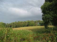 Birchenhill Wood, Hatherton |
|
 Hatherton |
|
| Population | 360 (2011) |
|---|---|
| OS grid reference | SJ687474 |
| Civil parish | Hatherton |
| Unitary authority | Cheshire East |
| Ceremonial county | Cheshire |
| Region | North West |
| Country | England |
| Sovereign state | United Kingdom |
| Post town | NANTWICH |
| Postcode district | CW5 |
| Dialling code | 01270 |
| Police | Cheshire |
| Fire | Cheshire |
| Ambulance | North West |
| EU Parliament | North West England |
| UK Parliament | Crewe and Nantwich |
Coordinates: 53°01′19″N 2°28′05″W / 53.022°N 2.468°W
Hatherton is a hamlet (at SJ687474) and civil parish in the unitary authority of Cheshire East and the ceremonial county of Cheshire, England. The hamlet is located 2¾ miles to the north east of Audlem and 3¾ miles to the south east of Nantwich. The parish also includes the small settlements of Birchall Moss, Broomlands and part of Artlebrook.[1] Nearby villages include Hankelow, Stapeley, Walgherton and Wybunbury. According to the 2001 Census, Hatherton civil parish had a population of 344,[2] increasing to 360 at the 2011 Census.[3]
Governance
Hatherton is administered jointly with the adjacent parish of Walgherton by Hatherton & Walgherton Parish Council.[4] From 1974 the civil parish was served by Crewe and Nantwich Borough Council, which was succeeded on 1 April 2009 by the unitary authority of Cheshire East.[5] Hatherton falls in the parliamentary constituency of Crewe and Nantwich,[6] which has been represented by Edward Timpson since a by-election in 2008.
Geography and transport
The A529 road runs north–south through the parish and the B5071 runs to the north-east from the A529 junction at Oakes Corner. The River Weaver runs north–south near the western boundary of the parish, and the area has several small meres. The parish also contains several small areas of deciduous and mixed woodland, including Birchall Moss.
See also
References
- ↑ "Cheshire Towns & Parishes: Hatherton". GENUKI UK & Ireland Genealogy. Retrieved 14 August 2007.
- ↑ "2001 Census: Hatherton CP". Office for National Statistics. Retrieved 14 August 2007.
- ↑ "Civil Parish population 2011". Neighbourhood Statistics. Office for National Statistics. Retrieved 16 March 2016.
- ↑ Hatherton & Walgherton Parish Council, Cheshire East Council, retrieved 21 October 2016
- ↑ Cheshire (Structural Changes) Order 2008
- ↑ Cheshire County Council: Interactive Mapping: Crewe and Nantwich (accessed 27 January 2009)
External links
![]() Media related to Hatherton, Cheshire at Wikimedia Commons
Media related to Hatherton, Cheshire at Wikimedia Commons
Cheshire Portal | |
| Unitary authorities | |
| Major settlements | |
| Rivers | |
| Topics | |