Interstate 90 in Montana
| ||||
|---|---|---|---|---|
| Riverbend North | ||||
_map.svg.png) | ||||
| Route information | ||||
| Maintained by MDT | ||||
| Length: | 554.10 mi[1] (891.74 km) | |||
| Major junctions | ||||
| West end: |
| |||
| East end: |
| |||
| Location | ||||
| Counties: | Mineral, Missoula, Granite, Powell, Deer Lodge, Silver Bow, Jefferson, Broadwater, Gallatin, Park, Sweet Grass, Stillwater, Yellowstone, Big Horn | |||
| Highway system | ||||
| ||||
.svg.png)
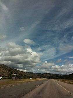
Interstate 90 in Montana (I-90) is a portion of the east–west transcontinental Interstate 90, which links Seattle, Washington to Boston, Massachusetts. The portion in the US state of Montana is 554.10 miles (891.74 km) long, linking fourteen counties through central and southern Montana.
Route description
Mineral County
Interstate 90 enters Montana and Mineral County from Shoshone County, Idaho over the 4,725-foot (1,440 m) high Lookout Pass, which traverses the Coeur d'Alène Mountains of the Bitterroot Range, and immediately has its first interchange, a partial cloverleaf serving extreme northwest Mineral County. The highway continues southeasterly through woodlands, paralleling the St. Regis River, before meeting the Dena Mora (Lookout Pass) rest area 4.7 mi (7.6 km) east of the Idaho–Montana border.[2] About a 1⁄2 mi (0.80 km) from the rest stop is a diamond interchange, serving a small minor road into the St. Joe National Forest in Idaho. The highway continues, winding through the woodlands until another diamond interchange, serving the small unincorporated community of Saltese. Continuing east for about 6 mi (9.7 km), each direction diverges for a small distance before returning side to side for a diamond interchange serving the unincorporated community of Haugan.[3][4]
Two miles (3.22 km) after Haugan, I-90 intersects the census-designated place (CDP) of De Borgia, continuing southeasterly, intersecting several minor roads, before reaching the CDP of St. Regis and Montana Highway 135 (MT 135). The highway stops paralleling the St. Regis River, and begins to parallel, and cross over several times, the Clark Fork River. Superior, the county seat, is intersected before the highway turns south through the Quartz Flats rest area, located 58.2 mi (93.7 km) from the Idaho border.[2] After leaving the rest area, the highway straightens out, heading easterly. The highway continues east before exiting the county, just south of Alberton.[3][4]
Missoula, Granite and Powell counties
Entering Missoula County, the highway intersects Alberton, before continuing easterly through Huson and MT 263. The highway continues southeast before intersecting the concurrent highways U.S. Route 93 (US 93) and MT 200, which join I-90 from the west. The three highways continue into the county seat of Missoula, where at the first exit, US 93 leaves on the western border of Missoula and travels through Orchard Homes. The next two exits travel into downtown Missoula, while the last exit serves East Missoula. US 12 joins I-90 and MT 200 exits to the north of the highway outside of Missoula, paralleling the Blackfoot River as I-90 continues east, following and then intersecting Montana Secondary Highway 210 (S-210) in Clinton. The Bearmouth rest area, 142.8 mi (229.8 km) from the Idaho border, is intersected before crossing the Missoula–Granite County border.[2][3][4]
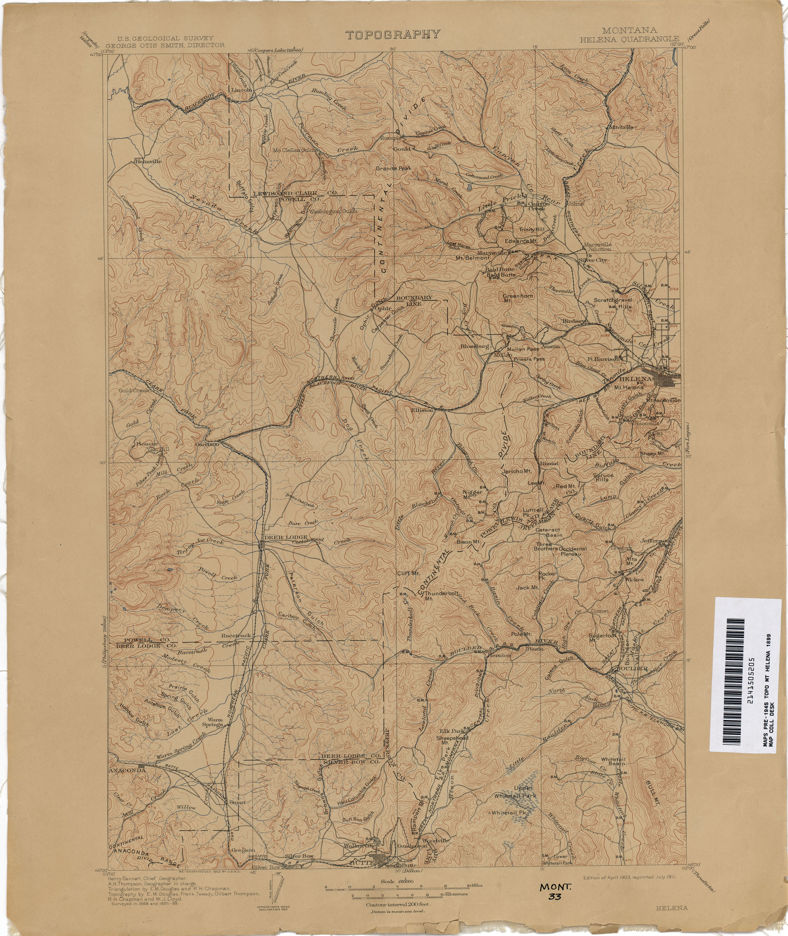
After entering Granite County, I-90 has an interchange with an access road to the Garnet Back Country Byway,[5] providing access to the Garnet Range on the west slope of the Rocky Mountains. The highway passes north of the Lolo National Forest while headed easterly. The highway continues through northern Granite county, intersecting MT 1 before exiting the county entering Powell County. Thirteen miles (29.92 km) after entering the county, I-90 intersects MT 272, which clips the eastern segment of the Lolo National Forest, before the seasonal Gold Creek rest area is intersected.[2] Garrison is northeast of the highway as US 12 ends its concurrency, traveling north from I-90 towards the state capital of Helena. I-90 turns south, paralleling former Northern Pacific Railway trackage,[6] before intersecting S-275 and the county seat, Deer Lodge. Continuing south, I90 exits Powell County at Race Track.[3][4]
Deer Lodge, Silver Bow and Jefferson counties
Interstate 90 bisects the northern tip of Deer Lodge County, in a southwesterly direction. Galen and S-273 are intersected, before the highway passes west of the Warm Springs State Wildlife Management Area. After passing the wildlife management area, the highway passes by Warm Springs and MT 48. Just northwest of the Deer Lodge–Silver Bow County border, I-90 intersects MT 1.[3][4]
Fairmont Hot Springs, accessible via S-441 is the first exit in Silver Bow County on I-90, as the highway starts to turn back towards the east. Ramsay is located in the southwest corner of the interchange where I-15 becomes concurrent with I-90 through Butte. On the western edge of Butte, I-115 continues east into town, as I-15/90 turns southeast, bypassing most of downtown Butte. An interchange with MT 2 serves the Bert Mooney Airport before I-15/90 split just east of Butte, with I-15 continuing north over the Continental Divide over the 6,368-foot (1,941 m) high Elk Park Pass, which straddles the Silver Bow–Jefferson County border. I-90 heads south then east, also entering Jefferson County, passing over the divide at Homestake Pass which is 6,375-foot (1,943 m) high. Jefferson County has interchanges with S-399 east of Pipestone and S-359 east of Cardwell before meeting the Jefferson–Broadwater County border.[3][4]
Broadwater, Gallatin and Park counties

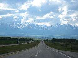
There is only one exit along I-90 in Broadwater County, linking MT 2 in the south and US 287 north of the highway before crossing the Broadwater–Gallatin County border at the Missouri River. I-90 parallels S-205, bypassing the towns of Trident, Logan, Manhattan and Belgrade on the north of the highway. A new interchange was constructed just east of Belgrade (Exit #299?)that services Yellowstone International Airport to the north and the western area of the city of Bozeman. MT 85 travels south from I-90 in Belgrade, providing access to Bozeman Hot Springs. The highway then enters the city of Bozeman, the county seat, and intersects and becomes concurrent with US 191. Intersecting and traveling north from I-90 is MT 86 providing access to Bridger Bowl Ski Area. I-90 exits the county at the Gallatin–Park County border at 5,760-foot (1,760 m) high Bozeman Pass. US 89 intersects I-90 in the county seat of Livingston, and passing over the Yellowstone River. The highway continues northeasterly, paralleling the river, intersecting S-295 before crossing the Park–Sweet Grass County border.[3][4]
Sweet Grass and Stillwater counties
Still paralleling the Yellowstone River, I-90 travels northwest intersecting S-298 and US 191 in the county seat of Big Timber. The highway turns back southeast, passing south of Greycliff and the Greycliff rest area, located 380.9 mi (613.0 km) from the Idaho border.[2] The highway passes through the Sweet Grass–Stillwater County border just west of Reed Point. After passing into Stillwater County, I-90 crosses over the river, and enters the county seat of Columbus, intersecting MT 78 south of the highway and S-306 on the north side of the highway. The highway is titled the Robert E. Ewing Jr. Memorial Highway between mileposts 410 and 424.[7] I-90 intersects the Columbus rest area, 418.8 mi (674.0 km) from the Idaho border,[2] followed by Park City before exiting Stillwater County.[3][4]
Yellowstone and Big Horn counties
US 212 becomes concurrent with I-90 just east of Laurel before entering the county seat of Billings. I-90 Bus. passes into town as the main freeway travels south of Billings and bisects Billings Heights and Lockwood intersecting MT 3 and US 87, which joins the I-90/US 212 concurrency. On the extreme eastern end of Billings, the three highways intersect the beginning of I-94, which heads northeast towards North Dakota, while I-90 turns southeast into Big Horn County. Immediately after entering Big Horn County the three highways pass the seasonal Hardin rest area.[2] Entering Hardin, the county seat, the three highways intersect S-313 and MT 47. S-313 provides access to Yellowtail Dam, while MT 47 connects back to I-94. After exiting Hardin, I-90 turns south, entering the Crow Indian Reservation and intersects S-384, before reaching Crow Agency. Crow Agency is home to the Little Bighorn Battlefield National Monument and Reno–Benteen Battlefield Memorial, which are passed after US 212 departs to the east. Continuing south, I-90/US 87 parallels S-451 and the Little Bighorn River, passing by Garryowen, Benteen, Lodge Grass and Wyola before exiting the state of Montana and entering Sheridan County, Wyoming.[3][4]
Expansion of the Billings area corridor
The 2012 Billings area I-90 corridor planning study recommends many improvements to the corridor from Laurel through Lockwood, including construction of new east and westbound bridges over the Yellowstone River, with each bridge having three to four traffic lanes. Also recommended are construction of additional eastbound and westbound traffic lanes from Shiloh to Johnson Lane and reconstruction and widening of many of the bridges, interchanges and on-off ramps along the corridor at an estimated cost of $114 million.[8]
History
Interstate 90 replaced US 10 between Livingston and the Idaho border,[9] and before that, the Yellowstone Trail.[10]
Until 1995 in Montana near the Idaho border, I-90 was not a divided highway for a few stretches, having only a narrow paved median. From 1995 until 1999, the daytime maximum speed limit in Montana was "reasonable and prudent." As of October 1, 2015 the daytime and nighttime speed limits on Interstate Highways are 80 miles per hour (130 km/h) for cars and light trucks and 65 miles per hour (105 km/h) for heavy trucks, except within urban areas, where the maximum speed limit is 65 mph for all vehicles, day or night. [11][12] According to an article in the Missoulian, dated September 28, 2015, "drivers headed east from Idaho on I-90 will be restricted to 75 mph for the first 34 miles, from Lookout Pass to just east of St. Regis. After St. Regis, there’ll be an 80 mph limit for the next 60 miles past Superior, Alberton and Frenchtown. The 20-mile zone around Missoula starts a couple of miles west of the Wye, where it drops to 75. That decreases to 65 mph within the Missoula urban area, then it becomes 75 again near the eastbound East Missoula on-ramp. The 80 mph stretch resumes roughly seven miles later at Turah and remains in place to Butte, where the speed limit remains at 65 mph." [13]
On I-90, at Exit 0 (right on the MT/ID border) is the Lookout Pass Ski Area, and one exit east of there is the Hiawatha Trail (rails-to-trails).
In 1996, a section of I-90 was closed for nineteen days due to a train derailment and chlorine spill near Alberton, Montana.[14]
Exit list
| County | Location | mi[15] | km | Exit | Destinations | Notes |
|---|---|---|---|---|---|---|
| Mineral | | 0.000 | 0.000 | Continuation into Idaho | ||
| | 0.077 | 0.124 | 0 | Lookout Pass | ||
| | 5.580 | 8.980 | 5 | Taft Area | ||
| | 10.418 | 16.766 | 10 | Saltese | ||
| | 16.541 | 26.620 | 16 | Haugan | ||
| | 18.752 | 30.178 | 18 | De Borgia | ||
| | 21.820 | 35.116 | 22 | Henderson | ||
| | 25.216 | 40.581 | 25 | Drexel | ||
| | 26.207 | 42.176 | 26 | Ward Creek Road | Eastbound exit and entrance | |
| | 29.940 | 48.184 | 30 | Two Mile Road | ||
| | 33.240 | 53.495 | 33 | |||
| | 37.016 | 59.571 | 37 | Sloway Area | ||
| | 42.247 | 67.990 | 43 | Dry Creek Road | ||
| Superior | 46.751 | 75.238 | 47 | |||
| | 54.653 | 87.955 | 55 | Lozeau, Quartz | ||
| | 60.971 | 98.123 | 61 | Tarkio | ||
| | 64.818– 65.565 | 104.314– 105.517 | 65 | Crystal Springs | ||
| | 66.055 | 106.305 | 66 | Fish Creek Road | ||
| | 69.483 | 111.822 | 70 | Cyr | Westbound exit and eastbound entrance | |
| Alberton | 74.328 | 119.619 | 75 | |||
| Missoula | | 76.809 | 123.612 | 77 | ||
| | 81.765 | 131.588 | 82 | Nine Mile Road | ||
| | 84.325 | 135.708 | 85 | Huson | ||
| | 88.888 | 143.051 | 89 | Frenchtown | ||
| Wye | 95.483 | 153.665 | 96 | West end of US 93 / MT 200 overlap | ||
| | 99.091 | 159.472 | 99 | Airway Boulevard | ||
| Missoula | 100.867 | 162.330 | 101 | East end of US 93 overlap | ||
| 103.930 | 167.259 | 104 | Orange Street | |||
| 104.794 | 168.650 | 105 | West end of US 12 overlap | |||
| 106.419 | 171.265 | 107 | East Missoula | |||
| | 109.634 | 176.439 | 109 | East end of MT 200 overlap | ||
| | 113.519 | 182.691 | 113 | Turah | ||
| | 120.423 | 193.802 | 120 | Clinton | ||
| | 125.475 | 201.932 | 126 | Rock Creek Road | ||
| | 129.868 | 209.002 | 130 | Beavertail Road | ||
| Granite | | 137.524 | 221.323 | 138 | Bearmouth Area | |
| Drummond | 152.802 | 245.911 | 153 | Eastbound exit and westbound entrance | ||
| 153.727 | 247.400 | 154 | Westbound exit and eastbound entrance | |||
| Powell | | 161.637 | 260.130 | 162 | Jens | |
| | 165.360 | 266.121 | 166 | Gold Creek | ||
| | 169.327 | 272.505 | 170 | Phosphate | ||
| | 173.471 | 279.175 | 174 | East end of US 12 overlap; Eastbound exit and westbound entrance | ||
| | 174.656 | 281.082 | 175 | No westbound entrance | ||
| | 178.245 | 286.858 | 179 | Beck Hill Road | ||
| Deer Lodge | 183.625 | 295.516 | 184 | |||
| | 186.640 | 300.368 | 187 | No westbound entrance | ||
| | 193.861 | 311.989 | 195 | Racetrack | ||
| Deer Lodge | | 196.271 | 315.868 | 197 | ||
| | 200.264 | 322.294 | 201 | Warm Springs | ||
| | 206.336 | 332.066 | 208 | |||
| Silver Bow | | 209.806 | 337.650 | 211 | ||
| | 214.860 | 345.784 | 216 | Ramsay | ||
| | 217.337 | 349.770 | 219 | West end of I-15 overlap; I-15 exit 121; exits in the I-15 overlap follow I-15 | ||
| | 218.408 | 351.494 | 122 | Rocker | ||
| Butte | 220.237 | 354.437 | 124 | Eastbound exit and westbound entrance | ||
| 222.263 | 357.698 | 126 | Montana Street | |||
| 223.883 | 360.305 | 127 | Signed as exits 127A and 127B eastbound; I-15 Bus./I-90 Bus. not signed eastbound | |||
| 224.933 | 361.995 | 227 | East end of I-15 overlap; I-15 exit 129 | |||
| | 226.785 | 364.975 | 228 | Continental Drive | ||
| | 231.425 | 372.442 | 233 | Homestake | ||
| Jefferson | | 240.144 | 386.474 | 241 | Pipestone | |
| Whitehall | 247.203 | 397.835 | 249 | |||
| | 254.472 | 409.533 | 256 | |||
| | 265.878 | 427.889 | 267 | Milligan Canyon Road | ||
| Broadwater | | 272.975 | 439.311 | 274 | ||
| Gallatin | | 276.514 | 445.006 | 278 | ||
| | 281.447 | 452.945 | 283 | Logan, Trident | ||
| | 286.871 | 461.674 | 288 | |||
| Belgrade | 296.474 | 477.129 | 298 | |||
| Bozeman | 303.434 | 488.330 | 305 | |||
| 305.084 | 490.985 | 306 | ||||
| 307.568 | 494.983 | 309 | West end of US 191 overlap | |||
| | 311.207 | 500.839 | 313 | Bear Canyon Road | ||
| | 314.528 | 506.184 | 316 | Trail Creek Road | ||
| | 317.428 | 510.851 | 319 | Jackson Creek Road | ||
| | 322.387 | 518.832 | 324 | Ranch Access | ||
| Park | | 328.850 | 529.233 | 330 | ||
| Livingston | 330.804 | 532.377 | 333 | West end of US 89 overlap | ||
| | 335.752 | 540.340 | 337 | |||
| | 338.282 | 544.412 | 340 | East end of US 89 overlap | ||
| | 341.144 | 549.018 | 343 | Mission Creek Road | ||
| | 348.308 | 560.547 | 350 | East End Access | ||
| | 350.562 | 564.175 | 352 | Ranch Access | ||
| Sweet Grass | | 352.169 | 566.761 | 354 | ||
| | 359.952 | 579.287 | 362 | De Hart | ||
| | 365.541 | 588.281 | 367 | East end of US 191 overlap | ||
| | 368.691 | 593.351 | 370 | |||
| | 375.932 | 605.004 | 377 | Greycliff | ||
| | 382.929 | 616.264 | 384 | Bridger Creek Road | ||
| Stillwater | | 390.017 | 627.672 | 392 | Reed Point | |
| | 394.893 | 635.519 | 396 | Ranch Access | ||
| | 398.526 | 641.365 | 400 | Springtime Road | ||
| | 406.813 | 654.702 | 408 | |||
| | 424.583 | 683.300 | 426 | Park City | ||
| Yellowstone | Laurel | 430.920 | 693.499 | 433 | Eastbound exit and westbound entrance | |
| 432.039 | 695.299 | 434 | West end of US 212 overlap | |||
| 435.439 | 700.771 | 437 | ||||
| Billings | 441.444 | 710.435 | 443 | Zoo Drive, Shiloh Road | ||
| 443.910 | 714.404 | 446 | ||||
| 445.150 | 716.399 | 447 | South Billings Boulevard – Billings City Center | |||
| 448.056 | 721.076 | 450 | ||||
| 450.817 | 725.520 | 452 | West end of US 87 overlap | |||
| 453.263 | 729.456 | 455 | Johnson Lane – Lockwood | |||
| 454.264 | 731.067 | 456 | I-94 west to 90 east exit 0. | |||
| | 460.132 | 740.511 | 462 | Pryor Creek Road | ||
| | 467.594 | 752.520 | 469 | Arrow Creek Road | ||
| Big Horn | | 476.564 | 766.955 | 478 | Fly Creek Road | |
| | 482.327 | 776.230 | 484 | Frontage Road – Toluca | ||
| Hardin | 493.863 | 794.795 | 495 | |||
| | 495.455 | 797.358 | 497 | |||
| | 501.149 | 806.521 | 503 | Dunmore | ||
| | 507.093 | 816.087 | 509 | Crow Agency | ||
| | 508.758 | 818.767 | 510 | East end of US 212 overlap | ||
| | 512.638 | 825.011 | 514 | Garryowen | ||
| | 528.564 | 850.641 | 530 | |||
| | 541.924 | 872.142 | 544 | Wyola | ||
| | 547.796 | 881.592 | 549 | Aberdeen | ||
| | 554.105 | 891.746 | Continuation into Wyoming | |||
1.000 mi = 1.609 km; 1.000 km = 0.621 mi
| ||||||
References
- Meeks, Harold (November 2000). On the road to Yellowstone: the Yellowstone Trail and American highways, 1900–1930. Missoula, Mont,: Pictoral Histories Publishing Company, Inc. ISBN 1-57510-079-7.
- ↑ "Table 1: Main Routes of the Dwight D. Eisenhower National System Of Interstate and Defense Highways". Route Log and Finder List. Federal Highway Administration. October 31, 2002. Retrieved November 8, 2010.
- 1 2 3 4 5 6 7 Montana Rest Areas (Map). Cartography by Google, Inc. Montana Department of Transportation. Retrieved November 8, 2010.
- 1 2 3 4 5 6 7 8 9 The Road Atlas (Map). 1 in ˜ 30 mi. Cartography by Rand McNally. Rand McNally. 2009. p. 60–61. ISBN 978-0-528-94219-8.
- 1 2 3 4 5 6 7 8 9 Montana Highway Map (PDF) (Map). Montana Department of Transportation. 2009.
- ↑ "Garnet Back Country Byway". National Scenic Byways Program. Federal Highway Administration. Retrieved November 9, 2010.
- ↑ Helena Quadrangle (Map). 1:250,000. United States Geological Survey. April 1903. Retrieved November 9, 2010.
- ↑ "60-1-213. Robert E. Ewing Jr. memorial highway.". Montana Code Annotated 2009. Montana Legislature. 2007. Retrieved November 10, 2010.
- ↑ "BILLINGS AREA I-90 CORRIDOR PLANNING STUDY". Retrieved 2013-01-29.
- ↑ Meeks, p. 127
- ↑ Junior Road Map – Montana (Map). Rand McNally. 1926.
- ↑ http://www.mdt.mt.gov/visionzero/roads/speedlimits.shtml
- ↑ MIKE DENNISON
Gazette State Bureau (May 5, 2015). "New law will increase some highway speed limits to 80 mph". The Billings Gazette. line feed character in
|author=at position 14 (help) - ↑ http://missoulian.com/news/local/mph-speed-limit-to-increase-on-most-but-not-all/article_129da926-1e62-5665-a86a-d8a8f5b06832.html
- ↑ Kato, Dillon. "Workshop Uses 1996 Alberton Chlorine Spill to Teach Emergency Management.” Missoulian, May 3, 2015.
- ↑ "Montana Road Log" (PDF). Montana Department of Transportation. 2013. pp. 9–18. Retrieved April 4, 2015.
| Previous state: Idaho |
Montana | Next state: Wyoming |