Jones, Oklahoma
| Jones, Oklahoma | |
|---|---|
| Town | |
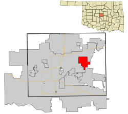 Location in Oklahoma County and the state of Oklahoma. | |
| Coordinates: 35°33′52″N 97°17′27″W / 35.56444°N 97.29083°WCoordinates: 35°33′52″N 97°17′27″W / 35.56444°N 97.29083°W | |
| Country | United States |
| State | Oklahoma |
| County | Oklahoma |
| Area | |
| • Total | 13.7 sq mi (35.4 km2) |
| • Land | 13.7 sq mi (35.4 km2) |
| • Water | 0.0 sq mi (0.0 km2) |
| Elevation | 1,115 ft (340 m) |
| Population (2000) | |
| • Total | 2,517 |
| • Density | 184.2/sq mi (71.1/km2) |
| Time zone | Central (CST) (UTC-6) |
| • Summer (DST) | CDT (UTC-5) |
| ZIP code | 73049 |
| Area code(s) | 405 |
| FIPS code | 40-38350[1] |
| GNIS feature ID | 1094256[2] |
| Website | Town of Jones City |
Jones is a town in Oklahoma County, Oklahoma, and a part of the Oklahoma City Metropolitan Area. The population was 2,517 at the 2000 census.
History
Early history
Originally known as Glaze, Jones was platted as a townsite on April 22, 1898 by Luther F. Aldrich before the St. Louis and Oklahoma City Railroad constructed a line from Sapulpa to Oklahoma City. Aldrich named the town after his friend and business associate, Charles G. "Gristmill" Jones who was a three-time mayor of Oklahoma City. Jones later named his eldest son Luther.[3]
Jones is located just south of the place that Washington Irving described as "The Ringing of Horses" in the book A Tour on the Prairies (1835)[3]
Jones was incorporated as a city on January 4, 1909. The 1910 Census counted the population at 163.[3]
2007 Ice storm and Jones High School fire
In December 2007, a devastating ice storm hit much of Oklahoma. It resulted in a fire at Jones High School, causing the school to burn to the ground. The new school was finished in 2010, after taking three years to build. The new school has a commons area and a theatre for drama club.
Earthquakes
On August 27, 2009 there were six earthquakes, the strongest of which registering a 3.7 magnitude on the Richter Scale, which occurred at 9:09pm Central Standard Time.
On January 15, 2010 there were four earthquakes, the strongest of which registering a 4.0 magnitude on the Richter Scale, which occurred at 9:25am Central Standard Time.[4]
On January 24, 2010 a magnitude 3.7 earthquake struck Jones at 1:15am Central Standard Time.[5][6]
On February 27, 2010 a magnitude 4.1 earthquake struck east of Oklahoma City at 4:22 pm Central Standard Time,[7] preceded by a foreshock of magnitude 3.1 farther west on February 26 at 3:02 am local time.[8]
On October 13, 2010 a 4.7 magnitude earthquake hit 10 miles (16 km) east of Norman Oklahoma at 9:06 A.M.[9]
Geography
Jones is located at 35°33′52″N 97°17′27″W / 35.56444°N 97.29083°W (35.564510, -97.290860).[10]
According to the United States Census Bureau, the town has a total area of 13.7 square miles (35 km2), all of it land.
Demographics
| Historical population | |||
|---|---|---|---|
| Census | Pop. | %± | |
| 1910 | 163 | — | |
| 1920 | 214 | 31.3% | |
| 1930 | 288 | 34.6% | |
| 1940 | 260 | −9.7% | |
| 1950 | 476 | 83.1% | |
| 1960 | 794 | 66.8% | |
| 1970 | 1,666 | 109.8% | |
| 1980 | 2,270 | 36.3% | |
| 1990 | 2,424 | 6.8% | |
| 2000 | 2,517 | 3.8% | |
| 2010 | 2,692 | 7.0% | |
| Est. 2015 | 2,948 | [11] | 9.5% |
As of the census[1] of 2000, there were 2,517 people, 914 households, and 673 families residing in the town. The population density was 184.2 people per square mile (71.1/km²). There were 986 housing units at an average density of 72.2 per square mile (27.9/km²). The racial makeup of the town was 88.16% White, 4.41% African American, 3.34% Native American, 0.16% Asian, 0.60% from other races, and 3.34% from two or more races. Hispanic or Latino of any race were 2.94% of the population.
There were 914 households out of which 34.7% had children under the age of 18 living with them, 57.9% were married couples living together, 11.5% had a female householder with no husband present, and 26.3% were non-families. 22.4% of all households were made up of individuals and 9.0% had someone living alone who was 65 years of age or older. The average household size was 2.61 and the average family size was 3.04.
In the town the population was spread out with 25.0% under the age of 18, 9.3% from 18 to 24, 27.5% from 25 to 44, 24.5% from 45 to 64, and 13.7% who were 65 years of age or older. The median age was 38 years. For every 100 females there were 97.9 males. For every 100 females age 18 and over, there were 96.8 males.
The median income for a household in the town was $36,806, and the median income for a family was $41,495. Males had a median income of $31,406 versus $23,393 for females. The per capita income for the town was $16,388. About 9.5% of families and 13.6% of the population were below the poverty line, including 16.6% of those under age 18 and 13.4% of those age 65 or over.
References
- 1 2 "American FactFinder". United States Census Bureau. Retrieved 2008-01-31.
- ↑ "US Board on Geographic Names". United States Geological Survey. 2007-10-25. Retrieved 2008-01-31.
- 1 2 3 Hedglen, Thomas L. "Jones," Encyclopedia of Oklahoma History and Culture, Oklahoma Historical Society. Accessed June 2, 2016.
- ↑ "M4.0 – Oklahoma". United States Geological Survey. Retrieved 6 November 2011.
- ↑ "Another small earthquake shakes eastern Oklahoma County". NewsOK. Retrieved 6 November 2011.
- ↑ "M3.7 – Oklahoma". United States Geological Survey. Retrieved 6 November 2011.
- ↑ "M4.1 – Oklahoma". United States Geological Survey. Retrieved 6 November 2011.
- ↑ "M3.1 – Oklahoma". United States Geological Survey. Retrieved 6 November 2011.
- ↑ Kimball, Michael. "Oklahoma earthquake: State survey lowers magnitude to 4.7". NewsOK. Retrieved 19 November 2010.
- ↑ "US Gazetteer files: 2010, 2000, and 1990". United States Census Bureau. 2011-02-12. Retrieved 2011-04-23.
- ↑ "Annual Estimates of the Resident Population for Incorporated Places: April 1, 2010 to July 1, 2015". Retrieved July 2, 2016.
- ↑ "Census of Population and Housing". Census.gov. Retrieved June 4, 2015.
External links
Municipalities and communities of Oklahoma County, Oklahoma, United States | ||
|---|---|---|
| Cities | 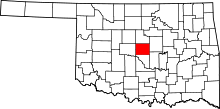 | |
| Towns | ||
| Unincorporated communities | ||
| Footnotes | ‡This populated place also has portions in an adjacent county or counties | |