Spencer, Oklahoma
| Spencer, Oklahoma | |
|---|---|
| City | |
 Location in Oklahoma County and the state of Oklahoma. | |
| Coordinates: 35°30′28″N 97°22′14″W / 35.50778°N 97.37056°WCoordinates: 35°30′28″N 97°22′14″W / 35.50778°N 97.37056°W | |
| Country | United States |
| State | Oklahoma |
| County | Oklahoma |
| Area | |
| • Total | 5.3 sq mi (13.8 km2) |
| • Land | 5.3 sq mi (13.8 km2) |
| • Water | 0.0 sq mi (0.0 km2) |
| Elevation | 1,198 ft (365 m) |
| Population (2000) | |
| • Total | 3,746 |
| • Density | 701.0/sq mi (270.7/km2) |
| Time zone | Central (CST) (UTC-6) |
| • Summer (DST) | CDT (UTC-5) |
| ZIP code | 73084 |
| Area code(s) | 405 |
| FIPS code | 40-69200[1] |
| GNIS feature ID | 1098350[2] |
Spencer is a city in Oklahoma County, Oklahoma, United States, and a part of the Oklahoma City metropolitan area. The population was 3,746 at the 2000 census.
Established in 1903, the City of Spencer is a historic community located just east of the North Canadian River.[3] Spencer is approximately ten miles from downtown Oklahoma City and borders the City of Nicoma Park to the east and the City of Midwest City to the south.
Contributing to the cultural fabric of Spencer are the Spencer Chamber of Commerce, the Spencer Garden Club, and the Spencer Historical Society.[3]
History
The region where Spencer was developed was opened to settlement in the Land Run of 1889.[4] Louis F. and Henry W. Kramer, businessmen originally from Spencer County, Indiana, who first arrived in Guthrie in 1889 and then to Oklahoma City.[4]
Originally an agricultural area, Spencer grew after World War II with the nearby General Motors Assembly Plant and Tinker Air Force Base offering employment.[4]
CPN Riley L. Pitts, the first black commissioned officer to receive the Medal of Honor, is buried in Spencer's Hillcrest Memory Gardens. Captain Pitts was a graduate of Wichita University (now Wichita State University.)
Geography
Spencer is located at 35°30′28″N 97°22′14″W / 35.50778°N 97.37056°W (35.507760, -97.370662).[5]
According to the United States Census Bureau, the city has a total area of 5.3 square miles (14 km2), all of it land.
Demographics
| Historical population | |||
|---|---|---|---|
| Census | Pop. | %± | |
| 1960 | 1,189 | — | |
| 1970 | 3,714 | 212.4% | |
| 1980 | 4,064 | 9.4% | |
| 1990 | 3,972 | −2.3% | |
| 2000 | 3,746 | −5.7% | |
| 2010 | 3,912 | 4.4% | |
| Est. 2015 | 4,027 | [6] | 2.9% |
As of the census[1] of 2000, there were 3,746 people, 1,420 households, and 1,002 families residing in the city. The population density was 701.0 people per square mile (270.9/km²). There were 1,567 housing units at an average density of 293.3 per square mile (113.3/km²). The racial makeup of the city was 39.94% White, 51.82% African American, 2.83% Native American, 0.35% Asian, 0.05% Pacific Islander, 0.51% from other races, and 4.51% from two or more races. Hispanic or Latino of any race were 2.32% of the population.
There were 1,420 households out of which 29.4% had children under the age of 18 living with them, 47.0% were married couples living together, 17.8% had a female householder with no husband present, and 29.4% were non-families. 26.1% of all households were made up of individuals and 11.5% had someone living alone who was 65 years of age or older. The average household size was 2.59 and the average family size was 3.09.
In the city the population was spread out with 28.8% under the age of 18, 7.8% from 18 to 24, 24.2% from 25 to 44, 24.1% from 45 to 64, and 15.1% who were 65 years of age or older. The median age was 38 years. For every 100 females there were 94.6 males. For every 100 females age 18 and over, there were 88.4 males.
The median income for a household in the city was $31,116, and the median income for a family was $37,470. Males had a median income of $30,199 versus $21,153 for females. The per capita income for the city was $18,242. About 15.0% of families and 19.1% of the population were below the poverty line, including 33.3% of those under age 18 and 11.2% of those age 65 or over.
References
- 1 2 "American FactFinder". United States Census Bureau. Retrieved 2008-01-31.
- ↑ "US Board on Geographic Names". United States Geological Survey. 2007-10-25. Retrieved 2008-01-31.
- 1 2 City of Spencer. (accessed January 20, 2010)
- 1 2 3 Everett, Dianna. Spencer, Encyclopedia of Oklahoma History and Culture. (accessed January 20, 2010)
- ↑ "US Gazetteer files: 2010, 2000, and 1990". United States Census Bureau. 2011-02-12. Retrieved 2011-04-23.
- ↑ "Annual Estimates of the Resident Population for Incorporated Places: April 1, 2010 to July 1, 2015". Retrieved July 2, 2016.
- ↑ "Census of Population and Housing". Census.gov. Retrieved June 4, 2015.
Municipalities and communities of Oklahoma County, Oklahoma, United States | ||
|---|---|---|
| Cities | 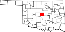 | |
| Towns | ||
| Unincorporated communities | ||
| Footnotes | ‡This populated place also has portions in an adjacent county or counties | |