Union City, Oklahoma
| Union City, Oklahoma | |
|---|---|
| Town | |
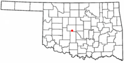 Location of Union City, Oklahoma | |
| Coordinates: 35°24′49″N 97°54′38″W / 35.41361°N 97.91056°WCoordinates: 35°24′49″N 97°54′38″W / 35.41361°N 97.91056°W | |
| Country | United States |
| State | Oklahoma |
| County | Canadian |
| Area | |
| • Total | 57.1 sq mi (147.8 km2) |
| • Land | 56.6 sq mi (146.6 km2) |
| • Water | 0.5 sq mi (1.2 km2) |
| Elevation | 1,322 ft (403 m) |
| Population (2010)[1] | |
| • Total | 1,645 |
| • Density | 29/sq mi (11.2/km2) |
| Time zone | Central (CST) (UTC-6) |
| • Summer (DST) | CDT (UTC-5) |
| ZIP code | 73090 [2] |
| Area code(s) | 405, exchange 483 |
| FIPS code | 40-75950 [3] |
| GNIS feature ID | 1099162 [4] |
| Website |
ucok1884 |
Union City is a town in Canadian County, Oklahoma, United States. The population was 1,645 at the 2010 census, a 19.6 percent increase from 1,375 at the 2000 census.[5] It is part of the Oklahoma City Metropolitan Statistical Area.
History
In 1889, a post office opened for the community of Union. A townsite plat was filed during the following year. Union City began in 1890 with the arrival of the Chicago, Kansas and Nebraska Railway (acquired by the Chicago, Rock Island and Pacific Railroad in 1891). The local economy was based on agriculture, and within four years the town had three grain elevators and a farm machinery dealership.[6]
1973 tornado
On May 24, 1973, a tornado rated F4 struck the Union City area and was the first tornado widely documented by science as part of storm chasing field research. NSSL out of Norman, Oklahoma placed numerous storm chasers around it to capture the life cycle on film.[7]
Geography
Union City is located in southern Canadian County at 35°24′49″N 97°54′38″W / 35.41361°N 97.91056°W (35.413582, -97.910634).[8] It is bordered to the east by Oklahoma City, to the north in part by El Reno, and to the south by Grady County, including the town of Minco. The Canadian River forms the county line and the southern boundary of Union City.
U.S. Route 81 passes through the center of the town, leading north 7.5 miles (12.1 km) to Interstate 40 and 10 miles (16 km) to El Reno, while leading south 6 miles (10 km) to Minco. Oklahoma State Highway 152 leads east from Union City 12 miles (19 km) to Mustang. Downtown Oklahoma City is 28 miles (45 km) to the east.
According to the United States Census Bureau, the town of Union City has a total area of 57.1 square miles (147.8 km2). 56.6 square miles (146.6 km2) of it is land, and 0.46 square miles (1.2 km2) of it (0.83%) is water.[9]
Demographics
| Historical population | |||
|---|---|---|---|
| Census | Pop. | %± | |
| 1950 | 301 | — | |
| 1960 | 329 | 9.3% | |
| 1970 | 300 | −8.8% | |
| 1980 | 558 | 86.0% | |
| 1990 | 1,000 | 79.2% | |
| 2000 | 1,375 | 37.5% | |
| 2010 | 1,645 | 19.6% | |
| Est. 2015 | 1,942 | [10] | 18.1% |
| [6] | |||
As of the 2010 United States Census, there were 1,645 people residing in the town.[1] The population density was 23.3 people per square mile (10/km²). There were 568 housing units at an average density of 12 per square mile (4/km²).[1] The racial makeup of the town was 91.49% White, 1.75% African American, 2.98% Native American, 0.07% Asian, 0.15% Pacific Islander, 0.65% from other races, and 2.91% from two or more races. Hispanic or Latino of any race were 2.33% of the population.
There were 483 households out of which 36.9% had children under the age of 18 living with them, 65.0% were married couples living together, 8.1% had a female householder with no husband present, and 21.9% were non-families. 18.0% of all households were made up of individuals and 6.8% had someone living alone who was 65 years of age or older. The average household size was 2.68 and the average family size was 3.05.
In the town the population was spread out with 30.8% under the age of 18, 8.5% from 18 to 24, 26.9% from 25 to 44, 24.9% from 45 to 64, and 8.9% who were 65 years of age or older. The median age was 35 years. For every 100 females there were 118.6 males. For every 100 females age 18 and over, there were 104.7 males.
The median income for a household in the town was $40,819, and the median income for a family was $47,417. Males had a median income of $33,646 versus $22,039 for females. The per capita income for the town was $17,020. About 7.4% of families and 8.3% of the population were below the poverty line, including 9.1% of those under age 18 and 9.5% of those age 65 or over.
Economy
The city's economy is still supported by goods and services for the local agriculture industry. One grain elevator still operates.[6]
Education
Union City has its own independent school district, Union City, which is composed of an elementary and a high school.[11]
References
- 1 2 3 "2010 City Population and Housing Occupancy Status". U.S. Census Bureau. Retrieved October 18, 2013.
- ↑ United States Postal Service (2012). "USPS - Look Up a ZIP Code". Retrieved 2012-02-15.
- ↑ "American FactFinder". United States Census Bureau. Retrieved 2008-01-31.
- ↑ "US Board on Geographic Names". United States Geological Survey. 2007-10-25. Retrieved 2008-01-31.
- ↑ Census Viewer:Union City (corporate and RR name for Union), Oklahoma Population Retrieved October 10, 2013.
- 1 2 3 Savage, Cynthia. "Union City," Encyclopedia of Oklahoma History and Culture, Oklahoma Historical Society. Accessed April 18, 2015.
- ↑ Union City Tornado Makes History
- ↑ "US Gazetteer files: 2010, 2000, and 1990". United States Census Bureau. 2011-02-12. Retrieved 2011-04-23.
- ↑ "Geographic Identifiers: 2010 Demographic Profile Data (G001): Union City town, Oklahoma". U.S. Census Bureau, American Factfinder. Retrieved February 6, 2015.
- ↑ "Annual Estimates of the Resident Population for Incorporated Places: April 1, 2010 to July 1, 2015". Retrieved July 2, 2016.
- ↑ "Home". unioncity.k12.ok.us. Retrieved 2014-02-01.
External links
Municipalities and communities of Canadian County, Oklahoma, United States | ||
|---|---|---|
| Cities | 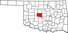 | |
| Towns | ||
| Unincorporated communities | ||
| Footnotes | ‡This populated place also has portions in an adjacent county or counties | |