Kōnan-ku, Niigata
| Kōnan-ku 江南区 | |
|---|---|
| Ward | |
| Kōnan Ward | |
|
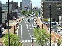
Kameda neighbourhood | |
 Location of Kōnan-ku in Niigata City | |
 Kōnan-ku
| |
| Coordinates: 37°52′3.5″N 139°5′38.5″E / 37.867639°N 139.094028°E | |
| Country | Japan |
| Region | Kōshin'etsu, Hokuriku (Chūbu) |
| Prefecture | Niigata |
| City | Niigata |
| Area | |
| • Total | 75.42 km2 (29.12 sq mi) |
| Population (June 1, 2016) | |
| • Total | 68,867 |
| • Density | 913/km2 (2,360/sq mi) |
| Time zone | Japan Standard Time (UTC+9) |
| Address | 3-4-5 Izumi-Chō, Kōnan-ku, Niigata-shi, Niigata-ken 950-0195 |
| Phone number | 025-383-1000 |
| Website |
www |
Kōnan-ku (江南区 Kōnan-ku) is one of the eight wards of Niigata City, Niigata Prefecture, in the Hokuriku region of Japan. As of 1 June 2016, the ward had an estimated population of 68,867 and a population density of 913 persons per km². Its total area was 75.42 square kilometres (29.12 sq mi).
Geography
Kōnan-ku is located in an inland region of north-central Niigata Prefecture, near the centre of Niigata City, directly south of the central Chūō-ku. The ward is bordered by Agano River, Koagano River, Shinano River, and the Nihonkai-Tōhoku Expressway.
Neighboring municipalities/wards
History
The area of present-day Kōnan-ku was part of ancient Echigo Province. The modern town of Kameda and the village of Yokogoshi were established on April 1, 1889 within Nakakanbara District, Niigata with the establishment of the municipalities system..
Yokogoshi was raised to town status on November 1, 1996. The city of Niigata annexed Kameda and Yokogoshi on March 21, 2005. Niigata became a government-designated city on April 1, 2007 and was divided into wards, with the new Kōnan Ward consisting of the former town of Kameda, village of Yokogoshi, and the Sonoki (曽野木), Ryokawa (両川) and Oeyama (大江山) neighbourhoods of southern Niigata City.[1]
Education
Kōnan-ku has 11 public elementary schools and six public middle schools. There is one public high school operated by the Niigata Prefectural Board of Education (Niigata Kōyō High School), and one private combined middle/high school (Niigata Meikun High School).
Transportation
Railway
Transit bus
- Transit bus operated by Niigata Kotsu
Highway
- Hokuriku Expressway / Nihonkai-Tōhoku Expressway
- Ban-etsu Expressway
- Japan National Route 49
- Japan National Route 403
Points of interest
- Northern Culture Museum
- AEON Mall Niigata Minami, shopping center
 Northern Culture Museum
 Aeon Mall Niigata Minami, shopping center
References
- ↑ http://www.city.niigata.lg.jp/multilingual/e_index/konan_english/outline.html
- ↑ 運行便別時刻表 [Bus Lines and Timetables (2016.3- )] (in Japanese). Niigata Kotsu. Retrieved 9 October 2016.
- ↑ 路線図(南方面) [Bus Map for South Niigata (2016.3- )] (PDF) (in Japanese). Niigata Kotsu. Retrieved 9 October 2016.
External links
![]() Media related to Kōnan-ku, Niigata at Wikimedia Commons
Media related to Kōnan-ku, Niigata at Wikimedia Commons
- Niigata official website (Japanese)
- Niigata Kōnan-ku website (Japanese)
- Welcome to Konan Ward - Niigata City (English)
- Niigata City Official Tourist Information (multilingual)
- Niigata Pref. Official Travel Guide (multilingual)
Coordinates: 37°52′4″N 139°5′39″E / 37.86778°N 139.09417°E