Nihonkai-Tōhoku Expressway
| |
|---|---|
| 日本海東北自動車道) | |
| Route information | |
| Maintained by East Nippon Expressway Company | |
| Length: |
53.6 km[1] (33.3 mi) Tolled sections |
| Existed: | 2001 – present |
| Major junctions | |
| From: |
Niigata-Chūō Junction in Niigata, Niigata |
| To: |
Kawabe Junction in Akita, Akita |
| Location | |
| Major cities: | Shibata, Tainai, Tsuruoka, Sakata, Nikaho, Yurihonjō |
| Highway system | |
|
National highways of Japan Expressways of Japan | |
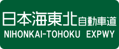
The Nihonkai-Tōhoku Expressway (日本海東北自動車道 Nihonkai Tōhoku Jidōsha-dō) is a national expressway in Japan. It is owned and operated by East Nippon Expressway Company.
Naming
The course of the expressway takes it alongside the coastline of the Sea of Japan (Nihonkai) in the Tōhoku region of Japan.
The Nihonkai-Tōhoku Expressway is the operating name for the sections of the Nihonkai Engan Tōhoku Expressway that are operated by East Nippon Expressway Company. The Nihonkai Engan Tōhoku Expressway is an official designation consisting of several routes that link Niigata with Aomori via Yamagata and Akita,[2] reaching a total of approximately 322 km.[3]
Overview
The first section of the expressway was opened to traffic in 2001. As of March 2008 the expressway incomplete in many areas. The next section is scheduled to open in 2009 (Nakajō Interchange to Arakawa Interchange)[4] to coincide with the National Sports Festival which is planned to be held in Niigata that year. After this, all future sections will be built according to the New Direct Control System, whereby the burden for construction costs will be shared by the national and local governments and no tolls will be collected. Currently the section between Honjō Interchange and Iwaki Interchange operates according to this principle.[5]
The expressway is 4 lanes from Niigata-Chūō Junction to Toyosaka Service Area, and 2 lanes for all remaining sections.
The route parallels the Uetsu Main Line of East Japan Railway Company and National Route 7 for much of its length.
List of interchanges and features
- IC - interchange, SIC - smart interchange, JCT - junction, SA - service area, PA - parking area, BS - bus stop, TB - toll gate, BR - bridge, TN - tunnel
Niigata section
| No. | Name | Connections | Dist. from Origin |
Dist. from Terminus |
Bus Stop | Notes | Location (all in Niigata) | |
|---|---|---|---|---|---|---|---|---|
| Through to | ||||||||
| (42) | Niigata-Chūō JCT | 0.0 | 67.5 | Kōnan-ku, Niigata | ||||
| 1[43] | Niigata-Kameda IC | 3.2 | 64.3 | |||||
| 1-1/BS | Niigata-Higashi SIC/Nishino Bus Stop | Pref. Route 4 | 7.4 | 60.1 | ○ | |||
| 2[44] | Niigata Airport IC | Pref. Route 16 (Niigata Kameda Uchino Route) | 9.2 | 58.3 | ||||
| 2-1/SA | Toyosaka SA/SIC | Pref. Route 27 | 11.7 | 55.8 | SIC: Nakajō-bound exit, Niigata-bound entrance only | Kita-ku, Niigata | ||
| BS | Kuzutsuka Bus Stop | 16.6 | 50.9 | ○ | ||||
| 3 | Toyosaka- Niigatahigashikō IC |
Pref. Route 46 (Niigata Chūō Kanjō Route) | 18.3 | 49.2 | ||||
| 4 | Seirō-Shibata IC | 25.7 | 41.8 | ○ | Seirō | |||
| BS | Kajikawa-Shiunji Bus Stop | 31.6 | 35.9 | ○ | Shibata | |||
| Emergency Exit | ↓ | ↑ | Access for Shibata Hospital Authorized vehicles only | |||||
| 5 | Nakajō IC | Pref. Route 591 (Nakajō Inter Route) | 36.9 | 30.6 | Tainai | |||
| TB | Nakajō Toll Gate | 37.0 | 30.5 | |||||
| BS | Tainai Bus Stop | 41.4 | 26.1 | ○ | ||||
| 6 | Arakawa-Tainai IC | 46.6 | 21.1 | Murakami | ||||
| 7 | Kamihayashi-Iwafunekō IC | 53.7 | 13.8 | |||||
| 8 | Murakami-Senamionsen IC | 57.7 | 9.8 | |||||
| 9 | Murakami-Saberi IC | Pref. Route 397 (Kamiyamada Saberi Route) | 61.4 | 6.1 | Asahi-bound exit, Murakami-bound entrance only | |||
| 10 | Asahi-Miomote IC | Pref. Route 349 (Tsuruoka Murakami Route) | 63.7 | 4.2 | Asahi-bound exit, Murakami-bound entrance only | |||
| 11 | Asahi-Mahoroba IC | Pref. Route 208 (Koage Sarusawa Route) | 67.5 | 0 | ||||
Yamagata section
| No. | Name | Connections | Dist. from Origin |
Dist. from Terminus |
Bus Stop | Notes | Location (all in Yamagata) |
|---|---|---|---|---|---|---|---|
| 13 | Atsumi-Onsen IC | Pref. Route 348 (Atsumigawa Kinomata Oiwagawa Route) | 104.2 | Tsuruoka | |||
| 14 | Iragawa IC | Pref. Route 61 (Sugenodai Katanorizawa Route) | 112.1 | Atsumi-bound exit, Tsuruoka-bound entrance only | |||
| 15 | Sanze IC | 116.9 | Atsumi-bound exit, Tsuruoka-bound entrance only | ||||
| 16 | Tsuruoka-nishi IC | 125.4 | |||||
| 17 | Tsuruoka JCT | 130.1 | |||||
| 18 | Shōnai Airport IC | Pref. Route 33 (Shōnai Airport Tachikawa Route) | 138.8 | Sakata | |||
| 19 | Sakata IC/Toll Gate | 144.9 | |||||
| 19-1 | Sakata-chuo IC | 149.7 | |||||
| 20 | Sakata-Minato IC | Pref. Route 59 (Sakata Yahata Route) | 156.4 | ||||
| Yuza-Hiko IC | Planned | Yuza | |||||
| Yuza-Jurizuka IC | Planned | ||||||
| Yuza-Chokai IC | Planned | ||||||
Akita section
| No. | Name | Connections | Dist. from Origin |
Dist. from Terminus |
Bus Stop | Notes | Location (all in Akita) |
|---|---|---|---|---|---|---|---|
| 11 | Kisakata IC | Pref. Route 58 | Nikaho | ||||
| 12 | Konoura IC | 0.0 | 57.7 | ||||
| 13 | Nikaho IC | 6.9 | 50.8 | ||||
| (Ryōzenji temporary IC) | 8.2 | 49.5 | Abolished on 27 October 2012 | ||||
| PA | Nishime PA | 13.2 | 44.5 | Yurihonjō | |||
| 14 | Honjō IC | 19.4 | 38.3 | ||||
| 14-1 | Ōuchi JCT | 28.6 | 29.1 | ||||
| 14-2 | Matsugasaki-Kameda IC | 35.5 | 22.2 | ||||
| TN | Futago Tunnel | ↓ | ↑ | ||||
| 15 | Iwaki IC | Pref. Route 44 (Yūwa Iwaki Route) | 41.0 | 16.7 | |||
| TB | Akita Airport Toll Gate | 54.9 | 2.8 | Akita | |||
| 16 | Akita Airport IC | Pref. Route 61 (Akita Goshono Yūwa Route) | 55.3 | 2.4 | |||
| 5-1 | Kawabe JCT | 57.7 | 0.0 |
References
- ↑ "E-NEXCO Expressway Data". Retrieved 2008-04-13.
- ↑ Ministry of Land, Infrastructure and Transport. "High Standard Trunk Road Map" (PDF). Archived from the original (pdf) on September 20, 2011. Retrieved 2008-04-13.
- ↑ Ministry of Land, Infrastructure and Transport. "Nihonkai Engan Tohoku Expressway Construction Status". Retrieved 2008-04-17.
- ↑ "E-NEXCO Opening Schedule". Retrieved 2008-04-15.
- ↑ Ministry of Land, Infrastructure and Transport. "Nihonkai Engan Tohoku Expressway Construction Status". Archived from the original on August 26, 2004. Retrieved 2008-04-17.
External links
- (Japanese) East Nippon Expressway Company
| East Nippon Expressway Company | |
|---|---|
| Central Nippon Expressway Company | |
| West Nippon Expressway Company |
|
| Honshū-Shikoku Bridge Expressway Company |
|
| Urban Expressways | |