Kallang Bahru
| Kallang Bahru | |
|---|---|
| Subzone of Kallang | |
| Other transcription(s) | |
| • Chinese |
加冷巴鲁 加冷峇鲁 |
| • Pinyin | Jiālěng Bālǔ |
| • Malay | Kallang Baru |
| • Tamil | காலாங் பாரு |
| Country |
|
| Region | Central Region |
| Planning Area | Kallang |
| Area[1] | |
| • Total | 0.84 km2 (0.32 sq mi) |
| Population (2015)[1] | |
| • Total | 30,000 |
| • Density | 36,000/km2 (92,000/sq mi) |
Kallang Bahru (Chinese: 加冷巴鲁, Tamil: காலாங் பாரு) is a subzone located in the town of Kallang in the Central Region of Singapore. The area mostly comprises industrial facilities and several residential apartments. It will be served by the future Downtown Line Stage 3's Geylang Bahru MRT Station and Bendemeer MRT Station, both of which are located under the road of the same name. Kallang Bahru is also within the vicinity of the Kallang River, as well as both the Kallang MRT Station and Boon Keng MRT Station.
"Kallang Bahru" is also the name given to a road which spans the area. The road links Pan Island Expressway in the east to Lavender Street in the southwest, with several major junctions at Geylang Bahru Road and Boon Keng Road.
Today, residents of Kallang Bahru are managed by the People's Association under the Kolam Ayer Kallang Bahru Residents Committee.[2]
See also
- Kallang
- Kallang MRT Station
- Geylang Bahru
- Geylang Bahru MRT Station (construction alias: Kallang Bahru)
References
- 1 2 City Population - statistics, maps and charts | Kallang Bahru
- ↑ "Location of Kolam Ayer Kallang Bahru". People's Association. 3 September 2015. Retrieved 16 June 2016.
External links
![]() Media related to Kallang Planning Area at Wikimedia Commons
Media related to Kallang Planning Area at Wikimedia Commons
| Organisations | 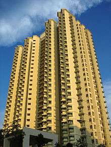 | |
|---|---|---|
| Building Programmes | ||
| Upgrading Programmes |
| |
| Other | ||