Marine Parade
| Marine Parade | ||||||||||
|---|---|---|---|---|---|---|---|---|---|---|
| Planning Area and HDB Estate | ||||||||||
| Other transcription(s) | ||||||||||
| • Chinese | 马林百列 | |||||||||
| • Pinyin | Mălín Băiliè | |||||||||
| • Malay | Marine Parade | |||||||||
| • Tamil | மரின் பரேட் | |||||||||
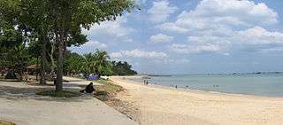
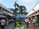
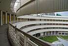
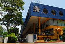
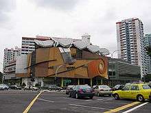
From top left to right: Panorama of East Coast Park, Marine Parade Promenade, Shophouses in Katong, Goodman Arts Centre, Katong Shopping Centre, Marine Parade Community Building, Marine Crescent Housing Estate, Tao Nan School | ||||||||||
 Marine Parade Location of Marine Parade within Singapore | ||||||||||
| Coordinates: SG 1°18′11″N 103°54′28″E / 1.30306°N 103.90778°E | ||||||||||
| Country |
| |||||||||
| Region |
| |||||||||
| CDC | ||||||||||
| Town council |
| |||||||||
| Constituencies | ||||||||||
| Government | ||||||||||
| • Mayor |
South East CDC
| |||||||||
| • Members of Parliament |
Marine Parade GRC Mountbatten SMC | |||||||||
| Area[1] | ||||||||||
| • Total | 6.12 km2 (2.36 sq mi) | |||||||||
| Population (2015)[1][2] | ||||||||||
| • Total | 48,730 | |||||||||
| • Density | 8,000/km2 (21,000/sq mi) | |||||||||
| Demonym(s) |
Official
Colloquial
| |||||||||
| Postal district | 15 | |||||||||
| Dwelling units | 7,862 | |||||||||


Marine Parade (Chinese: 马林百列, Tamil: மரின் பரேட்) is a planning area and residential estate located in the Central Region of Singapore. Straddling the tip of the southeastern coast of Pulau Ujong, Marine Parade serves as a buffer between the Central and East regions of the city-state. Bordering it are the planning areas of Geylang to the north, Kallang to the northwest, Bedok to the northeast, Marina East to the southwest and the Singapore Straits to the south.
Marine Parade's early history can be associated with the precinct of Katong. Throughout the early to mid 20th century, the area was a heaven for the wealthy Peranakan community of Singapore. Katong witnessed a growth in Straits Chinese culture, developing a distinctive architecture style and even becoming the place of origin for the renowned Katong Laksa dish. Marine Parade as it is known today, mainly consists of housing flats along the southernmost points of the estate, which were built in the 1970s after the reclamation of the island's east coast.
Infrastructure
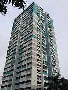
The main public housing estate comprises 58 blocks of HDB flats. The public estate is bisected by the arterial Still Road South that provides access to the major highway, East Coast Parkway, leading to the city area and to Singapore Changi Airport.
Town Centre
Despite being given estate status by the Housing and Development Board, Marine Parade, like other towns in Singapore, is oddly served by a town centre.
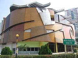
Dubbed, Marine Parade Promenade, the centre itself consists of several neighbourhood shops and a major commercial complex, Parkway Parade, that houses offices and a shopping centre.
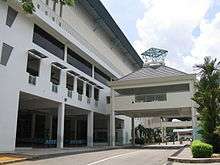
Marine Parade Community Building
The Marine Parade Community Building was completed in 2000. It houses the Marine Parade Community Club and the Marine Parade Community Library. Other facilities within the three-storey complex include a 263-seater theatrette, a glass-walled gymnasium, a covered basketball court on the rooftop, an air-conditioned and a sports hall.
Education
As Marine Parade is primarily either recreational or residential, it is host to a variety of schools.
- Primary Schools
- CHIJ (Katong) Primary 圣婴女校(加东)
- Ngee Ann Primary School 义安小学
- Tao Nan School 道南学校(Hokkien Huay Kuan)
- Secondary Schools
- CHIJ Katong Convent 加东修道院女校
- St. Patrick's School 圣伯特理中学
- Chung Cheng High School (Main) 中正中学(总校
- Tanjong Katong Secondary School 丹绒加东中学
- Tanjong Katong Girls' School 丹绒加东女校
- Victoria School 维多利亚学校
- Victoria Junior College 维多利亚初级学院
Politics
Marine Parade is a component division of the Marine Parade Group Representation Constituency, which also includes the Braddell Heights, Geylang Serai, Kembangan-Chai Chee and MacPherson divisions and elects five members to Singapore's Parliament. Singapore's former Prime Minister Goh Chok Tong is the Member of Parliament who represents the Marine Parade division.
| Wikimedia Commons has media related to Marine Parade. |
References
External links
| Organisations | 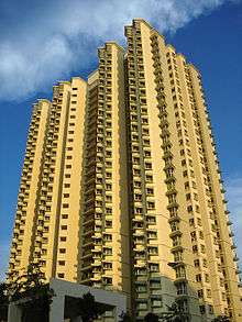 | |
|---|---|---|
| Building Programmes | ||
| Upgrading Programmes |
| |
| Other | ||