Kumasi
| Kumasi | ||
|---|---|---|
| City | ||
|
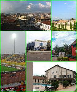
Top: Aerial view of Central Business District (CBD) in Kumasi and private housing estates in Kumasi; Bottom left: Kumasi Sports Stadium, Bottom: Ghana Commercial Bank (GBC) Building in Kumasi, Ghana Armed Forces (GAF) Museum in Kumasi and luxury real estates in Kumasi. | ||
| ||
_location_map.png) Kumasi Location of Kumasi in Ashanti | ||
| Coordinates: 6°40′N 1°37′W / 6.667°N 1.617°WCoordinates: 6°40′N 1°37′W / 6.667°N 1.617°W | ||
| Sovereign State |
| |
| Administrative division |
| |
| Metropolis | Kumasi Metropolitan | |
| Founded | 1680 | |
| Government | ||
| • Type | Mayor–council | |
| • mayor | vacant | |
| Area[1] | ||
| • Total | 254 km2 (98 sq mi) | |
| Elevation | 250 m (820 ft) | |
| Population (2013 est.)[2] | ||
| • Total | 2,069,350 | |
| • Density | 8,100/km2 (21,000/sq mi) | |
| Time zone | UTC | |
| Area code(s) | 032 | |
| Website | kma.gov.gh | |
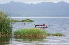
Kumasi (historically spelled Comassie or Coomassie and correctly spelled Kumase in Twi)[3] is a city in Ashanti Region, and is among the largest metropolitan areas in Ghana. Kumasi is near Lake Bosomtwe, in a rain forest region, and is the commercial, industrial and cultural capital of Asanteman. Kumasi is approximately 500 kilometres (300 mi) north of the Equator and 200 kilometres (100 mi) north of the Gulf of Guinea. Kumasi is alternatively known as "The Garden City" because of its many beautiful species of flowers and plants. It is also called Oseikrom, (Osei Tutu's town).
History
Origins
There is evidence that the area around Kumasi has been kept cleared since the Neolithic age and that the first human settlement was at Lake Bosomtwe.
Asanteman

The city rose to prominence in 1695 when it became capital of the Ashanti Confederacy due to the activities of its ruler Osei Tutu. The ruler of Kumasi, known as the Asantehene, also served as ruler of the Confederacy. With their 1701 victory over Denkyira the Asante confederacy became the primary state among the Ashantis.[4] Parts of the city, including the then royal residence, were destroyed by British troops in the Third Anglo-Ashanti War of 1874.
Lady Mary Alice Hodgson, the first English lady to visit Ashanti, wrote "The Siege of Kumasi" an account of the siege of the fort by the nationals of Ashanti Confederation Ashantiland and of the subsequent march to the coast.[5] (She was the daughter of Hon. W. A. G. Young, C.M.G., former governor of the Gold Coast, and the wife of Sir Frederick Mitchell Hodgson, K.C.M.G., the governor of the Gold Coast in 1900.[5])
In 1926, following the return of the Ashanti king, Prempeh I after a 30-year exile Kumasi was restored as the ceremonial control over the Ashanti sub-states and the full role of king was restored by the colonial administration in 1935. The city holds an important place in the history of the Ashanti people, as legend claims that it was here Okomfo Anokye received the golden stool, an embodiment of the soul of the Ashanti nation Ashanti.
Climate
Kumasi features a tropical wet and dry climate, with relatively constant temperatures throughout the course of the year. Kumasi averages around 1400 mm (55") of rain per year.
The city almost features two rainy seasons: a longer season from March through July and a shorter rainy season from September to November.
The months of February through to November is one long wet season, with a relative lull in precipitation in August. Similar to the rest of West Africa, Kumasi experiences the harmattan during the "low sun" months. Lasting from December to February, the harmattan is the primary source of the city's dry season.
| Climate data for Kumasi | |||||||||||||
|---|---|---|---|---|---|---|---|---|---|---|---|---|---|
| Month | Jan | Feb | Mar | Apr | May | Jun | Jul | Aug | Sep | Oct | Nov | Dec | Year |
| Record high °C (°F) | 36.7 (98.1) |
37.2 (99) |
37.8 (100) |
36.1 (97) |
35.0 (95) |
32.8 (91) |
31.1 (88) |
30.0 (86) |
31.7 (89.1) |
32.2 (90) |
32.8 (91) |
33.3 (91.9) |
37.8 (100) |
| Average high °C (°F) | 31.9 (89.4) |
33.5 (92.3) |
32.9 (91.2) |
32.3 (90.1) |
31.3 (88.3) |
29.5 (85.1) |
28.0 (82.4) |
27.7 (81.9) |
28.7 (83.7) |
30.1 (86.2) |
31.2 (88.2) |
30.7 (87.3) |
30.7 (87.3) |
| Average low °C (°F) | 20.4 (68.7) |
22.0 (71.6) |
22.3 (72.1) |
22.4 (72.3) |
22.2 (72) |
21.6 (70.9) |
21.2 (70.2) |
21.0 (69.8) |
21.1 (70) |
21.5 (70.7) |
21.7 (71.1) |
20.8 (69.4) |
21.5 (70.7) |
| Record low °C (°F) | 11.7 (53.1) |
13.3 (55.9) |
17.8 (64) |
19.4 (66.9) |
18.9 (66) |
18.9 (66) |
17.2 (63) |
16.1 (61) |
18.3 (64.9) |
15.6 (60.1) |
13.9 (57) |
10.6 (51.1) |
10.6 (51.1) |
| Average precipitation mm (inches) | 15.1 (0.594) |
66.3 (2.61) |
137.0 (5.394) |
129.3 (5.091) |
174.4 (6.866) |
214.3 (8.437) |
157.5 (6.201) |
89.9 (3.539) |
165.2 (6.504) |
153.3 (6.035) |
74.3 (2.925) |
25.8 (1.016) |
1,402.4 (55.213) |
| Average precipitation days | 2 | 5 | 9 | 10 | 14 | 17 | 14 | 12 | 17 | 17 | 8 | 3 | 128 |
| Mean monthly sunshine hours | 186.6 | 187.2 | 205.4 | 204.0 | 204.7 | 146.3 | 101.2 | 77.0 | 106.2 | 161.4 | 193.8 | 178.0 | 1,951.8 |
| Source #1: World Meteorological Organization,[6] Sistema de Clasificación Bioclimática Mundial (extremes)[7] | |||||||||||||
| Source #2: Deutscher Wetterdienst (sun, 1961–1990)[8][lower-alpha 1] | |||||||||||||
Landmarks
Features of the city include Fort Kumasi (built by in 1896 to replace an Asante fort and now a museum) and the Kumasi Hat Museum.
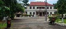
Royal Asante attractions include the Kumasi National Cultural Centre (including the Prempeh II Jubilee Museum with Asante regalia with a reproduction of the golden stool), the Okomfo Anokye Sword, the Asantehene's Palace (built in 1972), and the Manhyia Palace, dating from 1925, now a museum.
Kumasi is home to a zoo. St. Peter's Cathedral Basilica is the seat of the Roman Catholic Archdiocese of Kumasi. There is the large Kumasi Central Market and Tafo Kumasi.
Economy
The main occupations in Kumasi are professional such as services and manufacturing.
Mining and exports
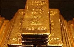
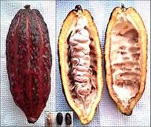
Due to large gold deposits that have been mined in the area, Kumasi is the wealthiest city in Ashantiland. The city's major produce are gold bars, hardwood and cocoa.
Manufacturing
Kumasi has 50% of the timber industry of Ashantiland, and the Kaasai Industrial Area plays an important role in the local industry. The Guinness Ghana Breweries is based in Kumasi.
Energy
Solar panels are prevalent in Kumasi and Ashanti. Solar energy technology is a major energy source and contributor of electricity generation in Ashanti.
Commerce
_%E2%80%93_The_Panoramic_view.jpg)
Much of the shopping and trading activity in the city takes place at Kumasi's shopping streets, in and around Kejetia Market and Adum. These two areas – Kejetia and Adum – have a common boundary.
Education and science
Senior high schools and colleges
There are notable senior high schools like Prempeh College which was founded in Kumasi by the King Osei Tutu Agyeman Prempeh II in 1949 and Opoku Ware School, named after the Asanteman King Opoku Ware I and founded in 1952. The city has a polytechnic to boost its education called Kumasi Polytechnic. Former president John Kufuor attended and graduated from the Prempeh College. Also well known schools are Kumasi High school which boasts of Alumni such as renowned economist the late Hon. Kwadwo Baah Wiredu, Lawyer and MP of Bantama Hon. Kokofu and owner of Joy industries. Other prominent high schools are Yaa Asantewaa, St. Louis Girls High School, T.I Amass and Kumasi Anglican School.
Universities
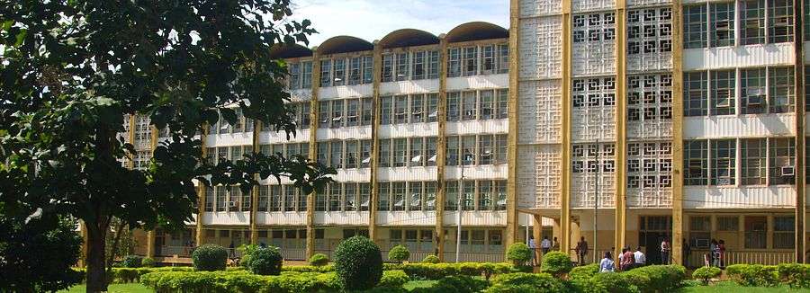
The Kwame Nkrumah University of Science and Technology, Kumasi (formerly the Kumasi College of Technology). Former Secretary-General of the United Nations, Kofi Annan attended and graduated from this institution.
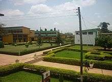
The University of Education Winneba has a campus called College of Technology in Tanoso, a suburb of Kumasi. Kumasi is the location of many private universities including Garden City University College, Ghana Baptist University College, Christian Service University College, Christ Apostolic University College, University College of Management Studies, Kumasi Campus among others.
Transportation
Air
Kumasi is served by the Kumasi Airport. As of May 2014 at least four airlines offered regularly scheduled flights to Accra, Takoradi and Sunyani. Airlines servicing the airport included Africa World Airlines, Antrak Air, Royal Fly-GH and Starbow Airlines. The airport has undergone construction to allow for night operations.[9]
Bus and Taxicab
Public transport in the city is provided by transit buses, a mix of privately owned mini-buses known as tro tros, taxicabs and buses. Tro tros are usually converted mini-buses that run regular, well-known routes. Some taxis also run regular routes, which cost more but provide for a more comfortable ride.
In 2002, the city introduced the metro bus services a rapid transit system for public road transport in Kumasi (MetroMass).[10] This was to reduce congestion on roads and to make a larger and more organised bus routine system in the city.[11]
Rail
Kumasi is served by the railway lines to Sekondi-Takoradi and Accra. The train service has been suspended for several years because of damaged track, bridges and locomotives. Currently, no train is running from and to Kumasi due to the collapse of the railway corporation some years back. A$6 billion project to upgrade the railways was due to get underway in 2011.[12]
Port
As of 2011, construction of the Boankra Inland Port, about 25 kilometres (16 mi) away, has come to a halt.[13]
Sports
The local football (soccer) team, the Kumasi Asante Kotoko has won several national and continental trophies and awards, and serves as a rival to the Accra based Hearts of Oak. Their Kumasi Sports Stadium, also known as Baba Yara Stadium, was built in 1959, renovated in 1978, and again in 2007 with a seating capacity of 40,000.[14] It is also the home of King Faisal Football Club, a premier division side. There is the Royal Golf Club which has the Asantehene as president. Former Leeds United and Ghana national football team footballer Tony Yeboah was born in Kumasi. Professional wrestler Kofi Kingston was born in Kumasi.
Healthcare
The Kumasi has the Komfo Anokye Teaching Hospital to support medical training at the university, the West End Hospital, several other private hospitals, public clinics and small hospitals.
International relations
Twin towns and sister cities
Kumasi is twinned with:
| Country | City | County / District / Region / State | Date | |||
|---|---|---|---|---|---|---|
| |
Ivory Coast | |
Abidjan | |
Lagunes | 2004 |
| Treichville | ||||||
| |
US | |
Atlanta | |
Georgia | 2010 |
| |
Netherlands | |
Almere | |
Flevoland | 2001 |
| |
US | |
Charlotte | |
North Carolina | 1996 |
| |
US | |
Columbus | |
Ohio | 2008 |
| |
Canada | |
Kitchener | |
Ontario | 2010 |
| |
US | |
Newark | |
New Jersey | 1999 |
| |
South Africa | |
Gauteng | 2010 | ||
| |
US | |
Winston-Salem | |
North Carolina | 2001 |
See also
References
- ↑ "Demographic Characteristics". Ghanadistricts.com. Retrieved 16 August 2010.
- ↑ "World Gazetteer online". World-gazetteer.com.
- ↑ "COOMASSIE AND MAGDALA: The Story of Two British Campaigns in Africa - Naval & Military Press". Retrieved 28 October 2016.
- ↑ McCaskie, T. C. "Denkyira in the Making of Asante" in The Journal of African History vol. 48 (2007) no. 1, p. 1
- 1 2 Morgan, Henry James Types of Canadian women and of women who are or have been connected with Canada : (Toronto, 1903)
- ↑ "World Weather Information Service–Kumasi". World Meteorological Organization. Retrieved 14 June 2015.
- ↑ "Ghana–Kumasi". Centro de Investigaciones Fitosociológicas. Retrieved 14 June 2015.
- ↑ "Station 65442: Kumasi". Global station data 1961–1990—Sunshine Duration. Deutscher Wetterdienst. Retrieved 14 June 2015.
- ↑ "President Respects All Tribes – NDC". Ghana Broadcasting Corporation. 9 May 2014. Retrieved 9 May 2014.
- ↑ "Ashanti Region". Metro Mass Transit Ltd. Retrieved 1 December 2011.
- ↑ "Bus Rapid Transit System". Metro Mass Transit Ltd. Retrieved 1 December 2011.
- ↑ "Ghana, China signs railway contract". Ghana News Link. 30 November 2010. Retrieved 1 December 2011.
- ↑ "Baonkra Inland Port Project, stuck?". Kapital News. Kapital Radio 97.1 FM. 7 February 2011. Retrieved 1 December 2011.
- ↑ Kumasi Sports Stadium Ready. TheStatesManOnline.com.
Notes
- ↑ Station ID for Kumasi is 65442 Use this station ID to locate the sunshine duration
External links
| Wikimedia Commons has media related to Kumasi. |
| Wikivoyage has a travel guide for Kumasi. |
- Kumasi News
- http://www.mygardencity.com Interactive Community Platform for Ashanti Region
- MSN Map
- KNUST home page
- Kumasi Market Video
- The Siege of Kumasi on the Internet Archive