L'Hôpital-du-Grosbois
| L'Hôpital-du-Grosbois | ||
|---|---|---|
|
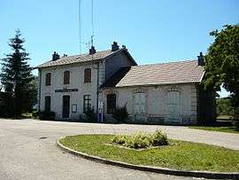
Train station | ||
| ||
 L'Hôpital-du-Grosbois | ||
|
Location within Bourgogne-Franche-Comté region  L'Hôpital-du-Grosbois | ||
| Coordinates: 47°10′22″N 6°13′02″E / 47.1728°N 6.2172°ECoordinates: 47°10′22″N 6°13′02″E / 47.1728°N 6.2172°E | ||
| Country | France | |
| Region | Bourgogne-Franche-Comté | |
| Department | Doubs | |
| Arrondissement | Besançon | |
| Canton | Ornans | |
| Intercommunality | Pays d'Ornans | |
| Government | ||
| • Mayor (2008–2014) | Jean-Claude Grenier | |
| Area1 | 7.84 km2 (3.03 sq mi) | |
| Population (2012)2 | 554 | |
| • Density | 71/km2 (180/sq mi) | |
| Time zone | CET (UTC+1) | |
| • Summer (DST) | CEST (UTC+2) | |
| INSEE/Postal code | 25305 / 25620 | |
| Elevation | 509–681 m (1,670–2,234 ft) | |
|
1 French Land Register data, which excludes lakes, ponds, glaciers > 1 km² (0.386 sq mi or 247 acres) and river estuaries. 2 Population without double counting: residents of multiple communes (e.g., students and military personnel) only counted once. | ||

L'Hôpital-du-Grosbois is a commune in the Doubs department in the Bourgogne-Franche-Comté region in eastern France.
Population
| Historical population | ||
|---|---|---|
| Year | Pop. | ±% |
| 1962 | 219 | — |
| 1968 | 257 | +17.4% |
| 1975 | 279 | +8.6% |
| 1982 | 349 | +25.1% |
| 1990 | 349 | +0.0% |
| 1999 | 377 | +8.0% |
| 2006 | 589 | +56.2% |
| 2008 | 529 | −10.2% |
| 2012 | 554 | +4.7% |
See also
References
| Wikimedia Commons has media related to L'Hôpital-du-Grosbois. |
This article is issued from Wikipedia - version of the 10/29/2016. The text is available under the Creative Commons Attribution/Share Alike but additional terms may apply for the media files.