La Porte Municipal Airport (Texas)
Coordinates: 29°40′09″N 095°03′51″W / 29.66917°N 95.06417°W
| La Porte Municipal Airport | |||||||||||||||
|---|---|---|---|---|---|---|---|---|---|---|---|---|---|---|---|
| IATA: none – ICAO: none – FAA LID: T41 | |||||||||||||||
| Summary | |||||||||||||||
| Airport type | Public | ||||||||||||||
| Owner | City of La Porte | ||||||||||||||
| Serves | La Porte, Texas | ||||||||||||||
| Elevation AMSL | 25 ft / 8 m | ||||||||||||||
| Runways | |||||||||||||||
| |||||||||||||||
| Statistics (2007) | |||||||||||||||
| |||||||||||||||
La Porte Municipal Airport (FAA LID: T41) is a city-owned public-use airport located three miles (5 km) northwest of the central business district of La Porte, a city in Harris County, Texas, United States.[1]
Facilities and aircraft
La Porte Municipal Airport covers an area of 300 acres (120 ha) which contains two asphalt paved runways: 12/30 measuring 4,165 x 75 ft (1,269 x 23 m) and 5/23 measuring 2,998 x 75 ft (914 x 23 m).[1]
For the 12-month period ending June 5, 2007, the airport had 79,433 general aviation aircraft operations, an average of 217 per day. At that time there were 95 aircraft based at the airport: 87% single-engine, 9% multi-engine, 1% jet and 2% helicopter.[1]
References
External links
- Airport page at City of La Porte web site
- "The Economic Impact of La Porte Municipal Airport" (PDF). at Texas DOT web site
- Resources for this airport:
- FAA airport information for T41
- AirNav airport information for T41
- FlightAware airport information and live flight tracker
- SkyVector aeronautical chart for T41
| Large cities | 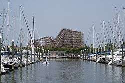 | |
|---|---|---|
| Other cities | ||
| CDPs and non- municipalities | ||
| Counties | ||
| Subregions | ||
| Bodies of water | ||
| Major ports | ||
| Nature preserves | ||
| Counties | 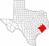 | |
|---|---|---|
| "Principal" cities | ||
| Other cities |
For a complete listing, see list of cities and towns in Houston–The Woodlands–Sugar Land MSA | |
| Unincorporated areas | ||
| Bodies of water | ||
