Lake Ozark, Missouri
| Lake Ozark, Missouri | |
|---|---|
| City | |
| City of Lake Ozark | |
 Location of Lake Ozark, Missouri | |
| Coordinates: 38°11′55″N 92°38′20″W / 38.19861°N 92.63889°WCoordinates: 38°11′55″N 92°38′20″W / 38.19861°N 92.63889°W | |
| Country | United States |
| State | Missouri |
| Counties | Miller, Camden |
| Government | |
| • Mayor | Johnnie Franzeskos |
| Area[1] | |
| • Total | 7.95 sq mi (20.59 km2) |
| • Land | 7.23 sq mi (18.73 km2) |
| • Water | 0.72 sq mi (1.86 km2) |
| Elevation | 751 ft (229 m) |
| Population (2010)[2] | |
| • Total | 1,586 |
| • Estimate (2012[3]) | 1,614 |
| • Density | 219.4/sq mi (84.7/km2) |
| Time zone | Central (CST) (UTC-6) |
| • Summer (DST) | CDT (UTC-5) |
| ZIP code | 65049 |
| Area code(s) | 573 |
| FIPS code | 29-40034[4] |
| GNIS feature ID | 0729529 [5] |
Lake Ozark is a city in Camden and Miller counties in the U.S. state of Missouri, near its namesake, the Lake of the Ozarks. The population was 1,586 at the 2010 census.
History
A post office called Lake Ozark has been in operation since 1932.[6] The community took its name from nearby Lake of the Ozarks.[7]
Geography
Lake Ozark is located at 38°11′55″N 92°38′20″W / 38.19861°N 92.63889°W.[5] According to the United States Census Bureau, the city has a total area of 7.95 square miles (20.59 km2), of which, 7.23 square miles (18.73 km2) is land and 0.72 square miles (1.86 km2) is water.[1]
Climate
Lake Ozark has a Humid continental climate. Summers are hot and humid, with thunderstorms and other severe weather common. Winters are generally cold with mild periods, but the temperature of the lake can alter the climate with heavy fog and milder weather than other municipalities further away from the lake.
| Climate data for Lake Ozark, Missouri | |||||||||||||
|---|---|---|---|---|---|---|---|---|---|---|---|---|---|
| Month | Jan | Feb | Mar | Apr | May | Jun | Jul | Aug | Sep | Oct | Nov | Dec | Year |
| Average high °F (°C) | 44 (7) |
47 (8) |
57 (14) |
68 (20) |
76 (24) |
84 (29) |
90 (32) |
89 (32) |
81 (27) |
70 (21) |
57 (14) |
47 (8) |
67.5 (19.7) |
| Average low °F (°C) | 24 (−4) |
27 (−3) |
33 (1) |
43 (6) |
52 (11) |
62 (17) |
66 (19) |
65 (18) |
58 (14) |
46 (8) |
36 (2) |
27 (−3) |
44.9 (7.2) |
| Source: The Weather Channel, LLC[8] | |||||||||||||
Demographics
| Historical population | |||
|---|---|---|---|
| Census | Pop. | %± | |
| 1970 | 507 | — | |
| 1980 | 534 | 5.3% | |
| 1990 | 681 | 27.5% | |
| 2000 | 1,489 | 118.6% | |
| 2010 | 1,586 | 6.5% | |
| Est. 2015 | 1,761 | [9] | 11.0% |
2010 census
As of the census[2] of 2010, there were 1,586 people, 715 households, and 455 families residing in the city. The population density was 219.4 inhabitants per square mile (84.7/km2). There were 1,688 housing units at an average density of 233.5 per square mile (90.2/km2). The racial makeup of the city was 96.5% White, 0.2% African American, 0.7% Native American, 0.8% Asian, 0.2% Pacific Islander, 0.3% from other races, and 1.3% from two or more races. Hispanic or Latino of any race were 1.2% of the population.
There were 715 households of which 25.5% had children under the age of 18 living with them, 52.9% were married couples living together, 7.6% had a female householder with no husband present, 3.2% had a male householder with no wife present, and 36.4% were non-families. 29.8% of all households were made up of individuals and 9.4% had someone living alone who was 65 years of age or older. The average household size was 2.22 and the average family size was 2.71.
The median age in the city was 48 years. 19.2% of residents were under the age of 18; 6.5% were between the ages of 18 and 24; 19.7% were from 25 to 44; 36.9% were from 45 to 64; and 17.7% were 65 years of age or older. The gender makeup of the city was 51.3% male and 48.7% female.
2000 census
As of the census[4] of 2000, there were 1,489 people, 649 households, and 427 families residing in the city. The population density was 211.6 people per square mile (81.7/km²). There were 1,143 housing units at an average density of 162.4 per square mile (62.7/km²). The racial makeup of the city was 96.24% White, 1.34% Native American, 0.47% Asian, 0.40% African American, 0.47% from other races, and 1.07% from two or more races. Hispanic or Latino of any race were 2.15% of the population.
There were 649 households out of which 26.5% had children under the age of 18 living with them, 53.5% were married couples living together, 8.8% had a female householder with no husband present, and 34.1% were non-families. 28.4% of all households were made up of individuals and 6.3% had someone living alone who was 65 years of age or older. The average household size was 2.29 and the average family size was 2.76.
In the city the population was spread out with 21.6% under the age of 18, 7.7% from 18 to 24, 26.7% from 25 to 44, 30.5% from 45 to 64, and 13.6% who were 65 years of age or older. The median age was 41 years. For every 100 females there were 103.1 males. For every 100 females age 18 and over, there were 104.4 males.
The median income for a household in the city was $37,386, and the median income for a family was $40,515. Males had a median income of $26,750 versus $21,667 for females. The per capita income for the city was $20,830. About 11.3% of families and 13.1% of the population were below the poverty line, including 19.2% of those under age 18 and 5.8% of those age 65 or over.
A four-lane highway connecting the Lake of the Ozarks Community Bridge to Highway 54 opened in December 2011. Route 242 (MO 242) opens new areas of land for development and speeds connections to the residential areas of Lake Ozark and Sunrise Beach.
References
- 1 2 "US Gazetteer files 2010". United States Census Bureau. Retrieved 2012-07-08.
- 1 2 "American FactFinder". United States Census Bureau. Retrieved 2012-07-08.
- ↑ "Population Estimates". United States Census Bureau. Retrieved 2013-05-30.
- 1 2 "American FactFinder". United States Census Bureau. Retrieved 2008-01-31.
- 1 2 "Lake Ozark". Geographic Names Information System. United States Geological Survey. Retrieved 2009-05-03.
- ↑ "Post Offices". Jim Forte Postal History. Retrieved 6 November 2016.
- ↑ "Miller County Place Names, 1928–1945". The State Historical Society of Missouri. Archived from the original on June 24, 2016. Retrieved November 6, 2016.
- ↑ "Average Weather for Lake Ozark, MO - Temperature and Precipitation". Cobb County, GA, United States: The Weather Channel, LLC. Retrieved February 18, 2012.
- ↑ "Annual Estimates of the Resident Population for Incorporated Places: April 1, 2010 to July 1, 2015". Retrieved July 2, 2016.
- ↑ "Census of Population and Housing". Census.gov. Retrieved June 4, 2015.
External links
Municipalities and communities of Camden County, Missouri, United States | ||
|---|---|---|
| Cities | 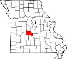 | |
| Villages | ||
| Townships | ||
| CDPs | ||
| Other unincorporated communities | ||
| Footnotes | ‡This populated place also has portions in an adjacent county or counties | |
Municipalities and communities of Miller County, Missouri, United States | ||
|---|---|---|
| Cities | 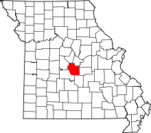 | |
| Villages | ||
| Townships | ||
| Unincorporated communities | ||
| Footnotes | ‡This populated place also has portions in an adjacent county or counties | |