Stoutland, Missouri
| Stoutland, Missouri | |
|---|---|
| Village | |
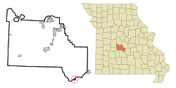 Location of Stoutland, Missouri | |
| Coordinates: 37°48′54″N 92°30′49″W / 37.81500°N 92.51361°WCoordinates: 37°48′54″N 92°30′49″W / 37.81500°N 92.51361°W | |
| Country | United States |
| State | Missouri |
| Counties | Camden, Laclede |
| Area[1] | |
| • Total | 0.60 sq mi (1.55 km2) |
| • Land | 0.60 sq mi (1.55 km2) |
| • Water | 0 sq mi (0 km2) |
| Elevation | 1,161 ft (354 m) |
| Population (2010)[2] | |
| • Total | 192 |
| • Estimate (2012[3]) | 191 |
| • Density | 320.0/sq mi (123.6/km2) |
| Time zone | Central (CST) (UTC-6) |
| • Summer (DST) | CDT (UTC-5) |
| ZIP code | 65567 |
| Area code(s) | 417 |
| FIPS code | 29-71008[4] |
| GNIS feature ID | 0727163[5] |
Stoutland is a village in Camden and Laclede counties in the U.S. state of Missouri. The population was 192 at the 2010 census.[6]
A post office called Stoutland has been in operation since 1870.[7] The village was named after Captain Stout, a railroad official.[8]
Geography
Stoutland is located at 37°48′54″N 92°30′49″W / 37.81500°N 92.51361°W (37.814926, -92.513557).[9]
According to the United States Census Bureau, the city has a total area of 0.60 square miles (1.55 km2), all of it land.[1]
Demographics
| Historical population | |||
|---|---|---|---|
| Census | Pop. | %± | |
| 1920 | 300 | — | |
| 1930 | 214 | −28.7% | |
| 1940 | 244 | 14.0% | |
| 1950 | 192 | −21.3% | |
| 1960 | 172 | −10.4% | |
| 1970 | 205 | 19.2% | |
| 1980 | 286 | 39.5% | |
| 1990 | 207 | −27.6% | |
| 2000 | 177 | −14.5% | |
| 2010 | 192 | 8.5% | |
| Est. 2015 | 192 | [10] | 0.0% |
2010 census
As of the census[2] of 2010, there were 192 people, 93 households, and 50 families residing in the city. The population density was 320.0 inhabitants per square mile (123.6/km2). There were 104 housing units at an average density of 173.3 per square mile (66.9/km2). The racial makeup of the city was 99.0% White and 1.0% from other races. Hispanic or Latino of any race were 5.7% of the population.
There were 93 households of which 21.5% had children under the age of 18 living with them, 37.6% were married couples living together, 11.8% had a female householder with no husband present, 4.3% had a male householder with no wife present, and 46.2% were non-families. 38.7% of all households were made up of individuals and 23.7% had someone living alone who was 65 years of age or older. The average household size was 2.06 and the average family size was 2.74.
The median age in the city was 46.4 years. 16.1% of residents were under the age of 18; 6.8% were between the ages of 18 and 24; 24% were from 25 to 44; 30.1% were from 45 to 64; and 22.9% were 65 years of age or older. The gender makeup of the city was 48.4% male and 51.6% female.
2000 census
As of the census[4] of 2000, there were 177 people, 81 households, and 52 families residing in the village. The population density was 296.7 people per square mile (113.9/km²). There were 97 housing units at an average density of 162.6 per square mile (62.4/km²). The racial makeup of the village was 95.48% White, and 4.52% from two or more races.
There were 81 households out of which 24.7% had children under the age of 18 living with them, 49.4% were married couples living together, 11.1% had a female householder with no husband present, and 35.8% were non-families. 34.6% of all households were made up of individuals and 8.6% had someone living alone who was 65 years of age or older. The average household size was 2.19 and the average family size was 2.81.
In the village the population was spread out with 20.9% under the age of 18, 5.6% from 18 to 24, 29.4% from 25 to 44, 23.7% from 45 to 64, and 20.3% who were 65 years of age or older. The median age was 40 years. For every 100 females there were 80.6 males. For every 100 females age 18 and over, there were 84.2 males.
The median income for a household in the village was $31,250, and the median income for a family was $41,875. Males had a median income of $30,500 versus $28,214 for females. The per capita income for the village was $15,476. About 5.1% of families and 5.5% of the population were below the poverty line, including 6.3% of those under the age of eighteen and 16.7% of those sixty five or over.
References
- 1 2 "US Gazetteer files 2010". United States Census Bureau. Retrieved 2012-07-08.
- 1 2 "American FactFinder". United States Census Bureau. Retrieved 2012-07-08.
- ↑ "Population Estimates". United States Census Bureau. Retrieved 2013-05-30.
- 1 2 "American FactFinder". United States Census Bureau. Retrieved 2008-01-31.
- ↑ "US Board on Geographic Names". United States Geological Survey. 2007-10-25. Retrieved 2008-01-31.
- ↑ "Profile of General Population and Housing Characteristics: 2010 Demographic Profile Data (DP-1): Stoutland city, Missouri". U.S. Census Bureau, American Factfinder. Retrieved March 6, 2012.
- ↑ "Post Offices". Jim Forte Postal History. Retrieved 8 September 2016.
- ↑ "Camden County Place Names, 1928–1945 (archived)". The State Historical Society of Missouri. Retrieved 8 September 2016.
- ↑ "US Gazetteer files: 2010, 2000, and 1990". United States Census Bureau. 2011-02-12. Retrieved 2011-04-23.
- ↑ "Annual Estimates of the Resident Population for Incorporated Places: April 1, 2010 to July 1, 2015". Retrieved July 2, 2016.
- ↑ "Census of Population and Housing". Census.gov. Retrieved June 4, 2015.
Municipalities and communities of Camden County, Missouri, United States | ||
|---|---|---|
| Cities |  | |
| Villages | ||
| Townships | ||
| CDPs | ||
| Other unincorporated communities | ||
| Footnotes | ‡This populated place also has portions in an adjacent county or counties | |
Municipalities and communities of Laclede County, Missouri, United States | ||
|---|---|---|
| Cities |  | |
| Villages | ||
| Townships |
| |
| CDP | ||
| Other unincorporated communities | ||
| Ghost towns | ||
| Footnotes | ‡This populated place also has portions in an adjacent county or counties | |