Sunrise Beach, Missouri
| Sunrise Beach, Missouri | |
|---|---|
| Village | |
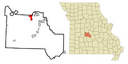 Location of Sunrise Beach, Missouri | |
| Coordinates: 38°10′47″N 92°46′21″W / 38.17972°N 92.77250°WCoordinates: 38°10′47″N 92°46′21″W / 38.17972°N 92.77250°W | |
| Country | United States |
| State | Missouri |
| Counties | Camden, Morgan |
| Area[1] | |
| • Total | 5.50 sq mi (14.24 km2) |
| • Land | 5.49 sq mi (14.22 km2) |
| • Water | 0.01 sq mi (0.03 km2) |
| Elevation | 846 ft (258 m) |
| Population (2010)[2] | |
| • Total | 431 |
| • Estimate (2012[3]) | 429 |
| • Density | 78.5/sq mi (30.3/km2) |
| Time zone | Central (CST) (UTC-6) |
| • Summer (DST) | CDT (UTC-5) |
| ZIP code | 65079 |
| Area code(s) | 573 |
| FIPS code | 29-71728[4] |
| GNIS feature ID | 0727318[5] |
Sunrise Beach is a village in Camden and Morgan counties in the U.S. state of Missouri. The population was 431 at the 2010 census.
A post office called Sunrise Beach has been in operation since 1932.[6] The village was named its location near the beach of Lake of the Ozarks.[7]
Geography
Sunrise Beach is located at 38°36′47″N 92°46′21″W / 38.61306°N 92.77250°W (38.179711, -92.772564).[8]
According to the United States Census Bureau, the village has a total area of 5.50 square miles (14.24 km2), of which, 5.49 square miles (14.22 km2) of it is land and 0.01 square miles (0.03 km2) is water.[1]
Demographics
| Historical population | |||
|---|---|---|---|
| Census | Pop. | %± | |
| 1960 | 78 | — | |
| 1970 | 126 | 61.5% | |
| 1980 | 148 | 17.5% | |
| 1990 | 181 | 22.3% | |
| 2000 | 368 | 103.3% | |
| 2010 | 431 | 17.1% | |
| Est. 2015 | 449 | [9] | 4.2% |
2010 census
As of the census[2] of 2010, there were 431 people, 207 households, and 122 families residing in the village. The population density was 78.5 inhabitants per square mile (30.3/km2). There were 418 housing units at an average density of 76.1 per square mile (29.4/km2). The racial makeup of the village was 94.7% White, 0.2% African American, 1.6% Native American, 0.5% from other races, and 3.0% from two or more races. Hispanic or Latino of any race were 3.0% of the population.
There were 207 households of which 21.7% had children under the age of 18 living with them, 43.0% were married couples living together, 10.6% had a female householder with no husband present, 5.3% had a male householder with no wife present, and 41.1% were non-families. 32.4% of all households were made up of individuals and 18.4% had someone living alone who was 65 years of age or older. The average household size was 2.08 and the average family size was 2.51.
The median age in the village was 48.9 years. 16.7% of residents were under the age of 18; 7.7% were between the ages of 18 and 24; 19.3% were from 25 to 44; 27.9% were from 45 to 64; and 28.5% were 65 years of age or older. The gender makeup of the village was 48.0% male and 52.0% female.
2000 census
As of the census[4] of 2000, there were 368 people, 171 households, and 112 families residing in the village. The population density was 83.0 people per square mile (32.1/km²). There were 350 housing units at an average density of 79.0 per square mile (30.5/km²). The racial makeup of the village was 93.48% White, 2.17% Native American, 0.54% Asian, 1.09% from other races, and 2.72% from two or more races. Hispanic or Latino of any race were 1.90% of the population.
There were 171 households out of which 15.2% had children under the age of 18 living with them, 59.1% were married couples living together, 4.7% had a female householder with no husband present, and 34.5% were non-families. 28.1% of all households were made up of individuals and 14.6% had someone living alone who was 65 years of age or older. The average household size was 2.15 and the average family size was 2.52.
In the village the population was spread out with 14.9% under the age of 18, 6.3% from 18 to 24, 19.6% from 25 to 44, 29.9% from 45 to 64, and 29.3% who were 65 years of age or older. The median age was 51 years. For every 100 females there were 96.8 males. For every 100 females age 18 and over, there were 92.0 males.
The median income for a household in the village was $27,679, and the median income for a family was $30,833. Males had a median income of $21,016 versus $15,536 for females. The per capita income for the village was $17,382. About 6.3% of families and 10.7% of the population were below the poverty line, including 43.9% of those under age 18 and 4.3% of those age 65 or over.
References
- 1 2 "US Gazetteer files 2010". United States Census Bureau. Retrieved 2012-07-08.
- 1 2 "American FactFinder". United States Census Bureau. Retrieved 2012-07-08.
- ↑ "Population Estimates". United States Census Bureau. Retrieved 2013-05-30.
- 1 2 "American FactFinder". United States Census Bureau. Retrieved 2008-01-31.
- ↑ "US Board on Geographic Names". United States Geological Survey. 2007-10-25. Retrieved 2008-01-31.
- ↑ "Post Offices". Jim Forte Postal History. Retrieved 8 September 2016.
- ↑ "Camden County Place Names, 1928–1945 (archived)". The State Historical Society of Missouri. Retrieved 8 September 2016.
- ↑ "US Gazetteer files: 2010, 2000, and 1990". United States Census Bureau. 2011-02-12. Retrieved 2011-04-23.
- ↑ "Annual Estimates of the Resident Population for Incorporated Places: April 1, 2010 to July 1, 2015". Retrieved July 2, 2016.
- ↑ "Census of Population and Housing". Census.gov. Retrieved June 4, 2015.
Municipalities and communities of Camden County, Missouri, United States | ||
|---|---|---|
| Cities | 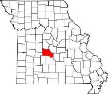 | |
| Villages | ||
| Townships | ||
| CDPs | ||
| Other unincorporated communities | ||
| Footnotes | ‡This populated place also has portions in an adjacent county or counties | |
Municipalities and communities of Morgan County, Missouri, United States | ||
|---|---|---|
| Cities | 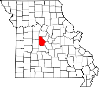 | |
| Villages | ||
| Townships | ||
| Unincorporated communities | ||
| Ghost town | ||
| Footnotes | ‡This populated place also has portions in an adjacent county or counties | |