Latham, New York
| Latham | |
| hamlet | |
| Official name: Latham, New York | |
| Name origin: For former hotel owner William G. Latham | |
| Country | United States |
|---|---|
| State | New York |
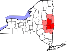
| Region | Capital District |
| County | Albany |
| Municipality | Town of Colonie |
| Elevation | 354 ft (108 m) |
| Coordinates | 42°44′49″N 73°45′32″W / 42.74694°N 73.75889°WCoordinates: 42°44′49″N 73°45′32″W / 42.74694°N 73.75889°W |
| Mayor | Paula Mahan |
| Timezone | EST (UTC-5) |
| - summer (DST) | EDT (UTC-4) |
| ZIP Code | 12110 |
| Area code | 518 |
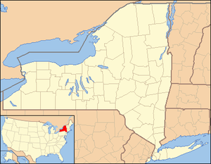 Location of Latham within the state of New York | |
Latham is a hamlet in Albany County, New York, United States. It is located along U.S. Route 9 in the town of Colonie, a dense suburb north of Albany. As of the 2010 census, the population was 20,736.
History
| Latham Historical Populations | ||
|---|---|---|
| Year | Pop. | ±% |
| 1970 | 9,661 | — |
| 1980 | 11,182 | +15.7% |
| 1990 | 10,131 | −9.4% |
| Sources: Censuses 1970 and 1980;[1] and 1990.[2] | ||
The area was known at different times in its history as Yearsley's (c. 1829), Van Vranken's (c. 1851), Town House Corners (c. 1860) and Latham's Corners, named after hotel owner William G. Latham. The "corner" referred to is now the intersection of Troy-Schenectady Road (NY Route 2) and Old Loudon Road.
The Old Loudon Road was built in 1755 during the French and Indian War to bring troops and provisions from Albany to the areas of Lake George and Ticonderoga. The Troy and Schenectady Turnpike was built in 1802 and intersected Old Loudon. An early first resident of this hamlet was Jonas Yearsley, 1785, who later built the first hotel close to this intersection. The hamlet was known first under the name of Yearsley's Corners and years afterward as Van Vrankens Corners in the 1850s. The name changed into Latham when William Latham became owner of the hotel. James, his son, continued to run the hotel until he died on August 14, 1933.
Geography
The hamlet itself is very narrow east-west and relatively long north-south, centered on the intersection of the Troy-Schenectady Road and Old Loudon Road. As a hamlet its boundaries are inexact though they are marked by the New York State Department of Transportation on the west and east ends on New York Route 2 and on the south end on U.S. Route 9 (US 9). On the west end the hamlet begins near the entrance to Latham Circle Mall; on the south end it starts near the Y-intersection of US 9 and Old Loudon Road; and on the east end the border is near the Kiwanis Park. The northern border is not marked. The area normally referred to as "Latham" extends well beyond the hamlet itself, as the name is also used for the post office of the 12110 ZIP Code. Many locations often considered in the northern and northeastern parts of Latham are in the Cohoes ZIP Code, while many in the eastern sections use a Watervliet ZIP Code.
Latham's terrain is mostly a hilly mix of deciduous and evergreen trees, with some ponds, creeks and swamps, including several protected water courses and New York State Wetlands. Streams east of Old Loudon Road and US 9 generally drain into the Hudson River; west of Old Loudon and US 9, the hamlet's watercourses drain into the Mohawk River.
Location
 |
Hamlet of Verdoy | Hamlet of Boght Corners | City of Cohoes | |
| Albany International Airport | |
City of Watervliet | ||
| ||||
| | ||||
| Hamlet of Newtonville |
Notable people
References
- ↑ 1980 Census of Population; Volume 1: Characteristics of the Population. United States Census Bureau. 1980. p. 34-10. Retrieved 2010-02-13.
- ↑ "American FactFinder". United States Census Bureau. Retrieved 2008-01-31.
External links
| Wikimedia Commons has media related to Latham, New York. |
- "Latham Circle Mall" at Dead Malls
- Town of Colonie (includes Latham)
- North Colonie Public Schools
- Hidden in Suburbia (Photo Essay)
- Latham Water Tower Replacement Plan (from Albany Airport)
- Latham Fire Department
Municipalities and communities of Albany County, New York, United States | ||
|---|---|---|
| Cities | 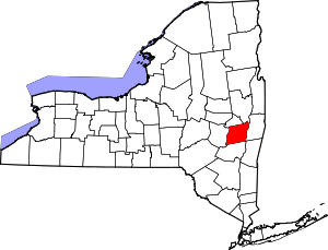 | |
| Towns | ||
| Villages | ||
| CDPs | ||
| Other hamlets |
| |