List of Maine state parks
This list includes state parks, public reserved lands, and state historic sites in the U.S. state of Maine. They are operated by the Maine Department of Conservation, with the exception of Baxter State Park, which is operated by the Baxter State Park Authority.
State parks
| Name | County | Locality | Area [1] | Estab- lished | River / lake / other | Image | Remarks | |
|---|---|---|---|---|---|---|---|---|
| Allagash Wilderness Waterway | Aroostook, Piscataquis |
22,840 acres | 9,240 ha | 1966 | Allagash River | Canoeing, fishing, hunting, camping | ||
| Androscoggin Riverlands | Androscoggin | Turner | 2,588 acres | 1,047 ha | Androscoggin River | Canoeing, multi-use trails along 12 miles of river frontage | ||
| Aroostook State Park | Aroostook | Presque Isle | 904 acres | 366 ha | 1938 | Echo Lake | Swimming, hiking, camping | |
| Baxter State Park | Piscataquis | 209,501 acres | 84,782 ha | 1931 | Hiking on Mount Katahdin | |||
| Birch Point State Park | Knox | Owls Head | 62 acres | 25 ha | Penobscot Bay | Pocket beach | ||
| Bradbury Mountain State Park | Cumberland | Pownal | 590 acres | 240 ha | 1939 | Mountain biking | ||
| Camden Hills State Park | Knox, Waldo | Camden, Lincolnville | 5,710 acres | 2,310 ha |  |
Trails: hiking, horseback riding, mountain biking, cross-country skiing, snowmobiling | ||
| Cobscook Bay State Park | Washington | Edmunds Township | 871 acres | 352 ha | 1964 | Cobscook Bay |  |
Tide watching |
| Crescent Beach State Park | Cumberland | Cape Elizabeth | 244 acres | 99 ha | 1966 | Atlantic Ocean | Saltwater beach, hiking trails | |
| Damariscotta Lake State Park | Lincoln | Jefferson | 19 acres | 7.7 ha | 1970 | Damariscotta Lake | Sandy beach | |
| Ferry Beach State Park | York | Saco | 117 acres | 47 ha | Atlantic Ocean | Sandy beach | ||
| Fort Point State Park | Waldo | Stockton Springs | 156 acres | 63 ha | 1974 | Penobscot Bay | Scenic vistas, fishing | |
| Grafton Notch State Park | Oxford | Grafton Township | 3,192 acres | 1,292 ha | Bear River | .jpg) |
Hiking | |
| Holbrook Island Sanctuary State Park | Hancock | Brooksville | 1,345 acres | 544 ha | 1971 | Penobscot Bay | Hiking, kayaking | |
| Lake St. George State Park | Waldo | Liberty Township | 358 acres | 145 ha | Lake St. George | Camping, swimming, boating, hiking | ||
| Lamoine State Park | Hancock | Lamoine | 55 acres | 22 ha | Frenchman's Bay | Camping, kayaking | ||
| Lily Bay State Park | Piscataquis | Greenville | 924 acres | 374 ha | 1961 | Moosehead Lake | Fronts the state's largest lake | |
| Mackworth Island | Cumberland | Falmouth | 100 acres | 40 ha | 1946 | Casco Bay | Hiking, scenic vistas | |
| Moose Point State Park | Waldo | Searsport | 146 acres | 59 ha | 1980s | Penobscot Bay | Hiking, scenic vistas | |
| Mount Blue State Park | Franklin | Weld | 7,489 acres | 3,031 ha | 1955 | Webb Lake | 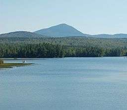 |
Beach, hiking, camping |
| Mount Kineo State Park | Piscataquis | Kineo Township | 800 acres | 320 ha | Moosehead Lake | Trails, vistas | ||
| Owls Head Light State Park | Knox | Owls Head | 13 acres | 5.3 ha | Penobscot Bay | Beaches, lighthouse | ||
| Peacock Beach State Park | Sagadahoc | Richmond | 10 acres | 4.0 ha | Pleasant Pond | Locally managed | ||
| Peaks-Kenny State Park | Piscataquis | Dover-Foxcroft, Bowerbank |
813 acres | 329 ha | 1964 | Sebec Lake | Beach, boating, camping | |
| Penobscot River Corridor | Piscataquis, Somerset |
12,500 acres | 5,100 ha | Penobscot River | Remote, wilderness recreation | |||
| Popham Beach State Park | Sagadahoc | Phippsburg | 605 acres | 245 ha | Atlantic Ocean | Sandy beach | ||
| Quoddy Head State Park | Washington | Lubec | 605 acres | 245 ha | 1962 | Atlantic Ocean |  |
Historic lighthouse |
| Range Ponds State Park | Androscoggin | Poland | 740 acres | 300 ha | Range Ponds | Sandy beach | ||
| Rangeley Lake State Park | Franklin | Rangeley, Rangeley Plantation |
870 acres | 350 ha | Rangeley Lake | Lakeside camping | ||
| Reid State Park | Sagadahoc | Georgetown | 770 acres | 310 ha | 1946 | Sheepscot Bay | Swimming, sandy beaches | |
| Roque Bluffs State Park | Washington | Roque Bluffs | 274 acres | 111 ha | 1969 | Englishman Bay | Hiking trails | |
| Sebago Lake State Park | Cumberland | Naples, Casco | 1,342 acres | 543 ha | 1938 | Sebago Lake | 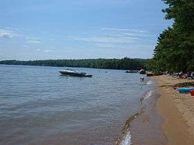 |
Boating, swimming, camping |
| Shackford Head State Park | Washington | Eastport | 87 acres | 35 ha | 1989 | Cobscook Bay | 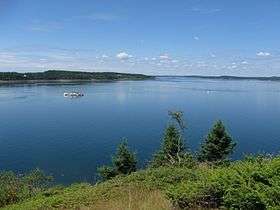 |
Shoreline and inland hiking |
| Swan Lake State Park | Waldo | Swanville | 67 acres | 27 ha | Swan Lake | Swimming, canoeing | ||
| Two Lights State Park | Cumberland | Cape Elizabeth | 41 acres | 17 ha | 1961 | Casco Bay |  |
Historic lighthouses |
| Vaughan Woods State Park | York | South Berwick | 165 acres | 67 ha | 1949 | Salmon Falls River | Old-growth forest | |
| Warren Island State Park | Waldo | Islesboro | 70 acres | 28 ha | 1959 | Penobscot Bay | Access by private boat | |
| Wolfe's Neck Woods State Park | Cumberland | Freeport | 244 acres | 99 ha | 1969 | Casco Bay | Osprey watching | |
State historic sites
| Name | County | Locality | Area [1] | Image | Remarks | |
|---|---|---|---|---|---|---|
| Bible Point | Aroostook | 27 acres | 11 ha | Campsite of the young Teddy Roosevelt on Mattawamkeag Lake | ||
| Colburn House State Historic Site | Kennebec | Pittston | 6 acres | 2.4 ha | Home of patriot and shipbuilder Reuben Colburn | |
| Colonial Pemaquid State Historic Site | Lincoln | Bristol | 19 acres | 7.7 ha |  |
Site of colonial settlement dating from the early 1600s |
| Eagle Island State Historic Site | Cumberland | Harpswell | 17 acres | 6.9 ha |  |
Casco Bay home of explorer Admiral Robert Peary |
| Fort Baldwin State Historic Site | Sagadahoc | Phippsburg | 10 acres | 4.0 ha | 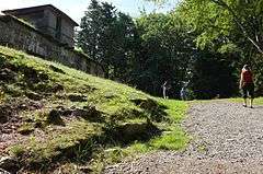 |
Early 20th-century coastal defense fortification near the mouth of the Kennebec River |
| Fort Edgecomb State Historic Site | Lincoln | Edgecomb | 3 acres | 1.2 ha | 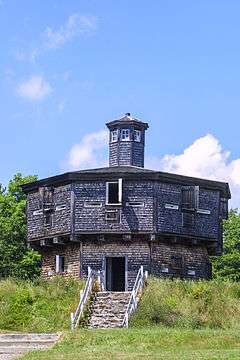 |
Two-story, octagonal wooden blockhouse on Davis Island |
| Fort Halifax State Historic Site | Kennebec | Winslow | 0.75 acres | 0.30 ha | .jpg) |
British colonial outpost on the Sebasticook River |
| Fort Kent State Historic Site | Aroostook | Fort Kent | 3 acres | 1.2 ha | .jpg) |
Fortification built during the Aroostook War at the confluence of the Fish and Saint John rivers |
| Fort Knox State Historic Site | Waldo | Prospect | 124 acres | 50 ha | Nineteenth-century coastal fortification on the Penobscot River | |
| Fort McClary State Historic Site | York | Kittery Point | 27 acres | 11 ha |  |
Nineteenth-century coastal fortification at the mouth of the Piscataqua River |
| Fort O'Brien State Historic Site | Washington | Machiasport | 2 acres | 0.81 ha |  |
Site of fortification on the Machias River destroyed during both the American Revolutionary War and the War of 1812 |
| Fort Popham State Historic Site | Sagadahoc | Phippsburg | 4 acres | 1.6 ha | 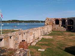 |
Civil War-era coastal fortification at the mouth of the Kennebec River |
| Fort Pownall | Waldo | Stockton Springs | 3 acres | 1.2 ha | 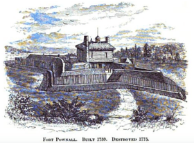 |
In Fort Point State Park |
| John Paul Jones State Historic Site | York | Kittery | 2 acres | 0.81 ha | Site of the Maine Sailors' and Soldiers' Memorial by Bashka Paeff | |
| Katahdin Iron Works | Piscataquis | T6R9 | 23 acres | 9.3 ha | Site of an ironworks in operation from 1845 to 1890 | |
| Storer Garrison State Historic Site | York | Wells | 0 acres | 0 ha | A plaque commemorating the site of the Storer Garrison | |
| Whaleback Shell Midden | Lincoln | Damariscotta | 11 acres | 4.5 ha | Oyster shell midden on the Damariscotta River | |
Public reserved lands
| Name | County | Locality | Area [1] | Established | River / lake / other | Image | Remarks | |
|---|---|---|---|---|---|---|---|---|
| Bald Mountain | Franklin | 1,873 acres | 758 ha | |||||
| Bigelow Preserve | Franklin, Somerset | 36,700 acres | 14,900 ha | |||||
| Bradley | Penobscot | 9,059 acres | 3,666 ha | |||||
| Chains of Ponds | Franklin | 1,141 acres | 462 ha | |||||
| Chamberlain Lake | Piscataquis | 9,557 acres | 3,868 ha | |||||
| Cutler Coast | Washington | 12,170 acres | 4,930 ha | |||||
| Day's Academy | Piscataquis | 7,275 acres | 2,944 ha | |||||
| Dead River | Somerset | 4,771 acres | 1,931 ha | |||||
| Deboullie | Aroostook | 21,871 acres | 8,851 ha | |||||
| Dodge Point | Lincoln | 506 acres | 205 ha | |||||
| Donnell Pond | Hancock | 14,496 acres | 5,866 ha | |||||
| Duck Lake | Hancock, Washington | 25,220 acres | 10,210 ha | |||||
| Eagle Lake | Aroostook | 23,882 acres | 9,665 ha | |||||
| Four Ponds | Franklin | 6,015 acres | 2,434 ha | |||||
| Gero Island | Piscataquis | 3,845 acres | 1,556 ha | |||||
| Great Heath | Washington | 6,067 acres | 2,455 ha | |||||
| Holeb | Somerset | 19,651 acres | 7,952 ha | |||||
| Kennebec Highlands | Franklin, Kennebec | 6,000 acres | 2,400 ha | |||||
| Little Moose | Piscataquis | 15,047 acres | 6,089 ha | |||||
| Machias River Corridor | Washington | 10,026 acres | 4,057 ha | |||||
| Mahoosuc | Oxford | 27,253 acres | 11,029 ha | |||||
| Moosehead Lake | Piscataquis | 12,673 acres | 5,129 ha | |||||
| Mount Abram | Franklin | 6,214 acres | 2,515 ha | |||||
| Nahmakanta | Piscataquis | 42,818 acres | 17,328 ha | |||||
| Pineland | Cumberland | 600 acres | 240 ha | |||||
| Richardson | Oxford | 17,757 acres | 7,186 ha | |||||
| Rocky Lake | Washington | 10,904 acres | 4,413 ha | |||||
| Round Pond | Aroostook | 20,349 acres | 8,235 ha | |||||
| Salmon Brook Lake Bog | Aroostook | 1,857 acres | 752 ha | |||||
| Scraggly Lake | Penobscot | 9,057 acres | 3,665 ha | |||||
| Scopan | Aroostook | 17,985 acres | 7,278 ha | |||||
| Seboeis | Penobscot, Piscataquis | 21,369 acres | 8,648 ha | |||||
| Seboomook Unit | Somerset | 41,436 acres | 16,769 ha | |||||
| Telos | Aroostook | 22,806 acres | 9,229 ha | |||||
| Tumbledown | Franklin | 9,990 acres | 4,040 ha | |||||
| Wassataquoik | Penobscot | 2,099 acres | 849 ha | |||||
See also
References
- 1 2 3 "Outdoors in Maine: State Parks, Public Lands, and Historic Sites" (PDF). Department of Agriculture, Conservation and Forestry. Retrieved December 9, 2015.
External links
This article is issued from Wikipedia - version of the 12/10/2015. The text is available under the Creative Commons Attribution/Share Alike but additional terms may apply for the media files.