Saint John, New Brunswick
| Saint John | |
|---|---|
| City | |
| City of Saint John Ville de Saint John | |
|
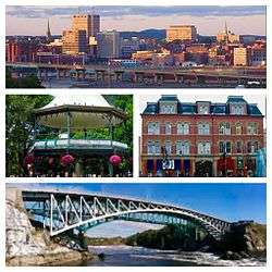
Clockwise: Uptown Saint John, City Market, Reversing Falls Bridge, and King's Square Bandstand | |
| Nickname(s): Canada's Irish City", "Fundy City", "Loyalist City", "Port City", "Original City" | |
|
Motto: "O Fortunati Quorum Jam Moenia Surgunt" (Latin for, "O Fortunate Ones Whose Walls Are Now Rising." or "O Happy They, Whose Promised Walls Already Rise") | |
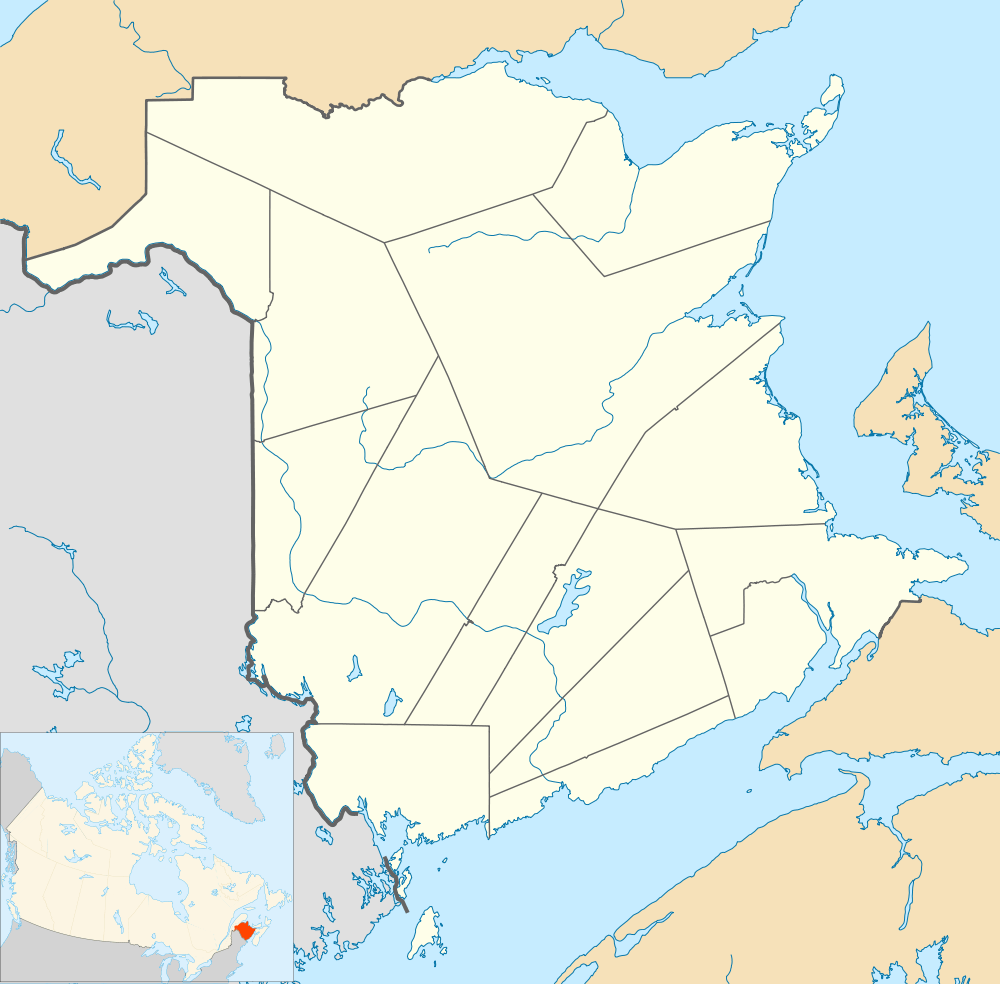 Saint John Location of Saint John in New Brunswick | |
| Coordinates: 45°16′50″N 66°04′34″W / 45.28056°N 66.07611°WCoordinates: 45°16′50″N 66°04′34″W / 45.28056°N 66.07611°W | |
| Country | Canada |
| Province | New Brunswick |
| County | Saint John County |
| Parish | City of Saint John[1] |
| Established | 1604 |
| Major Settlement Started | 1783 |
| Incorporation | May 18, 1785 |
| Founded by | Lt. Gov. Thomas Carleton |
| Named for | St. John the Baptist |
| Government | |
| • Mayor | Don Darling[2] |
| • Governing body | Saint John City Council |
| • MPs | Wayne Long |
| • MLAs | Trevor Holder, Ed Doherty, Dorothy Shephard, Glen Savoie |
| Area[3][4][5] | |
| • Land | 315.82 km2 (121.94 sq mi) |
| • Urban | 209.68 km2 (80.96 sq mi) |
| • Metro | 3,362.95 km2 (1,298.44 sq mi) |
| Highest elevation | 80.8 m (265.1 ft) |
| Lowest elevation | 0 m (0 ft) |
| Population (2011)[3][4][5] | |
| • City | 70,063 |
| • Density | 221.8/km2 (574/sq mi) |
| • Urban | 95,902 |
| • Urban density | 457.4/km2 (1,185/sq mi) |
| • Metro | 127,761 |
| • Metro density | 38.0/km2 (98/sq mi) |
| • Pop 2006-2011 |
|
| • Dwellings | 33,530 |
| Demonym(s) | Saint Johner |
| Time zone | Atlantic (AST) (UTC-4) |
| • Summer (DST) | Atlantic (ADT) (UTC-3) |
| Canadian Postal code | E2K, E2L, E2J, And E2P |
| Area code(s) | 506 |
| Telephone Exchanges | 202, 214, 333, 343, 557–8, 592, 608, 631–640, 642–654, 657–8, 663, 672, 674, 693–4, 696, 721, 977 |
| Highways |
|
| NTS Map | 021G08 |
| GNBC Code | DAEGW |
| Website |
www |
Saint John (French pronunciation: [sɛ̃ ʒɔn]) is the largest city in New Brunswick and the second largest city in the Maritime provinces. It is known as the Fundy City due to its location on the north shore of the Bay of Fundy at the mouth of the Saint John River, as well as being the only city on the bay. In 1785, Saint John became the first incorporated city in Canada.[6][7]
Saint John had a population of 70,063 in 2011 over an area of 315.82 square kilometres (121.94 sq mi).[3] The Saint John metropolitan area covers a land area of 3,362.95 square kilometres (1,298.44 sq mi) across the Caledonia Highlands, with a population (as of 2011) of 127,761.
History
Notable firsts

- 1785: First quarantine station in North America, Partridge Island, established by the city's charter.[8] In the early 19th century, it greeted sick and dying Irish immigrants arriving with inhospitable conditions.
- 1830: The first chartered bank in Canada, the Bank of New Brunswick.
- Canada's oldest publicly funded high school, Saint John High School[9]
- 1838: First penny newspaper in the Empire, the tri-weekly Saint John News, established by George E Fenety.[10]
- 1842: Canada's first public museum, originally known as the Gesner Museum, named after its Nova Scotian founder Abraham Gesner, the first modern commercial producer of kerosene. The museum is now known as the New Brunswick Museum.
- 1851: Marco Polo ship launched.
- 1849: Canada’s first labour union, the Laborer’s Benevolent Association (now ILA local 273) that was formed when Saint John’s longshoremen banded together to lobby for regular pay and a shorter workday. One of their first resolutions was to apply to the city council for permission to erect the bell, which would announce the beginning and end of the labourer’s 10-hour workday.[11]
- 1854: The automated steam foghorn was invented by Robert Foulis.[12]
- 1870: Canada's first Y.W.C.A. established by Mrs. Agnes A. Blizzard in a house on Germain Street.[13]
- 1870: First Knights of Pythias in British Empire.[14]
- 1872: Monitor top railroad cars in the world invented by James Ferguson. The original model is in the New Brunswick Museum in Saint John.[15]
- 1880: First clockwork time bomb developed in 1880.
- 1906: First public playground in Canada which was started by Miss Mabel Peters. This playground is known as the Allison Ground Playground in Rockwood Court. On July 16, 2009, 103 years after its opening, Allison Ground Playground is the first playground, that Mabel Peters encouraged, to be renamed in her honour as Mabel Peters Playground.[16]
- 1907: First orchestra to accompany a silent moving picture on the North American continent was by Walter Golding in the old nickel theatre, May 1907.
- 1918: First Minister of Health of the British Empire, W. F. Roberts, M.D.[17]
- 1918: One of the first police unions in Canada, the Saint John Police Protective Association, was formed in Saint John.[18]
- 1923: First Miss Canada Mrs. Harold Drummie (née Winnie Blair).[19][20]
Geography and climate
Physical geography
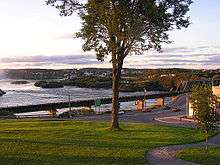
Situated in the south-central portion of the province, along the north shore of the Bay of Fundy at the mouth of the Saint John River, the city is split by the south-flowing river and the east side is bordered on the north by the Kennebecasis River where it meets the Saint John River at Grand Bay. The harbour is home to a terminal for cruise ships as well as being a fairly busy home for various container ships.
The Saint John River itself flows into the Bay of Fundy through a narrow gorge several hundred feet wide at the centre of the city. It contains a unique phenomenon called the Reversing Falls where the diurnal tides of the bay reverse the water flow of the river for several kilometres. A series of underwater ledges at the narrowest point of this gorge also create a series of rapids.
The topography surrounding Saint John is hilly; a result of the influence of two coastal mountain ranges which run along the Bay of Fundy – the St. Croix Highlands and the Caledonia Highlands. The soil throughout the region is extremely rocky with frequent granite outcrops. The coastal plain hosts numerous freshwater lakes in the eastern, western and northern parts of the city.
In Saint John the height difference from low to high tide is approximately 8 metres (28 ft) due to the funnelling effect of the Bay of Fundy as it narrows. The Reversing Falls in Saint John, actually an area of strong rapids, provides one example of the power of these tides; at every high tide, ocean water is pushed through a narrow gorge in the middle of the city and forces the Saint John River to reverse its flow for several hours.
Neighbourhoods
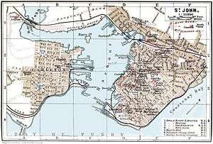
Saint John is a city of neighbourhoods, with residents closely identifying with their particular area.
South (End) Central Peninsula—Uptown
The central peninsula on the east side of the harbour and the area immediately opposite on the west side are the sites of the original city, which resulted from the merger of Parrtown and Carleton. The western side of the central peninsula subsequently saw increased development and currently includes the central business district (CBD) and the Trinity Royal Heritage Conservation Area, which together are referred to as "Uptown" by residents throughout the city. The term "Uptown" comes from the time when the city was an active port and people at the slips would go up the hill to the city. In addition, most of the central peninsula is situated on a hill. This central area of Saint John is only rarely called "Downtown." The south end of the central peninsula, south of Duke Street, is appropriately called the South End.
North End (Indiantown/Millidgeville/Mount Pleasant/Portland)

The area north of the Highway #1 from the South Central Peninsula is called the North End; both areas being predominantly urban residential older housing which is undergoing gentrification. Much of the North End is made up of the former city of Portland and comprises another former working class area which is slowly undergoing gentrification at the eastern end of Douglas Avenue; immediately north of Portland and upstream from the Reversing Falls is the former community of Indiantown.
Vessels navigating the Saint John River can only transit the Reversing Falls gorge at slack tide, thus Indiantown became a location during the 19th and 20th centuries where tugboats and paddle wheelers could dock to wait. Being located at the beginning of the navigable part of the Saint John River, Indiantown also became a major terminal for vessels departing to ply their trade upriver.
Further north of the central part of the city, and northeast of the North End and Portland, along the southern bank of the Kennebecasis River is the area of Millidgeville which is generally considered a neighbourhood separate from the North End. The boundary of Millidgeville is typically thought to begin at the "Y" intersection of Somerset Street and Millidge Ave or right after Tartan St. It is a middle to upper-class neighbourhood. Located here is University of New Brunswick, as well as New Brunswick's largest health care centre, the Saint John Regional Hospital, and Saint John's only completely French school and community centre, Centre Scolaire Communautaire Samuel-de-Champlain.
The eastern area of the North End plays host to the city's largest park, and one of Canada's largest urban parks. Rockwood Park encompasses 890 hectares of upland Acadian mixed forest, many hills and several caves, as well as several freshwater lakes, with an extensive trail network, a golf course, and the Cherry Brook Zoo. The park was designed by Calvert Vaux in the mid-to-late 19th century. Mount Pleasant borders the park, and is generally seen as distinct from the traditionally poorer North End.
East Side (Simonds/Loch Lomond)

To the east of the Courtney Bay / Forebay and south of New Brunswick Route 1 is the East Side, where the city has experienced its greatest suburban sprawl in recent decades with commercial retail centres and residential subdivisions. There has been significant and consistent commercial and retail development in the Westmorland Road-McAllister Drive-Consumer's Drive-Major's Brook Drive-Retail Drive corridor since the 1970s, including McAllister Place, the city's largest shopping mall, which opened in 1978, and with active year-to-year development since 1994. The city's current airport is located further east on the coastal plain among several lakes at the far eastern edge of the municipality. Far east side is Loch Lomond, including several urban neighbourhoods are found here, including Forest Hills, Champlain Heights, and Lakewood Heights. The malls were built by filling in Major's Brook (a tributary to Marsh Creek), making the area prone to flooding.
West Side (Carleton/Lancaster/Fairville)
The portion of the city west of the Saint John River is collectively referred to as West Side, although West Saint Johners typically divide this area into several neighbourhoods. As mentioned previously, the Lower West Side is the former working-class neighbourhood that was known as Carleton at the time of the city's formation in 1785. West and north of the Lower West Side is the former city of Lancaster (commonly referred to as Saint John West), which was amalgamated into Saint John in 1967. The dividing line is generally agreed upon to be Martello Tower and not Lancaster Avenue, with the streets east and south of Lancaster Avenue being considered to be the "West Side, and the streets north and west of Lancaster Avenue, having been renamed from Lancaster, NB to Saint John West, NB.
The southern part of Lancaster abutting Saint John Harbour and the Bay of Fundy is Bayshore and the location of Canadian Pacific Railway's Bayshore Yard. The north end of Lancaster, known as Fairville, is home to Moosehead Brewery and older neighbourhoods clustered along Manawagonish Road. North of Fairville are the communities of Milford and Randolph. Randolph, which is home to Dominion Park Beach, includes land on the city's largest island, and is joined by the Canal Bridge over Mosquito Cove on Greenhead Road. The area also contains the Irving Pulp and Paper mill, a highly visible manufacturing plant that sits directly next to the Reversing Falls and is owned and operated by J. D. Irving, Ltd.
West of Lancaster, the city hosts its second largest park, and one of the largest coastal urban parks in the country. The Irving Nature Park, along Saints' Rest Beach sits on an extensive peninsula called Taylor's Island extending into the western part of the harbour into the Bay of Fundy. The park is partially open to vehicles in summer and features ocean views and walking trails through mixed forests.
Suburbs
Saint John's suburbs, just on the edge of the city limit, are Rothesay, Quispamsis, and Grand Bay-Westfield. Mainly residential, the suburbs have attracted many of Saint John's residents leading to, until the last census of 2011, the city's population to shrink.
Climate
| Saint John | ||||||||||||||||||||||||||||||||||||||||||||||||||||||||||||
|---|---|---|---|---|---|---|---|---|---|---|---|---|---|---|---|---|---|---|---|---|---|---|---|---|---|---|---|---|---|---|---|---|---|---|---|---|---|---|---|---|---|---|---|---|---|---|---|---|---|---|---|---|---|---|---|---|---|---|---|---|
| Climate chart (explanation) | ||||||||||||||||||||||||||||||||||||||||||||||||||||||||||||
| ||||||||||||||||||||||||||||||||||||||||||||||||||||||||||||
| ||||||||||||||||||||||||||||||||||||||||||||||||||||||||||||
The climate of Saint John is humid continental (Köppen climate classification Dfb). The Bay of Fundy never fully freezes, thus moderating the winter temperatures compared with inland locations. Even so, with the prevailing wind blowing from the west (from land to sea), the average January temperature is about −8.2 °C (17.2 °F). Summers are usually warm to hot, and daytime temperatures often exceed 25 °C (77 °F). The highest temperature recorded in a given year is usually 30 °C (86 °F) or 31 °C (88 °F). The confluence of cold Bay of Fundy air and inland warmer temperatures often creates onshore winds that bring periods of fog and cooler temperatures during the summer months.
Precipitation in Saint John totals about 1,390 millimetres (55 in) annually and is well distributed throughout the year, although the late autumn and early winter is typically the wettest time of year. Snowfalls can often be heavy, but rain is as common as snow in winter, and it is not unusual for the ground to be snow-free even in mid-winter.
The highest temperature ever recorded in Saint John was 34.4 °C (94 °F) on 22 June 1941,[22] 15 August 1944,[23] and 22 August 1976.[24] The coldest temperature ever recorded was −36.7 °C (−34 °F) on 11 February 1948.[24]
| Climate data for Saint John Airport, 1981−2010 normals, extremes 1871−present[lower-alpha 1] | |||||||||||||
|---|---|---|---|---|---|---|---|---|---|---|---|---|---|
| Month | Jan | Feb | Mar | Apr | May | Jun | Jul | Aug | Sep | Oct | Nov | Dec | Year |
| Record high humidex | 16.8 | 13.3 | 27.0 | 23.8 | 35.4 | 37.4 | 40.3 | 40.3 | 39.2 | 28.3 | 24.0 | 19.8 | 40.3 |
| Record high °C (°F) | 14.5 (58.1) |
13.3 (55.9) |
25.4 (77.7) |
22.8 (73) |
33.0 (91.4) |
34.4 (93.9) |
32.8 (91) |
34.4 (93.9) |
33.9 (93) |
28.9 (84) |
21.7 (71.1) |
16.4 (61.5) |
34.4 (93.9) |
| Average high °C (°F) | −2.5 (27.5) |
−1.5 (29.3) |
2.4 (36.3) |
8.5 (47.3) |
15.0 (59) |
19.6 (67.3) |
22.6 (72.7) |
22.4 (72.3) |
18.2 (64.8) |
12.3 (54.1) |
6.4 (43.5) |
0.5 (32.9) |
10.3 (50.5) |
| Daily mean °C (°F) | −7.9 (17.8) |
−7.1 (19.2) |
−2.5 (27.5) |
3.7 (38.7) |
9.5 (49.1) |
14.0 (57.2) |
17.1 (62.8) |
16.8 (62.2) |
13.0 (55.4) |
7.6 (45.7) |
2.3 (36.1) |
−4.4 (24.1) |
5.2 (41.4) |
| Average low °C (°F) | −13.3 (8.1) |
−12.6 (9.3) |
−7.4 (18.7) |
−1.2 (29.8) |
3.9 (39) |
8.4 (47.1) |
11.6 (52.9) |
11.2 (52.2) |
7.7 (45.9) |
2.8 (37) |
−1.9 (28.6) |
−9.3 (15.3) |
0.0 (32) |
| Record low °C (°F) | −33.2 (−27.8) |
−36.7 (−34.1) |
−30 (−22) |
−16.7 (1.9) |
−7.8 (18) |
−2.2 (28) |
1.1 (34) |
−0.6 (30.9) |
−6.7 (19.9) |
−10.6 (12.9) |
−16.9 (1.6) |
−34.4 (−29.9) |
−36.7 (−34.1) |
| Record low wind chill | −44.8 | −44.4 | −39.5 | −26.1 | −13.9 | −2.6 | 0.0 | 0.0 | −5.7 | −12.9 | −25.9 | −41.9 | −44.8 |
| Average precipitation mm (inches) | 123.5 (4.862) |
91.0 (3.583) |
108.2 (4.26) |
105.3 (4.146) |
109.8 (4.323) |
101.0 (3.976) |
88.4 (3.48) |
81.7 (3.217) |
105.6 (4.157) |
116.4 (4.583) |
134.1 (5.28) |
130.4 (5.134) |
1,295.5 (51.004) |
| Average rainfall mm (inches) | 66.1 (2.602) |
49.0 (1.929) |
66.6 (2.622) |
85.7 (3.374) |
108.5 (4.272) |
101.0 (3.976) |
88.4 (3.48) |
81.7 (3.217) |
105.6 (4.157) |
115.8 (4.559) |
123.7 (4.87) |
84.0 (3.307) |
1,076 (42.362) |
| Average snowfall cm (inches) | 64.3 (25.31) |
48.4 (19.06) |
44.4 (17.48) |
20.0 (7.87) |
1.2 (0.47) |
0.0 (0) |
0.0 (0) |
0.0 (0) |
0.0 (0) |
0.5 (0.2) |
10.8 (4.25) |
49.9 (19.65) |
239.6 (94.33) |
| Average precipitation days (≥ 0.2 mm) | 16.2 | 12.8 | 14.0 | 13.9 | 13.7 | 12.9 | 11.5 | 10.5 | 10.5 | 11.9 | 14.4 | 15.6 | 157.9 |
| Average rainy days (≥ 0.2 mm) | 6.7 | 5.3 | 7.6 | 11.0 | 13.6 | 12.9 | 11.5 | 10.5 | 10.5 | 11.7 | 12.5 | 8.3 | 122.1 |
| Average snowy days (≥ 0.2 cm) | 12.9 | 10.2 | 9.4 | 5.1 | 0.5 | 0.0 | 0.0 | 0.0 | 0.0 | 0.5 | 3.9 | 10.2 | 52.6 |
| Mean monthly sunshine hours | 124.9 | 124.5 | 149.9 | 165.9 | 199.0 | 211.6 | 225.9 | 216.8 | 181.9 | 147.8 | 97.0 | 102.0 | 1,947.3 |
| Percent possible sunshine | 44.0 | 42.6 | 40.7 | 41.0 | 43.2 | 45.3 | 47.7 | 49.6 | 48.3 | 43.4 | 33.8 | 37.4 | 43.1 |
| Source: Environment Canada[24][25][26][27][28] | |||||||||||||
Buildings and structures
- Courtney Bay Smokestacks (each 106.7 metres (350 ft))
- Brunswick Square (80.8 metres (265 ft)) 19-story office building with 511,032 square feet (47,476.4 m2) which was built in 1976. It is the largest office building in New Brunswick in terms of square footage and second in Atlantic Canada behind the Maritime Centre in Halifax.
- Cathedral of the Immaculate Conception (Gothic style Catholic cathedral, construction began in 1853, its spire rises to 70.1 metres (230 ft))
- City Hall (55.2 metres (181 ft)) 15-storey office building (165,000 square feet (15,300 m2))
- Brunswick House (52 metres (171 ft)) 14-storey office building (103,000 square feet (9,600 m2))[29]
- Irving Building (50 metres (160 ft)) 14-storey office building[30]
- Brunswick Square Tower (81 metres (266 ft)) 19-storey office building
- Harbourside Senior Citizens Housing Complex (43 metres (141 ft)) 12-story apartment building
- Harbour Building (37 metres (121 ft)) 10-storey office building
- Mercantile Centre (30 metres (98 ft)) 7-storey office building (106,600 square feet (9,900 m2))[31]
- Chateau Saint John 8-storey Hotel (112 rooms)[32]
- City Market (built in 1876, oldest city market in North America, with an original ship's hull roof design)
- Loyalist Man
- Loyalist House (built in 1817)
National Historic Sites
There are 13 National Historic Sites of Canada in Saint John.[33]
Demography
Population
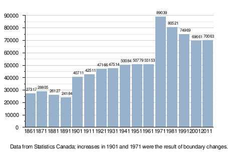
The population of the city declined from the 1970s to the early 21st century, but this trend has now reversed itself and has shown its first increase in many years in the 2011 census.
| Historical populations | ||
|---|---|---|
| Year | Pop. | ±% |
| 1825 | 8,488 | — |
| 1836 | 12,073 | +42.2% |
| 1842 | 19,281 | +59.7% |
| 1850 | 22,745 | +18.0% |
| 1861 | 27,317 | +20.1% |
| 1871 | 28,805 | +5.4% |
| 1881 | 26,127 | −9.3% |
| 1891 | 24,184 | −7.4% |
| 1901 | 40,711 | +68.3% |
| 1911 | 42,511 | +4.4% |
| 1921 | 47,166 | +11.0% |
| 1931 | 47,514 | +0.7% |
| 1941 | 50,084 | +5.4% |
| 1951 | 50,779 | +1.4% |
| 1961 | 55,153 | +8.6% |
| 1971 | 89,039 | +61.4% |
| 1981 | 80,521 | −9.6% |
| 1986 | 76,381 | −5.1% |
| 1991 | 74,969 | −1.8% |
| 1996 | 72,494 | −3.3% |
| 2001 | 69,661 | −3.9% |
| 2006 | 68,043 | −2.3% |
| 2011 | 70,063 | +3.0% |
Metropolitan area
In the year 2011 the population of the Greater Saint John area was 127,761, of whom 49% were male and 51% female. Children under five accounted for approximately 21% of the population. People 65 and over accounted for 27% of the population. In the years between 1996 and 2005, the population of Saint John declined 6.8%. When the census was taken in May 2006 the population of Saint John was 69,684 compared with 68,103 in 2001.
Ethnicity, religion and language
Saint John has often been called "Canada's Irish City". In the years between 1815, when vast industrial changes began to disrupt the old life-styles in Europe, and Canadian Confederation in 1867, when immigration of that era passed its peak, more than 150,000 immigrants from Ireland flooded into Saint John. Those who came in the earlier period were largely tradesmen, and many stayed in Saint John, becoming the backbone of its builders. But when the Great Irish Potato Famine raged between 1845-1852, huge waves of Famine refugees flooded these shores. It is estimated that between 1845 and 1847, some 30,000 arrived, more people than were living in the city at the time. In 1847, dubbed "Black 47," one of the worst years of the Famine, some 16,000 immigrants, most of them from Ireland, arrived at Partridge Island, the immigration and quarantine station at the mouth of Saint John Harbour.[34] By 1850, the Irish Catholic community constituted Saint John's largest ethnic group. In the census of 1851, over half the heads of households in the city registered themselves as natives of Ireland. By 1871, 55 per cent of Saint John's residents were Irish natives or children of Irish-born mothers or fathers. There were violent confrontations between the Catholic and the Protestant ("Orange") Irish especially in the 1840s.[35][36] Canada's 2006 Census found that amongst the Saint John population's reported ethnic origins, 42.1% of the population described their background as Canadian, followed by English (35.6%), Irish (33.6%), Scottish (27.3%), French (22.7%), German (6.0%), Dutch (3.2%), North American Indian (3.2%), Welsh (2.0%), and many others. (Numbers add to more than 100% due to multiple responses: e.g. "English & Scottish".)
With regard to religion, 89.2% identify as Christian (47.6% Protestant, 40.3% Roman Catholic, and 1.3% other Christian, mostly Orthodox and independent churches). 10.1% state no religious affiliation, and other religions including Islam, Judaism, Buddhism, and Hinduism together comprise less than 1%.
While New Brunswick is a bilingual province, the Greater Saint John area is overwhelmingly anglophone: of its 127,761 residents in 2011, only 5,520 were native French speakers, a much lower percentage than that for the province as a whole.
Municipal government (Common Council)
Responsibility
Saint John is governed by a body of elected officials, referred to as "Common Council" whose responsibilities include
- Setting the City Operational Budget
- Setting the City Water Utility Budget/ Rates
- Enacting and Amending By-Laws
- Rezoning and Land-Use permissions of properties in Saint John.
- Setting the Capital budget for the City.
- Act as the Board of Directors for the Corporation "City of Saint John"
- Appoint persons to City Staff and Commissions.
- Oversee the operation of City Commissions and Departments
Composition
The Common Council consists of:
- The Mayor, who runs at-large, acts as Chairman of the Board.
- Two at-large Common Councilors.
- Two Common Councilors, from each of the city's four wards.
One is elected by the council to serve as Deputy Mayor.
Current Council is Mayor Don Darling Councillor at Large Gary Sullivan
Ward 1 Blake Armstrong, Greg Norton
Ward 2 John MacKenzie, Sean Casey
Ward 3 Donna Reardon, Gerry Lowe
Ward 4 Ray Strowbridge David Meritthew
In the October 9, 2007 Plebiscite, it was decided that as of the May 2008 quadrennial municipal elections, the city will be divided into four wards of approximately equal population, with two councilors to be elected by the voters in that ward, and two councilors to be elected at large.
Economy
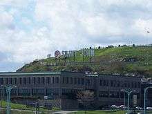
Politically, socially, economically, as well as geographically, the sea has shaped Saint John. The Fundy City, as the city has been called as it is the only city located on the Bay of Fundy, has a long history of shipbuilding at the city's dry dock which is one of the largest in the world. Since 2003 shipbuilding has ended on the scale it once was forcing the city to adopt a new economic strategy. The University of New Brunswick, the New Brunswick Museum and the New Brunswick Community College are important institutions along with Radian6 and Horizon Health Network and many others are a part of Saint John's fast growing Research and Information Technology sectors. As the city moves away from its industrial past it now begins to capitalize on the other new growing economies in Saint John of tourism, having over 1.5 million visitors a year and 200,000 cruise ship visitors a year, creating a renaissance in the city's historic downtown (locally known as uptown) with many small businesses moving in and large scale waterfront developments underway such as the Fundy Quay being condo, hotel, office space along with the Saint John Law Courts and Three Sisters Harbour front condos.
The Arts & Culture sector play a large role in Saint John's economy. The Imperial Theatre is home to the highly acclaimed Saint John Theatre Company, and the Symphony New Brunswick and hosts a large collection of plays, concerts and other stage production year round. Harbour Station entertainment complex is home to the Saint John Sea Dogs of the QMHL and the Saint John Millrats of the NBL.
Art galleries in Saint John cover the uptown, more than any other atlantic Canadian city. Artists like Miller Brittain and Fred Ross have made Uptown Saint John their home and now the torch has been passed to artists like Gerard Collins, Cliff Turner and Peter Salmon and their respective galleries. Uptown art galleries also include the Trinity Galleries, Citadel Gallery, Handworks Gallery and the Saint John Arts Centre (SJAC). The SJAC located in the Carnegie Building, hosts art exhibits, workshops, local songwriters circles and other shows too small to be featured at the grand Imperial Theatre.
Saint John still maintains industrial infrastructure in the city's east side such as Canada's largest oil refinery. Wealthy industrialist K.C. Irving and his family built an industrial conglomerate in the city during the 20th century with interests in oil, forestry, shipbuilding, media and transportation. Irving companies remain dominant employers in the region with North America's first deepwater oil terminal,[37] a pulp mill, a paper mill and a tissue paper plant.
Other important economic activity in the city is generated by the Port of Saint John,[38] the Moosehead Brewery (established in 1867, is Canada's only nationally distributed independent brewery [M. Nicholson]), James Ready Brewing Co., the New Brunswick Power Corporation which operates three electrical generating stations in the region including the Point Lepreau Nuclear Generating Station, Bell Aliant which operates out of the former New Brunswick Telephone headquarters, the Horizon Health Network, which operates 5 hospitals in the Saint John area,[39] and numerous information technology companies. There are also a number of call centres which were established in the 1990s under provincial government incentives.

Maritime activities
Until the early first decade of the 21st century, Canada's largest shipyard (Irving Shipbuilding) had been an important employer in the city. During the 1980s-early 1990s the shipyard was responsible for building 9 of the 12 Halifax-class multi-purpose patrol frigates for the Canadian Navy. However, the shipyard failed to buckle to Union pressure and shut down production. The 25 year Union contract with the shipyard is due to expire at the end of 2012. This would allow the shipyard to operate under a new contract. Prior to the opening of the St. Lawrence Seaway in 1959, the Port of Saint John functioned as the winter port for Montreal, Quebec when shipping was unable to traverse the sea ice in the Gulf of St. Lawrence and St. Lawrence River. The Canadian Pacific Railway opened a line to Saint John from Montreal in 1889 across the state of Maine and transferred the majority of its trans-Atlantic passenger and cargo shipping to the port during the winter months. The port fell into decline following the seaway opening and the start of year-round icebreaker services in the 1960s. In 1994 CPR left Saint John when it sold the line to shortline operator New Brunswick Southern Railway. The Canadian National Railway still services Saint John with a secondary mainline from Moncton.
Military
Besides being the location of several historical forts, such as Fort Howe, Fort Dufferin, Fort Latour, and the Carleton Martello Tower, Saint John is the location of a number of reserve units of the Canadian Forces.
- HMCS Brunswicker – a Naval Reserve Division.[40]
- 3rd Field Artillery Regiment, RCA (The Loyal Company) – the oldest artillery regiment in Canada and third in the British Commonwealth, a part of 37 Canadian Brigade Group.[41]
- B Company, 4 Platoon, Royal New Brunswick Regiment (Carleton & York) – an infantry unit of 37 Canadian Brigade Group.
- 36 Combat Service Support Company of the 37 Service Battalion, a part of 37 Canadian Brigade Group.[42]
- 2 Squadron of the 37 Signal Regiment, a part of 37 Canadian Brigade Group.[43]
Energy projects
Canaport LNG
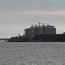
Canaport LNG, a partnership between Irving Oil (25%) and Repsol (75%), constructed a state-of-the-art LNG receiving and regasification terminal in Saint John, New Brunswick that began operations in 2009. It is the first LNG regasification plant in Canada, sending out natural gas to both Canadian and American markets. The terminal has a send-out capacity, or the ability to distribute via pipeline, 1 billion cubic feet (28 million cubic metres) of natural gas a day after it has been regasified from its liquid state.[44]
Brunswick Pipeline
Emera Inc. will invest approximately $350 million, for full ownership of a proposed pipeline which will deliver natural gas from the planned Canaport(TM) Liquefied Natural Gas (LNG) import terminal near Saint John, New Brunswick to markets in Canada and the US Northeast. Brunswick Pipeline will have a diameter of 30 inches (760 mm) and will be capable of carrying approximately 850 million cubic feet (24,000,000 m3) per day of re-gasified LNG. Capacity can be expanded with added compression.[45]
The 145 km (90 mi) pipeline would extend through southwest New Brunswick to an interconnection with the Maritimes and Northeast Pipeline at the Canada/US border near St. Stephen, New Brunswick. The National Energy Board (NEB) has issued its Environmental Assessment Report (EA Report) on the proposed Brunswick Pipeline project. The main finding of the EA Report is that the project is not likely to result in significant adverse environmental effects, provided Brunswick Pipeline meets all of its environmental commitments, and all of the NEB’s recommendations are implemented.[46] The pipeline's construction was completed on January 31, 2009.[47]
Transportation
Air service into Saint John is provided by the Saint John Airport/Aéroport de Saint-Jean, located near Loch Lomond approximately 25 kilometres by road northeast of the city centre. Flights are offered by Sunwing Airlines (seasonal) and Air Canada. WestJet recently decided to withdraw from the Saint John Airport. Quebec-based PASCAN Aviation announced its expansion into Saint John in late 2012, with direct flights from Saint John to Quebec City, Newfoundland, and other destinations beginning in September 2012.[48]
The main highway in the city is the Saint John Throughway (Route 1). Route 1 extends west to St. Stephen, and northeast towards Moncton. A second major highway, Route 7, connects Saint John with Fredericton. There are two main road crossings over the Saint John River: the Harbour Bridge and the Reversing Falls Bridge, approximately 1-nautical-mile (1.9 km) upstream.
The Reversing Falls Railway Bridge carries rail traffic for the New Brunswick Southern Railway on the route from Saint John to Maine. Saint John was serviced by the "Atlantic" Line of Via Rail passenger service. Passenger rail service in Saint John was discontinued in December 1994, although the Canadian National Railway and New Brunswick Southern Railway continue to provide freight service.
Bay Ferries operates a ferry service, MV Fundy Rose, across the Bay of Fundy to Digby, Nova Scotia. The Summerville to Millidgeville Ferry, a free propeller (as opposed to cable) ferry service operated by the New Brunswick Department of Transportation, connects the Millidgeville neighbourhood with Summerville, New Brunswick, across the Kennebecasis River on the Kingston Peninsula.
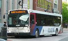
Bus service is provided by Saint John Transit (Greater Saint John Area) and Maritime Bus (Inter-city). Acadian Lines used to operate regular inter-city bus services between New Brunswick, Prince Edward Island, Nova Scotia, Bangor, as well as Rivière-du-Loup, Quebec (connecting with Orléans Express). In November 2012, Acadian Lines ceased operations.
Culture
Saint John shares much of the same cultural roots found in cities like Boston and New York. The presence of Irish heritage is very apparent along with strong maritime traditions. Saint John is a true maritime city with ties to the fisheries and shipbuilding, and is known for the Marco Polo as its flagship vessel. The city has been a traditional hub for creativity, boasting many notable artists, actors and musicians, including Walter Pidgeon, Donald Sutherland, Louis B. Mayer, Fred Ross and Miller Brittain.
Saint John has a long history of brewers, such as Simeon Jones, The Olands, and James Ready. The city is now home to Moosehead Breweries, James Ready Brewing Co., and Big Tide Brewing Co.
Dance, music, and theatre ensembles in the city include:
- Before the Mast, an a cappella men's vocal group that performs sea "shanties" from New Brunswick's past
- Cantabile Women's Ensemble
- Carleton Choristers
- Connection Dance Works
- InterAction Children's Theatre[49]
- New Brunswick Youth Orchestra
- Opera New Brunswick[50]
- Open Arts - a series featuring post-classical and experimental music
- Port City Dance Academy
- Saint John Chorale
- Saint John Men's Chorus
- Saint John Rotary Boys' Choir - a boys' choir founded in 1965
- Saint John String Quartet - performs an annual chamber music concert series
- Saint John Theatre Company[51]
- Symphony New Brunswick (SNB)- the province's only professional symphony orchestra.[52] Though based locally, playing a concert series every season in Saint John,[53] SNB offers concerts in other cities province wide.[54]
Saint John has several small private art galleries, as well as concert series hosted by local churches and schools. Cultural festivals and venues include:
- St. Andrew and St. David United Church
- Citadel Gallery
- Fundy FRINGE Festival
- Handworks Gallery
- Harbour Station - venue for large indoor concerts and events
- Jones Gallery
- Peter Buckland Gallery
- Portland United Church
- The Imperial Theatre
- Saint John Free Public Library, Library Millenium Artplace
- Saint John Shakespeare Festival[55]
- Saint John Arts Centre
- Canada Day Celebrations
- Salty Jam
- Third Space Gallery[56]
- Trinity Galleries
The following museums are also located in Saint John:
- Barbour's General Store
- Carleton Martello Tower
- Fort Howe
- Loyalist House
- New Brunswick Museum
- Old No. 2 Engine House Museum
- Saint John Jewish Historical Museum
- Saint John Floral Museum
- Saint John Police Museum
National Historic Sites of Canada located in Saint John include the following:
- Carleton Martello Tower
- Chipman Hill
- Fort Charnisay (also sometimes called Fort Menagoueche)
- Fort Howe
- Fort La Tour
- Imperial Theatre
- Loyalist House
- Number 2 Mechanics' Volunteer Company Engine House
- Partridge Island Quarantine Station
- Prince William Streetscape
- Saint John City Market
- Saint John County Courthouse
- St. John's Anglican Stone Church
Sports
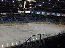
The following teams are based in Saint John:
- The Quebec Major Junior Hockey League's Saint John Sea Dogs
- The National Basketball League of Canada's Saint John Riptide.
The following sporting events have been held here:
- 2010 Canadian Senior Little League Championships
- 2010 Jeux d'Acadie
- 2009 Canadian Senior Little League Championships
- The Saint John Flames of the AHL played here from 1993–2003, winning the Calder Cup in 2000–2001.
- 1999 & 2014 World Curling Championships
- 1998 North American Short Track Speed Skating Championships
- 1998 World Junior Figure Skating Championships
- 1997 AHL All-Star Game
- 1995 Skate Canada International
- 1985 Canada Games
- In 1867, the local The Paris Crew became the rowing champions of the world.
Saint John is also home to Exhibition Park Raceway, a Harness Racing facility that has been hosting this form of Horse Racing for over the past 120 years. Prior to 1950 it was known as Moosepath Park.
Education
In 1964, the University of New Brunswick created UNB Saint John. Initially located in buildings throughout the downtown CBD, in 1968 UNBSJ opened a new campus in the city's Tucker Park neighbourhood. This campus has undergone expansion over the years and is the fastest growing component of the UNB system with many new buildings constructed between the 1970s-first decade of the 21st century. A trend in recent years has been a growth in the number of international students. The city also hosts a New Brunswick Community College campus in the East End of the city. There has also been a satellite campus of Dalhousie Medical School added within the UNBSJ campus in 2010, instructing 30 medical students each year.
In the fall of 2007, a report commissioned by the provincial government recommended that UNBSJ and the NBCC be reformed and consolidated into a new polytechnic post-secondary institute. The proposal immediately came under heavy criticism and led to the organizing of several protests in the uptown area. The diminishment of UNB as a nationally accredited university, the reduction in accessibility to receive degrees, and there are only a couple of the reasons why the community was enraged by the recommendation with support slightly below 90% to keep UNBSJ as it was, and expand the university under its current structure. Seeing that too much political capital would be lost, and that several Saint John are MPs were likely not to support the initiative if the policies recommended by the report were legislated, the government abandoned the commission's report and created an intra-provincial post-secondary commission.
Saint John is served by two school boards; District 8 for Anglophone schools and District 1 (based out of Dieppe, New Brunswick) for the city's only Francophone school, Centre-Scolaire-Communautaire Samuel-de-Champlain. Saint John is also home to Canada's oldest publicly funded school, Saint John High School. The other high schools in the city are Harbour View High School, St. Malachy's High School, and Simonds High School.
Media
Notable people
Twin/sister cities
 Koper, Slovenia[57]
 Shantou, Guangdong, China [58]
 Shenzhen, China
 Donghae, Gangwon, South Korea
 Newport, Rhode Island, US[59]
 Bangor, Maine, US
 Digby, Nova Scotia, Canada[60]
 Caraquet, New Brunswick, Canada
See also
References
- ↑ "Territorial Divisions Act (section 27(a))". The Province of New Brunswick, through the Queen’s Printer. Retrieved 7 February 2016.
- ↑ http://www.cbc.ca/news/canada/new-brunswick/saint-john-rothesay-quispamsis-election-1.3574008
- 1 2 3 "Census Profile: Saint John, New Brunswick (Census subdivision)". Canada 2011 Census. Statistics Canada.
- 1 2 "Census Profile: Saint John, New Brunswick (Population centre)". Canada 2011 Census. Statistics Canada. Retrieved September 30, 2013.
- 1 2 "Census Profile: Saint John, New Brunswick (Census metropolitan area)". Canada 2011 Census. Statistics Canada. Retrieved September 30, 2013.
- ↑ history/public records and archives – The Official Site of The City of Saint John / Le Site Officiel de The City of Saint John Archived February 7, 2009, at the Wayback Machine.
- ↑ "Archives Canada". Archivescanada.ca. Retrieved May 5, 2011.
- ↑ Canada's First City: Saint John. Saint John, N.B.: Lingley Printing. 1962. p. 30.
- ↑ Van Horn, Celinda. "Principal's Message". Saint John High School. Retrieved May 30, 2016.
- ↑ John Quinpool, First Things in Acadia", Halifax, 1936, p. 122
- ↑ http://www.wfhathewaylabourexhibitcentre.ca/labour-history/for-whom-the-bells-toll/
- ↑ Famous Glaswegians – Robert Foulis, JR, accessed 05-09-08
- ↑ "Our History in Canada". YWCA Canada. Retrieved May 30, 2016.
- ↑ William D. Kennedy, Pythian History, Part 1, 1904, p. 52
- ↑ The Commissioners of Patents Journal, Great Britain Patent Office, 1872
- ↑ Mabel Peters Playground Dedicated – The Official Site of The City of Saint John / Le Site Officiel de The City of Saint John
- ↑ John Quinpool, First Things in Acadia", Halifax, 1936, p. 154
- ↑ Greg Marquis, "The history of policing in the Maritime provinces: themes and prospects.", Huban History Review, June 1990
- ↑ "This week in New Brunswick history, Feb. 8–15 (00/02/07)". gnb.ca
- ↑ "Saint John New Brunswick Time Date". new-brunswick.net
- ↑ "Saint John A". Canadian Climate Normals 1971–2000. Environment Canada. Retrieved September 30, 2013.
- ↑ "Daily Data Report for June 1941". Canadian Climate Data. Environment Canada. September 22, 2015. Retrieved 26 June 2016.
- ↑ "Daily Data Report for August 1944". Canadian Climate Data. Environment Canada. September 22, 2015. Retrieved 26 June 2016.
- 1 2 3 "Saint John A". Canadian Climate Normals 1981–2010. Environment Canada. Retrieved May 12, 2014.
- ↑ "Saint John A". Canadian Climate Normals 1981–2010. Environment Canada. Retrieved September 30, 2013.
- ↑ "Saint John". Canadian Climate Data. Environment Canada. Retrieved 26 June 2016.
- ↑ "Hourly Data Report for March 21, 2012". Canadian Climate Data. Environment Canada. Retrieved 26 June 2016.
- ↑ "Daily Data Report for March 2012". Canadian Climate Data. Environment Canada. Retrieved 26 June 2016.
- ↑ "Commercial Properties".
- ↑ "JD Irving".
- ↑ "CBRE".
- ↑ "Chateau Saint John".
- ↑ "Saint John". Directory of Designations of National Historic Significance of Canada. Parks Canada.
- ↑ Thomas P. Power, ed., The Irish in Atlantic Canada, 1780-1900 (Fredericton, NB: New Ireland Press, 1991)
- ↑ Scott W. See, Riots in New Brunswick: Orange nativism and social violence in the 1840s (Univ of Toronto Press, 1993)
- ↑ Scott W. See "The Orange Order and Social Violence in Mid-Nineteenth Century Saint John." Acadiensis (1983): 68-92. online
- ↑ www
.worldportsource .com /ports /CAN _Saint _John _Port _130 .php - ↑ "Port of Saint John".
- ↑ www
.horizonnb .ca /saint-john-facilities-services .php - ↑ HMCS Brunswicker
- ↑ 3rd Field Artillery Regiment
- ↑ 37 Service Battalion
- ↑ 37 Signal Regiment
- ↑ "About". Canaport LNG. Retrieved May 5, 2011.
- ↑ "Brunswick Pipeline: Emera to Invest in Proposed Brunswick Pipeline – May 16, 2006".
- ↑ "Brunswick Pipeline: Emera's Brunswick Pipeline Receives NEB Environmental Assessment – April 12, 2007".
- ↑ "Brunswick Pipeline Mechanically Complete".
- ↑ "PASCAN Aviation confirms its schedule of flights from Saint John, NB starting September 17". Canada Newswire. Retrieved August 9, 2012.
- ↑ "Interaction Children's Theatre Company". Interactiontheatre.com. Retrieved May 5, 2011.
- ↑ "Opera New Brunswick".
- ↑
- ↑ "Symphony New Brunswick". Symphonynb.com. Retrieved May 5, 2011.
- ↑ "Symphony New Brunswick". Symphonynb.com. Retrieved May 5, 2011.
- ↑ "Symphony New Brunswick". Symphonynb.com. Retrieved May 5, 2011.
- ↑
- ↑ "Third Space Gallery". Thirdspacegallery.ca. Retrieved May 5, 2011.
- ↑
- ↑
- ↑
- ↑ Welcome to the Town of Digby
- ↑ Based on station coordinates provided by Environment Canada, climate data recorded near downtown Saint John from January 1871 to September 1970, and at Saint John Airport from November 1946 to present.
External links
| Wikimedia Commons has media related to Saint John, New Brunswick. |
| Wikivoyage has a travel guide for Saint John. |
- City of Saint John official website
- Discover Saint John, official tourism website
- TrinityRoyal.com – The Historic Heart of Saint John
- The New Brunswick Museum
- Heritage Resources Saint John
- The Story of the Great Fire in St. John, N.B., June 20, 1877 by George Stewart
- Fundy Tour: The Most Comprehensive Bay of Fundy tour in Saint John, New Brunswick Available through Project Gutenberg
