Long Ridge Village Historic District
|
Long Ridge Village Historic District | |
|
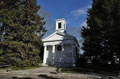
St. Francis Episcopal Church | |
  | |
| Location | Old Long Ridge Rd. bounded by the New York State Line, Rock Rimmon Rd., and Long Ridge Rd./CT 104, Stamford, Connecticut |
|---|---|
| Coordinates | 41°9′20″N 73°35′37″W / 41.15556°N 73.59361°WCoordinates: 41°9′20″N 73°35′37″W / 41.15556°N 73.59361°W |
| Built | 1750 |
| Architect | Platt,John |
| Architectural style | Colonial Revival, Greek Revival, Federal |
| NRHP Reference # | [1] |
| Added to NRHP | June 2, 1987 |
The Long Ridge Village Historic District is a historic district in the city of Stamford, Connecticut. The district, located in rural northern Stamford near the border with New York, was listed on the National Register of Historic Places in 1987.[1] Although the district includes a few early 19th-century properties, the area was most heavily developed between 1850 and 1920, and was a local center of shoe manufacturing until it was bypassed by railroads, sending the business nearer to downtown Stamford. The district extends along Old Long Ridge Road, and includes several property on adjacent Rock Rimmon Road. There are 34 historically significant houses, and two churches.[2]
Significant contributing properties include:
- St. Francis Episcopal Church, 503 Old Long Ridge Road, (see #11 in photo set accompanying NRHP document)
- Hickford Marshall House, 528 Old Long Ridge Road (see accompanying photo #12)
References
| Wikimedia Commons has media related to Long Ridge Village. |
- 1 2 National Park Service (2009-03-13). "National Register Information System". National Register of Historic Places. National Park Service.
- ↑ Lucinda McWeeney; Steven Bedford; Nils Kerschus & John Herzan (February 1985). "National Register of Historic Places Inventory-Nomination: Long Ridge Village Historic District" (PDF). National Park Service. and Accompanying 18 photos, from 1984 (see photo locations page 22 of text document)
| Lists by county |  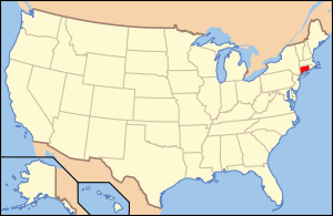 | |
|---|---|---|
| Lists by city or town | ||
| Other lists | ||
Municipalities and communities of Fairfield County, Connecticut, United States | ||
|---|---|---|
| Cities | 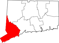 | |
| Towns | ||
| Borough | ||
| CDPs | ||
| Other communities | ||
This article is issued from Wikipedia - version of the 11/26/2016. The text is available under the Creative Commons Attribution/Share Alike but additional terms may apply for the media files.