Monroe, Connecticut
| Monroe, Connecticut | ||
|---|---|---|
| Town | ||
| ||
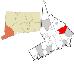 Location in Fairfield County and the state of Connecticut. | ||
| Coordinates: 41°20′10″N 73°13′33″W / 41.33611°N 73.22583°WCoordinates: 41°20′10″N 73°13′33″W / 41.33611°N 73.22583°W | ||
| Country | United States | |
| State | Connecticut | |
| NECTA | Bridgeport-Stamford | |
| Region | Greater Bridgeport | |
| Incorporated | 1823 | |
| Government | ||
| • Type | Selectman-town council | |
| • First Selectman | Steve Vavrek (R) | |
| • Town Council |
Chm Frank Lieto (R), Vice Chm Enid Lipeles (R) Sean O'Rourke Terry Rooney (R) Kevin Reid (R) Ken Kellogg (R) Phyllis Kansky (D) Dee Dee Martin (D) Nicholas Kapoor (D) | |
| Area | ||
| • Total | 26.3 sq mi (68.1 km2) | |
| • Land | 26.1 sq mi (67.7 km2) | |
| • Water | 0.2 sq mi (0.5 km2) | |
| Elevation | 522 ft (159 m) | |
| Population (2010) | ||
| • Total | 19,479 | |
| • Density | 740/sq mi (290/km2) | |
| Time zone | Eastern (UTC-5) | |
| • Summer (DST) | Eastern (UTC-4) | |
| ZIP code | 06468 | |
| Area code(s) | 203 | |
| FIPS code | 09-48620 | |
| GNIS feature ID | 0213463 | |
| Website |
www | |
Monroe is a town in Fairfield County, Connecticut, United States. The population was 19,479 at the 2010 census.[1]
Like many of its neighbors, Monroe is largely considered a bedroom community of New York City and Bridgeport. Monroe's neighbors are Easton, Newtown, Oxford, Shelton, and Trumbull. The New York Times profiled Monroe in a February 2013 article called "Living In Monroe, Conn.; a Friend, in Need and Deed."[2]
Geography
According to the United States Census Bureau, the town has a total area of 26.3 square miles (68 km2), of which 26.1 square miles (68 km2) is land and 0.2 square miles (0.52 km2), or 0.76%, is water. The Pequonnock River begins in Monroe in Wolfe Park.
Neighborhoods
Monroe is made up of several neighborhoods:
- East Village
- Midtown
- Monroe Center
- North Central
- Stepney
- Stevenson
- Upper Stepney
- Zoar
History
The Monroe town seal is in the form of a circle with the words "Town of Monroe Connecticut" written in the outer rim of the seal. Inside this outer circle is a profile of a bust of James Monroe, who was the fifth President of the United States, serving from 1817-1825.
 Monroe, Webb Mountain Park Discovery Zone, Classroom Court pond.
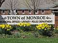 Sign in front of Monroe CT Town Hall
 The East Village Barn Hill Schoolhouse of 1790
 Edith Wheeler Memorial Library in Monroe, Connecticut
 Monroe CT Gazebo
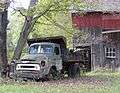 Old Truck and Barn in Monroe CT
 Masuk Marching Band percussion
 Fountain and Pond at Wolfe Park
 Sign in front of Town Hall
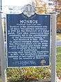 Back of sign
 Two fawns frolic in Monroe back yard
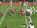 Masuk High School football
 Great Hollow Lake in Monroe CT
 Classic Nights Car Club Show in Monroe Connecticut May 2013
On May 15, 1656, the Court of the Colony of Connecticut in Hartford affirmed that the town of Stratford included all of the territory 12 miles (19 km) inland from Long Island Sound, between the Housatonic River and the Fairfield town line, to include the southern portion of present-day Monroe. In 1662, Stratford selectmen Lt. Joseph Judson, Captain Joseph Hawley and John Minor had secured all the written deeds of transfer from the Golden Hill Paugussett Indian Nation for this vast territory that comprises the present-day towns of Trumbull, Shelton and Monroe. In 1671, Stratford purchased from the Paugusset Indians the territory which included the remainder of the northern portions of Monroe, Trumbull and Shelton, in what is known as "The White Hills Purchase", and officially annexed it to the Township of Stratford.


_Monroe%2C_CT.JPG)
Town information
| Historical population of Monroe[3] | |
| 1830 | 1,522 |
| 1840 | 1,351 |
| 1850 | 1,442 |
| 1860 | 1,382 |
| 1870 | 1,226 |
| 1880 | 1,157 |
| 1890 | 994 |
| 1900 | 1,043 |
| 1910 | 1,002 |
| 1920 | 1,161 |
| 1930 | 1,221 |
| 1940 | 1,728 |
| 1950 | 2,892 |
| 1960 | 6,402 |
| 1970 | 12,047 |
| 1980 | 14,010 |
| 1990 | 16,896 |
| 2000 | 19,247 |
| 2010 | 19,479 |
Media
- The town of Monroe owns and operates the FM radio station WMNR.
- The Monroe Courier is the weekly town newspaper.
- The local online newspaper is the Monroe Patch.
Monroe Public Schools
The school district for Monroe is called Monroe Public Schools and includes approximately 4,000 students, in three elementary schools (Fawn Hollow, Monroe Elementary, and Stepney Elementary) two middle schools (Jockey Hollow and recently opened STEM Academy), and a high school (Masuk High School). In 2011, the STEM Academy at Masuk High School was opened as an alternative school option for 6th, 7th, and 8th graders.[4] One of Monroe's schools (Chalk Hill) was provided to its neighboring town Newtown, Connecticut in the aftermath of the Sandy Hook Elementary School shooting.[5]
Private school
St. Jude School, a Catholic school with around 220 students, is located next to St. Jude Parish on Route 111, very close to Route 111's and 110's intersection. St. Jude holds a carnival in the parking lot in the back of the church every year in the end of August before the school year begins.
In 2003, the St. Jude boys junior varsity basketball team won the New England CYO tournament, defeating Springfield, Massachusetts in the championship, becoming the first team from St. Jude to win the tournament. The first selectman of the town dedicated a day to them. In 2005, they returned to the tournament in Rhode Island as 8th graders. After defeating Worcester and Boston, they lost to Hartford by 5.
In 2006, the St. Jude boys junior varsity again won the New England CYO tournament, defeating Hartford, Connecticut.
Places of worship
The town of Monroe features ten houses of worship representing numerous faiths.
- Beacon Hill Evangelical Free - Evangelical Free Church of America
- Good Shepherd Lutheran Church - Lutheran
- Faith World Outreach - Non-denominational Christian
- Monroe Congregational Church - Congregationalist
- Our Lady of the Rosary Chapel - Roman Catholic
- Pilgrims Pathway Wesleyan Church - Wesleyans
- Saint Jude's Roman Catholic Church - Roman Catholic
- Saint Peter's Episcopal Church - Episcopal
- Stepney Baptist Church - Baptist
- United Methodist Church of Monroe - United Methodist
- Islamic Community of Fairfield County - Islamic
Emergency services
Fire departments
The town of Monroe is protected 24/7, 365 days a year by three independent and all-volunteer fire departments operating from six fire stations, two in each district. The combined departments operate a total of 1 Truck, 1 Quint, 2 Rescues, 8 Engines, 3 Tankers, 2 Brush Units, 1 Fire Boat, 2 Utility Units, 1 Squad, and 3 Command Vehicles. The combined departments respond to an averaged total of over 1,000 emergency calls annually. The Fire Marshal is William B. Davin.
Stepney Volunteer Fire Department (since 1917)
Stepney Volunteer Fire Department
- Fire Headquarters - Fire Station # 1 - 88 Main St. (CT Rt. 25)
- Engine 102
- Engine 104
- Rescue 120
- Chief 151 (Command Unit)
- Deputy Chief 152 (Command Unit)
- Fire Station # 2 - 801 Main St.(CT Rt. 25)
- Engine 101
- Truck 100
- Utility 114
Monroe Volunteer Fire Department (since 1923)
Monroe Volunteer Fire Department
- Fire Headquarters - Fire Station # 1 - 18 Shelton Rd. (CT Rt. 110)
- Engine-Rescue 203
- Engine-Tanker 205
- Squad 230 (Rehab. Unit)
- Utility 214
- Chief 251 (Command Unit)
- Deputy Chief 252 (Command Unit)
- Fire Station # 2 - 54 Jockey Hollow Rd.
- Engine 201
- Quint 200
Stevenson Volunteer Fire Department (since 1950)
Stevenson Volunteer Fire Department
- Fire Headquarters - Fire Station # 2 - 1260 Monroe Turnpike (CT Rt. 111)
- Engine 301
- Engine 302
- Rescue 320
- Tanker 315
- Tanker 316
- Brush 310
- Marine 1
- Chief 351 (Command Unit)
- Deputy Chief 352 (Command Unit)
- Fire Station # 1 - 300 Cottage St. (CT Rt. 111)
- Truck 312 (Brush Unit)
- Truck 314 (Brush/Utility Unit)
Emergency medical services
The town of Monroe is served by Monroe Volunteer Emergency Medical Service. Founded in 1977, MVEMS provides pre-hospital emergency care and hosts emergency training courses such as CPR/AED, EMR, and EMT.
Police department
Officially organized in 1952, the Monroe Police Department operates out of Monroe Town Hall.
Notable locations
- Lake Zoar, a reservoir on the Housatonic River
- Stevenson Dam, which holds back Lake Zoar, and is the bridge for CT Route 34 across the Housatonic
- Stepney Cemetery, founded in 1794 and located near the Stepney Green
- Webb Mountain Park, a municipal park with hiking trails and campsites
- William E. Wolfe Park, a town park located on Cutlers Farm Road and on the northern end of Cross Hill Road. The park includes a public pool, four baseball fields, a football field, a basketball court, a playground, and a hiking trail that leads to Great Hollow Lake. The park includes a barbecue set up on the grass, and a nearby pavilion. Great Hollow Lake is located in the south-western area of the park.
- Rails to Trails is an approximately 5 mile scenic walking and biking trail that runs from Great Hollow Lake in Wolfe Park, and continues to the Newtown Town line where it currently ends. It is being considered to connect Monroe's walking trail to Trumbull's, which would connect both Monroe, Trumbull, and Bridgeport's Rails to Trails paths.
- The Warren's Occult Museum: world-renowned museum with hundreds of thousands of yearly visits that houses the largest array of occult artifacts from the Ed and Lorraine Warren investigations.[6]
Locations on the National Register of Historic Places
- Daniel Basset House — 1024 Monroe Turnpike (added September 23, 2002)
- Monroe Center Historic District — CT 110 and CT 111 (added September 19, 1977)
- Stevenson Dam Hydroelectric Plant — CT 34 (added October 29, 2000)
- Thomas Hawley House — 514 Purdy Hill Rd. (added May 11, 1980)
Notable people
- Mike Gminski, former Duke basketball standout and NBA player. An assortment of Mike Gminski memorabilia, including shorts he wore while playing for the 76'ers, is on display in a glass case outside the gymnasium at Fawn Hollow Elementary School.
- Mary O'Hara, author of "My Friend Flicka" and several other books, lived on an estate called Tyrawley on Bagburn Hill Road for nearly 20 years.
- Jesse Schwartz, the voice of Leo on Little Einsteins.
- Ed Wojna, former Major League pitcher.
- Ed and Lorraine Warren, paranormal investigators and authors
Economy
Though Monroe's commercial base is primarily services and retail outlets, the following corporations are headquartered in Monroe.
- Victorinox (North American Headquarters)
- Aquarion Water Company
- Sippin Energy Products
- Cornell-Carr
Infrastructure
Connecticut Route 25, Main Street, runs across Monroe from Upper Stepney to the Trumbull town line. The highway starts in Brookfield/Danbury and runs to Bridgeport. From Brookfield through Monroe, it is a 2-lane road, and just over the Monroe-Trumbull border within Trumbull, it becomes a 6-lane freeway which connects to Interstate 95.
Connecticut Route 34 runs through the northern (Stevenson) section of Monroe. The route begins in Newtown and ends in New Haven, where it connects with I-91 and I-95.
Connecticut Route 59 begins at its intersection with Route 25 in Monroe and travels south through Easton and Fairfield, where it ends in Bridgeport.
Connecticut Route 110 begins in Monroe at its intersection with Route 111, then travels through Shelton before ending in Stratford.
Connecticut Route 111, Monroe Turnpike, begins at its intersection with Route 34 in Monroe and runs south to Trumbull, where it terminates just north of Bridgeport at the Merritt Parkway.
Demographics
| Historical population | |||
|---|---|---|---|
| Census | Pop. | %± | |
| 1850 | 1,442 | — | |
| 1860 | 1,382 | −4.2% | |
| 1870 | 1,226 | −11.3% | |
| 1880 | 1,157 | −5.6% | |
| 1890 | 994 | −14.1% | |
| 1900 | 1,043 | 4.9% | |
| 1910 | 1,002 | −3.9% | |
| 1920 | 1,161 | 15.9% | |
| 1930 | 1,221 | 5.2% | |
| 1940 | 1,728 | 41.5% | |
| 1950 | 2,892 | 67.4% | |
| 1960 | 6,402 | 121.4% | |
| 1970 | 12,047 | 88.2% | |
| 1980 | 14,010 | 16.3% | |
| 1990 | 16,896 | 20.6% | |
| 2000 | 19,247 | 13.9% | |
| 2010 | 19,479 | 1.2% | |
| Est. 2014 | 19,867 | [7] | 2.0% |
As of the census[9] of 2000, there were 19,247 people, 6,481 households, and 5,346 families residing in the town. The population density was 736.5 people per square mile (284.4/km²). There were 6,601 housing units at an average density of 252.6 per square mile (97.5/km²). The racial makeup of the town was 96.87% White, 0.20% African American, 0.08% Native American, 1.52% Asian, 0.50% from other races, and 0.83% from two or more races. Hispanic or Latino of any race were 1.50% of the population.
There were 6,481 households out of which 42.5% had children under the age of 18 living with them, 74.0% were married couples living together, 6.0% had a female householder with no husband present, and 17.5% were non-families. 14.9% of all households were made up of individuals and 6.6% had someone living alone who was 65 years of age or older. The average household size was 2.96 and the average family size was 3.31.
In the town the population was spread out with 29.1% under the age of 18, 4.8% from 18 to 24, 29.9% from 25 to 44, 25.7% from 45 to 64, and 10.5% who were 65 years of age or older. The median age was 38 years. For every 100 females there were 96.5 males. For every 100 females age 18 and over, there were 93.5 males.
The median income for a household in the town was $85,000 and the median income for a family was $92,514. Males had a median income of $61,109 versus $41,572 for females. The per capita income for the town was $34,161. About 1.8% of families and 2.6% of the population were below the poverty line, including 2.6% of those under age 18 and 5.5% of those age 65 or over.
| Voter registration and party enrollment as of October 25, 2005[10] | |||||
|---|---|---|---|---|---|
| Party | Active voters | Inactive voters | Total voters | Percentage | |
| Republican | 3,388 | 228 | 3,616 | 26.79% | |
| Democratic | 2,200 | 122 | 2,322 | 17.21% | |
| Unaffiliated | 7,074 | 479 | 7,553 | 55.96% | |
| Minor parties | 3 | 2 | 5 | 0.04% | |
| Total | 12,665 | 831 | 13,496 | 100% | |
Notes
- ↑ "Race, Hispanic or Latino, Age, and Housing Occupancy: 2010 Census Redistricting Data (Public Law 94-171) Summary File (QT-PL), Monroe town, Connecticut". U.S. Census Bureau, American FactFinder 2. Retrieved August 9, 2011.
- ↑ http://www.nytimes.com/2013/02/03/realestate/living-in-monroe-conn-a-friend-in-need-and-deed.html?pagewanted=all&_r=0. Missing or empty
|title=(help) - ↑ Archived February 16, 2008, at the Wayback Machine.
- ↑ "STEM Academy Forum Draws a Large Audience Summary File (QT-PL), Monroe town, Connecticut". Monroe Patch 2. Retrieved October 8, 2011.
- ↑ "Sandy Hook Shooting School Survivors to move to Monroe, CT's Chalk Hill School".
- ↑ "The Warren's Occult Museum". The New England Society For Psychic Research.
- ↑ "Annual Estimates of the Resident Population for Incorporated Places: April 1, 2010 to July 1, 2014". Retrieved June 4, 2015.
- ↑ "Census of Population and Housing". Census.gov. Retrieved June 4, 2015.
- ↑ "American FactFinder". United States Census Bureau. Retrieved 2008-01-31.
- ↑ "Registration and Party Enrollment Statistics as of October 25, 2005" (PDF). Connecticut Secretary of State. Archived from the original (PDF) on 2006-09-23. Retrieved 2006-10-02.
References
- Reverend Samuel Orcutt, A History of Stratford and the City of Bridgeport Connecticut, Fairfield Historical Society, 1886
External links
- Town of Monroe official website
- Monroe Volunteer Emergency Medical Service
- Newspaper - Monroe Courier
- Monroe Historical Society

Municipalities and communities of Fairfield County, Connecticut, United States | ||
|---|---|---|
| Cities | 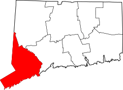 | |
| Towns | ||
| Borough | ||
| CDPs | ||
| Other communities | ||