Lowood, Queensland
| Lowood Queensland | |||||||||||||
|---|---|---|---|---|---|---|---|---|---|---|---|---|---|
|
Post office | |||||||||||||
 Lowood | |||||||||||||
| Coordinates | 27°28′0″S 152°35′0″E / 27.46667°S 152.58333°ECoordinates: 27°28′0″S 152°35′0″E / 27.46667°S 152.58333°E | ||||||||||||
| Population | 3,336 (2011 census)[1] | ||||||||||||
| Established | 1872 | ||||||||||||
| Postcode(s) | 4311 | ||||||||||||
| Location | |||||||||||||
| LGA(s) | Somerset Region | ||||||||||||
| State electorate(s) | Ipswich West | ||||||||||||
| Federal Division(s) | Blair | ||||||||||||
| |||||||||||||
Lowood is a town and locality in the Somerset Region in south-east Queensland, Australia.[2][3] The town is on the Brisbane River, 66 kilometres (41 mi) west of the state capital, Brisbane and 31 kilometres (19 mi) north of Ipswich. In the 2011 census, Lowood had a population of 3,336 people.[1]
History
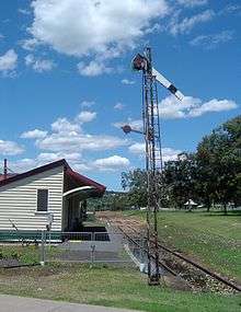
Lowood was established as the first terminus of the Brisbane Valley branch railway in 1884 and the town grew from the subdivision around the new station. The name is derived from the "low woods" of brigalow in the Lowood area, as opposed to the taller trees elsewhere in the Brisbane Valley. Lowood Post Office opened on 15 October 1888 (a receiving office had been open from 1884).[4]

At the 2006 census, Lowood had a population of 1,010.[5]
Due to its proximity to Brisbane and Ipswich, Lowood is becoming an area for hobby farmers and residential commuters. Nearby Lake Wivenhoe is a popular place for activities such as boating and fishing.
Airfield
During World War II, an airfield called Lowood, which was actually located at Mount Tarampa, was the site of a military airfield operated by the Royal Australian Air Force. No. 71 Squadron operated from the airfield during 1943, conducting coastal patrol and naval convoy escort missions. After the war the airfield was converted into a motor racing circuit with the same name and operated for 20 years, the highlight hosting the 1960 Australian Grand Prix.[6] The airfield no longer exists but a small memorial marks its previous location.[7]
Transport
Following the withdrawal of the railmotor service to Toogoolawah in 1989, a substitute bus service to Ipswich was introduced by Queensland Rail (QR). There are two services in the morning and return services in the late afternoon. Time tables are available from QR.
Heritage listings
Lowood has a number of heritage-listed sites, including:
- 12 Railway Street: former Royal Bank of Queensland, built sometime between 1901 and 1917, the former bank is now a dental surgery.[8]
See also
References
- 1 2 Australian Bureau of Statistics (31 October 2012). "Loowood". 2011 Census QuickStats. Retrieved 6 July 2015.
- ↑ "Loowood (entry 20197)". Queensland Place Names. Queensland Government. Retrieved 6 July 2015.
- ↑ "Loowood (entry 44894)". Queensland Place Names. Queensland Government. Retrieved 6 July 2015.
- ↑ Premier Postal History. "Post Office List". Premier Postal Auctions. Retrieved 10 May 2014.
- ↑ Australian Bureau of Statistics (25 October 2007). "Lowood (L) (Urban Centre/Locality)". 2006 Census QuickStats. Retrieved 28 October 2007.
- ↑ Australian Grand Prix - The 50-race history, 1986, pages 256 to 266
- ↑ Oz at war - Amateur historian site -Retrieved 2 November 2006.
- ↑ "Dental Surgery (entry 600496)". Queensland Heritage Register. Queensland Heritage Council. Retrieved 12 July 2013.
External links
| Wikimedia Commons has media related to Lowood, Queensland. |
- University of Queensland: Queensland Places: Lowood
- Lowood District Community Website
- Somerset Region
- Travelmate
- Lowood Tourism Association
- Information about Lowood, Queensland